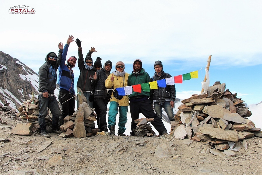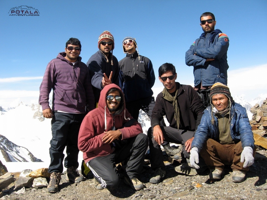
Pin Parvati Pass a popular trek route from Parvati to Pin Valley in Spiti
Pin Parvati Pass at an altitude of 5,319 m / 17,450 feet connects the Parvati Valley (Kullu) in the west and Pin Valley (Spiti) in the east. Pin Parvati can be crossed without any technical difficulties.
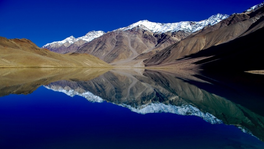
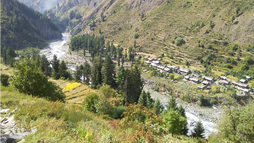
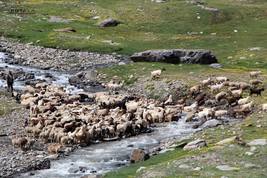
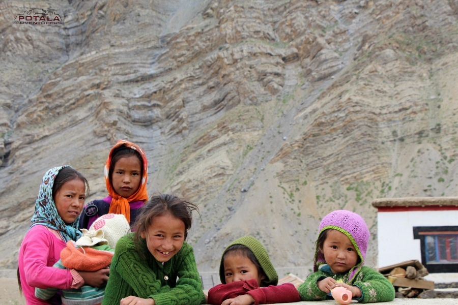
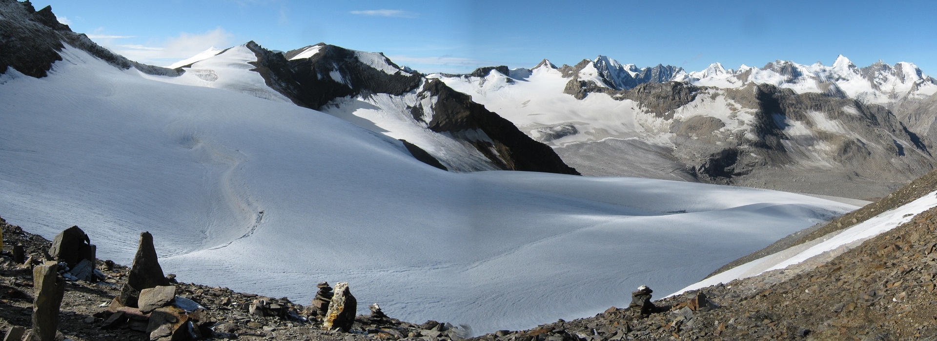
In Parvati Valley, the trail begins at a relatively low altitude, which makes better acclimatization before crossing 5319m. After the large alpine meadows of Tunda Bhuj, you reach the large flat valley floor at Mantalai, where the moraines of the Parvati glacier come to an end. Leaving the valley, steep path to the left to base camp. A long stretch of a glacier crossing, the trail runs through steep scree to the small pass, which provides a panoramic view of the Great Himalayan range peaks, Parvati South, Parvati North, Pinnacle, Kullu Eiger all above 6`000 m. A steep descent to Pin River. An easy trail along the left banks of Pin River to Mudh (3820m), the last village in the Pin Valley. With the extreme difference in climate, Pin Valley is much more rugged and barren than Parvati Valley. This cold desert valley with its snowy crags, cliff, jagged rocks, and other fossils make Pin Valley a unique geological lab. Pin Valley National Park is home to snow leopard, red fox, marten, weasel, Himalayan Royle Pika, bearded vulture, golden eagle, lynx, and Tibetan wolf. The Pin area has been conserved as a national park since 1987. The main attraction of Pin Valley is the Chamurthi pony, known for its fast, sure-footed-on mountain terrain, moving safely on ice, and well adapted to cost and harsh environment.
Due to the southern edge of the main Himalayan range, during summer monsoons often at the foothills determine the weather, which brings rain and snow around the pass. Mudslides at Pin Valley can cause unpleasant surprises during monsoon, which brings the Pin Valley to cut off from the main Spiti Valley. The best time to go for this trek remains is from mid-June to mid-July and from the third week of August to the end of September. But be careful after the third week of September, when frozen monsoon tails can bring huge snowfall at the main Himalayan range.
PIN PARVATI TREK - ITINERARY
Day 1: Manali to Barsheni (2200 m/7217 ft) drive 97 km. Trek Khir Ganga (2850 m / 9350 ft). 9 km.
Day 2: Trek Tunda Bhuj (3360 m/11023 ft). 12 km.
Day 3: Trek Thakur Kuan (3600 m/11811 ft). 6 km.
Day 4: Trek Odi Thach (3820 m/12532 ft). 10 km.
Day 5: Trek Mantalai (4130 m/13549 ft). 9 km.
Day 6: Trek Parvati Base camp (4940 m/16207 ft). 10 km.
Day 7: Trek Pin Parvati pass (5300 m/17400 ft) - Base camp Pin side (4400 m / 14435 ft), 9 km.
Day 8: Trek Wichkurung Thach / Tiya (4000 m/13123 ft) 13 km.
Day 9: Trek Mudh (3850 m/12631 ft ) 10 km, Drive to Kaza (3700 m / 12139 ft), drive 50 km.
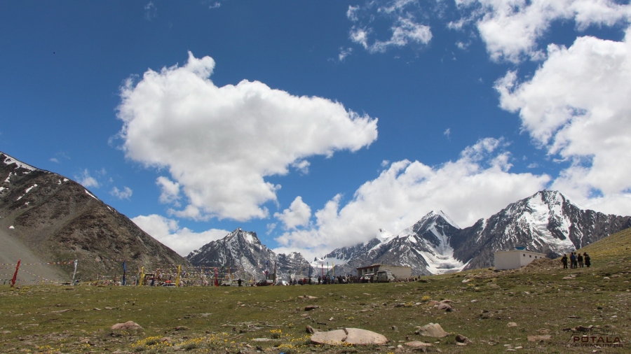
Day 10: Kaza - Kunzum la (4551m/14931 ft) - Atal Tunnel - Manali. drive 185 km. 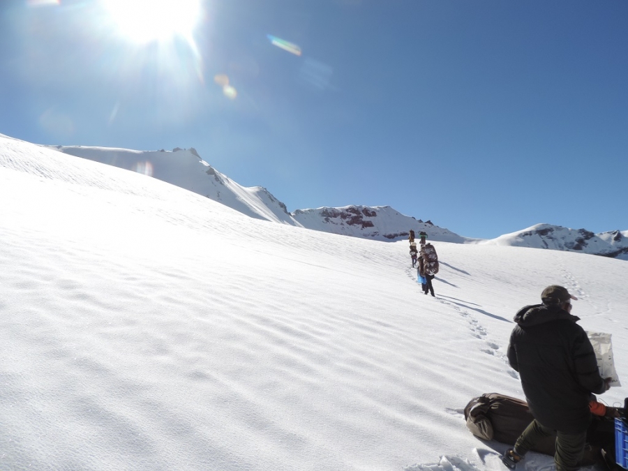
TRIP DOSSIER
Day 1: Manali to Barsheni (2200 m / 7217 ft) drive 97 km, 3-4 hours, Barsheni to Khir Ganga (2850 m / 9350 ft), trek 9 km. 5-6 hours.
An early departure from Manali today. Leaving Manali we drive 84 km to Manikaran (1700 m). Manikaran is famous for its hot water springs and ancient temples. From Bhunter the road goes along the left banks of the Parvati river until Manikaran. Manikaran to Barshaini road distance is 12 km. The setting of a trek from Barsheni ( 2220 m / 7217 ft), we descend to the riverbed and a short ascend to Nakthan. Now an easy trail passes through some small villages and further leads through coniferous forests and waterfalls. Arriving at Rudranag and crossing the wooden bridge above the roaring Parvati River, the trail winds up to Khirganga (2850 m / 9350 ft). It is a steep climb up to Khirganga. Khirganga is an open meadow and a hot springs at a distance of 100m up the meadow. 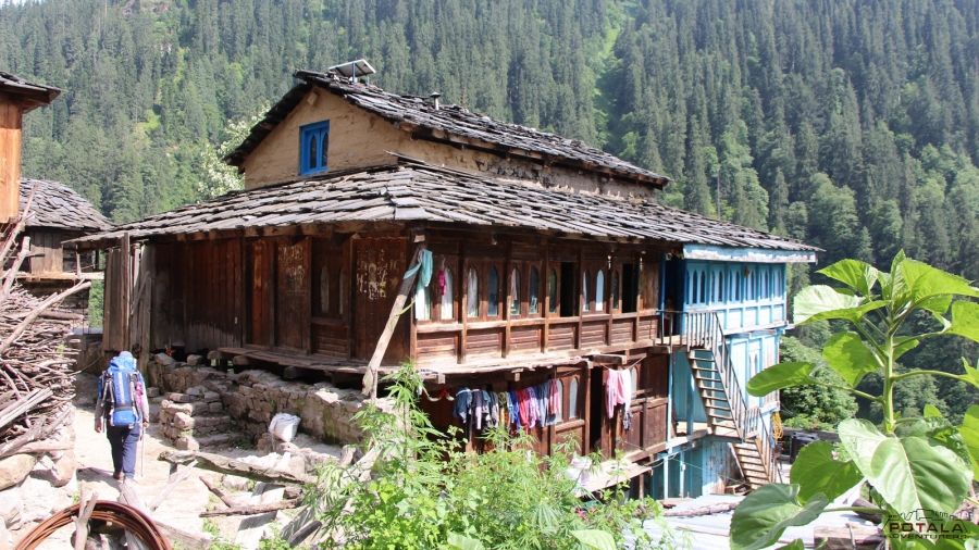
Day 2: Khir Ganga (2850 m) to Tunda Bhuj (3360m / 11023 ft), trek 12 k, 5-6 hours.
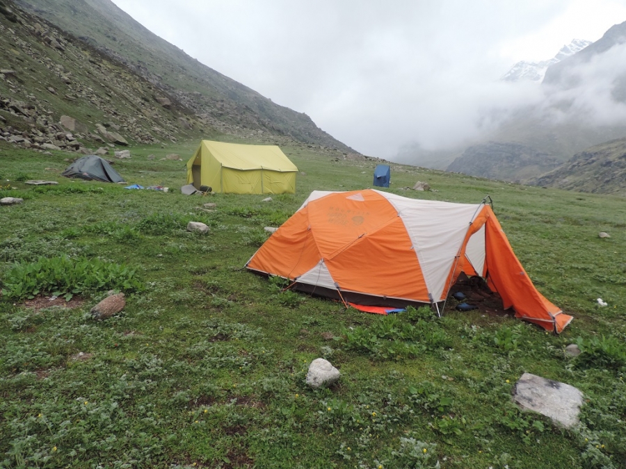
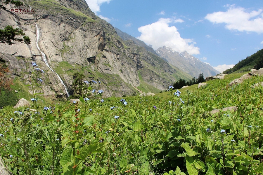
Leaving Khir Ganga today, the trail is muddy through the forest and a steady ascent out of the gorge, where the valley then widens and the trail crosses several delightful pastures supporting a variety of wildflowers in the summer. Mostly now trail goes on flat terrain inside deep thick forests of conifer where it opens up the meadows at sudden. Arrive at the campsite of Tunda Bhuj ( 3250 m / 11023 ft) there are fine alpine views down the valley and waterfalls tumbling down the cliffs on the opposite side of the valley. All the area of Tunda Bhuj is covered with Birch forest.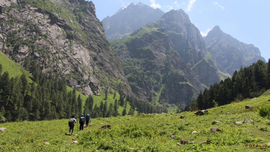
Day 3: Tunda Bhuj (3360 m) to Thakur Kuan (3600 m / 11811 ft), trek 6 km, 4 hours.
Today After breakfast, leaving Tunda Bhuj the trail goes through birch groves, rocks, and dense vegetation then the trail descends to the river bank. It is a short trek today as we have to gain only a few hundred meters in elevation. As we leave the tree line behind the trail later gets a bit narrow in rocky. The campsite of Thakur Kuan sits right next to the Parvati riverbed and the campsite is a vast expanse of pasture land. Close to the campsite, there is a trolley bridge mostly used by Shepherds and this used to be the main trail a few years ago with the wooden bridge right below. Now this wooden bridge has been washed away due to high water in Parvati. Enjoy the afternoon exploring the surroundings.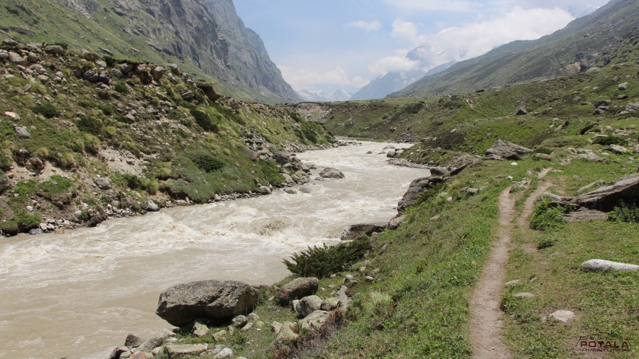
Day 4: Thakur Kuan (3600 m) to Odi Thach (3820 m / 12532 ft ), trek 10 km, 5-6 hours.
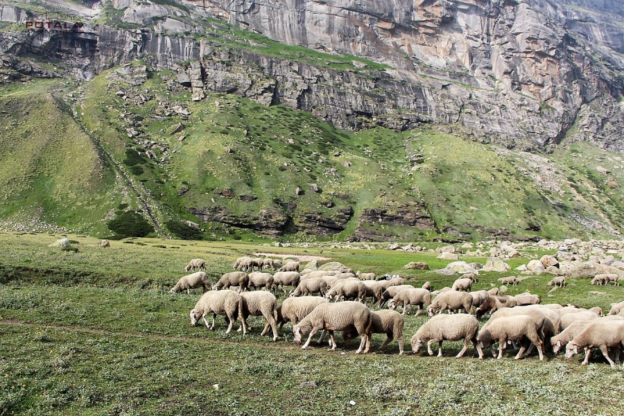
We continue trekking along the river and later climb gently and will take you to the first bridge. A short descent down to the river, and to the next massive boulder lying on Parvati River making it a natural rock bridge. This natural rock bridge is called Pandu Pul ( 3680 m). Continue to trail that now on the right of the river. A short climb starts immediately after crossing the bridge for an hour. After finishing the climb vast meadows open up in front of you. The Odi Thatch area is filled with several Shepherd's encampments with flocks of sheep. Thatch means "meadows" in the Kulluvi dialect. The most attractive view from the camp is the Kullu Eiger (5650 m / 18530 ft) peaks, which sit in front of Odi Thach and across the Parvati River. We camp at the end of the meadow.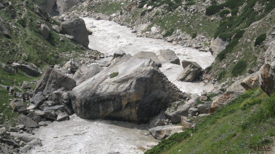
Day 5: Odi Thach ( 3820 m) to Mantalai (4130 m / 13549 ft)), trek 9 km, 5-6 hours
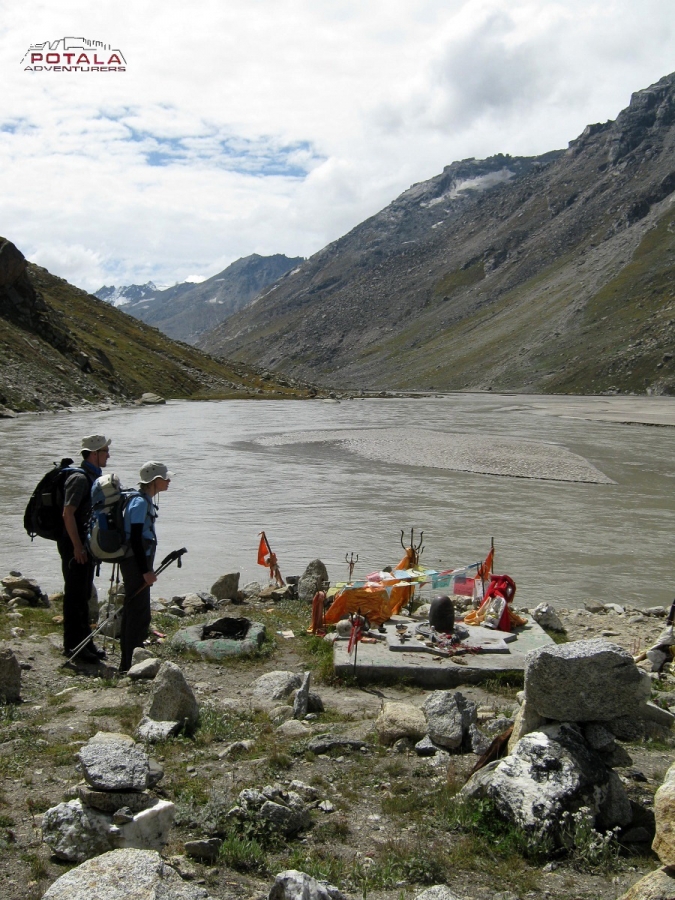
As our trek to Pin Parvati pass continues, we leave Odi Thatch meadows to our next camp of Mantalai. As we gain 300 m in altitude today, so relatively there is no descent but an easy ascent. The trail ascends gradually through a series of flowered meadows intercepted with boulder fields brought down by many side streams. The trail goes along the right side of refreshing Parvati to mini Mantalai. Just before Mantalai, 200 m ascend over the boulders and moraine field to the glacial lake of Mantalai ( 4130 m / 13549 ft). Camp is set on the banks of the lake. This area is also a marshland in the middle of the valley surrounded by the mighty Himalayas. A tiny temple is built here with cairns and flags. The grassy shores of Mantalai are the perfect spot to relax after a trek.
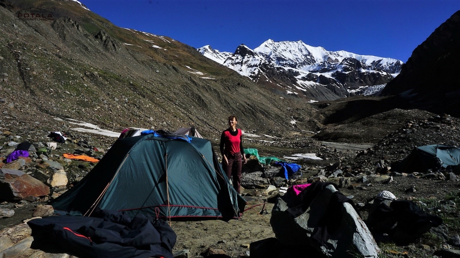
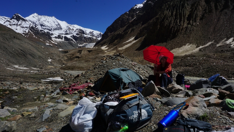
Day 6: Mantalai ( 4130 m) to Parvati Base Camp (4940 m / 16207 ft), trek 10 km, 7-8 hrs
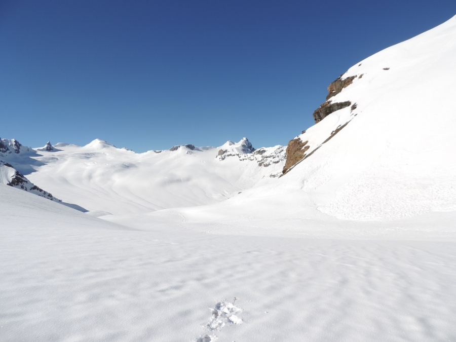
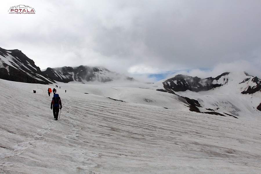
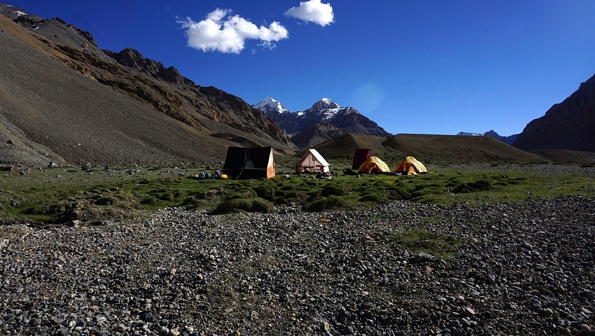
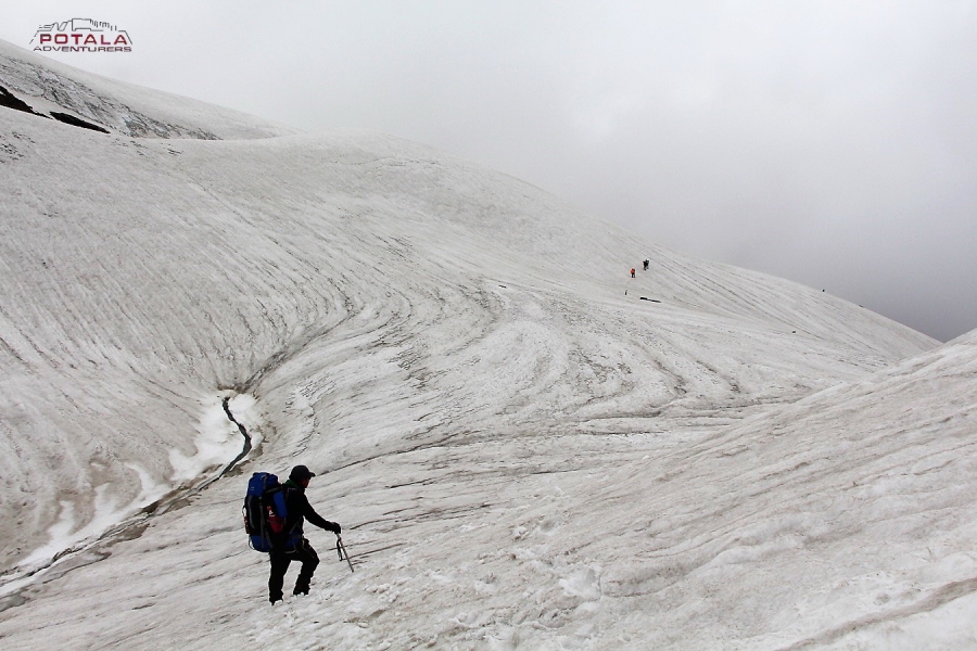
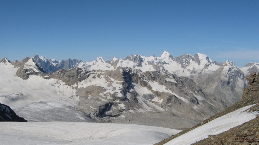
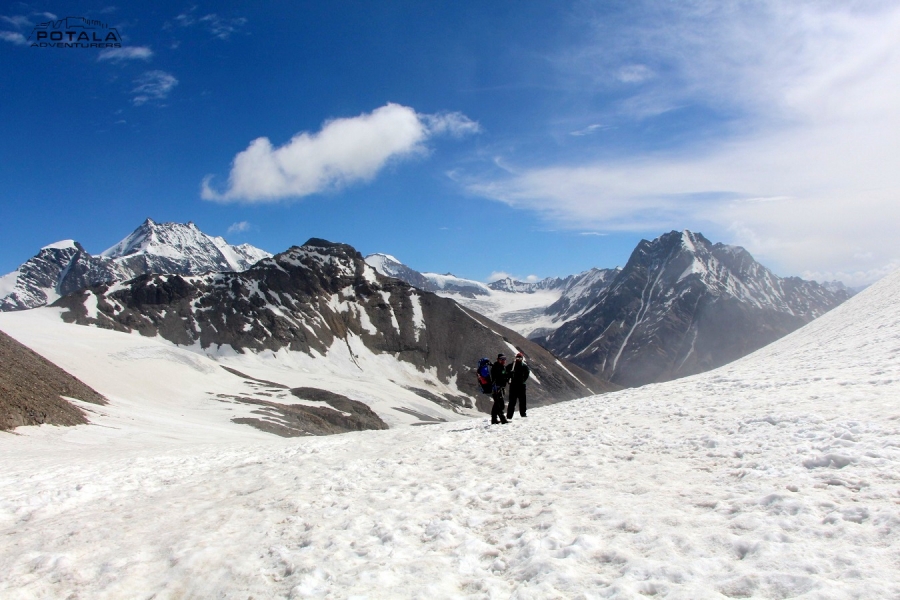
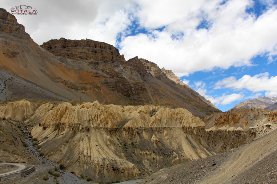
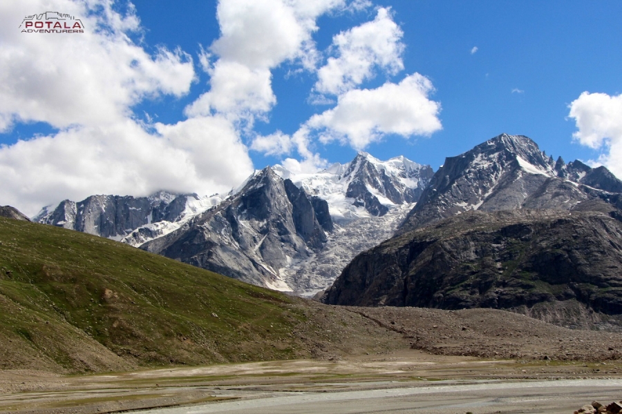
Today is a long and strenuous day, as we have 800 meters to gain in height. We make an early start from the camp and trek along the valley after crossing muddy parts with large sections of loose scree & small streams. We keep left as we climb a steep and steady ridge and the long and hard ascend starts. Trek is now through Boulder and scree out of the main valley. The trail crosses a series of rocky terrain before a further steep climb leads to the base of Pin Parvati pass. Our final climb on a rocky ridge takes us to the beginning of the glacier. It is the edge of the Parvati glacier. We camp at the edge of the glacier to use a base camp Parvati side (4940 m / 16207 ft). The spectacular view of Parvati South and Pyramid Peak can be seen towards the west from the base camp.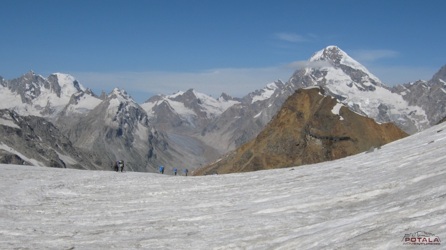
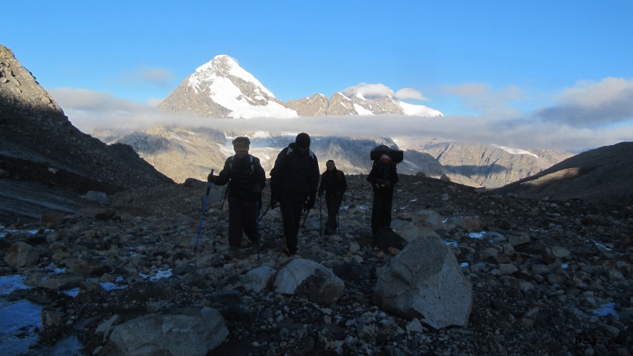
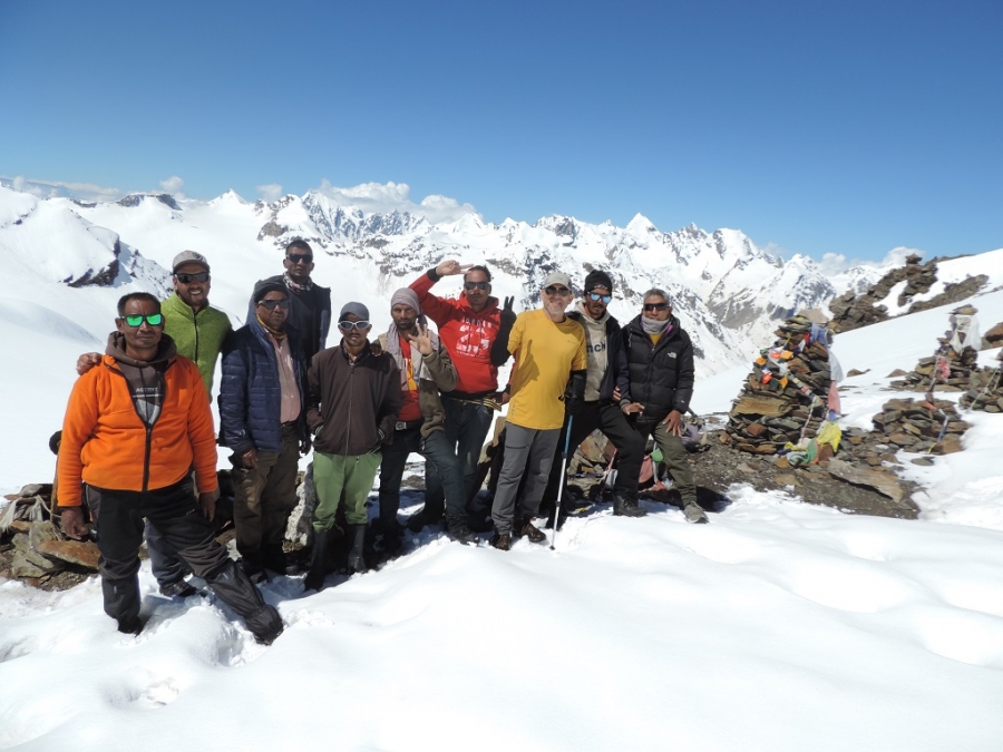
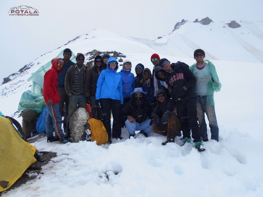
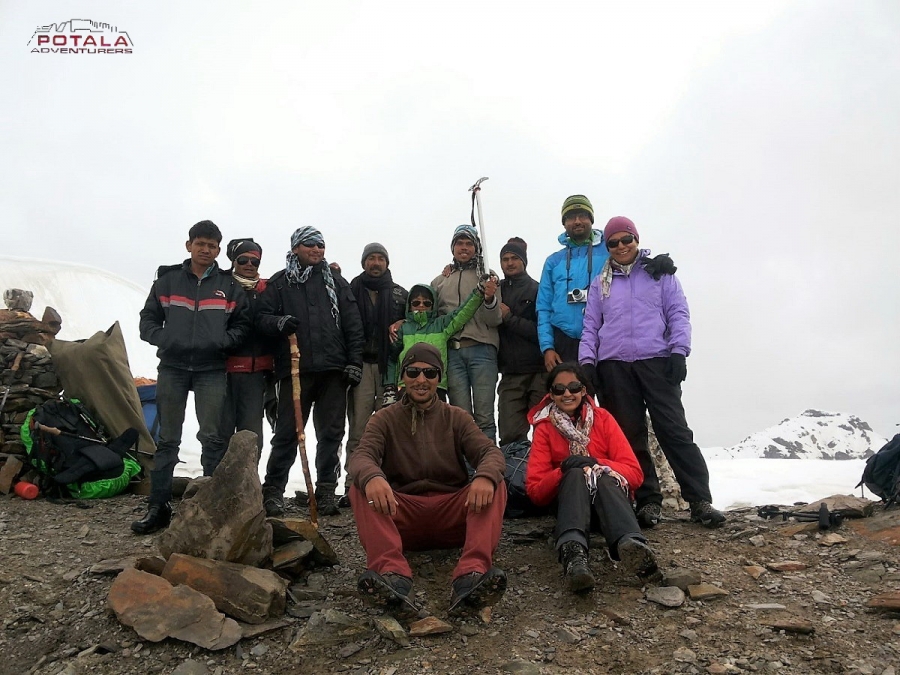
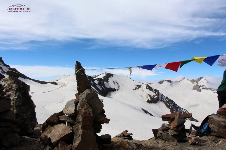
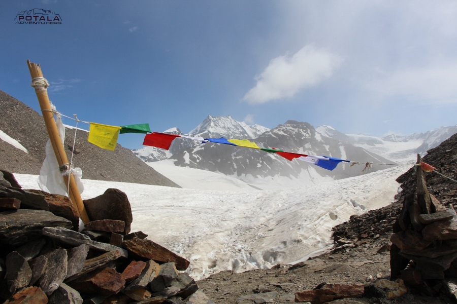
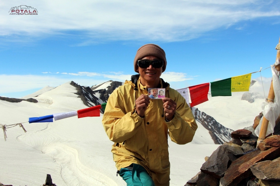
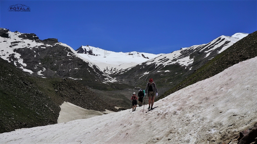
Day 7: Base Camp ( 4940 m) to Pin Parvati pass (5300 m /17400 ft) - Base camp Pin Valley (4400 m / 14450 ft), trek 9 km, 7-8 hours.
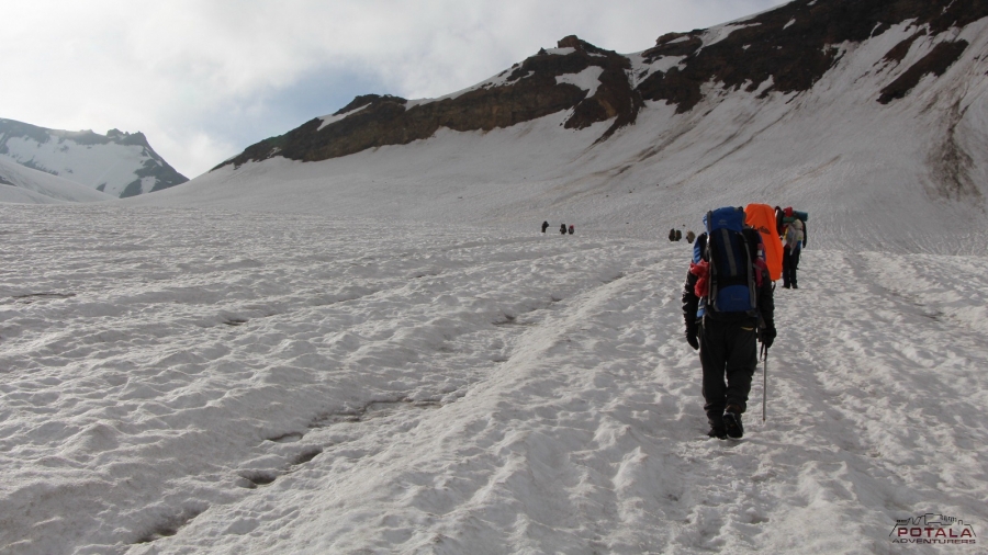
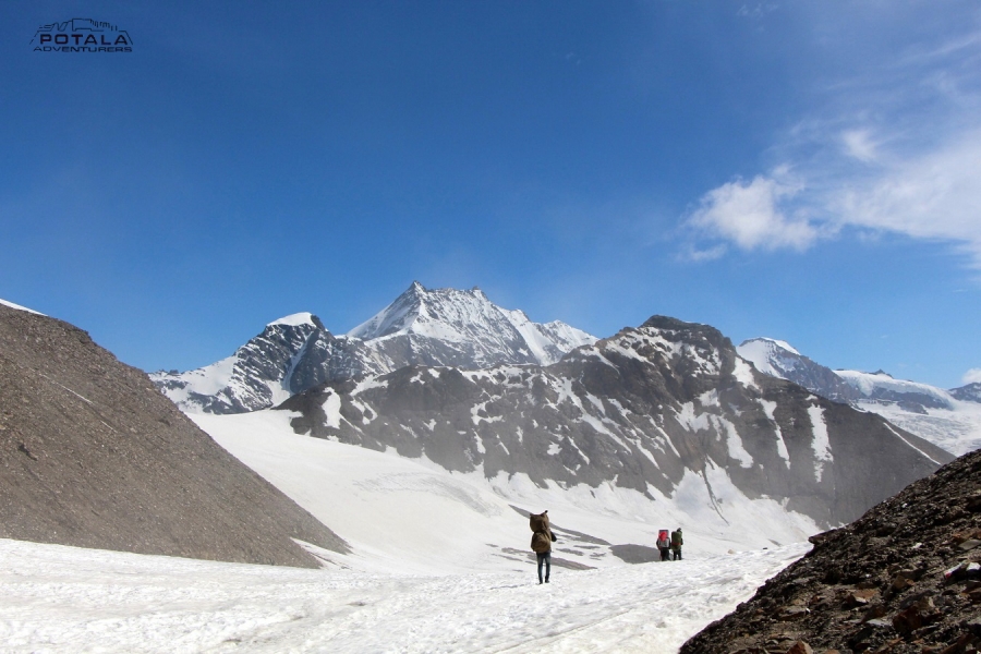
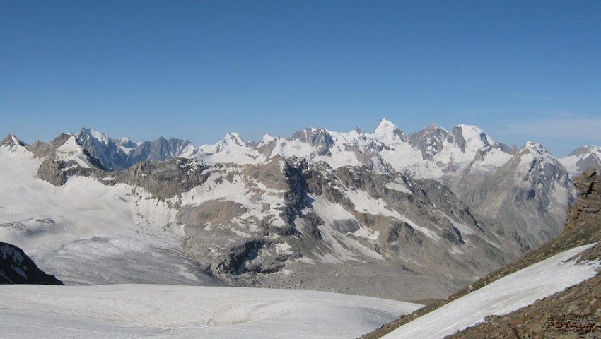
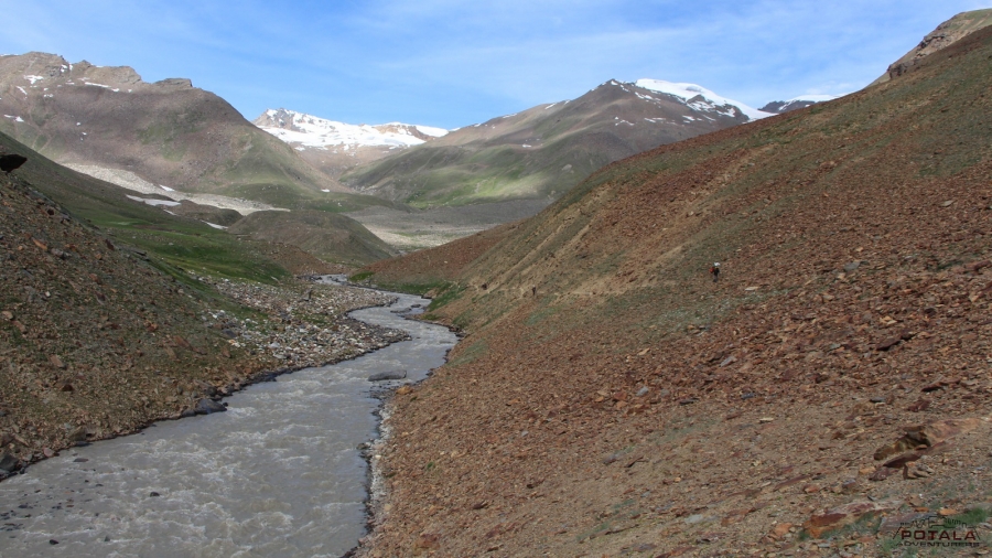
An early start today, as today is the day for the pass, as we make our way into Spiti. Leaving camp trek across the huge ice and snowfield leading to the pass. We need to negotiate the crevasses and icy slopes on glaciers. Following the guide's trail and footprints we continue making our way to the pass which will take us 3-4 hours to reach the Pin Parvati pass ( 5300 m / 17400 ft). The last part is a bit of a steep climb on a rocky ridge. As the sun moves on, the ice becomes unstable, and hence it's harder to walk to snow. So early starts are recommended when the snow and ice remain hard. Reaching the top before noon also gives a clear sky, as afternoon the clouds from the valley start to appear so the view starts to disappear. The pass offers a wide panorama of peaks and the valley of Spiti. We descend gradually from the first on snow and ice, then steep descent on loose scree. Reaching the foot of the pass, we cross an ice-cold stream and reach the camp at Pin side base camp (4400m ) 14450 ft) on a patch of grass on the left bank of the Pin River. 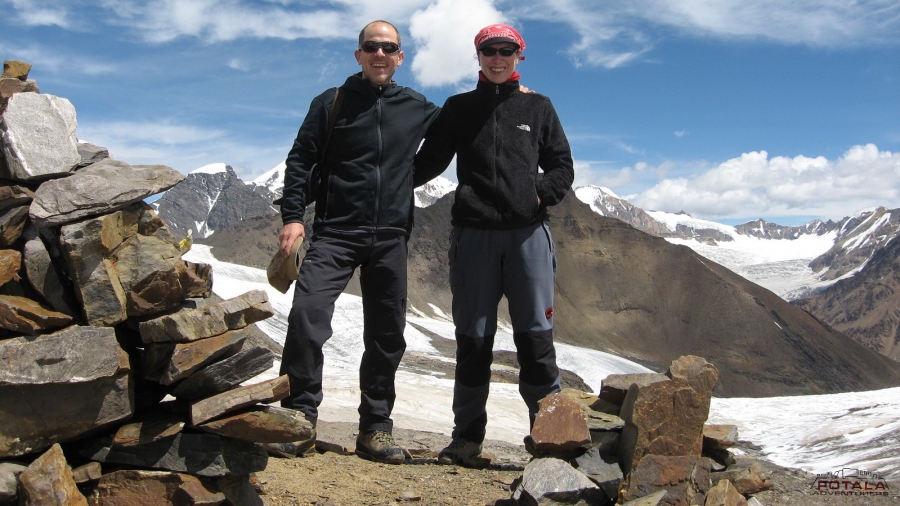
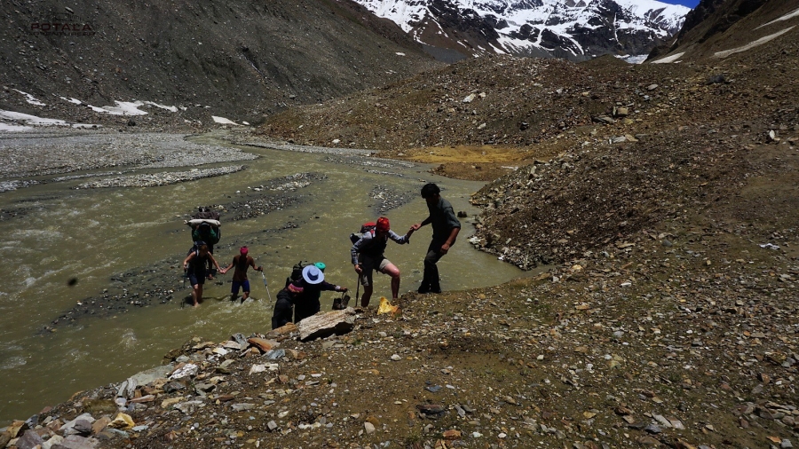
Day 8: Base camp Pin side ( 4400 m) to Wichkurung Thach / Tiya (4000 m / 13123 ft), 13 km, 6-7 hours
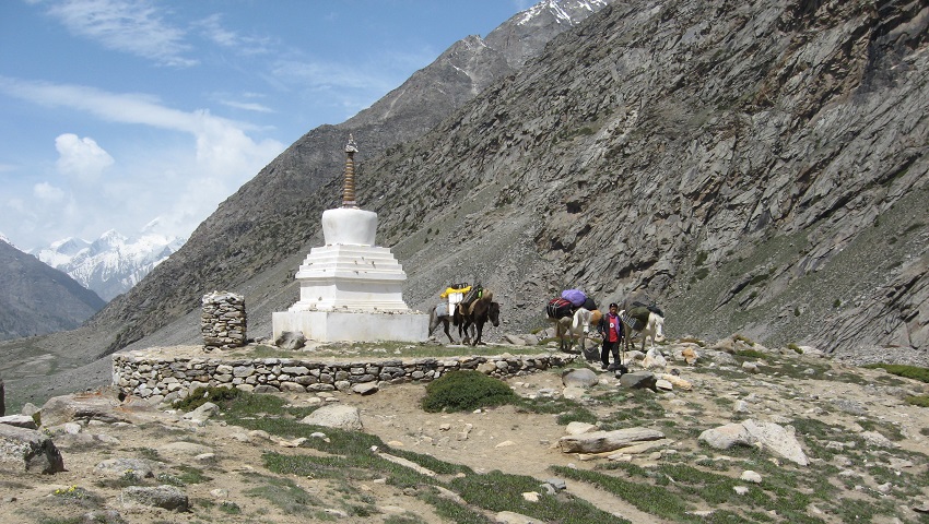
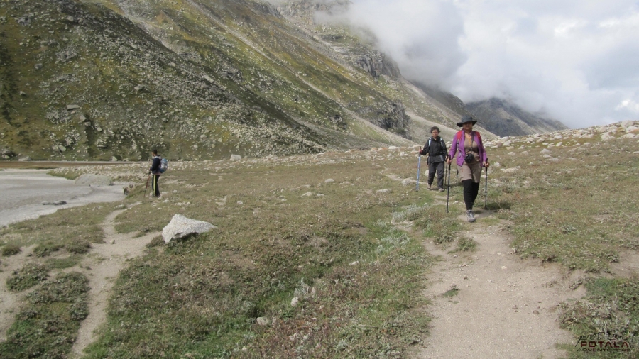
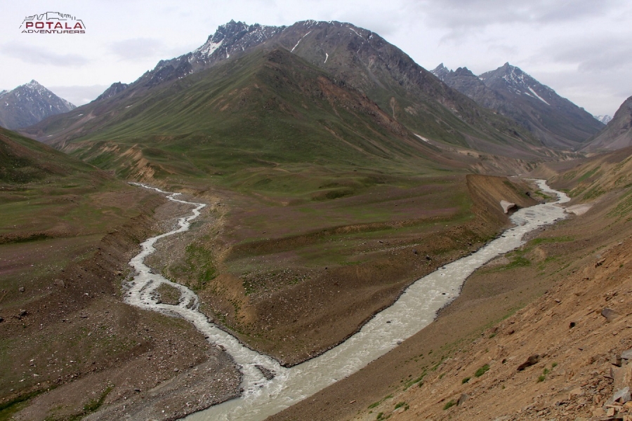
Today we descend slowly along the left banks of Pin River, walking on the loose rocks and many small streams to cross. Today the landscape changes dramatically as we trek in Spiti, from lush green terrain in Parvati to barren landscape in Spiti. Arrive at the campsite. From camp, one can see the route leading towards the Bhaba pass. The valley slightly broadens up here. We camp for the night. The Mudh village is not so far from here. 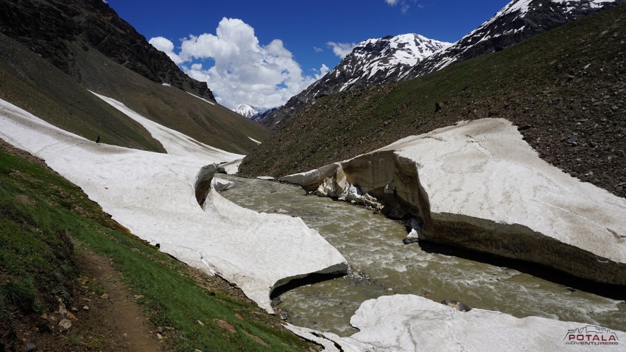
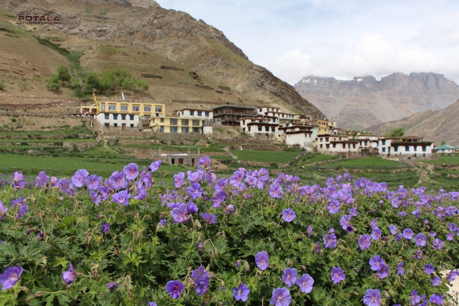
Day 9: Trek to Mudh (3850 m / 12631 ft) 12 km, 4-5 hours, Drive to Kaza (3600m), drive 50 km, 2 hours.
Leaving camp today, we trek in a wide-open valley with numerous streams spread across its floor.
Pin valley landscape scenery is amazing to watch, with the colors of the terrain to the top of mountains and green at the bottom of the valley. Continue on a trail, we stop for a lunch short before arriving at Mudh. Reaching the first village of Pin Valley at Mudh, we stop for a tea break and a homestay shop to taste Himalayan cuisine before heading to Kaza. A short time to spend here exploring the mountain culture and meeting with locals. Finally, into the road drive for 2 hours to reach Kaza. 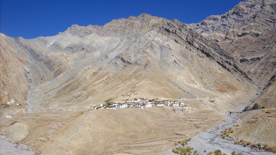
Day 10: Kaza ( 3700 m / 12139 ft) - Kunzum la (4551m / 14931 ft) - Atal Tunnel - Manali. drive 185 km. 8-9 hours.
The last day of our Pin Parvati trip. Back to Manali, leaving Kaza we drive to Losar – the last village in Spiti Valley, after Losar road climbs up to Kunzum la pass (4551m.), which connects Lahoul with Spiti. The road descends to Batal, we are now in Lahaul valley. Along the Chandra River for hours before entering the Atal Tunnel to Dhundi and passing Solang Nala to Manali. End of the trip.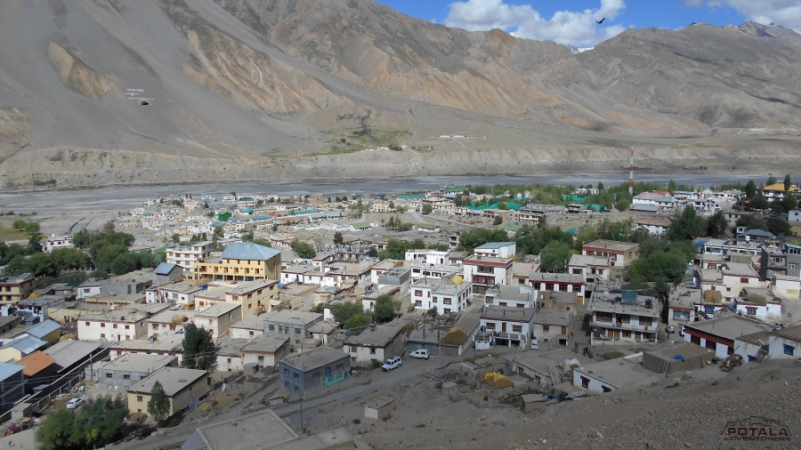
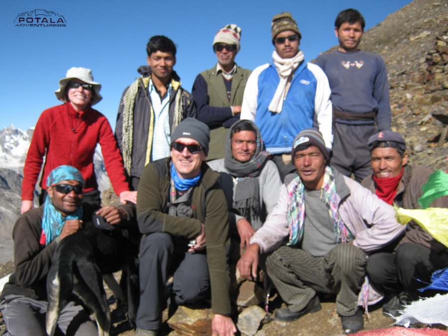
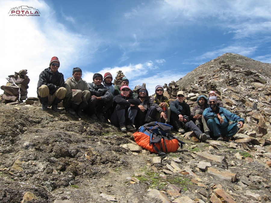
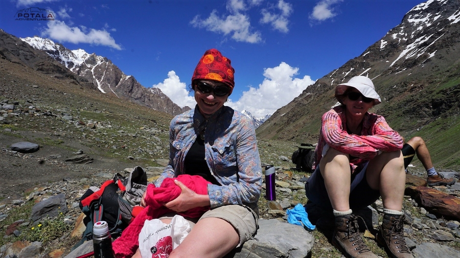
What clients/trekkers has to say
"Potala Adventurers organized a top-notch trek across the Pin Parvati pass with an experienced team and a trained guide. They were always available to help on the difficult sections and ensured I did not feel insecure at any stage. Suresh Kumar is a great asset as a guide and is a wealth of knowledge on the route. I will not hesitate to recommend Potala Adventurers to anyone who would want to do the Pin Parvati Pass trek.
The crew was simply amazing and went above and beyond to have every campsite organized in time. Prem Singh was super easy to deal with from the start and communicated clearly and promptly.
Thank you team for a great time."
Mr. Gautam Nath, New Zealand, June 2023
" I would like to thank you my guide Sherab Gyaltson for assisting me in completing the Pin Parvati & Hamta pass trek successfully. it's a nice & beautiful trek which I enjoy a lot throughout. During the trek, Sherab assisted me in overcoming many obstacles along the way, boulders and river crossing. Walk over the scree, slopes, rocks & ice with soft snow. He also show me various types of flora & fauna and medical herbs which widen my knowledge. He also brought me to Langza village in Spiti valley for finding the fossils in the nallah and brought me to visit several Shepherds summer camps to have tea & chit chat with them which makes the trip more interesting and enhance me a better understanding of their life & hardship. I would also like to thank you Mr Prem Singh organize this trek successfully. He has great passion with deep knowledge of organizing treks and climb in the region. I am looking forward to the next adventure trip with Potala Adventurers. "
Mr Stanley Lai - Singapore - 22nd June to 10th July 2016
Stanley's 6th Great Himalayan trek with us.
1. Parang la & Kanamo peak - 2011
2. Zanskar Traverse - 2014
3. Umasi la & Kanji la - 2015
4. Pin Parvati & Hamta pass - 2016
5. Poat la & Stok kangri - 2017
6. Kharnak trek & Kang Yatse II - 2019
“Our Guide was very competent and responsible person. He was always on place with a good attitude to all the staff. The trek was demanding according to monsoon time and we felt very safe and had no doubt we are in good hands. The kitchen staff was very helpful in all the situations. The food prepared by the cook was very tasty and we liked all the dishes. "
Dorota, Ewa & Malgorzata - Warsaw - POLAND - 15 July 2015
Mrs Dorotas 3rd Indian Himalayan trip with us
1. Markha valley & Stok Kangri - 2012
2. Pin Parvati trek & Spiti Kinnaur tour - 2015
3. Parang la trek - Kibber to Korzok - 2017
“Thanks for putting together a wonderful team for our Pin - Parvati trek. We had great time. We truly appreciate it. Now I don't have to search for agency for our next year's Himalayan trip. Thanks much !!. "
Mrs B. Marwah & family - USA - 9 July 2015
"The guide and cook very helpful.
Ganesh- the head porter was very helpful & took initiative when we reached campsites to pitch tents etc. Personal shawl was a good touch. Food was varied and interesting every day. Dharam paul is a jolly fellow & everyone was kind enough to make cake and pizza. The candle was awesome. Overall, I had a great time and we will definitely come back! "
Padma – 4 September – 13 September 2013
At Kafnoo (Malana, Pin Parvati & Bhaba pass combined 19 days trekking)
Trek member – Rohit and Sriparna
"Had the most wonderful 19 days with the team of Potala Adventurers. Pritam, Dharampal and the team of 5 porters were most instrumental in the making this long trek a super success. Sriparna and I will miss them all and these gone days spent in the wilderness. We promise to be back for more treks in Himachal and Ladakh with Potala." Cheers
R Chaudhary and Sriparna G – 31 August – 18 September 2013
An early departure from Manali today. Leaving Manali we drive 84 km to
Manikaran (1700 m). Manikaran is famous for its hot water springs and ancient
temples. From Bhunter the road goes along the left banks of the Parvati river until
Manikaran. Manikaran to Barshaini road distance is 12 km. Setting off a trek from Barsheni
( 2220 m / 7217 ft), we descend to the riverbed and a short ascend to Nakthan. Now
an easy trail passes through some small villages and further leads through
coniferous forests, waterfalls. Arriving at Rudranag and crossing the wooden bridge
above roaring Parvati River, the trail winds up to Khirganga (2850 m / 9350 ft).
It is a steep climb up to Khirganga. Khirganga is an open meadow and a hot
springs at the distance of 100m up the meadow.
Leaving Khir Ganga today, the trail is muddy through a forest and a steady ascent out of the gorge, where the valley then widens and
the trail crosses several delightful pastures supporting a variety of
wildflowers in the summer. Mostly now trail goes on flat terrain inside deep
thick forests of conifer where it opens up the meadows at sudden. Arrive at the
campsite of Tunda Bhuj ( 3250 m / 11023 ft) there are fine alpine views down
the valley and waterfalls tumbling down the cliffs on the opposite side of the
valley. All the area of Tunda Bhuj is covered with Birch forest.
Today After breakfast, leaving Tunda Bhuj the trail
goes through birch groves, rocks, and dense vegetation then the trail descends
to the river bank. It is a short trek today as we have to gain only a few
hundred meters in elevation. As we leave the tree line behind the trail
later gets a bit narrow in rocky. The campsite of Thakur Kuan sits right next to
the Parvati riverbed and the campsite is a vast expanse of pasture land. Close to
the campsite, there is a trolley bridge mostly used by Shepherds and this used
to be the main trail a few years ago and with the wooden bridge right below.
Now this wooden bridge has been washed away due to high water in Parvati. Enjoy
the afternoon exploring the surroundings.
We continue trek along the river and later climb
gently and will take you to the first bridge. A short descent down to the river,
and to the next massive boulder lying on Parvati River making it a natural rock
bridge. This natural rock bridge is called Pandu Pul ( 3680 m). Continue to trail
that now on the right of the river. A short climb starts immediately after crossing
the bridge for an hour. After finishing the climb vast meadows open up in front of
you. All the Odi Thatch area is filled with several Shepherds encampments with
flocks of sheep. Thatch means "meadows" in the Kulluvi dialect. The most
attractive view from the camp is Kullu Eiger (5650 m / 18530 ft) peaks, which sit
in front of Odi Thach and across the Parvati river. We camp at the end of the meadow.
As our trek to Pin Parvati pass continues, we leave
Odi Thatch meadows to our next camp of Mantalai. As we gain 300 m in altitude
today, so relatively there is no descent but an easy ascent. The trail
ascends gradually through a series of flowered meadows intercepted with boulder
fields brought down by many side streams. The trail goes along the right side of
refreshing Parvati to mini Mantalai. Just before Mantalai, 200 m ascend over
the boulders and moraine field to the glacial lake of Mantalai ( 4130 m / 13549 ft). Camp
is set on the banks of the lake. This area is also a marshland in the middle of
the valley surrounded by mighty Himalayas. A tiny temple is built here with
cairns and flags. The grassy shores of Mantalai is perfect spot to relax after trek.
Today is a long and strenuous day, as we have 800 meters
to gain in height. We make an early start from the camp and trek along the
valley after crossing muddy parts with large sections of loose scree & small
streams. We keep left as we climb a steep and steady ridge and the long and
hard ascend starts. Trek is now through boulder and scree out of the main
valley. The trail crosses a series of rocky terrain before a further steep
climb leads to the base of Pin Parvati pass. Our final climb on a
rocky ridge takes us to the beginning of the glacier. It is the edge of Parvati
glacier. We camp at the edge of the glacier to us a base camp Parvati side
(4940 m / 16207 ft). The spectacular view of Parvati South and Pyramid peak can
be seen towards west from the base camp.
An early start today, as today is the day for a pass, as we make our way into Spiti. Leaving camp trek across the huge ice and
snowfield leading to the pass. We need to negotiate the crevasses and icy
slopes on glaciers. Following the guide's trail and footprints we continue making
our way to the pass which will take us 3-4 hours to reach the Pin Parvati pass
( 5300 m / 17400 ft). The last part is a bit of a steep climb on a rocky ridge. As the
sun moves on, the ice becomes unstable, and hence it's harder to walk to snow. So
early starts are recommended when the snow and ice remain hard. Reaching the top
before noon also gives a clear sky, as afternoon the clouds from valley starts
of appears so the view starts to disappear. The pass offers a wide panorama of
peaks and the valley of Spiti. We descend gradually from the pass-first on snow
and ice, then steep descent on loose scree. Reaching the foot of the pass, we
cross an ice-cold stream and reach the camp at Pin side base camp (4400m )
14450 ft) on a patch of grass on the left bank of the Pin river.
Today we descend slowly along the left banks of Pin
River, walking on the loose rocks and many small streams to cross. Today the
landscape changes dramatically as we trek in Spiti, from lush green terrain in
Parvati to barren landscape in Spiti. Arrive at the campsite. From camp one can
see the route leading towards the Bhaba pass. The valley slightly broadens up
here. We camp for the night. The Mudh village is not so far from here.
Leaving camp today, we trek in a wide-open valley with
numerous streams spread across its floor.
Pin valley landscapes scenery is amazing to watch, with the colors of the
terrain to the top of mountains and green at the bottom of a valley. Continue on
a trail, we stop for a lunch short before arriving at Mudh. Reaching the first
village of Pin valley at Mudh, we stop for a tea break and a homestay shop to
taste Himalayan cuisine before heading to Kaza. A short time to spend here
exploring the mountain culture and meeting with locals. Finally into the road
drive for 2 hours to reach Kaza.
The last day of our Pin Parvati trip. Back to Manali,
leaving Kaza we drive to Losar – the last village in Spiti valley, after Losar road
climbs up to Kunzum la pass (4551m.), which connects Lahoul with Spiti. The
road descends to Batal, we are now in Lahaul valley. Along the Chandra river for
hours before entering the Atal Tunnel to Dhundi and passing Solang Nala to
Manali. End of the trip.
"Potala Adventurers organised a top-notch trek across the Pin Parvati pass with an experienced team and a trained guide. They were always available to help on the difficult sections and ensured I did not feel insecure at any stage. Suresh Kumar is a great asset as a guide and is a wealth of knowledge on the route. I will not hesitate to recommend Potala Adventurers to anyone who would want ...
" I would like to thank you my guide Sherab Gyaltson to assist me of completing the Pin Parvati & Hamta pass trek successfully. it's a nice & beautiful trek which I enjoy a lot throughout. During the trek, Sherab assisted me to overcome many obstacles along the way, boulders and river crossing. Walk over the scree, slopes, rocks & ice with soft snow. He also show me various types of ...
“Our Guide was very competent and responsible person. He was always on place with a good attitude to all the staff. The trek was demanding according to monsoon time and we felt very safe and had no doubt we are in good hands. The kitchen staff was very helpful in all the situations. The food prepared by the cook was very tasty and we liked all the dishes. " Mrs. ...
“We can't say enough thanks to Prem Barbogpa at Potala Adventurers for excellent management of our Pin Parvati Trek in July. We are extremely happy with Potala's services, from the first interaction to the completion of trek, everything was handled with great professionalism. Prem delivered more than he promised. Prem put together a perfect team for our family, which includes 2 kids. Our guide Pritam, chef Sherab and porters were all ...
"The guide and cook very helpful. Ganesh- the head porter was very helpful & took initiative when we reached campsites to pitch tents etc. Personal shawl was a good touch. Food was varied and interesting every day. Dharam paul is a jolly fellow & everyone was kind enough to make cake and pizza. The candle was awesome. Overall, I had a great time and we will definitely come back! " Ms ...
At Kafnoo (Malana, Pin Parvati & Bhaba pass combined 19 days trekking) Trek member – Rohit and Sriparna "Had the most wonderful 19 days with the team of Potala Adventurers. Pritam, Dharampal and the team of 5 porters were most instrumental in the making this long trek a super success. Sriparna and I will miss them all and these gone days spent in the wilderness. We promise to be back for more treks in ...
Pin Parvati trek - Spiti tour - Chandratal - Manali - Shimla - Kalka - Delhi - 15 nights 16 days “Dear Prem and Tenzing we like to thank you for the magnificent time we had on the Pin-Parvati-Trek, the really amazing Jeep trip though the remote Spiti valley and the little trek to Chandratal Lake. The ride to Shimla and the trains to Delhi were well organized as well; you choose ...
TRIP FACT
Activity: Trekking & hiking
Region: Kullu & Spiti of Himachal
Difficulty level: Moderate to strenuous
Max altitude: 5,319 meters
Max sleeping altitude: 4680m
Lowest trekking altitude: 2220m
Trip length: 13 days from Delhi
10 or 11 days Manali to Manali
9 days of trekking, 8 nights of camping
Best time: Mid-June to mid-October.
HIGHLIGHT
Trek across the Great Himalayan range
Peaceful campsites along the Parbati & Pin River
Spectacular drive over Kaza - Manali road
Great Himalayan National Park &
Pin Valley National Park