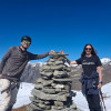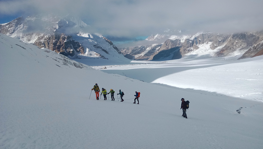
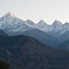
Miyar valley: Yosemite of India, Stunning mountains, Crossing of 24 kms long Kang La glacier at Greater Himalayan Range, Southern Zanskar and its high villages
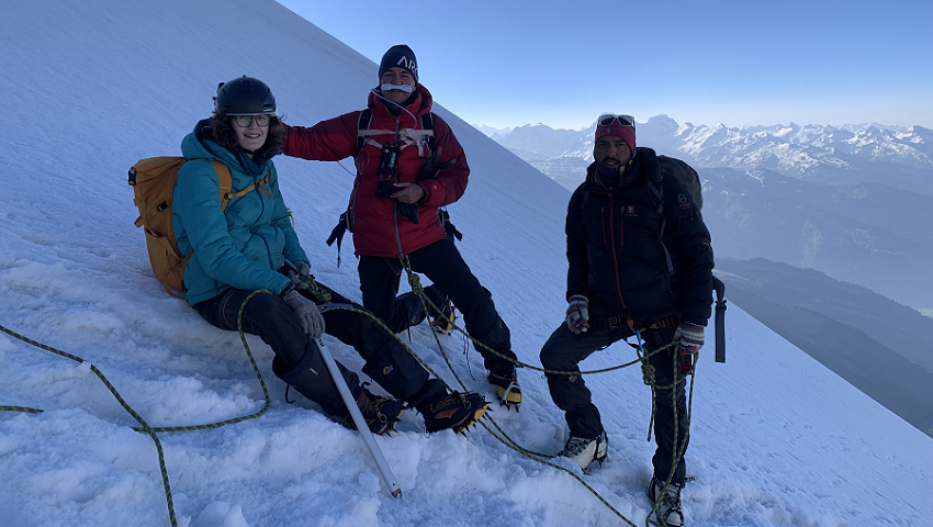
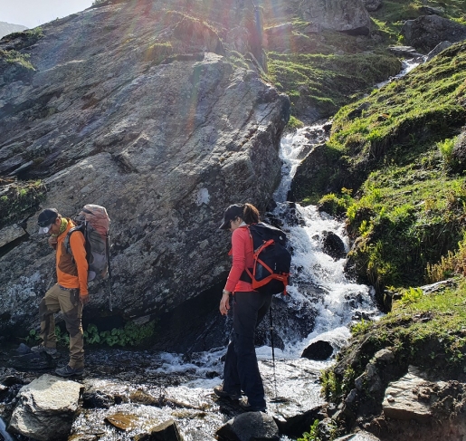
One of the least explored trekking routes and mythical journeys in the Indian Himalaya. With passes over 5000m that connects Sarchu to Kanji. Zanskar grand traverse, Zanskar wild and remote or La Grande Traversee du Zanskar is an updated Zanskar traverse known to the world as Darcha Lamayuru. Twenty-two days of walking in the heart of spectacular landscape and the complete crossing of Zanskar from South to North. Zanskari village which remains cut off from the rest of the world for eight months. The inhabitants of Zanskarpa live in serenity and inner peace.
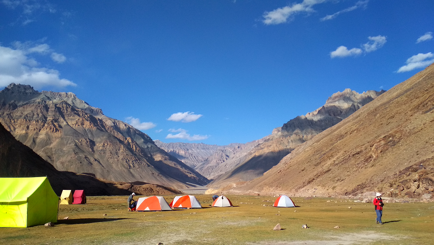
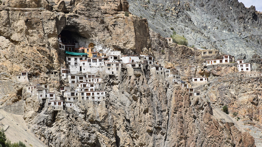
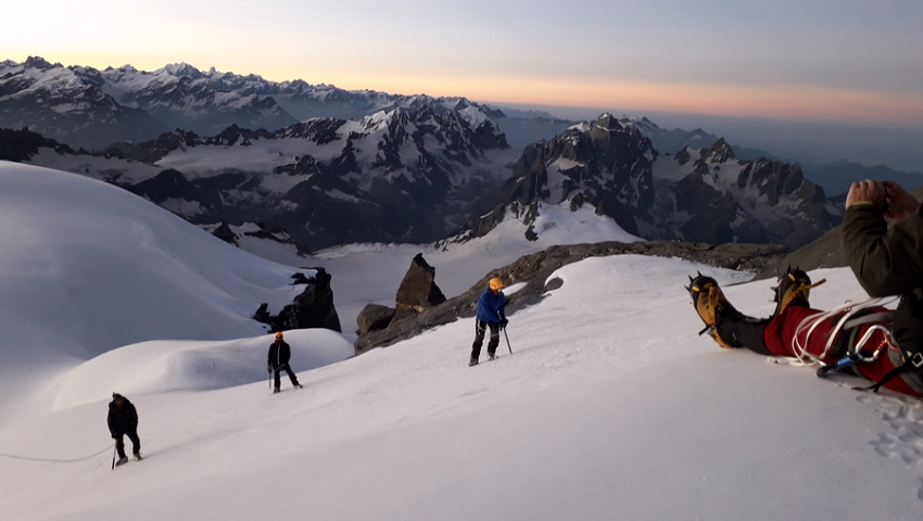
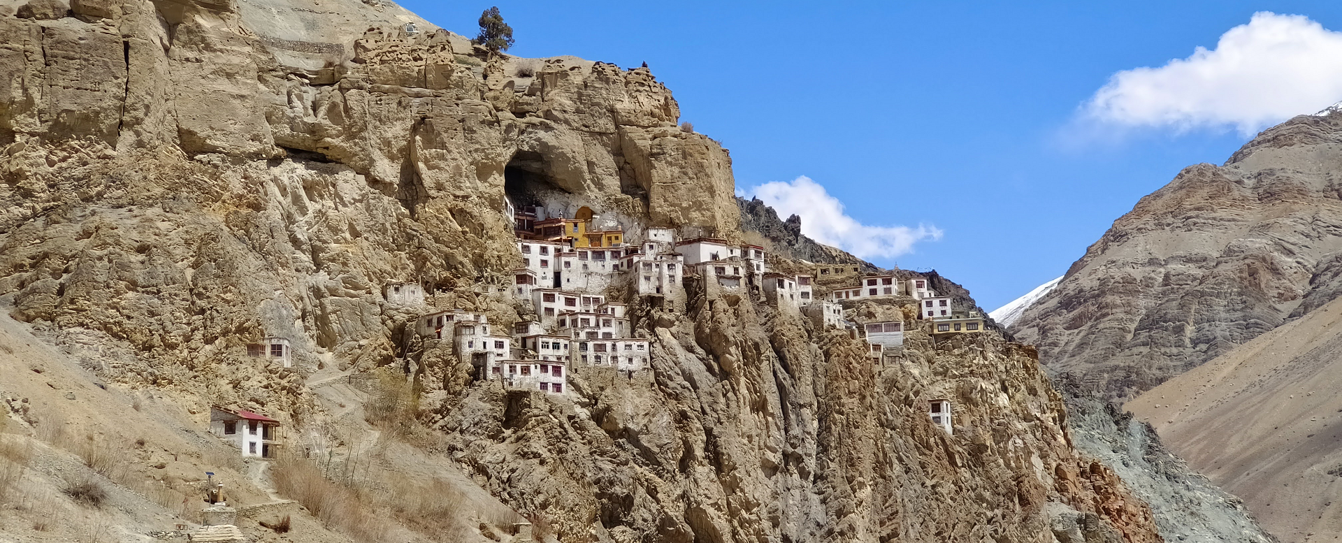
Setting off from Leh after 2-3 days of well acclimatizing, you drive to Sarchu crossing the Taglang la 5268 m on Leh - Manali highway known as 2nd highest mountain road in the world. We pass through high plains on the Rupshu Changthang to the wide valley of Sarchu., from where we cross the highest pass of our trek Phirtse la 5450m and descend to Lungnak River valley. Passing through villages and exploring the daily life of Zanskari to Phugtal gompa, this is built under a huge cave. We continue to Shade one of the remotest village in Himalaya, a series of high passes and narrow gorge of Zangla before we visit Karsha and Padum.
Our 2nd stage will take us through the Ladakh part after crossing Hanuma la into Lingshed, Final ascent to Sengge la to Photoksar where our trek ends.
A Himalayan village on the path of Alexander the Great - Trek to remote & lonely Bara Bhangal village - home of Himalayan shepherds
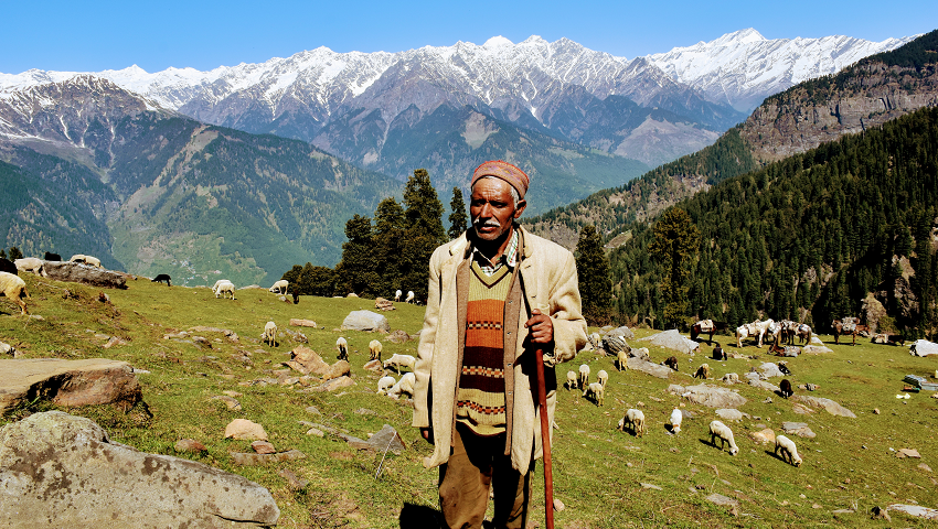
Trek across beautiful Pir Panjal range into Dhauladhar range of lower Himalaya to remote & lovely village of Bara Bhangal - home of Himalayan shepherds. Over craggy passes, pass icy glaciers and ancient monasteries. The Dhauladhar range divides the Kullu and Kangra valley of Himachal. To the north lie Lahoul and Spiti, which have a fantastic range of snow peaks- a mountaineer's paradise.
This trek is one of the most enchanting and picturesque, leading from the Kullu valley to scenic Kangra valley over the Dhauladhar range of the Himalayas A high altitude trek, anyone reasonably fit will find it an almost dreamlike experience. Each day presents a different and startlingly beautiful landscape all lavishly decorated, a trek that leaves one with wonderful awesome of the Himalayan regions. The Trek terminates at Bir near Dharamsala: the mini Lhasa in India which is the seat of His Holiness the Dalai Lama. A demanding and challenging trek into the Bara-Bhangal region, which still remains cut off from the World by 4500- 4700m high passes and still, a very few trekkers find their way here.
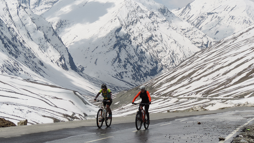
You may have already heard of some of the famous Ladakh cycling routes. But did you know that Ladakh has the highest cycling route in the world and some of the toughest and longest climbs you’ll find in this part of the Indian Himalayas? Zanskar is a sub-district of extremes; we have the mountains and the steep climbs. You’ll never be bored of the views here either. Even if they’re shrouded in mist, there might just be a snow-covered mountain, abandoned monasteries, or herd of highland yaks around the next corner.
One of the Indian Himalayas’ most spectacular, diverse, and challenging bicycle trips! Our Great Zanskar cycling trip passes through remote, sublimely beautiful regions of northern India – the Chandra Bhaga and Zanskar River valleys, Atal Tunnel, Buddhist central Lahaul & Zanskar, a hike to Phuktal monastery and Zanskari villages and its people – ending this epic cycling trip in the Ladakh moon land at Lamayuru, we stay on tents occasionally homestays and tour the Khardung La, the perfect end to an amazing bicycle adventure!
Enjoy the views out to Gonbo Rangjun peak, and Phuktal Gompa is the most spectacular sight in Zanskar, built under a huge cave and situated on the rock above the Tsarap River. Stops for a tasty lunch prepared by our camp cook every day. Travel from Kurgiakh the first village of Zanskar southern highland to the ancient capital of Padum. Soak up the stunning mountain scenery as you cycle through the plains of Padum, and Thongde before being rewarded with a panoramic view of the central Zanskar Mountains. The stunning (but challenging) loop northwest of Zanskar travels through some of the region's wildest and most idyllic landscapes. See famous mountains such as Singe La, Sirsir La, Lingshed monastery, and Zanskar River gorge, as well as a tranquil area of Zangla creating the best experience for cycling in Zanskar mountains.
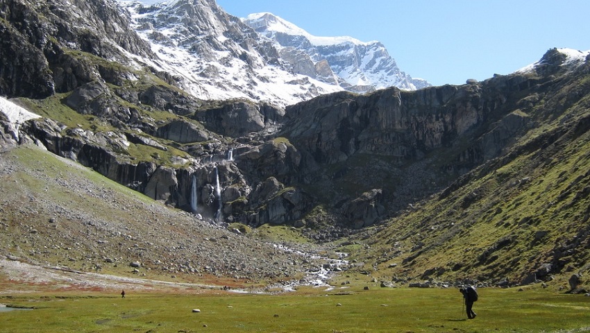
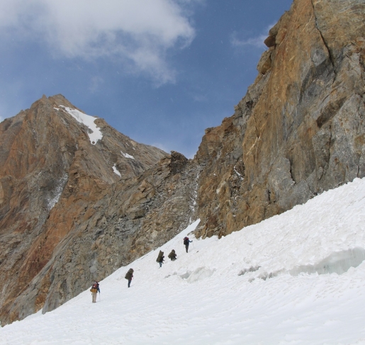
Pin Parvati Pass at an altitude of 5,319 m / 17,450 ft connects the Parvati Valley (Kullu) in the west and Pin Valley (Spiti) in the east. Pin Parvati can be crossed without any technical difficulties. In Parvati Valley, the trail begins at a relatively low altitude, which makes better acclimatization before crossing 5319m. After the large alpine meadows of Tunda Bhuj, you reach the large flat valley floor at Mantalai, where the moraines of the Parvati glacier come to an end. Leaving the valley, steep path to the left to base camp. A long stretch of a glacier crossing, the trail runs through steep scree to the small pass, which provides a panoramic view of the Great Himalayan range peaks, Parvati South, Parvati North, Pinnacle, Kullu Eiger all above 6`000 m. A steep descent to Pin River. The easy trail along the left banks of Pin River to Mudh (3820m), the last village in the Pin valley. With the extreme differences in climate, Pin Valley is much more rugged and barren than Parvati Valley. This cold desert valley with its snowy crags, cliff, jagged rocks, and other fossils makes Pin Valley a unique geological lab. Pin Valley National Park is home to snow leopard, red fox, marten, weasel, Himalayan Royle Pika, bearded vulture, golden eagle, lynx, and Tibetan wolf. The Pin area has been conserved as a national park since 1987. The main attraction of Pin Valley is the Chamurthi pony, known for its fast, sure-footed-on mountain terrain, moving safely on ice, and being well adapted to cost and harsh environment.
Due to the southern edge of the main Himalayan range, during summer monsoons often at the foothills determine the weather, which brings rain and snow around the pass. Mudslides at Pin Valley can cause unpleasant surprises during the monsoon, which brings the Pin Valley cut off from the main Spiti valley. The best time to go for this trek remains is from mid-June to mid-July and from the third week of August to the end of September. But be careful after the third week of September, when frozen monsoon tails can bring huge snowfall at the main Himalayan range.
The picturesque village of Mudh, where the trek ends is surrounded by barley fields. From here, a jeep safari into the Spiti valley offers opportunities to visit the sights of Spiti i.e. Kungri, Tabo, Dhankar, Lalung, Langza, Comik, and Kee-Kibber, before returning to Manali.
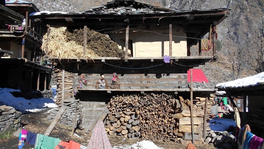
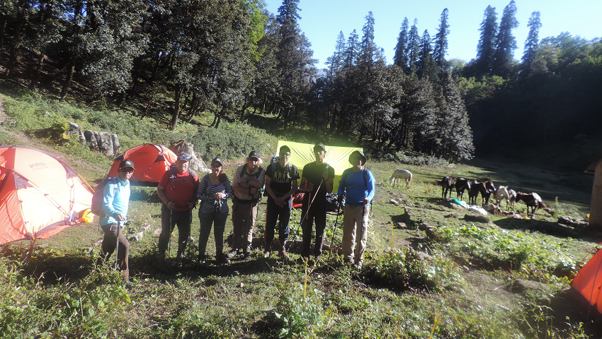
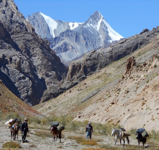
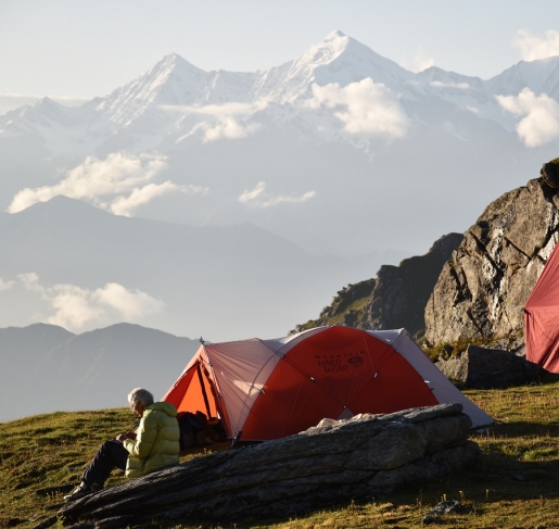
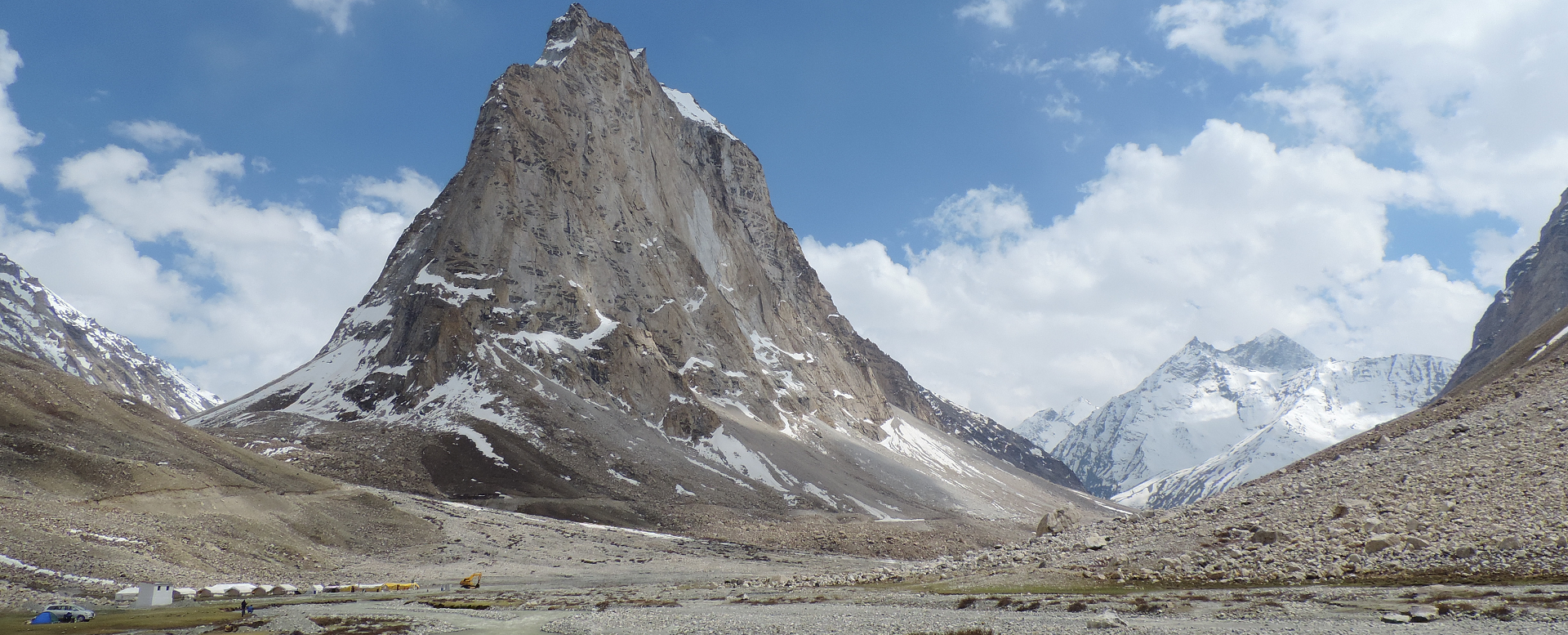
Miyar Valley is situated in the west of Lahaul and Spiti district of Himachal Pradesh. The Miyar Valley is stretching over 75 km from Udaipur to the great Kang la. Miyar Nala as it is often known, with the Miyar River running down from the snout of Kang la glacier into Chenab River for almost 50 km. This glacier stretches a further 24 km up to the high Kang La Jot ( 5,468 m). North of Kang La lies Zanskar of Ladakh union territory. Miyar Valley is also known as the Valley of Flowers. It’s an unspoiled area similar to Zanskar and local people in the area follow Buddhist customs and are mainly shepherds and farmers. During summer cultivating peas, Barley, and other vegetables.
July and August are prime times to visit this magnificent valley, blooming with high-altitude flowers, medicinal plants, herbs, and the rare Blue poppy quite famous among all. The Miyar valley is comparatively easy to reach by road and there are plenty of unspoiled things to explore which are still hidden from the outside world. The best time to do the Miyar Valley trek is from mid-May to mid-July and September. Miyar Valley is a paradise of Gaddi Shepherds, their flocks of sheep and goats graze in the high-altitude meadows until late summer. Known to the outside world as Yosemite of India or the Himalayas, many professional rock climbers have made ascents of unclimbed peaks, still, some peaks have not been climbed yet. We at Potala Adventure have successfully made logistic support for professional rock climbers in the past, the first ascent of Lotus Tower SE face was climbed by Cyrill Bosch, Elias Gmunder, Arunas Kamandulis, and Gediminas Simutis all logistics to them given by Potala Adventurers.
Leaving Manali we drive to Udaipur which is famous for wood wood-carved Mrikula Devi temple, continue to drive we enter the Miyar valley. Arriving at Urgos where there is a small gompa and further at Shukto, where we start our trek to Khanjar, Thanpattan, Zardung, and finally to Kesar Yon Chhap which means seven sacred water at the snout of the Miyar glacier at the bottom of Castle peak, which dominates the Palphu area. A day to explore the Chhudong valley. Takdung Glacier faces Southwest and the Pimu la Glacier sits on the opposite side of the Miyar River. The climbing peaks in the area are Neverseen Tower (5,990 m) nearly 6,000 m located above Tawa glacier, Ogre I, II, & III, Lotus, Iris, Mt. Maudit, Om Shanti, Shabnam, Garuda Peak, Premsingh Peak, Toro peak, Ashoka's pillar, Mt. Mahindra peak (6080 m). Apart from these peaks, the well-known peaks in Miyar Valley are Mt. Menthosa (6,443 m), Tharang I, II & III, and Phabrang (6,172 m).
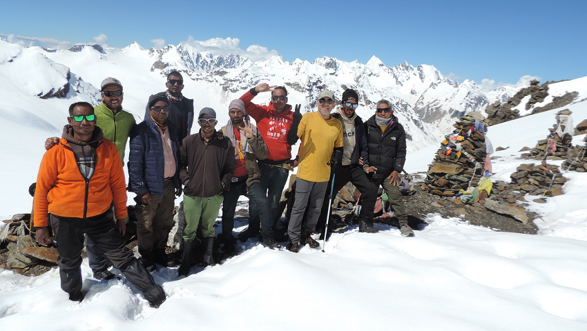
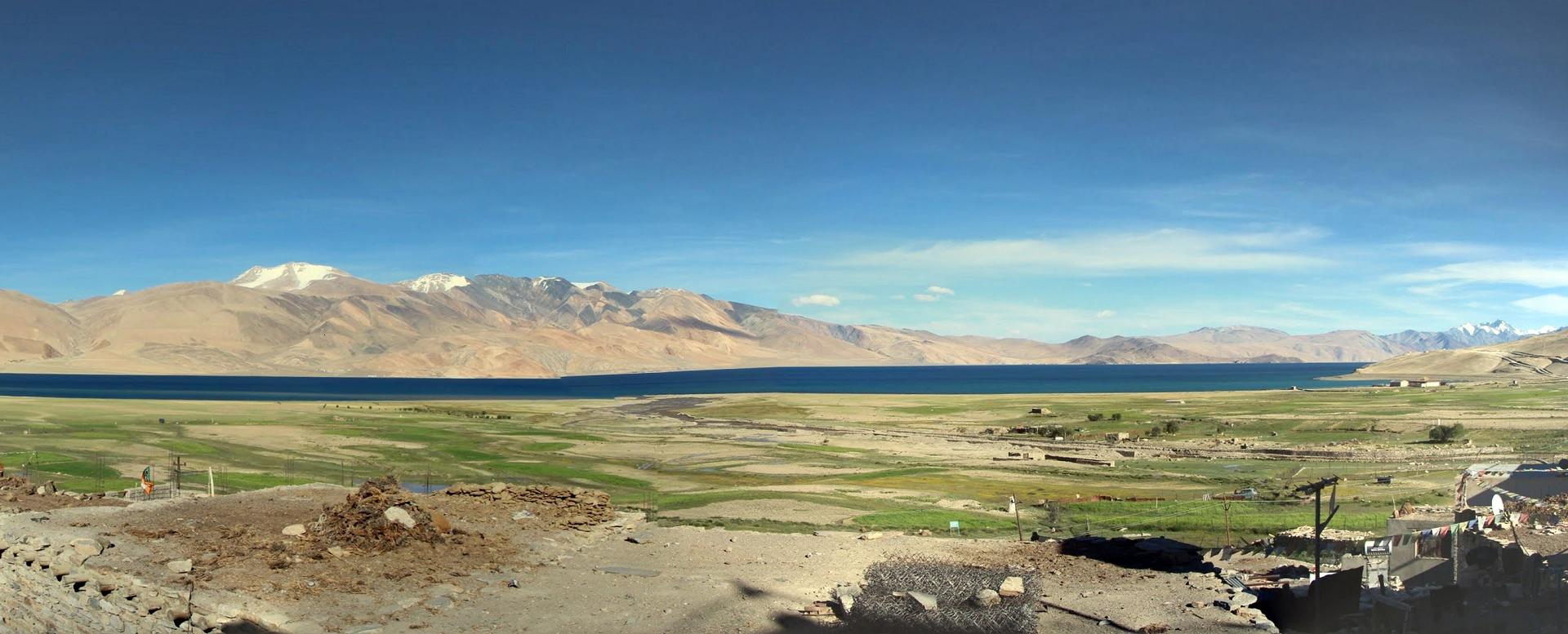
This demanding and Challenging Trek takes us to the land of Changpa nomads living on the vast high plateau of Changthang. It focuses mainly on the life of Nomadic people and wildlife in motion. After 2-3 days of well acclimatizing in Leh, we drive to Rumtse (85 km) at the foot of Tanglang la pass (5328 m). Beginning to trek from Rumtse we cross over passes of Kyamari la, Mandalachan la, and Shingbuk la before approaching Lake Tsokar. This tour is taking place in the Changthang region, which has an average altitude of 4000-5000m, higher than central Ladakh and Nubra Valley. In that case, a long acclimatization is a must before starting the trek.
The first stage of the area is relatively uninhabited, while the second phase after Tsokar up to the Tsomoriri Lake area is vastly dwelt by Changpa nomads. We visit several yurts along our trail and carefully witness nomadic daily life. Crossing over 3 high passes of Kyamayuri la, Kartse la, and Yarlung Nyau la we arrive at Karzok phu. One of the largest nomadic settlements in the region. Occasionally chances to see wildlife such as Kyang, black naked crane, Tibetan Antelope, Himalayan Marmot, and Blue Sheep. Finishing trek at Karzok we drive back to Leh via Chumathang.
Spiti valley is located on the Tibetan border enclosed on the South East by Tibet, North West by Ladakh, and West by Lahoul and Kullu. Geologically and archeologically Spiti valley is a living museum. Spiti valley is high altitude cold desert and in its lunar landscapes are still stretches, where every other rock is fossils. Spiti valley is formed by the Spiti River, which rises on the slopes of Kunzom pass (4’551 m) and ends at the river confluence with Pare-Chu near Sumdo. The length of the valley is about 150km. Enroute Spiti River receives the water of many streams: Guindi Nala, Parilungbi Chu, Pin River and Lingti River. There are two routes to Spiti valley, one over Rohtang-pass (3’978m/13’050ft) and Kunzom pass and other via Shimla, Rampur and Kinnaur.
Spiti was once a part of the West-Tibetan Kingdom of Guge in the early 17th century. Guge became fragmented and Spiti, along with Lahoul, came under Ladakhi rule. A vital link of Great Trans Himalayan trade route from Lhasa to Kashmir and Spiti – Literally “The middle country” – found itself locked between the mountain range and International border, now a part of Himalayan tribal sub-division of Lahoul and Spiti district of Himachal Pradesh.
Today more and more travellers, tourists, trekkers, geologists and researchers are discovering this wonderful and last inhabitable world.
Zanskar refers to a high-altitude region in the Union Territory of Ladakh, India, known for its remote Zanskar Valley and the surrounding Zanskar Range.
Zanskar is one of the most isolated and sparsely populated parts of the Himalayas, traditionally part of the Kargil district but recently designated to become its own district by 2028.
Geography: A high-altitude semi-desert at 3,500–7,000 metres, protected from the monsoon by the Great Himalayan Range. Padum: The administrative centre and largest village. Phugtal Monastery: A unique monastery built into a cave. Zanskar River: Famous for the Chadar Trek, a winter trail over its frozen surface. Gumbok Rangan: A sacred, standalone peak known as "God's Mountain". Culture: Primarily Tibetan Buddhist, known for preserving ancient traditions due to its geographical isolation. Adventure Sports: The Zanskar River offers world-class white-water rafting (Grade III to V) in summer and the famous Chadar Trek (Frozen River Trek) in January and February.
The valley is now accessible via three primary routes, though most remain seasonal:
Via Manali (Shortest): Manali - Darcha - Shinku La Pass - Padum. This route is typically open from April to December. A 4.1km all-weather tunnel is currently under construction beneath Shinku La, with a revised completion target of August 2028.
Via Kargil (Traditional): Srinagar/Leh - Kargil - Suru Valley? Pensi La Pass? Padum. This scenic route is generally open from June to September.
Via Leh (Adventurous): Leh - Nimmu - Padum. This newer axis (N-P-D road) is under construction to provide a third gateway to the region.
Best Time: June to September for pleasant weather
Connectivity: Extremely limited. Only Postpaid works reliably in Padum. There is a frequent scarcity of fuel, so travelers should fill up in Kargil or Padum.
Health: Due to the high altitude (3,500m to 7,000m), 2 days of acclimatisation in Lahaul, Leh or Kargil is highly recommended to avoid Acute Mountain Sickness (AMS).
Welcome to Potala Adventurers Himalaya. Potala Adventurers is a
place where you can have unique info, filled with our regional knowledge on
trekking in Ladakh & Zanskar, Lahaul-Spiti & Kinnaur, Kullu &
Manali, Garhwal & Eastern Kishtwar regions of Indian Himalayas. Potala
Adventurers is a small trekking company, organizing treks and a varieties of
customized trips in Indian Himalayas. We offer a wide range of
trekking and overland trips in the Indian Himalaya for short and long holiday
seekers. All of our treks are unique in its, own specialty and planned
carefully to benefit maximum visits of places of the area that you are visiting
upon. We will be happy to share our experiences of our Himalayan regions; its
culture, history, tales, nature, brilliant landscapes, and native people. Our
programs include: Zanskar traverse, Parang la & Nomads of Rupshu, Nubra valley, Markha valley & Stok-Kangri Ascent

WHY CHOOSE US ?

POTALA Adventurers HIMALAYA
Kaliheni Pass, located at 4820m on the Pir Panjal range and in the extreme west of Manali, and Khanpari Tibba, at an altitude of 4020m, is one of the best spots to view the Beas River valley at once. To the West lies the Kalihani Pass at an altitude of 4,830 m, connecting the remote Bara Bangahal village of Kangra district. During summer to late Autumn, this area is mainly inhabited by Shepherds and this pass is frequently used by them to go rain shadow of high grassland. Apart from Sheperd's route, this area has one of the best trekking routes in the Manali region. Spectacular view of the Great Himalayan Range and snow-clad peak rising above 6000m, Indrasan 6220m, Deo Tibba 6001m to the East, and Maker Beh 6068m, Shikar Beh 6200m to the North and looking down the beautiful Kullu valley are the main characteristics of this trek.
Setting off from near Hadimba, we climb gently through the thick forest of Cedar and Oak. Climbing up through the Manalsu River valley the gentle slopes and lush green meadows of Lamadugh appear. Later, trek beneath the ridge of Khanpari Tibba (4,025m) we arrive at a place from where Indrasan (6,220m.) And Deo Tibba (6,001m.) peaks can be seen. One can see the full view of Manali town and upper Kullu valley. Continue going upward through brilliant shrubs of Rhododendron, Birch pave on the way, and wildflowers all around. Arriving at the dome of Khanpari to have a spectacular 360-degree view of the Great Himalayan Range to the East, Dhauladhar to the West, and Pir Panjal to the North. Keep your attention towards wildlife to see Monal, Fox, and Bear.
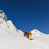
Patalsu peak (4240m) (13,910 ft) is located at the North end of Manali, East of Solang valley, and West of Rohtang La in Himachal Pradesh. The peak is easy to approach from Solang throughout the year. During summer by hike and during winter by ski touring. The slopes of Patalsu remain snow-covered during the month of April, May, and June. Mid-July to Mid Sept is not recommendable during monsoon. Mid Sept to Oct end is another good time to reach the top of this peak. January, February, and March is good for Ski touring. Our this trip in 3 days 2 nights, making it a comfortable hike in Solang valley. The trek starts from Solang and passing through Apple orchards and deodar forest to higher up at Shaga dugh base camp. The spectacular and panoramic view of Solang valley and Beas River valley to the south can be seen from the slopes of Patalsu. To the North towering 6000m peaks of Makar Beh & Shikar Beh and to the SE you will have a view of Indrasan and Deo Tibba. An excellent short trek in Solang valley close to white mountains.
Friendship peak is a stunning and spectacular mountain standing at 5289m elevation located just above Beas Kund and on the Pir Panjal range in the Kullu valley of Himachal Pradesh. Friendship peak is perfect for the first Himalayan summit and its trekker's delight. The entire area is surrounded by spectacular peaks and glacier Hanuman Tibba (5932m) and Seven sisters peak to the west, Maker Beh (6069m), Shikhar Beh (6200m), Ladakhi peak (5345m) to the North as well as peaks of Great Himalayan ranges in Lahaul. The Southern slopes are steep but it doesn't require any technical ability to climb. A view of Indrasan (6221m) and Deo Tibba (6001m) to the South at a distance is a rewarding point on this trek.
Friendship trekking peak is an ideal peak for those with no mountaineering experience. The best months for this trek are from May to Mid July, when the western slopes of the peak remain covered with snow and September & October months remain rocky terrain.
Deo Tibba base camp trek, also known as the Chota Chandertal trek is one of the most beautiful treks in the Manali region. A favorite trekking route to the base of Deo Tibba peak goes through Duhangan valley. It takes 3 days to reach the base camp located near a glaciated lake called Mini Chandertal. The emerald blue water of Chota Chandertal lake is located close to the glaciers that fall on the southeast face of Deo Tibba. The North-East Ridge is clearly visible from crossing the Hamta pass. Deo Tibba (6001m) and Indrasan (6200m) peak dominate the entire region. The other clearly visible peaks are the Norbu peak (5226 m) and Jagatsukh peak ( 5050 m)
Setting off from Manali we drive to the ancient village of Jagatsukh located 6 km south of Manali, once it was an old capital of Kullu valley. Leaving Jagatsukh the road winds up to Allain Duhangan power project point from where the actual trekking starts. First climb through an alpine forest filled with pine, spruce, oak, fir, and silver birch trees and along with the crystal clear Duhangan stream. We climb up to Chikka which is famous for its Takshak nag temple and natural stone carving. Continue along with the steam we pass the beautiful high pasture of Seri and climb to Tenta, which is beautifully located, surroundings with hanging glaciers, crystal clear streams, and waterfalls. Finally exploring In around Chota Chandertal situated at 4480m and the domains of Deo Tibba itself makes this trip one of the best trekking experiences in the Manali region. The best time to do this trek is from Mid May to Mid October.
From Jagatsukh we follow one of the best alpine walks with an untiring gradient to Sarotu thach (Thach – meadow) and Raudi Khodi. Crossing the wonderful alpine plateau a breath-taking view of Deo Tibba appears with magical suddenness. Piang Neru at about 12000 feet where lateral moraines of the PiangNeru glacier come to an end. Finally easy descent to Chikka at Hamta nallah and along the rock wall to Chachoga heights to Chadiyari village.
Malana is connected to Kullu by three mountain passes - it can be reached from Parbati Valley crossing over the 3180 metres Rashol Pass and via Naggar over the 3600 metres beautiful Chanderkhani Pass. For the outsiders, there is a long list of do's and don'ts to be followed in the village. The people are friendly but outsiders are told to keep their distance and not to touch anything in the village. Malana is divided into two: upper Malana (dhara beda) and lower Malana (sor beda). Kanashi, the language of Malana, does not resemble any of the dialects spoken in its neighbourhood but seems to be a mixture of Sanskrit and several Tibetan dialects. Two important festivals are celebrated in Malana. One called Badoh Mela is celebrated in August and the other called Fagdi Mela in February.
Rani Sui Lake located on the extreme west of Manali, lies below Khanpari Tibba 4025m, this Rani Sui lake and Khanpari Tibba is one of the best and perfect spots to view Beas River valley at once. To the West lies Kalihani pass at an altitude of 4830m Connecting remote Bara Bhangal village of Kangra district. During summer to late Autumn, this area is mainly inhabited by Shepherds and this pass is frequently used by them to go rain shadow of high grassland. Apart from Shepherd's route, this area has one of the best trekking routes in the Manali region. Spectacular view of Great Himalayan Range and snow-clad peak rising above 6000m i.e. Indrasan 6220m, Deo Tibba 6001m to the East and Maker Beh 6068m, Shikar Beh 6200m to the North and looking down the beautiful Kullu valley are main characteristics of this trek.
Setting off from near Hadimba we climb gently through the thick forest of Cedar and Oak. Climbing up through the Manalsu River valley the gentle slopes and lush green meadows of Lamadugh appears. Later trek beneath the ridge of Khanpari Tibba (4,025m) we arrive at a place from where Indrasan (6,220m.) And Deo Tibba (6,001m.) peaks can be seen. One can see the full view of Manali town and upper Kullu valley. Continue going upward through brilliant shrubs of Rhododendron, Birch pave on the way, and wildflowers all around. Arriving at the dome of Khanpari to have a spectacular 360-degree view of the Great Himalayan Range to the East, Dhauladhar to the West, and Pir Panjal to the North. Keep your attention towards wildlife to see Monal, Fox, and Bear.
The elegant Deo Tibba 6001m. is located east of Manali, above Jagat Sukh village. The Southeast ridge is clearly visible from while crossing of Hamta pass. Deo Tibba and Indrasan Peak 6200m dominate the entire region East of Manali. The surroundings of Deo Tibba above 3500m. provide the finest skiing and heli-skiing slopes known worldwide today. We start our expedition from an ancient village of Jagatsukh to Chikka, which is at an altitude of 10200 feet. The further crossing of Seri and to Tenta - our base camp for the Deo Tibba climb. We will go for camp I and via Piton ridge climb Deo Tibba.
Superb 6000m summit in Kullu valley, approach to the base with short trek & view of GH range and its peak
“We just came back from the journey. (10 days tour of the Kumaon Himalayas) It was great, thank you. All the locations and hotels were very nice. We particularly want to say that our driver was a very kind, knowledgeable, and excellent person who took good care of us.” All the best
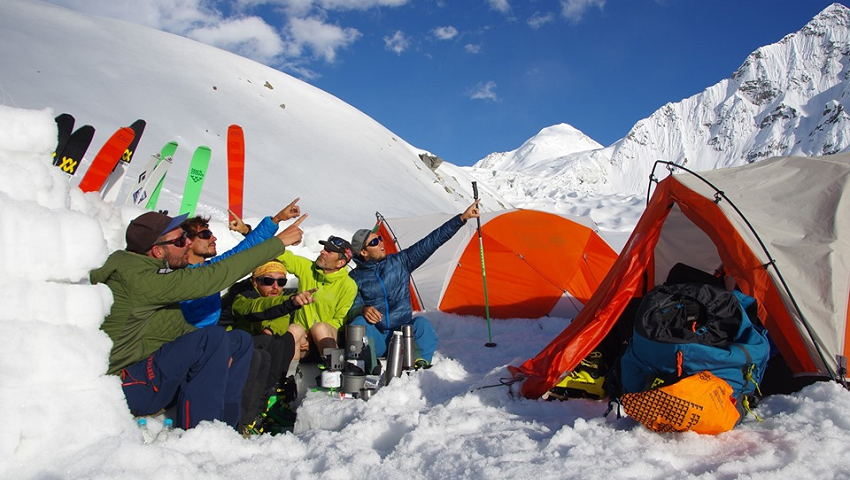
“Hello Prem, Many thanks to you and your team to give us all the support for this unforgettable ski touring trip around Lahaul Mountains. We really appreciate your help and flexibility to adapt the trip and logistics according to our needs. Hope to see you again for our future adventures in the Indian Himalaya. Many thanks for everything and wish you all the best”.
This 9-day trek (organized by POTALA adventures agency) from Rumtse to Tso Moriri Lake was a highly adventurous and difficult trek. I was accompanied by my cousin and my uncle. The total distance covered was more than 100 kilometers, and the max peak height we reached was 5450 meters. What made it much more challenging was the fact that we also slept at the high altitudes, sometimes more than 5000 meters. The trek ...
“Finally we would like to give some feedback for the hike: thanks for coming up with an alternative route, when friendship peak was closed due to snow. We thoroughly enjoyed the 5 days of the hike. Regardless: we enjoyed the trip and everything you and the crew did for us. Best regards”.