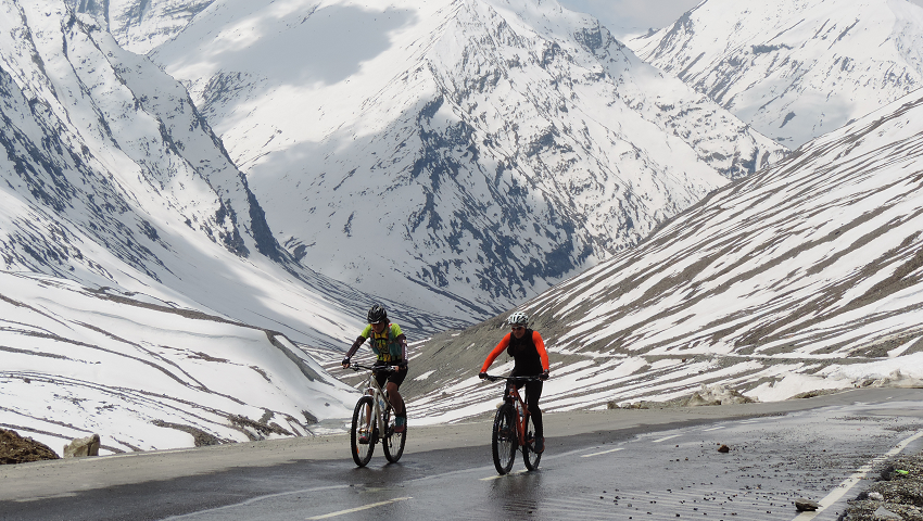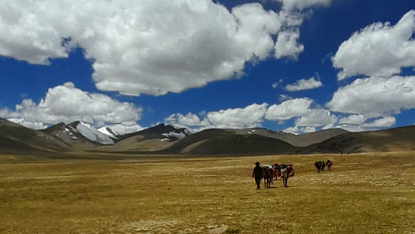
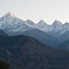
You may have already heard of some of the famous Ladakh cycling routes. But did you know that Ladakh has the highest cycling route in the world and some of the toughest and longest climbs you’ll find in this part of the Indian Himalayas? Zanskar is a sub-district of extremes; we have the mountains and the steep climbs. You’ll never be bored of the views here either. Even if they’re shrouded in mist, there might just be a snow-covered mountain, abandoned monasteries, or herd of highland yaks around the next corner.
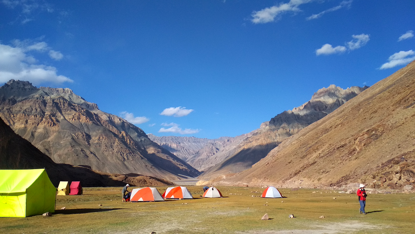
One of the Indian Himalayas’ most spectacular, diverse, and challenging bicycle trips! Our Great Zanskar cycling trip passes through remote, sublimely beautiful regions of northern India – the Chandra Bhaga and Zanskar River valleys, Atal Tunnel, Buddhist central Lahaul & Zanskar, a hike to Phuktal monastery and Zanskari villages and its people – ending this epic cycling trip in the Ladakh moon land at Lamayuru, we stay on tents occasionally homestays and tour the Khardung La, the perfect end to an amazing bicycle adventure!
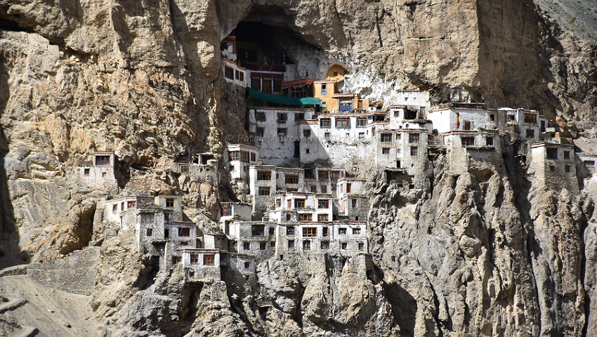
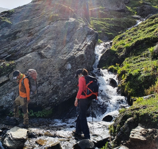
Enjoy the views out to Gonbo Rangjun peak, and Phuktal Gompa is the most spectacular sight in Zanskar, built under a huge cave and situated on the rock above the Tsarap River. Stops for a tasty lunch prepared by our camp cook every day. Travel from Kurgiakh the first village of Zanskar southern highland to the ancient capital of Padum. Soak up the stunning mountain scenery as you cycle through the plains of Padum, and Thongde before being rewarded with a panoramic view of the central Zanskar Mountains. The stunning (but challenging) loop northwest of Zanskar travels through some of the region's wildest and most idyllic landscapes. See famous mountains such as Singe La, Sirsir La, Lingshed monastery, and Zanskar River gorge, as well as a tranquil area of Zangla creating the best experience for cycling in Zanskar mountains.
Miyar Valley is situated in the west of Lahaul and Spiti district of Himachal Pradesh. The Miyar Valley is stretching over 75 km from Udaipur to the great Kang la. Miyar Nala as it is often known, with the Miyar River running down from the snout of Kang la glacier into Chenab River for almost 50 km. This glacier stretches a further 24 km up to the high Kang La Jot ( 5,468 m). North of Kang La lies Zanskar of Ladakh union territory. Miyar Valley is also known as the Valley of Flowers. It’s an unspoiled area similar to Zanskar and local people in the area follow Buddhist customs and are mainly shepherds and farmers. During summer cultivating peas, Barley, and other vegetables.
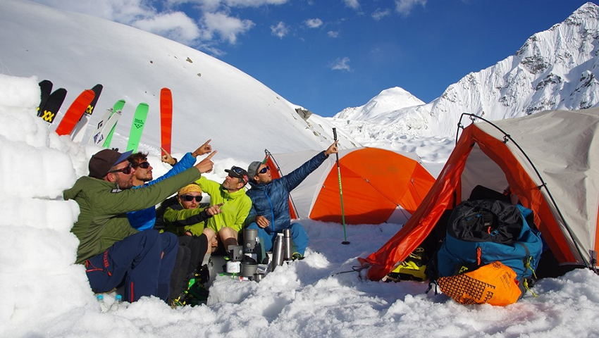
July and August are prime times to visit this magnificent valley, blooming with high-altitude flowers, medicinal plants, herbs, and the rare Blue poppy quite famous among all. The Miyar valley is comparatively easy to reach by road and there are plenty of unspoiled things to explore which are still hidden from the outside world. The best time to do the Miyar Valley trek is from mid-May to mid-July and September. Miyar Valley is a paradise of Gaddi Shepherds, their flocks of sheep and goats graze in the high-altitude meadows until late summer. Known to the outside world as Yosemite of India or the Himalayas, many professional rock climbers have made ascents of unclimbed peaks, still, some peaks have not been climbed yet. We at Potala Adventure have successfully made logistic support for professional rock climbers in the past, the first ascent of Lotus Tower SE face was climbed by Cyrill Bosch, Elias Gmunder, Arunas Kamandulis, and Gediminas Simutis all logistics to them given by Potala Adventurers.
Leaving Manali we drive to Udaipur which is famous for wood wood-carved Mrikula Devi temple, continue to drive we enter the Miyar valley. Arriving at Urgos where there is a small gompa and further at Shukto, where we start our trek to Khanjar, Thanpattan, Zardung, and finally to Kesar Yon Chhap which means seven sacred water at the snout of the Miyar glacier at the bottom of Castle peak, which dominates the Palphu area. A day to explore the Chhudong valley. Takdung Glacier faces Southwest and the Pimu la Glacier sits on the opposite side of the Miyar River. The climbing peaks in the area are Neverseen Tower (5,990 m) nearly 6,000 m located above Tawa glacier, Ogre I, II, & III, Lotus, Iris, Mt. Maudit, Om Shanti, Shabnam, Garuda Peak, Premsingh Peak, Toro peak, Ashoka's pillar, Mt. Mahindra peak (6080 m). Apart from these peaks, the well-known peaks in Miyar Valley are Mt. Menthosa (6,443 m), Tharang I, II & III, and Phabrang (6,172 m).
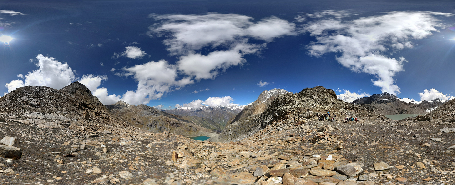
Pin Parvati Pass at an altitude of 5,319 m / 17,450 ft connects the Parvati Valley (Kullu) in the west and Pin Valley (Spiti) in the east. Pin Parvati can be crossed without any technical difficulties. In Parvati Valley, the trail begins at a relatively low altitude, which makes better acclimatization before crossing 5319m. After the large alpine meadows of Tunda Bhuj, you reach the large flat valley floor at Mantalai, where the moraines of the Parvati glacier come to an end. Leaving the valley, steep path to the left to base camp. A long stretch of a glacier crossing, the trail runs through steep scree to the small pass, which provides a panoramic view of the Great Himalayan range peaks, Parvati South, Parvati North, Pinnacle, Kullu Eiger all above 6`000 m. A steep descent to Pin River. The easy trail along the left banks of Pin River to Mudh (3820m), the last village in the Pin valley. With the extreme differences in climate, Pin Valley is much more rugged and barren than Parvati Valley. This cold desert valley with its snowy crags, cliff, jagged rocks, and other fossils makes Pin Valley a unique geological lab. Pin Valley National Park is home to snow leopard, red fox, marten, weasel, Himalayan Royle Pika, bearded vulture, golden eagle, lynx, and Tibetan wolf. The Pin area has been conserved as a national park since 1987. The main attraction of Pin Valley is the Chamurthi pony, known for its fast, sure-footed-on mountain terrain, moving safely on ice, and being well adapted to cost and harsh environment.
Due to the southern edge of the main Himalayan range, during summer monsoons often at the foothills determine the weather, which brings rain and snow around the pass. Mudslides at Pin Valley can cause unpleasant surprises during the monsoon, which brings the Pin Valley cut off from the main Spiti valley. The best time to go for this trek remains is from mid-June to mid-July and from the third week of August to the end of September. But be careful after the third week of September, when frozen monsoon tails can bring huge snowfall at the main Himalayan range.
The picturesque village of Mudh, where the trek ends is surrounded by barley fields. From here, a jeep safari into the Spiti valley offers opportunities to visit the sights of Spiti i.e. Kungri, Tabo, Dhankar, Lalung, Langza, Comik, and Kee-Kibber, before returning to Manali.
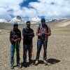
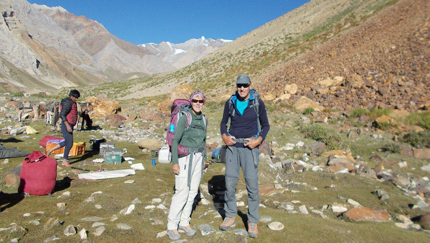
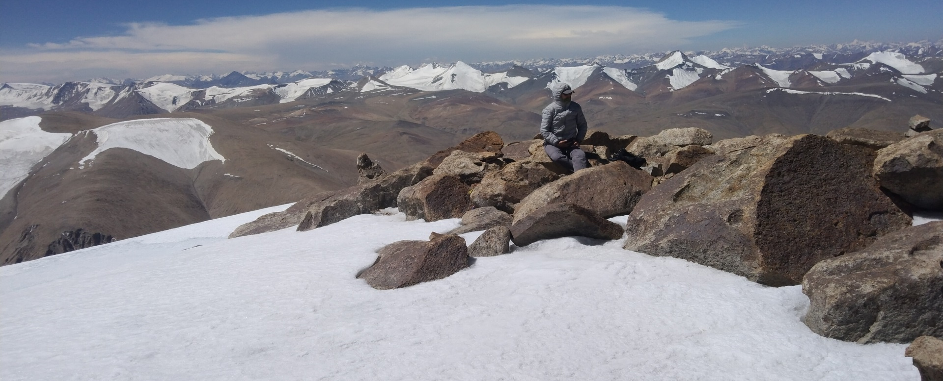
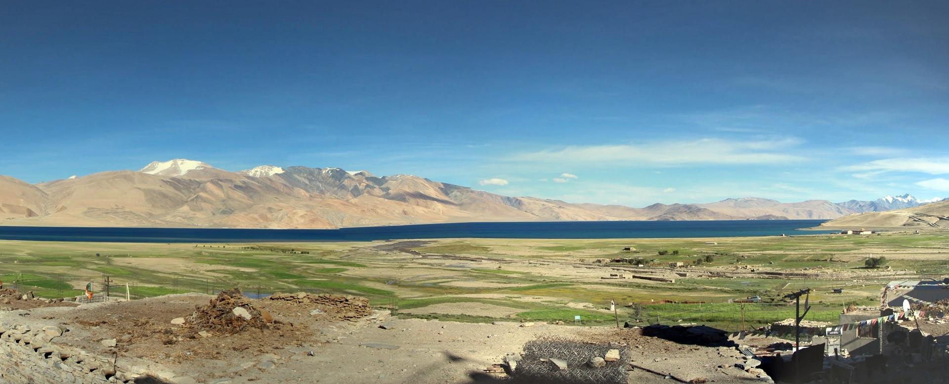
The high-altitude area between Tso Kar and Tsomoriri Lakes in the Changthang regions of Ladakh offers magnificent trekking and tempting non-technical peaks. The Changthang region is tucked in the northeast corner of Ladakh India and geographically, the parts of the high Western Tibetan plateau. In this trekking tour, you will see Ladakh Urial locally known as Shapo, Blue sheep, Tibetan wolves, and Kyang (Tibetan wild ass). Also, you will meet Changpa herders with Cashmere goats. It is a remote peak in the Korzok mountain range namely Spangnak Ri, Gyama groups of peaks, Yalung Nong and Mentok Kangri. Let's explore, traverse and ascend these colorful mountains with varied landscapes.
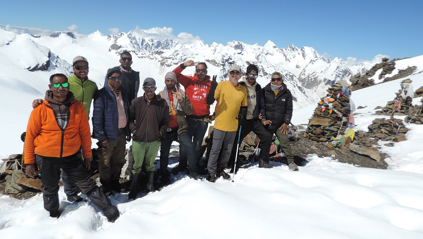
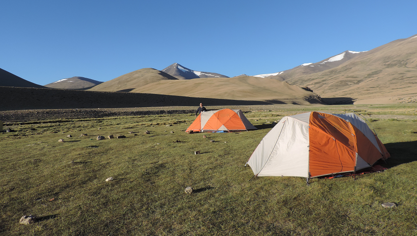
Before setting off from Leh, we took a couple of days to acclimate to hiking around to visit the Indus Valley and ancient colorful gompas. With proper acclimatization, we will set out to our starting point of wonderful trekking. From Leh, a journey of more than a hundred kilometers by road that connects Leh with Manali, once over the Taglang La to vast plains of More plains then we arrive at Tso Kar (White Lake) and from there to Riyul. We will set up camp at Nuruchan to start the trekking tour, en suite crossing the Horlam Kongka La at 4970 m, and ascending the surrounding peaks up to 5200m. Continue trekking and crossing Kyamayuri La (5430m) to Gyama Barma we will set our base camp at 5300 of Spangnak Ri the next day our first real peak option is Spangnak Ri (6390m). We summited Spangnak Ri in July 2024, truly a non-technical peak.
with a magnificent view towards the South are Gyama (6250m) group of peaks, Yalung Nong South (6080m), Mentok Kangri group of peaks and Chamser (6622m), Lungser Kangri (6666m) and Chalung Peak (6546m) towards the east. We will set up a base camp at Gyama and trek up Gyama East (6100m) and our next real peak option is Gyama Pyramid peak (6300m) also known as Gyama North with multiple summits in the area, hopefully, we can find a non-technical way to the true summit. We will use crampons, ice axes, and roped up with safety gear if we need it.
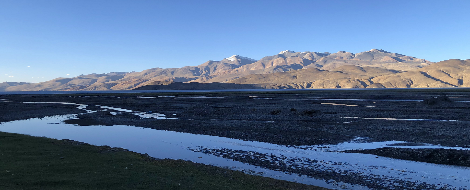
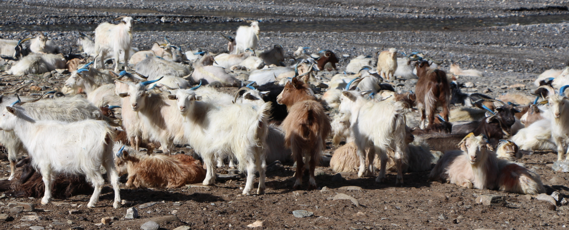
Finally wrapping up at base camp, traverse the flat scree slopes on the right side of Yalung Nyau La without a trail reaching the pass and descend to Korzok. From Korzok along the shores of Lake Tsomoriri to Kiangdam, we will take the trail from Kiangdam to Pang in the broad valley where we meet the Changpa nomads with flocks of Cashmere goats. Over the Thelakongka La (5020m) pass with panoramic views into the tight canyons. We will finish the trek at Pang, by car back to Leh on the Manali – Leh highway. Pang has network connectivity to Jio's mobile phone. Our caravan-style trek is surprisingly comfortable with our fully self-contained horse caravan.
Markha valley trek allows you to experience the local village life of Ladakhi. Markha valley trek in Ladakh is the best way to interact with the villagers. On this trip, we explore the Markha valley. Markha Valley is one of the most famous treks of the Ladakh Region. It is an amazing trip to get introduced to the magical and remote Buddhist Kingdom of Ladakh. Markha Valley remains one of the most popular trekking routes in the Indian Himalayas. This trek offers abundant natural beauty, and mountains with different colors, shapes, and sizes. With altitudes exceeding 3000m to 6000m and numerous small villages along the trails, pastures, and passes. The valley is greatly dominated by Kang Yatse (6400m) and its surrounding peaks. However, there are great chances to observe wild species in the late afternoon and early morning.
Setting off from Leh after 1-2 days of well acclimatizing for our Zingchen to Chogdo. We drive to Zingchen and trek to Rumbak & Skiu village. We follow the Markha River to the Nimaling plains. Meeting locals visiting their homes and exploring the region finally steep descent from Kongmaru la to Chogdo. Where our trek ends. A short trek of 7 days is well suited for travelers looking to experience trekking in Ladakh the same as time experiencing Ladakhi village life. Markha valley trek in Ladakh is a unique experience and we love to run this trip, but we can organize a 7-day Markha valley camping trek if you prefer.
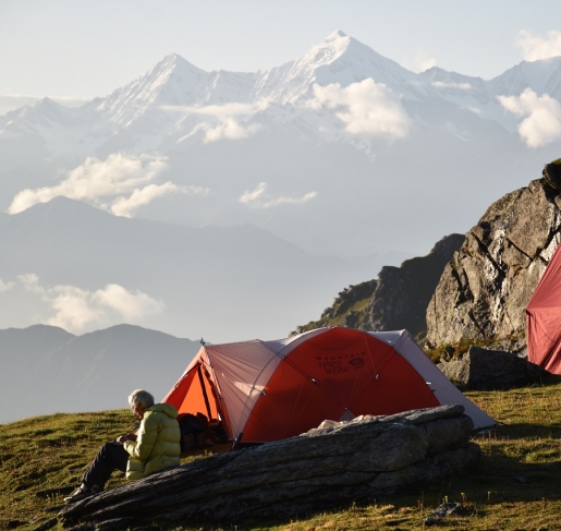
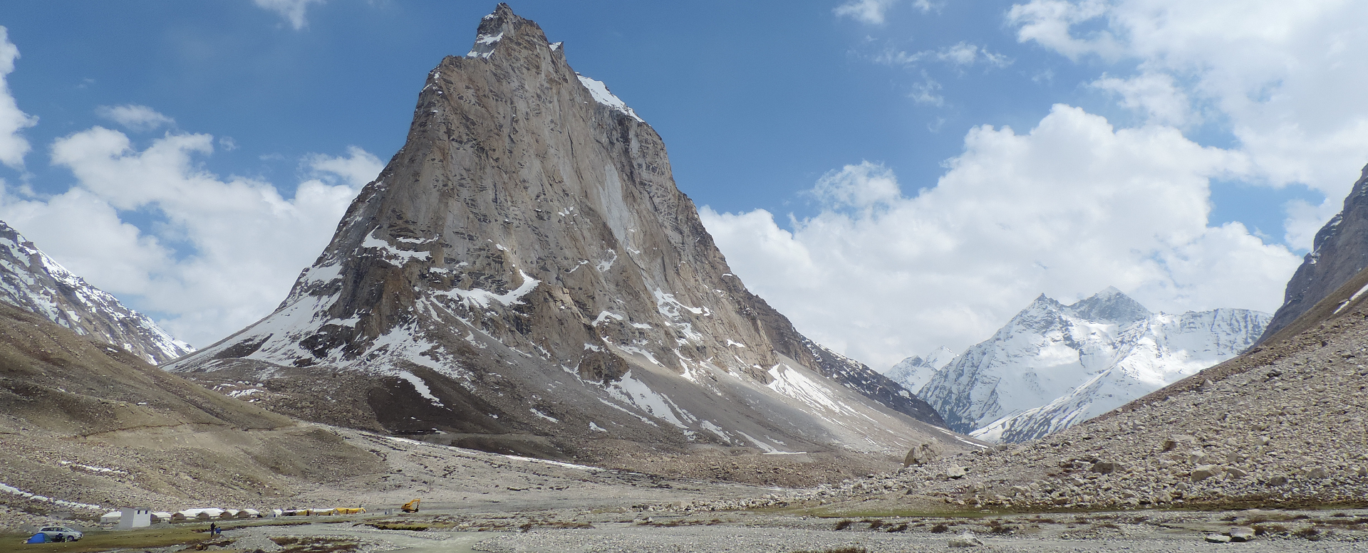
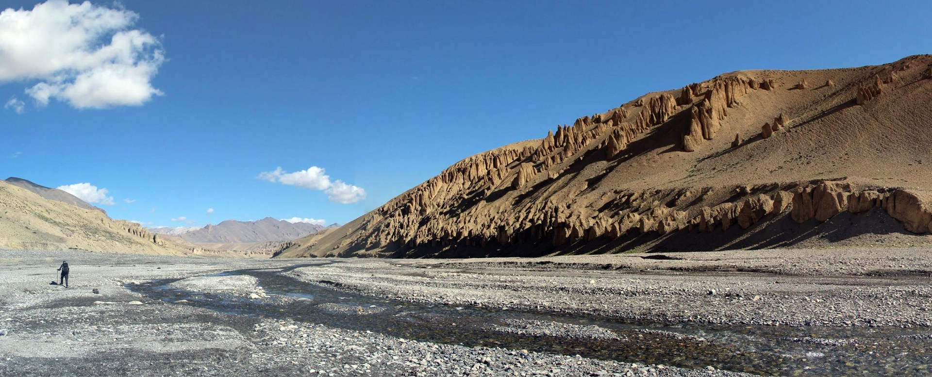
Our new and updated GHT Zanskar Great Himalaya Trail will take you to one of the remotest parts of the Indian Himalayas. With passes over 5000m and through canyons & gorges, you will pass through many villages along the way and meet with locals at their homes that are with our Zanskari staff. Spectacular view of Greater Himalayan range and its peak rising above 6000m, some of best view are K2 and Nanga Parbat from Kanji La view of Nun 7135m and Kun 7077m and Akshu, Doda 6550m and Brahma 6574 m peak in Southern Zanskar, wild routes while crossing of Phirtse la 5450m. A complete crossing of Ladakh and Zanskar from North to South.
Setting off from Leh after 2-3 days of well acclimatizing. We drive to Lamayuru enroute vising Likir and Alchi Gompa. Crossing a small pass near Lamayuru you enter in jaw-dropping Shilla gorge and after crossing of Yogma la to Kanji village. Along the stream to base and further crossing of Kanji la 5342m, one of the highest pass in this trek after Phirtse la 5450m, we descent to sumdo and long ascent to Pikdong la to the remote village of Shade. From Shade you follow the Oma chu to the base of Hanuma la to large plains of Zanskar at Padum, here you will have the opportunity to visit a number of sights. Along the Tsarap River to one of the most spectacular sights of our trek to Phuktal and finally exploring the high villages of Southern Zanskar we climb to our last pass to the vast plains of Sarchu, where our trek ends. Instead of going back to Leh, you will drive on Leh - Manali highway to the hill resort town of Manali. After a day of relax at Manali hill station before making a final departure to Delhi.
Four weeks in Ladakh Zanskar - Trekking in the Indian Himalayas & Zanskar Odyssey.
This demanding and Challenging Trek takes us to the land of Changpa nomads living on the vast high plateau of Changthang. It focuses mainly on the life of Nomadic people and wildlife in motion. After 2-3 days of well acclimatizing in Leh, we drive to Rumtse (85 km) at the foot of Tanglang la pass (5328 m). Beginning to trek from Rumtse we cross over passes of Kyamari la, Mandalachan la, and Shingbuk la before approaching Lake Tsokar. This tour is taking place in the Changthang region, which has an average altitude of 4000-5000m, higher than central Ladakh and Nubra Valley. In that case, a long acclimatization is a must before starting the trek.
The first stage of the area is relatively uninhabited, while the second phase after Tsokar up to the Tsomoriri Lake area is vastly dwelt by Changpa nomads. We visit several yurts along our trail and carefully witness nomadic daily life. Crossing over 3 high passes of Kyamayuri la, Kartse la, and Yarlung Nyau la we arrive at Karzok phu. One of the largest nomadic settlements in the region. Occasionally chances to see wildlife such as Kyang, black naked crane, Tibetan Antelope, Himalayan Marmot, and Blue Sheep. Finishing trek at Karzok we drive back to Leh via Chumathang.
Spiti valley is located on the Tibetan border enclosed on the South East by Tibet, North West by Ladakh, and West by Lahoul and Kullu. Geologically and archeologically Spiti valley is a living museum. Spiti valley is high altitude cold desert and in its lunar landscapes are still stretches, where every other rock is fossils. Spiti valley is formed by the Spiti River, which rises on the slopes of Kunzom pass (4’551 m) and ends at the river confluence with Pare-Chu near Sumdo. The length of the valley is about 150km. Enroute Spiti River receives the water of many streams: Guindi Nala, Parilungbi Chu, Pin River and Lingti River. There are two routes to Spiti valley, one over Rohtang-pass (3’978m/13’050ft) and Kunzom pass and other via Shimla, Rampur and Kinnaur.
Spiti was once a part of the West-Tibetan Kingdom of Guge in the early 17th century. Guge became fragmented and Spiti, along with Lahoul, came under Ladakhi rule. A vital link of Great Trans Himalayan trade route from Lhasa to Kashmir and Spiti – Literally “The middle country” – found itself locked between the mountain range and International border, now a part of Himalayan tribal sub-division of Lahoul and Spiti district of Himachal Pradesh.
Today more and more travellers, tourists, trekkers, geologists and researchers are discovering this wonderful and last inhabitable world.
To visit Zanskar from Manali via Manali - Leh road and further from Leh - Kargil - Padum almost more than 600 km. Manali - Leh highway crosses from four high mountain passes and remains closed for seven months in winter.
Now there is a new road opened that connects Manali - Padum via Shinkun La also known as Shingo La. After the Atal Rohtang tunnel BRO (Border road organization) will construct a tunnel below Shinkun La to make Manali - Padum road all weather.
Shinkun La is the border between Ladakh union territory and Himachal Pradesh.
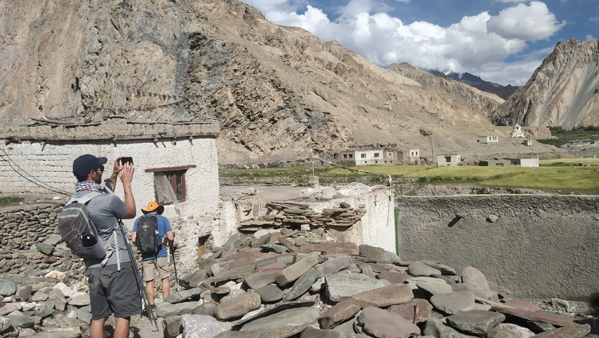
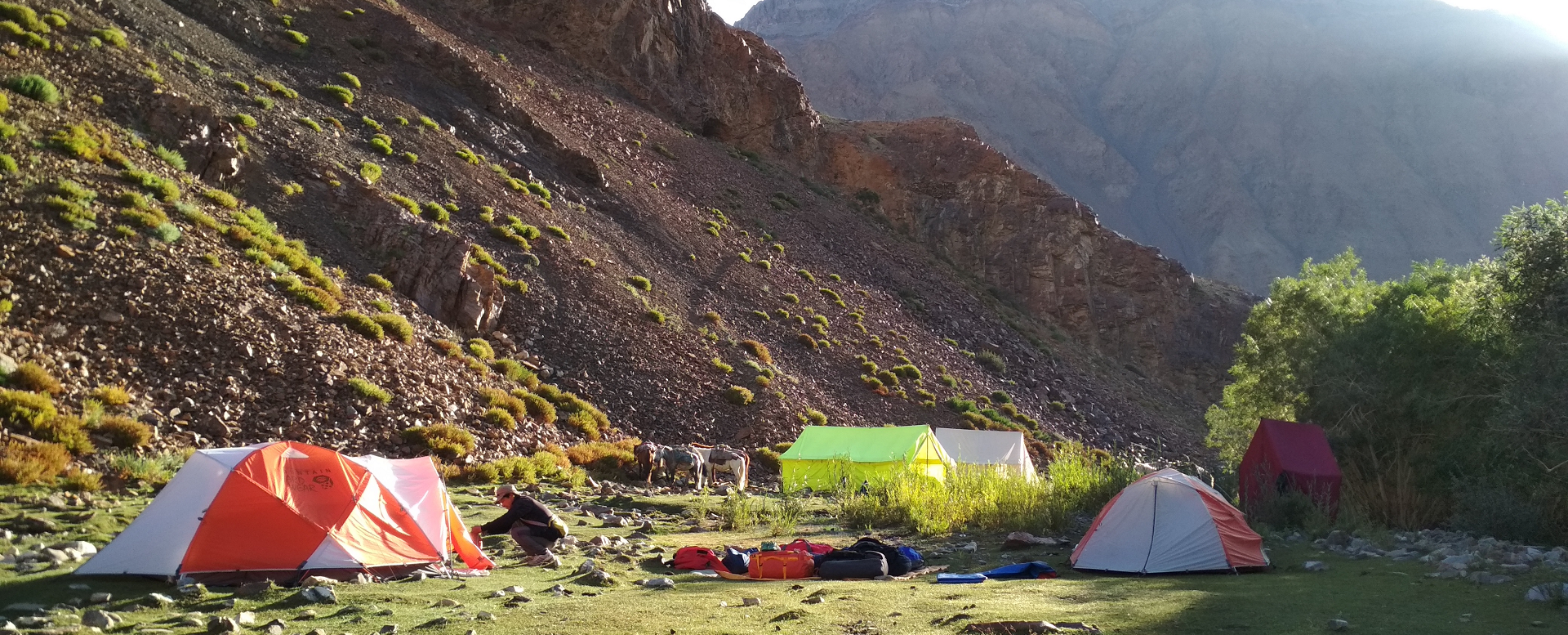
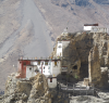
This Manali - Padum - Zanskar - Leh tour, is going to be one of the best tours of the Himalayan region. Setting off from Manali the first-day drive to Keylong via Atal Tunnel Rohtang, a new gateway to Lahaul, Spiti, Pangi, and Zanskar valleys., Acclimatization in this Bunan/Gahar & Stod valley is a must before crossing Shinkun La. A night in Keylong or Jispa in Lahaul will ensure proper acclimatization. We cross Shinkun La (5,090 m) to get into Zanskar. Many ancient gompas on the way: Phuktal gompa which is built under a huge cave and provides one of the fantastic views. Karsha Gompa is the biggest in the Zanskar region. En route, we pass shepherds with their flocks of sheep and climb beautiful snow-covered passes with panoramic views of the Great Himalayan range. Passing through the beautiful Chandra valley with some spectacular views of peaks rising above 6000 m. At Tandi where Chandra & Bhaga meets to form a Chenab River, we enter Gahar valley and continue to Jispa at Stod valley. Chikka and Rarik are the last villages in Lahaul before Shinkun la pass and Kurgiakh is the first village in Lungnak River valley of Zanskar. From Zanskar Sumdo at the foot of Shinkun La, the road descends to Lakhong, Lakhong is a high pasture land where villager from Kurgiakh, Thangso village keep their domestic animals Yak, dzo, sheep, goat, horses for summer grazing. This is the upper slopes of Zanskar where meadows are covered with edelweiss and at the foot of Gumborunjom peak (5580 meters), a Blue poppy can be found. Next a series of beautiful villages along the route to Purney, which is located at the confluence of Kurgiakh chu and Tsarap River. Purney to Phugtal road is still under construction and 2:30 hrs of a walk to one of the most spectacular sights of Zanskar - The Phugtal gompa. Which is built under a huge cave. Continuing from Purney to Anmo village to Raru and finally to Karsha bypassing Mune, Bardan & Padum. Next couple of days to visit the sights in the heart of Zanskar before entering in Ladakh at Lingshed. And crossing two passes namely Sengge La and Sirsir La to join the Srinagar - Leh road at Lamayuru. Exploring the Lamayuru and finally visiting Alchi and Likir, we drive to Leh. Where our trip ends.
Welcome to Potala Adventurers Himalaya. Potala Adventurers is a
place where you can have unique info, filled with our regional knowledge on
trekking in Ladakh & Zanskar, Lahaul-Spiti & Kinnaur, Kullu &
Manali, Garhwal & Eastern Kishtwar regions of Indian Himalayas. Potala
Adventurers is a small trekking company, organizing treks and a varieties of
customized trips in Indian Himalayas. We offer a wide range of
trekking and overland trips in the Indian Himalaya for short and long holiday
seekers. All of our treks are unique in its, own specialty and planned
carefully to benefit maximum visits of places of the area that you are visiting
upon. We will be happy to share our experiences of our Himalayan regions; its
culture, history, tales, nature, brilliant landscapes, and native people. Our
programs include: Zanskar traverse, Parang la & Nomads of Rupshu, Nubra valley, Markha valley & Stok-Kangri Ascent

WHY CHOOSE US ?

POTALA Adventurers HIMALAYA
Beas Kund - Beas so named after Rishi Sage Vyas and Kund is the Hindi word for a tiny pond. This tiny and high-altitude alpine lake of Beas Kund at an altitude of 3,700 meters / 12,139 feet is situated at the higher and upper valley of Solang, located at the North end of Manali and at the foot of Mt. Shitidhar, Ladakhi, and Friendship peak.
It’s an ideal base camp for climbing nearby peaks Shitidhar, Friendship, and Ladakhi peak (5,345 m). The Westside of Beas Kund is a magnificent peak of Hanuman Tibba 5,990m, which access through a tiny pass above this lake. The entire area is surrounded by spectacular peaks and Glaciers around Beas Kund. Our Beas Kund trek starts from Dhundi at a distance of 8 km from Solang Nala, Solang which is a popular destination for skiing in winter and summer outdoor activities. Setting off from Dhundi the trail goes along the stream upward to Beas Kund and Seven sisters peak, Hanuman Tibba, and Friendship peak remain insight throughout the trek.
Beas Kund trek offers a spectacular view of the snow-capped mountains all around.
An easy trek for all ages.
Bhrigu Lake is located at the East of Rohtang pass and above the Gulaba slopes. Situated at Pir Panjal eastern end mountain range and at an altitude of 4170 m / 13681 feet above sea level. With a panoramic view of Pir Panjal, Dhauladhar, the Great Himalayan range, and numbers of peaks rising above 6000m.The closest 6000m peak nearby are Deo Tibba, Indrasan, Maker Beh, and Shiker Beh. And most mesmerizing peaks that remain insight are Hanuman Tibba and Seven Sisters peaks.
Bhrigu lake opens up to mesmerizing natural vistas that showcase an endless alpine carpet of meadows, streams that carry crystal clear water along the winding paths, and sweeping vistas of magnificent snow-capped mountains.
This tiny lake is known to locals as "Bhrigu". The lake is named after Maharishi Bhrigu and it has a great religious significance to locals, especially of Vashisht and nearby villages.
Our classic 3 days Bhrigu lake trek sets out at Gulaba 23 km from Manali and ends at Vashisht village. With many trails to Bhrigu, our trekking route changes based on snow conditions. May until mid-June either one can start from Gulaba - Rola kholi - Bhrigu lake and back to Gulaba. The other route which involves more ascending starts from Kulang - Mori dugh - Bhrigu lake - back to Mori dugh and Kulang. In our classic Bhrigu lake trek, you will have the opportunity to spend two nights at a different camp, which will give undoubtedly more natural views of Manali.
For those who are speed trekkers, we offer you a Bhrigu lake trek in one day. The route for Bhrigu lake in one day is Gulaba - Raoli khoi - Bhrigu lake - back to Gulaba 10 to 12 hours.
Bhrigu lake trek is one of the favorite short treks in Manali. An ideal weekend trekking in Manali for both beginners as well as experienced hikers.
Hampta Pass trek is the most beautiful trek around Manali and can be done by anyone reasonably fit. Hampta pass lies on the beautiful Pir Panjal range and is a small corridor between Lahaul and the Kullu valley of Himachal Pradesh. Hamta pass is frequently used by Shepherds of the lesser Himalayan region. Seeking high-altitude grassland in the dry cold desert of Lahaul during summertime. Numbers of wildflowers and varieties of herbs can be found at an altitude between 3000 to 3800m.
Setting off from Manali we drive to Sethan village 2700m and continue to Panduropa - Jobri. Our starting point of the trek. Setting off from Jobri first we cross the ford on Jobri nullah originating from Deo Tibba massif. The route from Chikka to Jobri passes through the forest of Deodar, Oak, walnut, and Birch tree. A gradual climb to Jwara and Balu ka Ghera. Balu ka Ghera is better known for Bear's den or Bear's circle. Can see it only from May end to mid-June. The final ascent leads through boulder and scree to the Hampta pass. Spectacular view of Indrasan 6221m and Deo Tibba 6001m only can have on a clear sky. Crossing the river near Shea Goru camp we descend to the river bed and follow the left bank of Chandra River to Chatru. Where our trek ends.
From Jagatsukh we follow one of the best alpine walks with an untiring gradient to Sarotu thach (Thach – meadow) and Raudi Khodi. Crossing the wonderful alpine plateau a breath-taking view of Deo Tibba appears with magical suddenness. Piang Neru at about 12000 feet where lateral moraines of the PiangNeru glacier come to an end. Finally easy descent to Chikka at Hamta nallah and along the rock wall to Chachoga heights to Chadiyari village.
Friendship peak is a stunning and spectacular mountain standing at 5289m elevation located just above Beas Kund and on the Pir Panjal range in the Kullu valley of Himachal Pradesh. Friendship peak is perfect for the first Himalayan summit and its trekker's delight. The entire area is surrounded by spectacular peaks and glacier Hanuman Tibba (5932m) and Seven sisters peak to the west, Maker Beh (6069m), Shikhar Beh (6200m), Ladakhi peak (5345m) to the North as well as peaks of Great Himalayan ranges in Lahaul. The Southern slopes are steep but it doesn't require any technical ability to climb. A view of Indrasan (6221m) and Deo Tibba (6001m) to the South at a distance is a rewarding point on this trek.
Friendship trekking peak is an ideal peak for those with no mountaineering experience. The best months for this trek are from May to Mid July, when the western slopes of the peak remain covered with snow and September & October months remain rocky terrain.
The elegant Deo Tibba 6001m. is located east of Manali, above Jagat Sukh village. The Southeast ridge is clearly visible from while crossing of Hamta pass. Deo Tibba and Indrasan Peak 6200m dominate the entire region East of Manali. The surroundings of Deo Tibba above 3500m. provide the finest skiing and heli-skiing slopes known worldwide today. We start our expedition from an ancient village of Jagatsukh to Chikka, which is at an altitude of 10200 feet. The further crossing of Seri and to Tenta - our base camp for the Deo Tibba climb. We will go for camp I and via Piton ridge climb Deo Tibba.
Superb 6000m summit in Kullu valley, approach to the base with short trek & view of GH range and its peak
Rani Sui Lake located on the extreme west of Manali, lies below Khanpari Tibba 4025m, this Rani Sui lake and Khanpari Tibba is one of the best and perfect spots to view Beas River valley at once. To the West lies Kalihani pass at an altitude of 4830m Connecting remote Bara Bhangal village of Kangra district. During summer to late Autumn, this area is mainly inhabited by Shepherds and this pass is frequently used by them to go rain shadow of high grassland. Apart from Shepherd's route, this area has one of the best trekking routes in the Manali region. Spectacular view of Great Himalayan Range and snow-clad peak rising above 6000m i.e. Indrasan 6220m, Deo Tibba 6001m to the East and Maker Beh 6068m, Shikar Beh 6200m to the North and looking down the beautiful Kullu valley are main characteristics of this trek.
Setting off from near Hadimba we climb gently through the thick forest of Cedar and Oak. Climbing up through the Manalsu River valley the gentle slopes and lush green meadows of Lamadugh appears. Later trek beneath the ridge of Khanpari Tibba (4,025m) we arrive at a place from where Indrasan (6,220m.) And Deo Tibba (6,001m.) peaks can be seen. One can see the full view of Manali town and upper Kullu valley. Continue going upward through brilliant shrubs of Rhododendron, Birch pave on the way, and wildflowers all around. Arriving at the dome of Khanpari to have a spectacular 360-degree view of the Great Himalayan Range to the East, Dhauladhar to the West, and Pir Panjal to the North. Keep your attention towards wildlife to see Monal, Fox, and Bear.
All Year Around
Day hikes in Manali. Manali day hikes are for those who want to enjoy a brilliant walk on the outskirts of Manali town. Starting from a 2000m the day treks goes up to 4000m thus gaining a 2000m altitude in a day. All-day hikes start early morning. After the end of the trek, some require transportation to get back to Manali, and some start at Manali and end at Manali. The day hiking tour allows its participants to enjoy the beautiful green forests, above tree line meadows, and spectacular view of Pin Pannjal and the Great Himalayan range.
"We had an amazing trip to Spiti Valley! And thanks to Potala adventures they made it so memorable! Mr. Prem Singhji customized it to our needs while traveling with young kids. The Driver Mr Raju knew the roads and terrain so well and did a wonderful job taking us around safely! The Dolma Homestay was a home away from home. Mr. Rahul and Mrs. Tashi were the most hospitable hosts ...
“We just came back from the journey. (10 days tour of the Kumaon Himalayas) It was great, thank you. All the locations and hotels were very nice. We particularly want to say that our driver was a very kind, knowledgeable, and excellent person who took good care of us.” All the best
“Hello Prem, Many thanks to you and your team to give us all the support for this unforgettable ski touring trip around Lahaul Mountains. We really appreciate your help and flexibility to adapt the trip and logistics according to our needs. Hope to see you again for our future adventures in the Indian Himalaya. Many thanks for everything and wish you all the best”.
Hi Prem, the trek was excellent; especially the crew members were amazing and outstanding - couldn’t have asked for better ones. Thanks very much for organizing this. Everything is top-notch. I'll also keep in touch and let u know in case any of my friends or family members are interested in other tours.