Gangotri Gaumukh Tapovan Trek
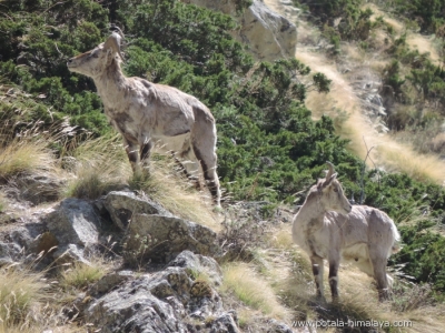
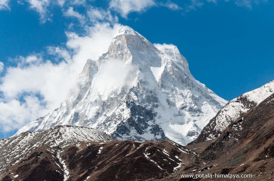
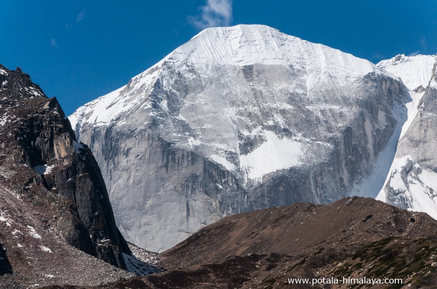
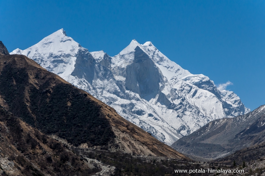
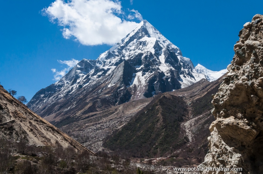
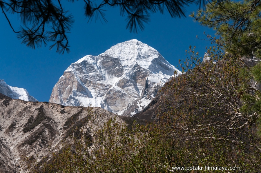
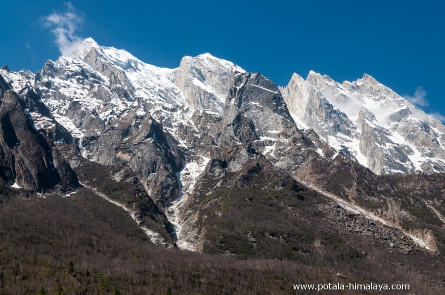
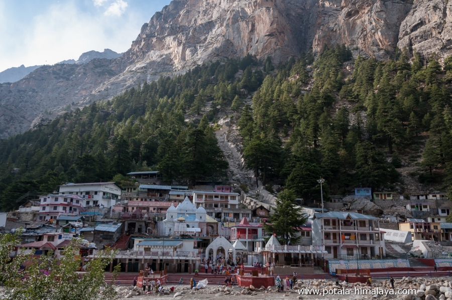
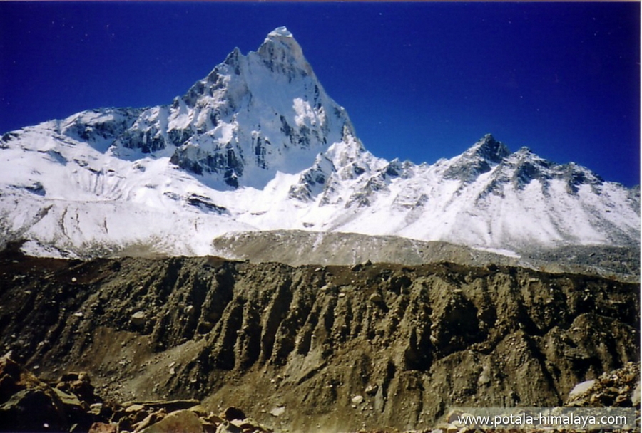
Gangotri is located in the Greater Himalayan Range. Gangotri is situated on the banks of River Bhagirathi and is a sacred place for the Hindus. Chirbasa means “Home of Pine Trees” which you may find abundantly growing here. From Chirbasa you get superb views of Bhagirathi I (6856m), II (6512m) and III (6454m), Bhrigu Parbat (6000m), Manda peak (6511m). The sunset view of the Bhagirathi group of peaks is one of the best to witness from Chirbasa. The soaring peak of Mt. Shivling (6543m) comes suddenly in complete view. Tapovan is open grassland, and the base camp of Mt. Shivaling (6450m), and Meru (6660m). The view from Tapovan is spectacular, which is surrounded by the peaks of Shivling, Meru, and Bhagirathi group and Kedardome.
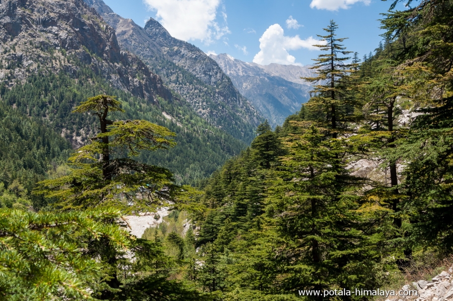
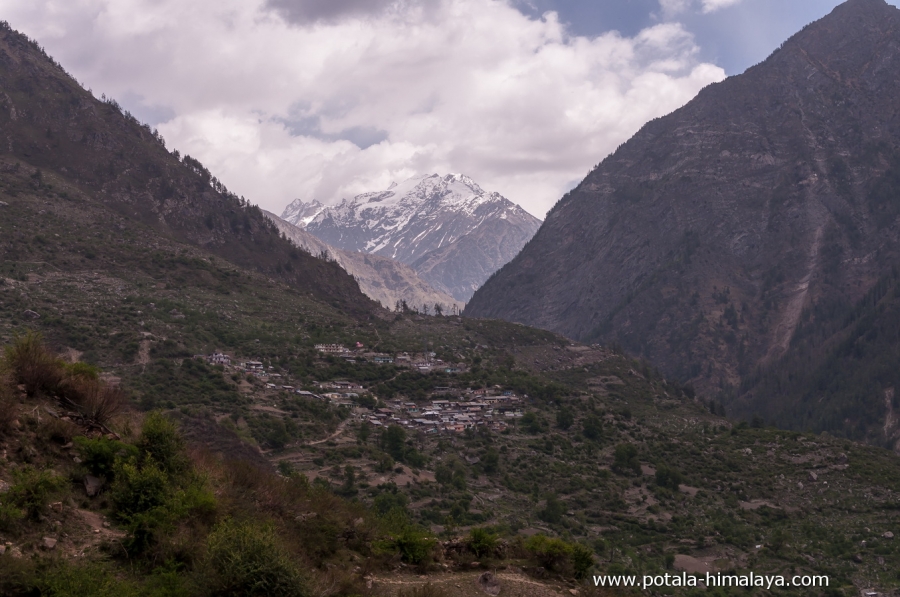
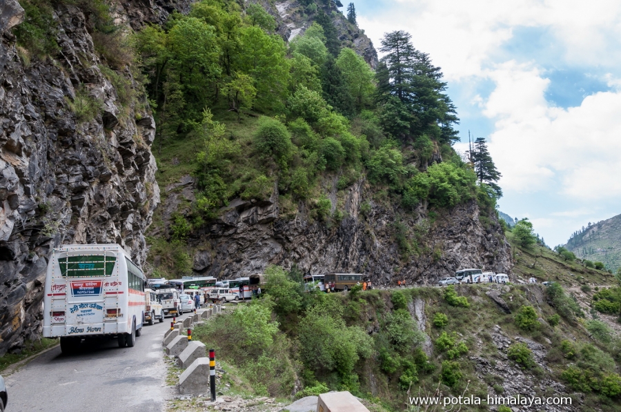
Setting off from Dehradun (750m), which is the capital of Uttarakhand state of India and sits at the Himalayan foothills, the drive to Uttarkashi takes you on the foothills of the Himalayas and continue to drive to Gangotri, arriving at the Greater Himalayan Range - the most scenic Dham (pilgrimage site) route in the Garhwal Himalayas. Starting a trek from Gangotri as we walk through the lush rhododendron forests and alpine pastures to visit Gaumukh, River Ganges gushes out from the glacier snout overlooked by Shivling (6,543 m). En suite crossing the glacier slopes that lead to the vast meadow at Tapovan, surrounded by magnificent peaks of Bhagirathi, Shivling, Meru, and much more.
Experience the Garhwal big mountains on the Greater Himalayan Range at the closest in a short trip.
Outline itinerary
Day 1: Arrive in Dehradun (750m), Drive to Uttarkashi (1120m), 140 km, 5 hrs.
Day 2: Drive Uttarkashi to Gangotri (3070m), 98 km, 5-6 hrs. Trek Gangotri to Chirbasa (3550m) 4 hrs.
Day 3: Trek Chirbasa to Bhojbasa (3780m), 5 hrs.
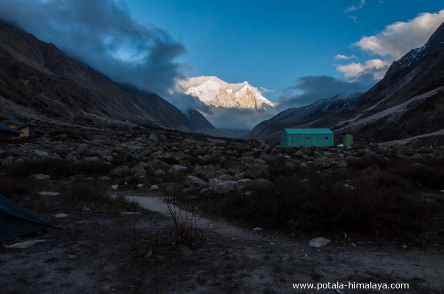
Day 4: Trek Bhojbasa to Gaumukh (4060m) - Tapovan (4310), 12 kms. 4-5 hrs.
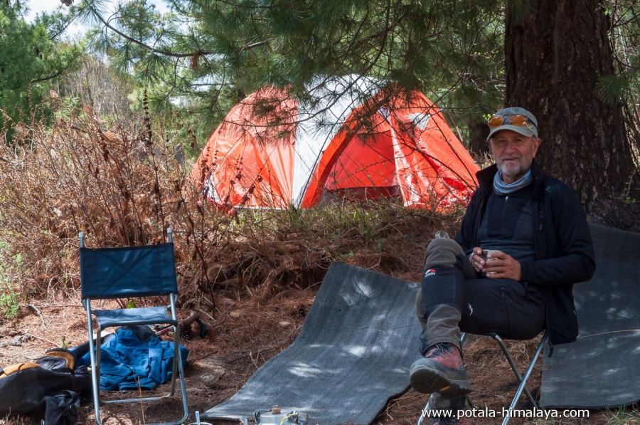
Day 5: Rest & acclimatize at Tapovan (4310m).
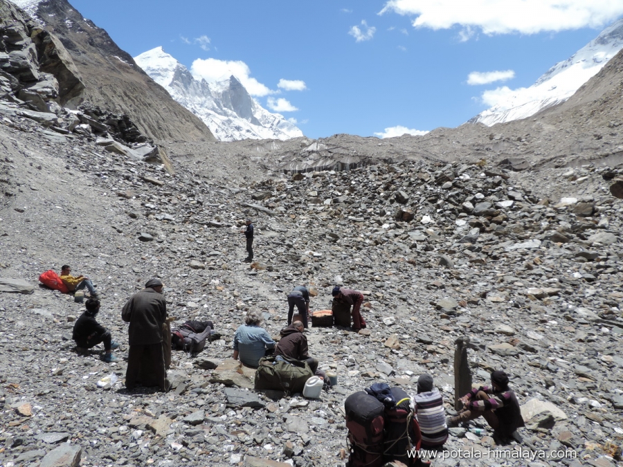
Day 6: Day hike to Kirti Glacier.
Day 7: Trek Tapovan (4310m) to Chirbasa (3550m). 6-7 hrs.
Day 8: Trek Chirbasa to Gangotri (3070m), 3 hrs, Drive Gangotri to Uttarkashi (1120m), 4 hrs.
Day 9: Drive from Uttarkashi (1120m) to Dehradun (750m), 6 hrs. Trip ends. 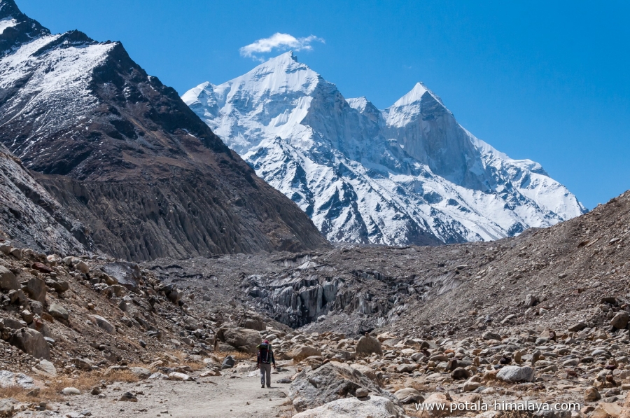
Detailed Itinerary
Day 1: Arrive in Dehradun (750m), Drive to Uttarkashi (1120m), 140 km, 5 hrs.
Arrive early in the morning at Dehradun, drive to Uttarkashi, and have lunch en route. It is a half-day trip to Uttarkashi from Dehradun.
Day 2: Drive Uttarkashi to Gangotri (3070m), 98 km, 5-6 hrs. Trek Gangotri (3070m) to Chirbasa (3550m) 4 hrs.
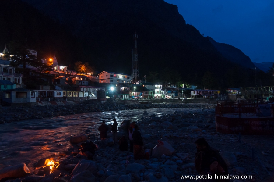
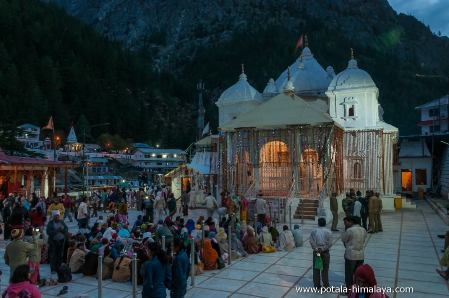
After breakfast, we drive to Gangotri (4038 M) covering 98 km in 5 hrs, another half-day trip to Gangotri. Gangotri is located in the Greater Himalaya Range and sits on the banks of River Bhagirathi is a sacred place for the Hindus.
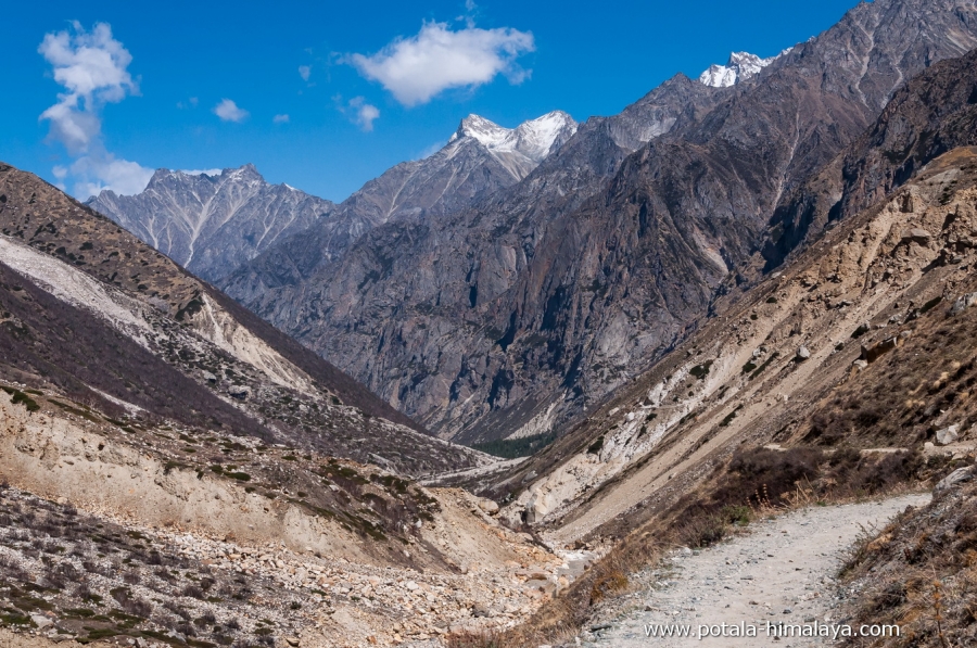
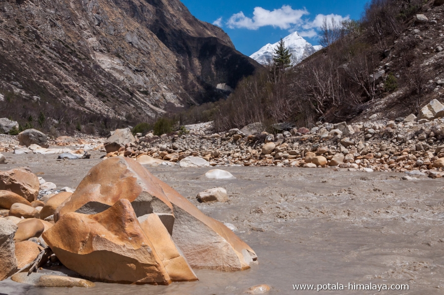
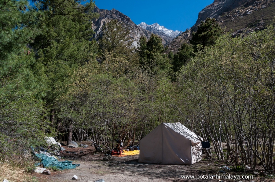
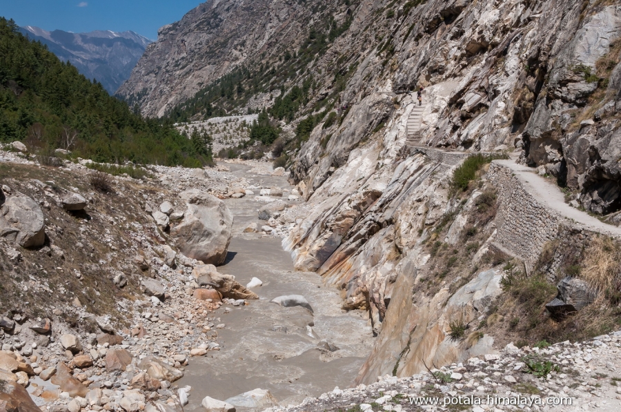
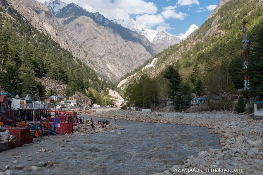
Setting off from Gangotri we follow a well-defined trail of this pilgrimage route to Gangotri glacier. Leaving Gangotri a gradual ascent through the pine forests along the River Bhagirathi with high cliffs on both sides of the River, passing the Gangotri Conversation Project checkpost, It’s a 3 hrs minimum and a maximum of 4 hrs to reach Chirbasa from Gangotri. The trail or entire trek goes along the right bank of the roaring Bhagirathi River. Chirbasa means “Home of Pine Trees” which you may find abundantly growing here. Arriving at Chirbasa you get superb views of Bhagirathi I (6856m), II (6512m) and III (6454m), Bhrigu Parbat (6000m), Manda peak (6511m). The sunset view of the Bhagirathi group of peaks is one of the best to witness from Chirbasa and Bhojbasa. Overnight stay in tents. 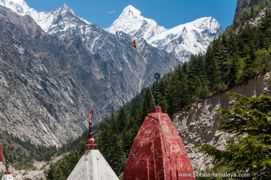
Day 3: Trek Chirbasa to Bhojbasa (3780m), 5 hrs.
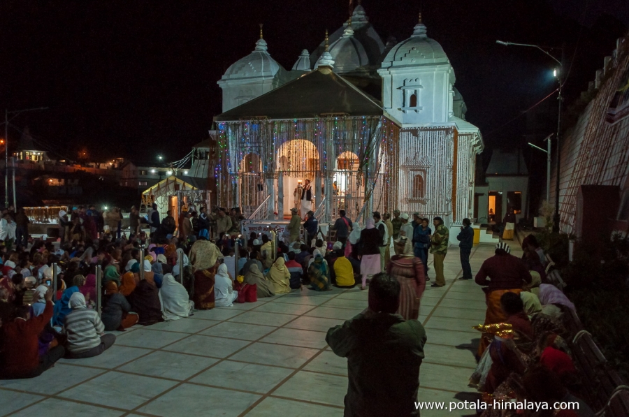
Leaving Chirbasa 2 hours trek to Bhojbasa (3780m), which has a tourist guest house, police station, and an ashram. The trail goes along the River Bhagirathi. Bhojbasa is named after the birch tree forest in the area. Now there are hardly any birch trees left, only the remains of dead birch of the past. Post lunch hike to the snout of Gaumukh glacier, known to be the origin of the Ganga River, the most sacred River in India, and back to Bhojbasa for overnight stay in tents. 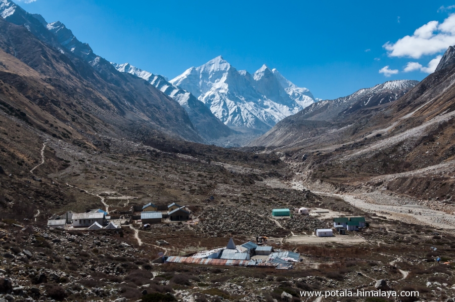
Day 4: Trek Bhojbasa to Gaumukh (4060m) - Tapovan (4310), 12 kms. 4-5 hrs.
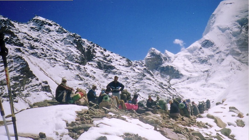
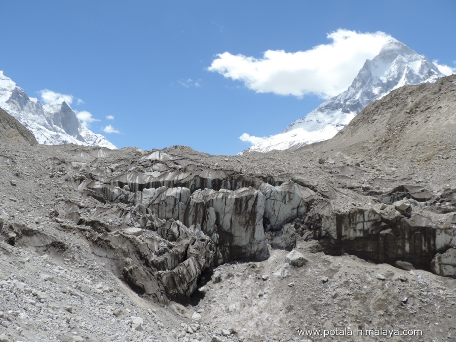
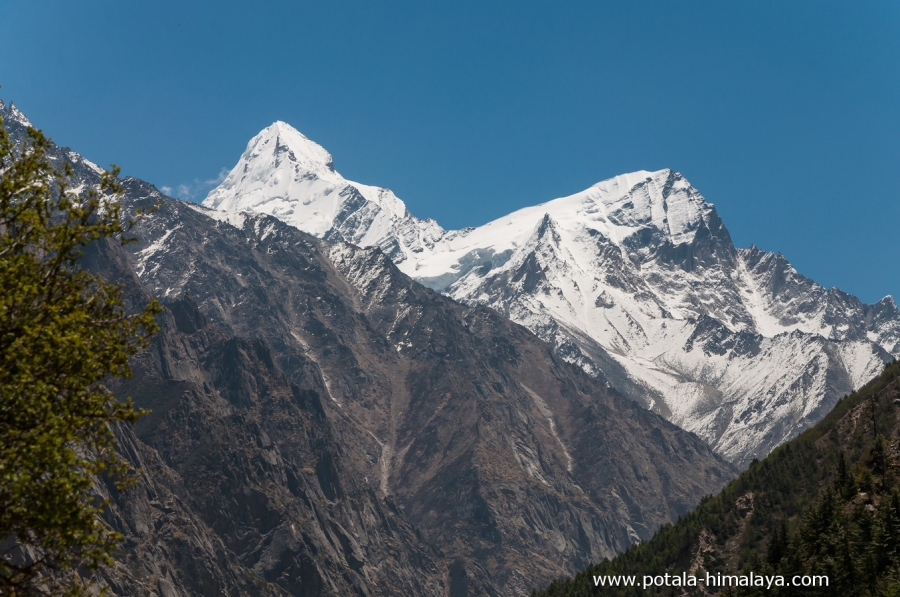
A fascinating day of trek to the crossing of the glacier, a gradual walk from Bhojbasa to Gaumukh, and soon after Gaumukh the glacier crossing becomes strenuous with the effect of high altitude. With steep and rocky terrain trek steadily towards the Tapovan with final ascend. The trek begins on rocky boulders and terrain. The Gaumukh glacier is covered by moraines that don’t require any technical gear but with the assist of a trekking pole is a good choice. The soaring peak of Mt. Shivling (6543m) comes suddenly in complete view. Tapovan is an open grassland and base camp of Mount Shivaling (6450m), and Meru (6660m). The spectacular sight all around with the peaks of Shivling, Meru, and Bhagirathi group and Kedardome. Overnight stay in tents. 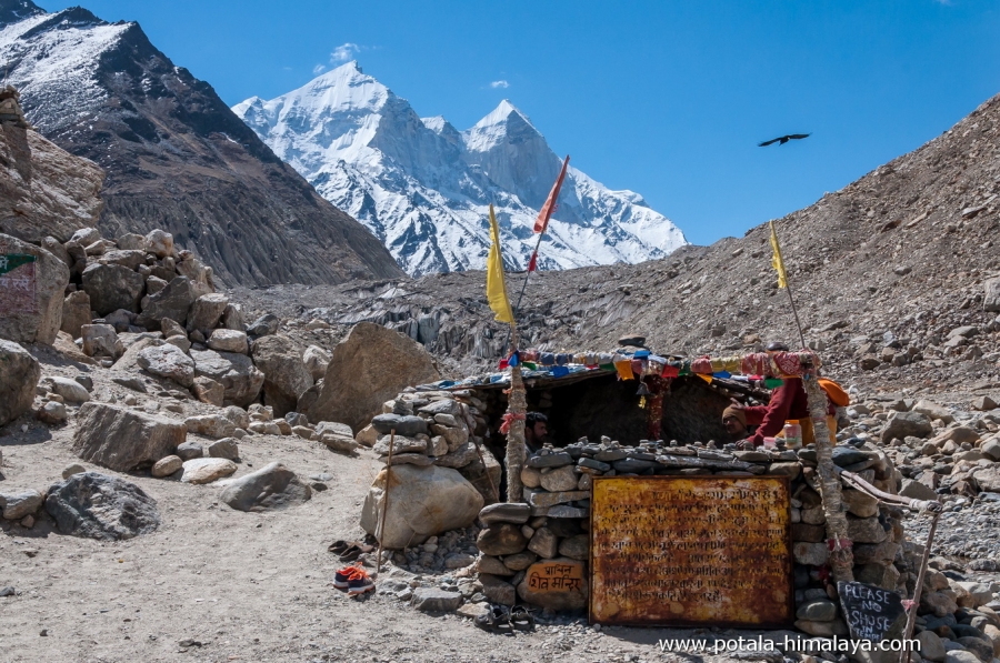
Day 5: Rest & acclimatize at Tapovan (4310m).
A day to rest, acclimatize to high altitude and soak in the area and sun.
Day 6: Day hike to Kirti Glacier.
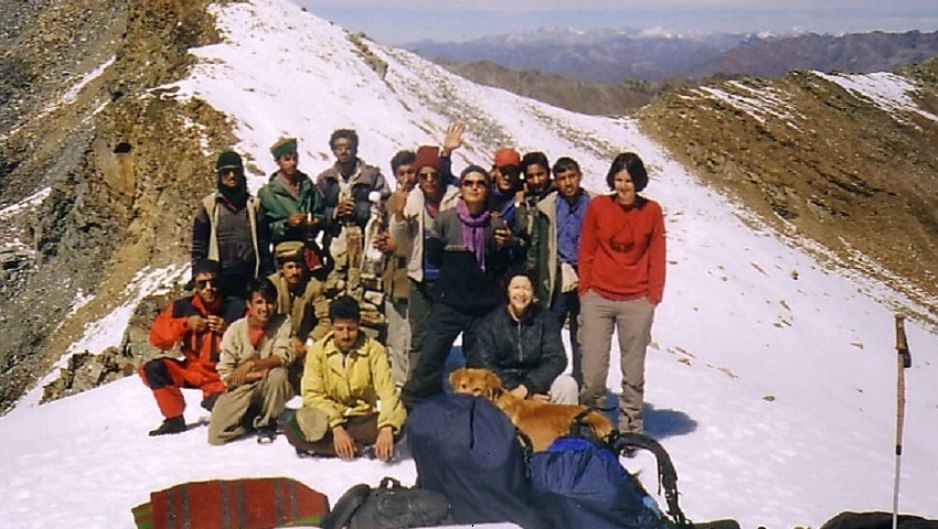
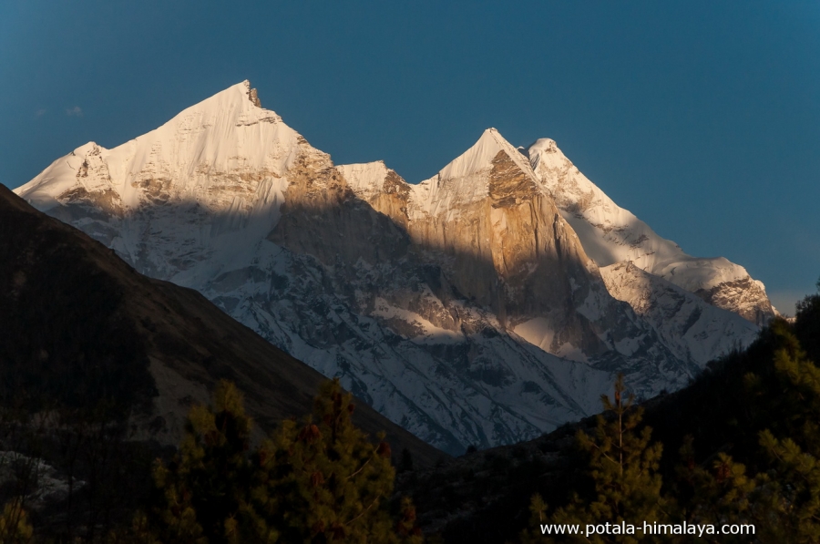
Today an early start from camp to full day trek to Kirti glacier. Finally an impressive view of Meru, Thalay Sagar, Kedarnath, Kedardome, and many other peaks. The most interesting point of view is Shivling. Finally, retrace back to camp. You will have an option for a day hike to Meru Glacier as well. Discuss with a guide and choose the route you prefer.
Day 7: Trek Tapovan (4310m) to Chirbasa (3550m). 6-7 hrs.
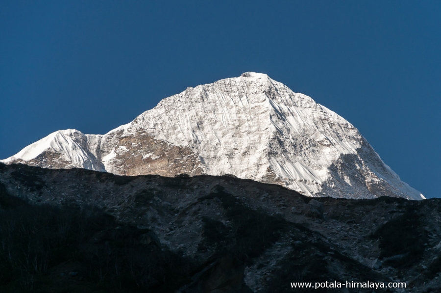
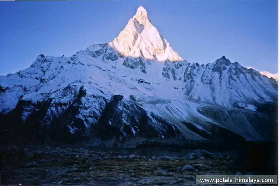
An early wake-up call to see the spectacular sunrise view of towering peaks above 6000m. The main peak which remains most of the time in trek is Mt. Shivling and sunrise or sunset is undoubtedly the main show of the trek. Retrace back to Chirbasa camp, at first steep descent to the glacier followed by a rocky traverse a second time and finally a gradual descent to Chirbasa. Overnight stay in tents.
Day 8: Trek Chirbasa to Gangotri (3070m) 3 hrs, Drive Gangotri to Uttarkashi (1120m), 4 hrs.
An early departure from Chirbasa to Gangotri, the trail descends along the right bank of the Bhagirathi River and it’s a 3-hour trek, arrive at Gangotri and drive to Uttarkashi. Overnight stay in hotel.
Day 9: Drive from Uttarkashi (1120m) to Dehradun (750m), 6 hrs. Trip ends.
Post breakfast leaving Uttarkashi, drive to Dehradun. If you have a flight from Dehradun, we will drop you off at the airport, if not drop at the hotel in Dehradun. Trip ends!
Arrive early in the morning at Dehradun, drive to Uttarkashi, and have lunch en route. It is a half-day trip to Uttarkashi from Dehradun.
After breakfast, we drive to Gangotri (4038 M) covering 98 km in 5 hrs, another half-day trip to Gangotri. Gangotri is located in the Greater Himalaya Range and sits on the banks of River Bhagirathi is a sacred place for the Hindus.
Setting off from Gangotri we follow a well-defined trail of this pilgrimage route to Gangotri glacier. Leaving Gangotri a gradual ascent through the pine forests along the River Bhagirathi with high cliffs on both sides of the River, passing the Gangotri Conversation Project checkpost, It’s a 3 hrs minimum and a maximum of 4 hrs to reach Chirbasa from Gangotri. The trail or entire trek goes along the right bank of the roaring Bhagirathi River. Chirbasa means “Home of Pine Trees” which you may find abundantly growing here. Arriving at Chirbasa you get superb views of Bhagirathi I (6856m), II (6512m) and III (6454m), Bhrigu Parbat (6000m), Manda peak (6511m). The sunset view of the Bhagirathi group of peaks is one of the best to witness from Chirbasa and Bhojbasa. Overnight stay in tents.
Leaving Chirbasa 2 hours trek to Bhojbasa (3780m), which has a tourist guest house, police station, and an ashram. The trail goes along the River Bhagirathi. Bhojbasa is named after the birch tree forest in the area. Now there are hardly any birch trees left, only the remains of dead birch of the past. Post lunch hike to the snout of Gaumukh glacier, known to be the origin of the Ganga River, the most sacred River in India, and back to Bhojbasa for overnight stay in tents.
A fascinating day of trek to the crossing of the lacier, a gradual walk from Bhojbasa to Gaumukh, and soon after Gaumukh the glacier crossing becomes strenuous with the effect of high altitude. With steep and rocky terrain trek steadily towards the Tapovan with final ascend. The trek begins on rocky boulders and terrain. The Gaumukh glacier is covered by moraines that don’t require any technical gear but with the assist of a trekking pole is a good choice.
The soaring peak of Mt. Shivling (6543m) comes suddenly in complete view. Tapovan is an open grassland and base camp of Mount Shivaling (6450m), and Meru (6660m). The spectacular sight all around with the peaks of Shivling, Meru, and Bhagirathi group and Kedardome. Overnight stay in tents.
A
day to rest, acclimatize to high altitude and soak in the area and sun.
Today an early start from camp to full day trek to Kirti glacier. Finally an impressive view of Meru, Thalay Sagar, Kedarnath, Kedardome, and many other peaks. The most interesting point of view is Shivling. Finally, retrace back to camp. You will have an option for a day hike to Meru Glacier as well. Discuss with a guide and choose the route you prefer.
An early wake-up call to see the spectacular sunrise view of towering peaks above 6000m. The main peak which remains most of the time in trek is Mt. Shivling and sunrise or sunset is undoubtedly the main show of the trek. Retrace back to Chirbasa camp, at first steep descent to the glacier followed by a rocky traverse a second time and finally a gradual descent to Chirbasa. Overnight stay in tents.
An early departure from Chirbasa to Gangotri, the trail descends along the right bank of the Bhagirathi River and it’s a 3-hour trek, arrive at Gangotri and drive to Uttarkashi. Overnight stay in hotel.
Post
breakfast leaving Uttarkashi, drive to Dehradun. If you have a flight from
Dehradun, we will drop you off at the airport, if not drop at the hotel in
Dehradun. Trip ends!
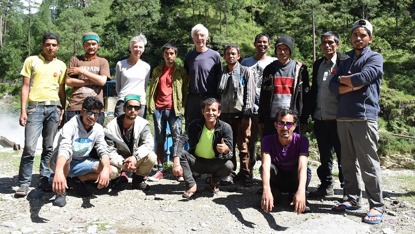
It has been a very good journey. Kedarnath and Gaumukh are very beautiful at impressive locations. Many thanks for your organization and everything, what you have done for us.
Trip info
Activity - Trekking & hiking
Region: Uttarakhand
Difficulty level - Moderate
Highest point – 4500m Kirti Glacier
Highest sleeping night - 4310m, Tapovan
Lowest trek altitude - 3070m, Gangotri
Trip Length - 9 days (6-day trek + 2-day drive + 1 day acclimatize hike)
Trekking days: 6
Hotel: 2 nights
Camp: 6 nights
Best time – Mid-May to Mid-July & Sept to Oct. End.
Cost
Price on request