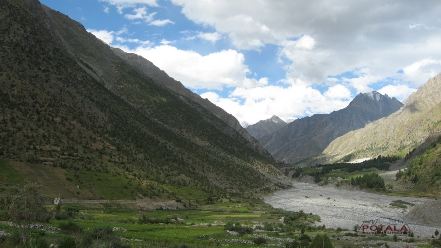
The Miyar Valley, located in the Indian part of the Great Himalaya Range, stretches for over 100 km from Udaipur to the Kang La pass. The locals - the Tharanga people - are mainly shepherds and farmers much like the Gaddis but follow a curious mix of Hindu/Buddhist religion.
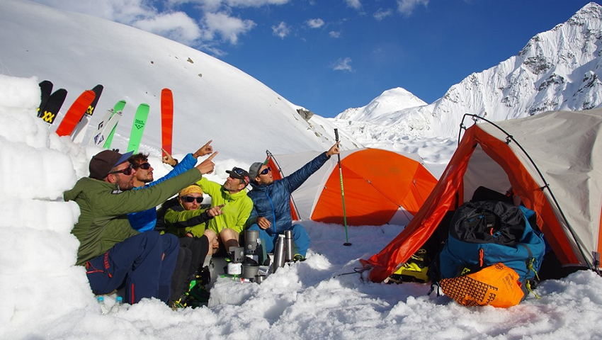
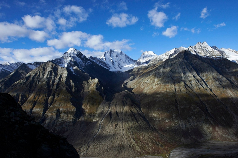
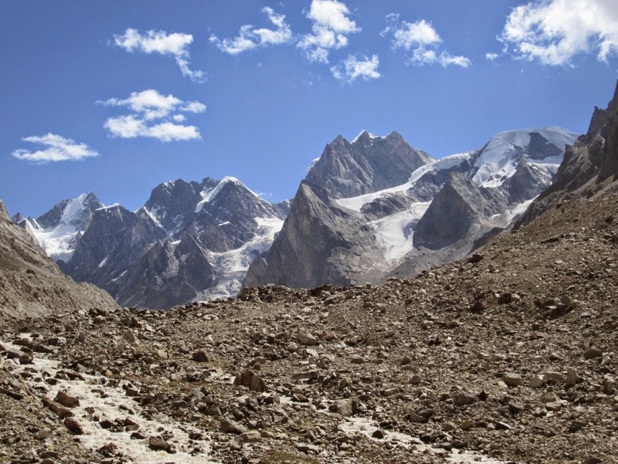
It is the westernmost of the Lahul valley's on the watershed between the Lahul & Zanskar in Ladakh, it's known for its profusion of wild flowers and medicinal herbs especially during July and August and its breathtaking landscape of quaint villages and rolling meadows which are replaced by glaciers and big rock walls as you move deeper into the valley. In recent years the valley has also attracted a lot of climbing teams (Teams from Slovenia, Poland, Italy, US, UK & India and Spanish too, It is hosts hundreds of peaks that are, by Himalayan standards, accessible and low in altitude, with very few exceeding 6000 m. As a result, Alpine-style routes are possible here that have a technical standard not normally seen in the Himalaya. The wealth of climbing possibilities here led Chris Bonington to dub it as “the Yosemite of India”
Famous peaks in the area are: Menthosa 6,443mtrs / 21,260 ft is the largest peak in the area. For trekkers the Udaipur (Urgus roadhead) -Kang La -Padum (zanskar traverse) is quite popular another viable option is to link up the Chandra Valley and Miyar via the Taralumsa pass. Another interesting option would be the crossing of the Poat La pass which would link up the Kishtwar Region to the Miyar Valley.
ITINERARY
Day 1: Manali to Udaipur (2,650m) - Chamrat (2,090m) - Urgos (3,250m). Drive.
Day 2: Urgos to Shukto Drive, Trek to Khanjar - Tharang (3,450m).
Day 3: Trek Zardung (3,900m).
Day 4: Trek Palphu (4,000m) Kesar Yon Chhap /Snout of glacier.
Day 5: At Kesar Yon Chaap Rest & acclimatization.
Day 6: Trek to Camp 1 (4,200 m) Miyar glacier camp.
Day 7: Trek to Camp 2 (4,750 m) Base Kang la Jot.
Day 8: Cross Kang la jot (5,450 m) – Temasa Tokpo (4,800m).
Day 9: Trek to Burdan (3,670 m), Drive Padum (3,600 m).
Day 10: Padum to Kargil (2,670 m)
Day 11: Kargil – Srinagar or Kargil – Leh.
BURDAN TO MANALI
Day 9: Trek Burdan, Drive Purney (3,960 m)
Day 10: Purney to Gonbo Rangjun - Shinkun La (5,090 m) - Manali.
MIYAR VALLEY - KANG LA TRIP DOSSIER
Day 1: Manali to Udaipur (2,650m) - Chamrat (2,090m) - Urgos (3,250m). Drive.
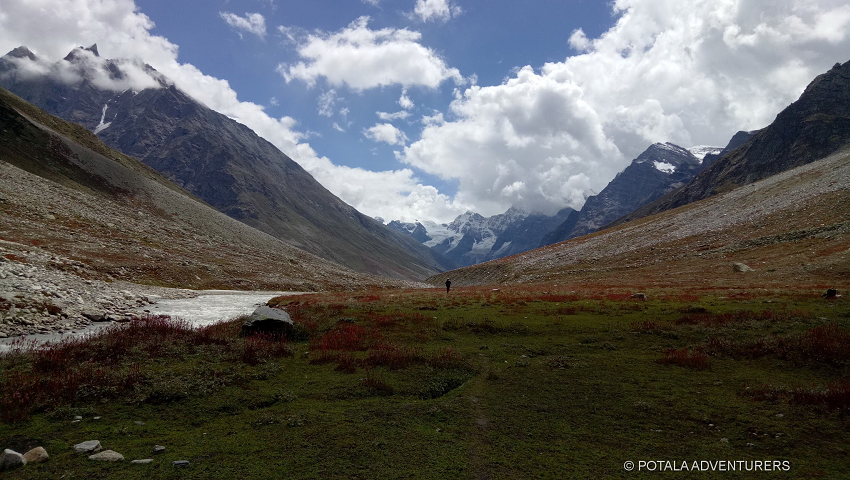
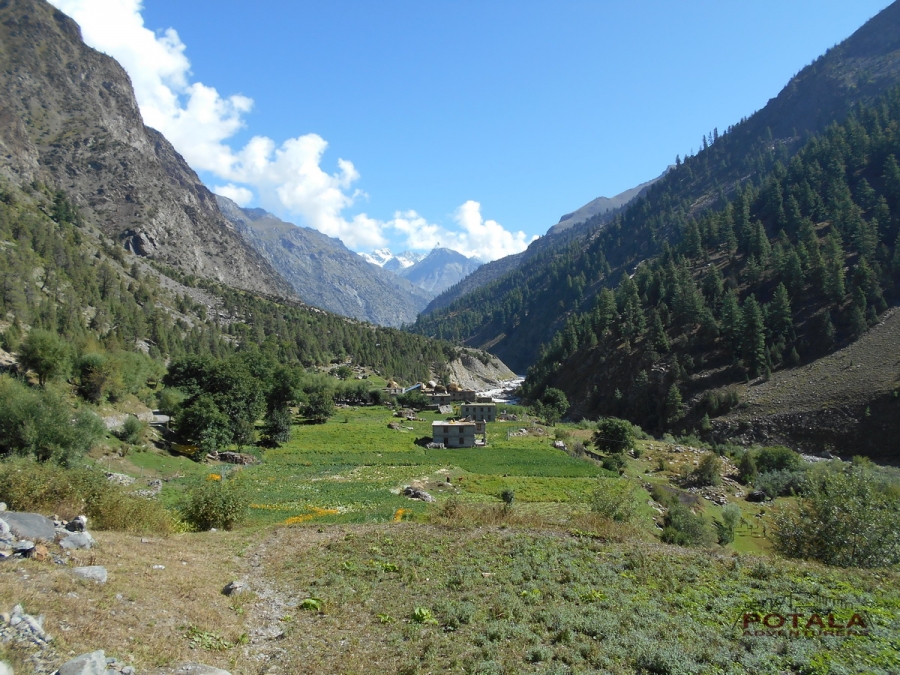
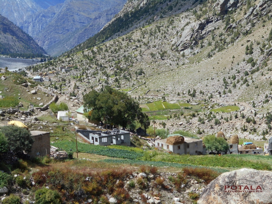
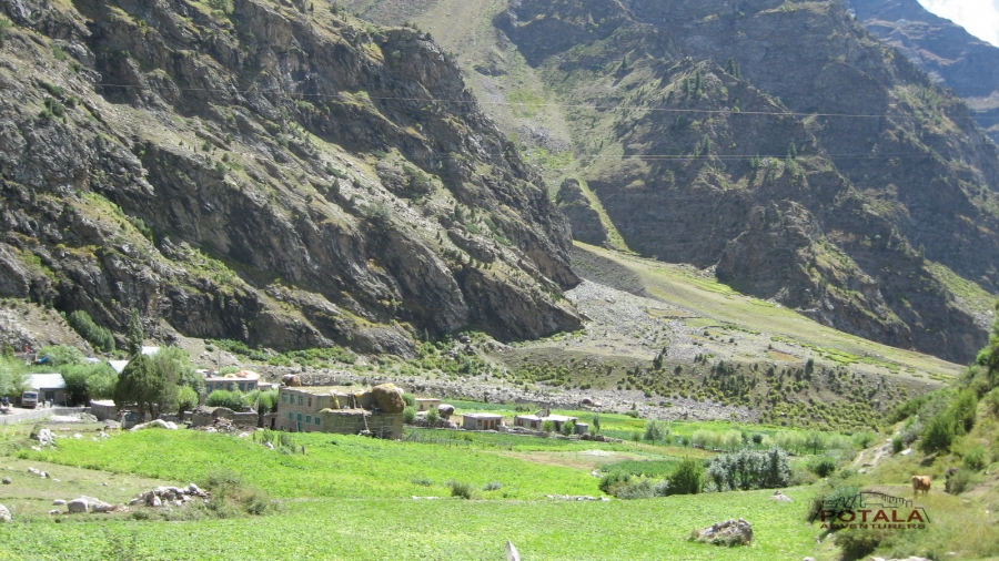
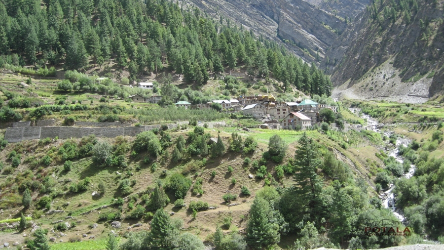
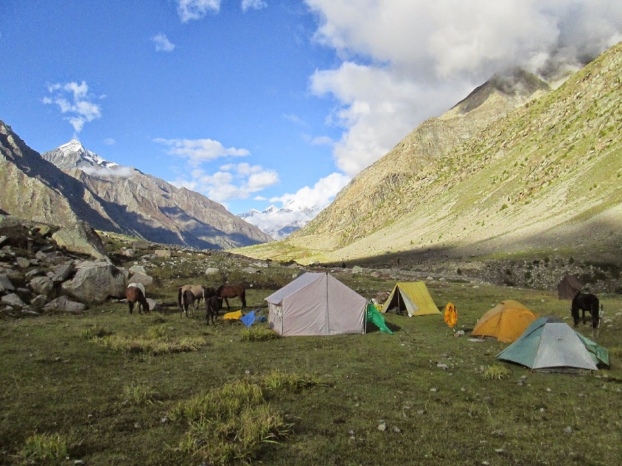
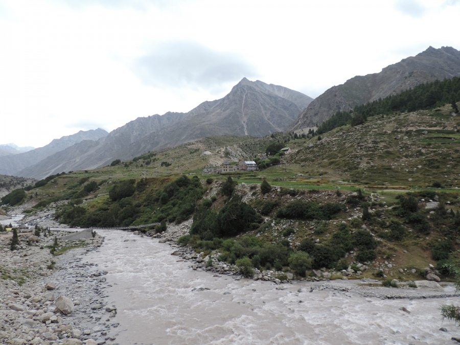
Starting trip from Manali, at the head of the lush green Kullu valley. The road slowly winds up the Lahaul valley. The landscape changes dramatically, the greenery being replaced by barren hillsides, where the village with their bountiful fields of barley, peas and potatoes, stand out in stark contrast. On entering Lahoul the Buddhist influence is visible in the many monasteries crossed on the way. The people here have distinct Tibetan features. Today we drive along the Chenab River. On the way we visit famous Trilok Nath temple and Mrikula Devi temple at Udaipur. From Udaipur follow a road, which has recently been constructed, through the narrow gorge making the entrance to Miyar valley. Cross the wooden bridge before Chamrat and continue on the true left bank of the valley. The village of Chamrat is with Mani walls and prayer flags, is the first village in the Miyar valley. Now road leads through flowered meadows and peas and millet fields to the village of Karput. Urgos is at the confluence with the valley leading to the Mt. Menthosa (6,443m), overnight home stay.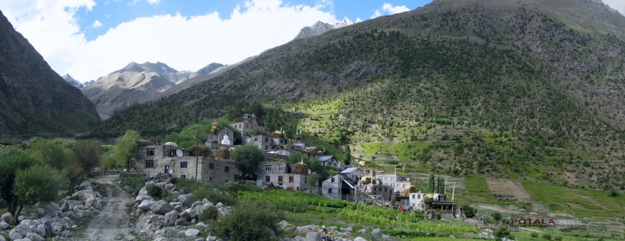
Day 2: Urgos to Shukto Drive, Trek to Khanjar - Tharang (3,450m). 6 to 7 hours.
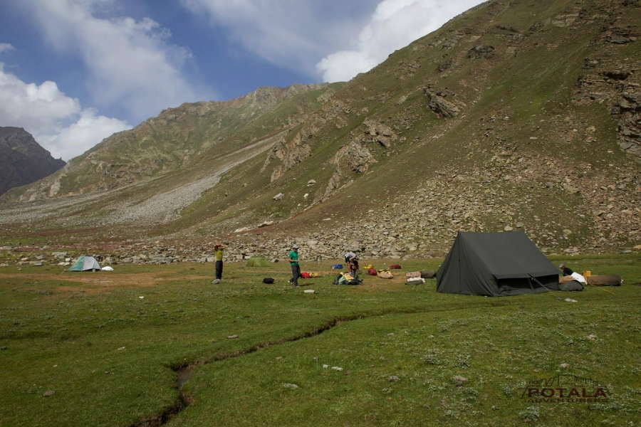
Leaving Urgos, we drive 6 kms to Shukto - Khanjar bridge, across a stony moraine stretch and some side streams to Khanjar, the last village. above the village on a beautiful alpine meadow, carpeted with edelweiss and catmint. It is not rare to see the Himalayan Griffins and Lammergeyers.
There are lovely pastures all along the trek up to the camping site. The trek continues to the left side of the stream. A side stream coming from the Shinkun La is forded to reach at a camping site. A side stream mingles here with the Miyar nullah. The camp is established here.
Day 3: Trek Zardung (3,900m). 5 to 6 hours.
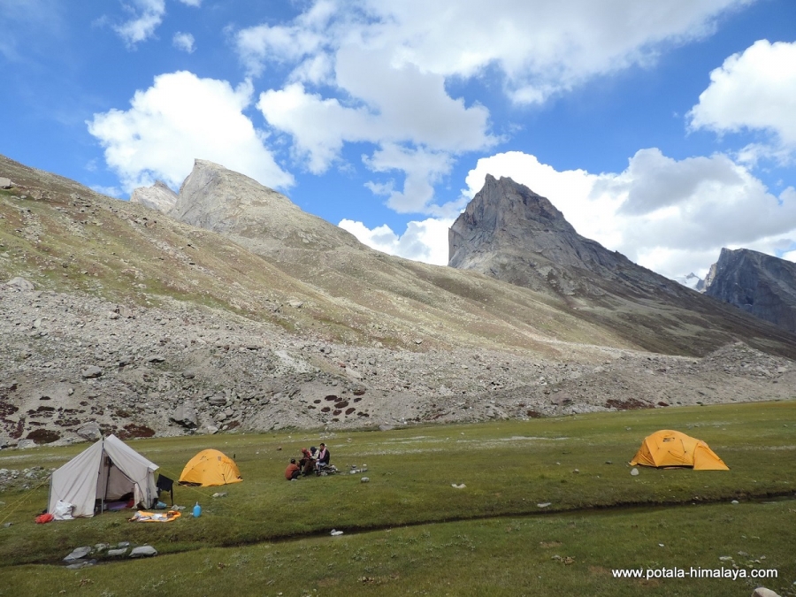
Now gradual ascent over rich grazing pasture, during summer these area are carpeted with wild flowers. Arriving at Gumba Nala and crossing stream by a bridge we take Northwest and again continue over grassy meadows to reach stunning campsite at Zardung
Day 4: Trek Palphu (4,000m) Kesar Yon Chhap /Snout of glacier. 4 to 5 hours.
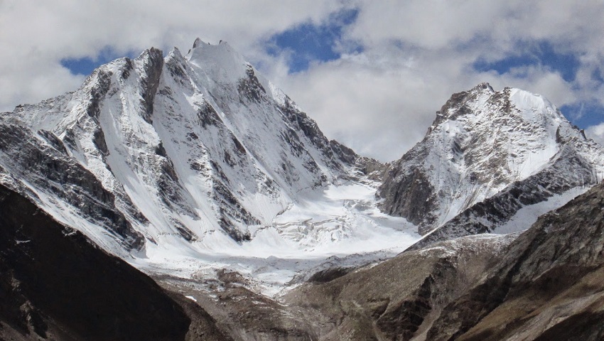
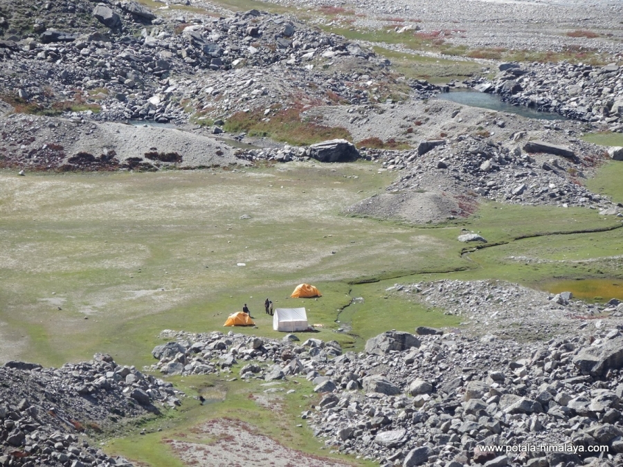
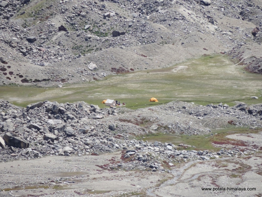
Leaving early Takdung Nala to be crossed this morning. After crossing an easy trail below the castle peak to Kesar Yon Chhap. Pimu nala and Pimu la can be seen across the Miyar nala. After lunch at Palphu, another stream coming from the Chhudong glacier is to be crossed. It's not so far from the campsite here. Crystal clear lake short before our wonderful campsite at the foot of Kang La glacier. For those who are interested in bouldering, there is a number of boulders suitable for rock climbers. The entire Miyar valley is a favorite grazing area and Shepherds can be seen all across the valley, who know many trails that are not yet marked on maps. Arriving at camp, relax and explore in around. Kesar Yon Chaap which means seven sacred water at the snout of the Miyar glacier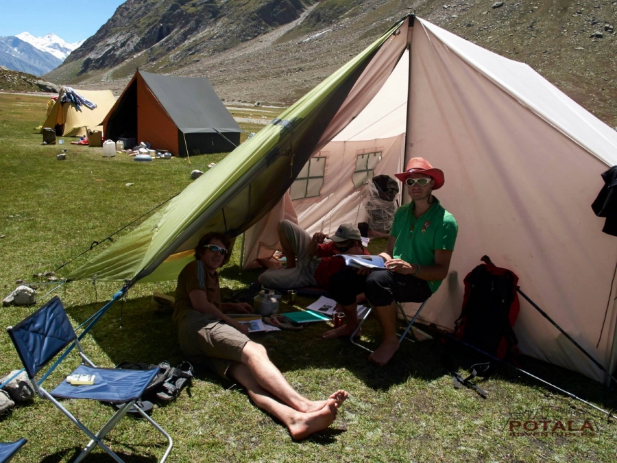
Day 5: Rest & Acclimatization.
A rest and acclimatization day at Kesar Yon Chhaap and final preparation before heading to Miyar glacier.
Day 6: Trek to Camp 1 (4,200 m) Miyar glacier camp. 7 to 8 hours.
Today from camp a short and climb steep along the slopes for about an hour than along the left side of glacier for hours. From today the trail from vast meadows are replaced with moraine and scree as the trek becomes tougher. Ocassionally some grassy slopes with wild flowers to relax with a glacier view below.
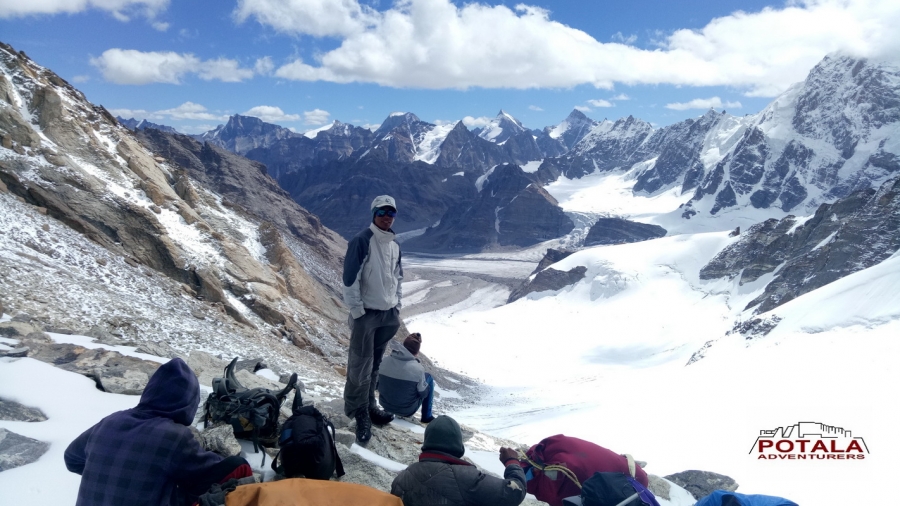
Finally descend to Jungpar glacier coming down from true left of Miyar glacier and cross it to and reach on the main Miyar glacier and to the campsite. The first view of Kang la glacier can be obtained from here.
Day 7: Trek to Camp 2 (4,750 m) Base Kang la Jot. 6 to 7 hours.
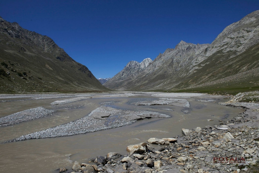
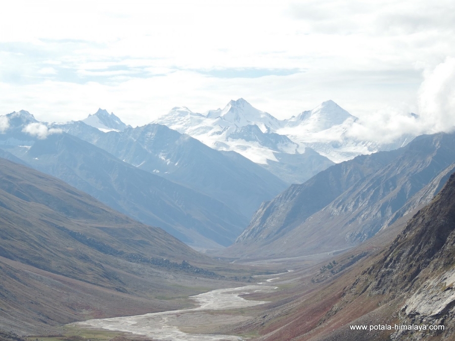
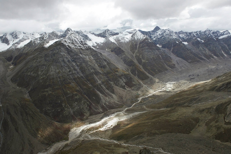
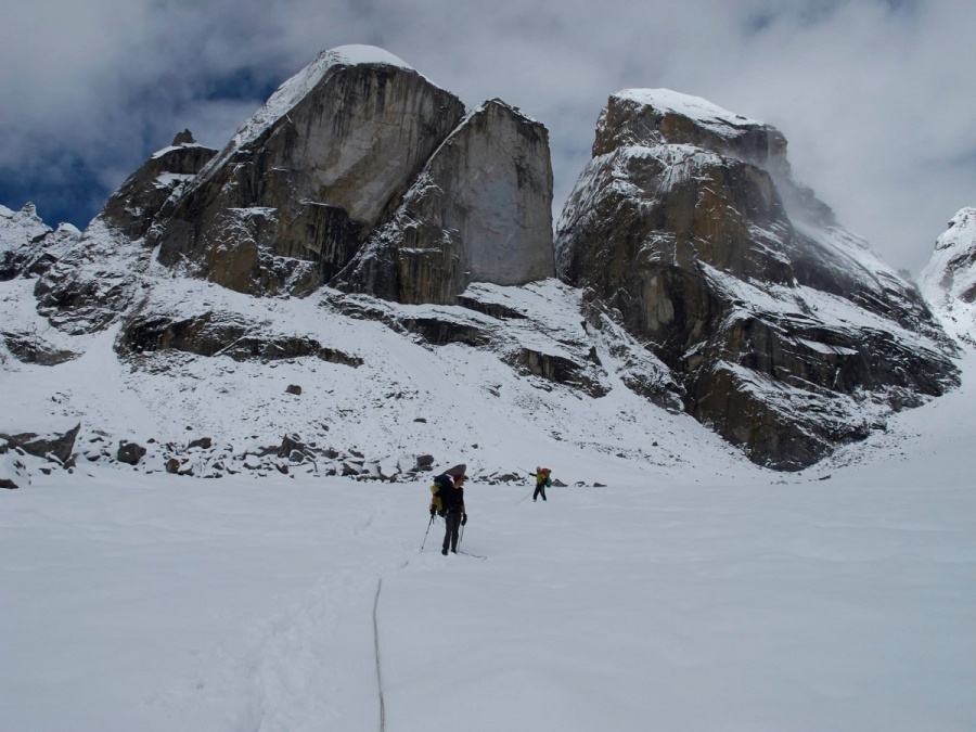
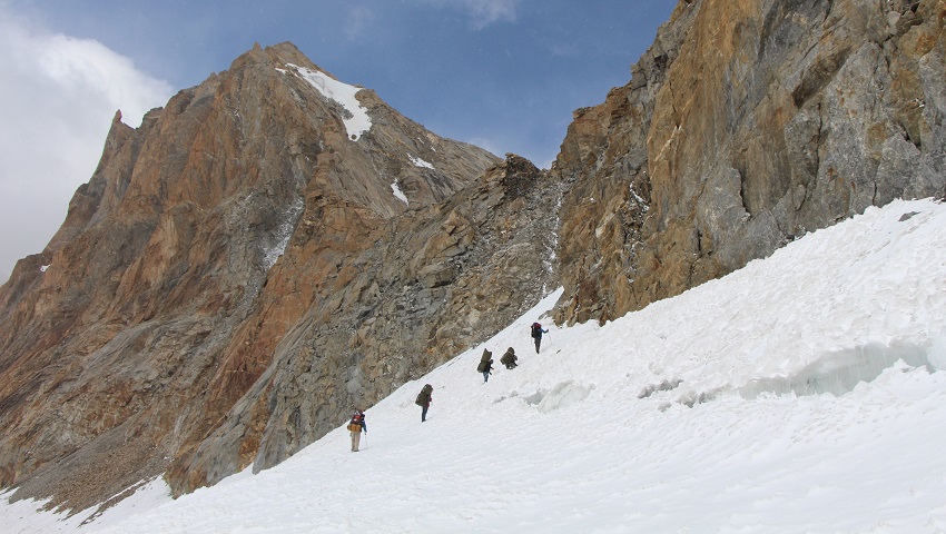
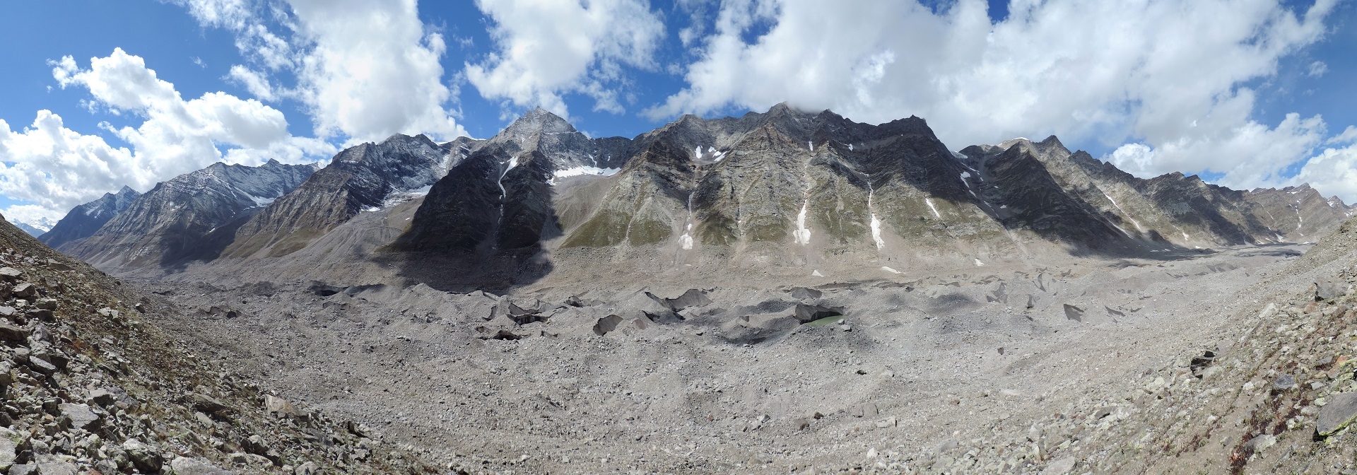
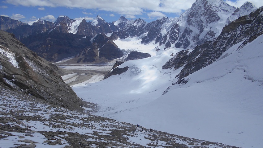
An early start today to make walk on snow easier, a gentle ascends right up the middle of glacier. A spectacular & amazing view of snowy mountains all around while walking towards base camp. Miyar glacier, which is 28 km long, from camp at the snout glacier there is choice of route. Walk across the terminal moraine to the left side of the glacier, route tiring ups and downs along and increasingly ill-defined trail. Demanding terrains for the first 7/8 km until the confluence with a glacier flowing from the East side. Easy going from here with a gradual ascent over smooth black ice. An occasional well exposed crevasses to negotiate. Camp just above the confluence with the side glacier, there is 3 passes and the center one is the actual pass.
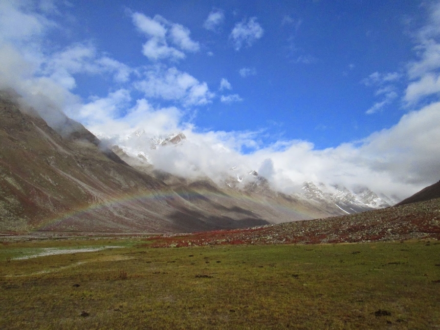
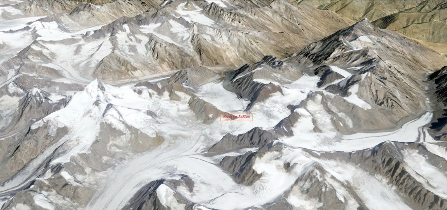
Day 8: Cross Kang la jot (5,450 m) – Temasa Tokpo (4,800m). 8 to 9 hours.
Leaving early from camp with first daylight, we walk along the middle of the huge snow covered glacier at a gentle pace. A magnificent views down the valley to Menthosa 6,443m. At the head of the glacier, a large snow field curves to the East side to the base of the pass. 250 m ascent from the snowfield to the pass is not hard. Better to rope up to crossing crevasses, than 1.5 kms long Kang la pass (5,450 m) enclosed by rock cliff to the north and snow walls to the south. You will be rewarded with with spectacular view of snow capped peaks and glaciers all around. We descend along the right side of the valley to the river junction. After crossing Kang la pass camp near the two confluences of the 2 valley streams.
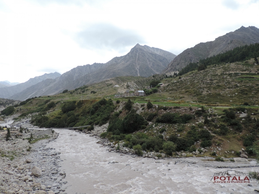
Day 9: Trek to Burdan (3,670 m), Drive Padum (3,600 m).
Now follow the true right side of the valley. After crossing the many side streams and grassy campsites, 2/3 km downs the valley following the Temasa River. Arriving at rocky plateau, trail descends steeply in places through meadows and boulder fields. Temasa Tokpo remains on the right bank, it flows down to a grassy meadow above the Tsarap River. Continue for 2 hrs to reach Burdan roadhead, we wil board our vehicles for Padum approximately for an hour. The districts headquarter of Zanskar sub division. Overnight stay in guest house or hotel.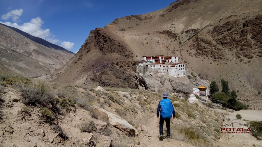
Day 10: Padum to Kargil. Drive 230 km. 8 to 9 hours.
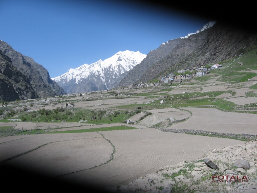
Today, leaving Padum the road to Penzi La (4,400 m) goes along the Stod River and by passing small and beautiful villages of Tungri, Phe, Phey, Abran and Aksho. You will see a gigantic Drang Drung glacier across the Penzi la towards South. Crossing the Rangdum the road continue along the Suru valley to our final stop at Kargil.
Day 11: Kargil – Srinagar or Kargil – Leh. 8 to 9 hours.
Leaving Kargil, today you will have two options. Either to end trip in Leh or in Srinagar.
Kargil – Leh route passes through Lamayuru and Kargil – Srinagar road goes over the Zoji La pass.
PRICE INCLUDES
· All ground transportation to & fro as per the itinerary.
· Hotel accommodation in Padum, Kargil, Leh (Room + Breakfast)
· All camping facilities: Mess tent, camp chairs and table.
· Accommodation in quality 4 season tents, sleeping bags, foam mattress, trekking poles & safety gears.
· Meals on full board (Breakfast, Lunch and Dinner) Tea, snacks during the trek
· Qualified & trained well English speaking trekking guide and experienced crew.
· Porters or mules for porterage of gear & duffel bags
· Camping fee, trekking permits and fee, park fee.
· First aid medical kit, Oxymeter to check pulse, heart rate and oxygen saturation at higher altitude.
· Goods and services tax.
Starting trip from Manali, at the head of the lush green Kullu valley.
The road slowly winds up the Lahaul valley. The landscape changes dramatically,
the greenery being replaced by barren hillsides, where the village with their
bountiful fields of barley, peas and potatoes, stand out in stark contrast. On
entering Lahoul the Buddhist influence is visible in the many monasteries
crossed on the way. The people here have distinct Tibetan features. Today we
drive along the Chenab River. On the way we visit famous Trilok Nath temple and
Mrikula Devi temple at Udaipur. From Udaipur follow a road, which has recently
been constructed, through the narrow gorge making the entrance to Miyar valley.
Cross the wooden bridge before Chamrat and continue on the true left bank of
the valley. The village of Chamrat is with Mani walls and prayer flags, is the
first village in the Miyar valley. Now road leads through flowered meadows and
peas and millet fields to the village of Karput. Urgos is at the confluence
with the valley leading to the Mt. Menthosa (6,443m), overnight home stay.
Leaving Urgos, we drive 6 kms to Shukto - Khanjar bridge, across a stony
moraine stretch and some side streams to Khanjar, the last village. above the
village on a beautiful alpine meadow, carpeted with edelweiss and catmint. It
is not rare to see the Himalayan Griffins and Lammergeyers.
There are lovely pastures all along the trek up to the camping site. The trek
continues to the left side of the stream. A side stream coming from the Shinkun
La is forded to reach at a camping site. A side stream mingles here with the
Miyar nullah. The camp is established here.
Now gradual ascent over rich grazing pasture, during summer these areas are carpeted with wildflowers. Arriving at Gumba Nala and crossing the stream by a
bridge we take Northwest and again continue over grassy meadows to reach the stunning campsite at Zardung.
Leaving early Takdung Nala to be crossed this morning. After crossing an
easy trail below the castle peak to Kesar Yon Chhap. Pimu nala and Pimu la can
be seen across the Miyar nala. After lunch at Palphu, another stream coming
from the Chhudong glacier is to be crossed. It's not so far from the campsite
here. Crystal clear lake short before our wonderful campsite at the foot of
Kang La glacier. For those who are interested in bouldering, there is a number
of boulders suitable for rock climbers. The entire Miyar valley is a favorite
grazing area and Shepherds can be seen all across the valley, know many
trails that are not yet marked on maps. Arriving at camp, relax and explore in
around. Kesar Yon Chaap which means seven sacred waters. at the snout of the
Miyar glacier.
A rest and acclimatization day at Kesar Yon Chhaap and final preparation
before heading to Miyar glacier.
Today from camp a short climb steep along the slopes for about an
hour then along the left side of the glacier for hours. From today the trail from
vast meadows is replaced with moraine and scree as the trek becomes tougher. Occasionally some grassy slopes with wildflowers to relax with a glacier view below.
Finally descend to Jungpar glacier coming down from the true left of Miyar glacier and
cross it to reach on the main Miyar glacier and to the campsite. The first
view of Kang la glacier can be obtained from here.
An early start today to make walking on snow easier, a gentle ascend right
up the middle of the glacier. A spectacular & amazing view of snowy mountains
all around while walking towards base camp. Miyar glacier, which is 28 km long,
from camp at the snout of the glacier there is a choice of route. Walk across the
terminal moraine to the left side of the glacier, route tiring ups and downs
along an increasingly ill-defined trail. Demanding terrains for the first 7/8
km until the confluence with a glacier flowing from the East side. Easy going
from here with a gradual ascent over smooth black ice. An occasional well-exposed crevasses to negotiate. Camp just above the confluence with the side
glacier, there is 3 passes and the center one is the actual pass.
Leaving early camp with the first daylight, we walk along the middle of
the huge snow-covered glacier at a gentle pace. A magnificent view down the
valley to Menthosa is 6,443m. At the head of the glacier, a large snow field
curves to the East side to the base of the pass. 250 m ascent from the
snowfield to the pass is not hard. Better to rope up to crossing crevasses,
than the 1.5 km long Kang la pass (5,450 m) enclosed by a rock cliff to the north
and snow walls to the south. You will be rewarded with a spectacular view of
snow-capped peaks and glaciers all around. We descend along the right side of
the valley to the river junction. After crossing Kang la pass camp near
the two confluences of the 2 valley streams.
Now follow the true right side of the valley. After crossing the many side
streams and grassy campsites, 2/3 km downs the valley follows the Temasa
River. Arriving at a rocky plateau, the trail descends steeply in places through
meadows and boulder fields. Temasa Tokpo remains on the right bank, it flows
down to a grassy meadow above the Tsarap River. Continue for 2 hrs. to reach
Burdan Road head, we will board our vehicles for Padum approximately for an hour.
The districts headquarter of Zanskar sub-division. Overnight stay in a guest
house or hotel.
Today, leaving Padum the road to Penzi La (4,400 m) goes along the Stod
River and by passing the small and beautiful villages of Tungri, Phe, Phey, Abran, and Aksho. You will see a gigantic Drang Drung glacier across the Penzi la
towards the South. Crossing the Rangdum the road continues along the Suru valley to
our final stop at Kargil.
Leaving Kargil, today you will have two options. Either to end trip in
Leh or in Srinagar.
Kargil – Leh route passes through Lamayuru
and Kargil – Srinagar Road goes over the Zoji La pass.
PRICE INCLUDES
· All ground transportation to & fro as per the itinerary.
· Hotel accommodation in Padum, Kargil & Leh at CP plan.
· All camping facilities: Mess tent, camp chairs and table.
· Accommodation in quality 4 season tents, sleeping bags, foam mattress, trekking poles & safety gears.
· Meals on full board (Breakfast, Lunch and Dinner) Tea, snacks during the trek
· Qualified & trained well English speaking trekking guide and experienced crew.
· Porters or mules for porterage of gear & duffel bags
· Camping fee, trekking permits and fee, park fee.
· First aid medical kit, Oxymeter to check pulse, heart rate and oxygen saturation at higher altitude.
· Goods and services tax.
PRICE DOES NOT INCLUDES
· Domestic flight.
· Hotel in Delhi, Manali & Srinagar.
· Travel insurance.
· Soft or hard drinks.
· Equipment rentals
· Personal tip to staff: Guide, cook, helper, horseman, driver.
· Any unforeseen cost arises by natural hazards rain, snow, road block which cost extra lodging & boarding beyond trip Schedule.
Trip info
Trip facts
Region - Miyar valley, Himachal Pradesh
Zanskar region - Jammu Kashmir, India
Difficulty Level - Moderate to Strenuous
Max Altitude - 5450m
Trip Length - 17 days Delhi to Delhi,
11 days Manali to Leh or Manali to Srinagar
8 days of trekking
Activity - Trekking expedition
Best time - Mid June to mid-Oct
Dates
28 Aug. to 7 Sept. 2023
Price
79900
11 days Manali to Padum or
Manali to Manali