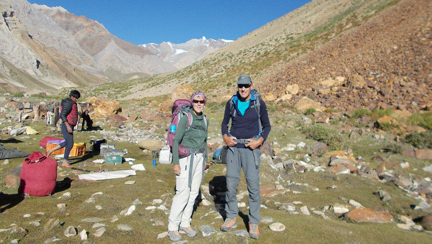
This is one of our most exciting and diverse trekking routes, a stunningly beautiful and challenging trek through remote canyon lands, crossing many high Himalayan passes (most 5000+ meters), and trekking through the hidden, green valleys and villages of mythical Ladakh and Zanskar.
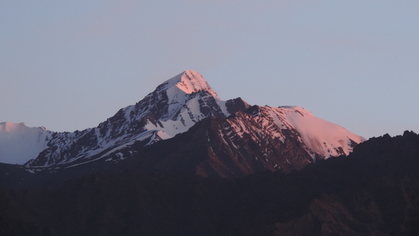
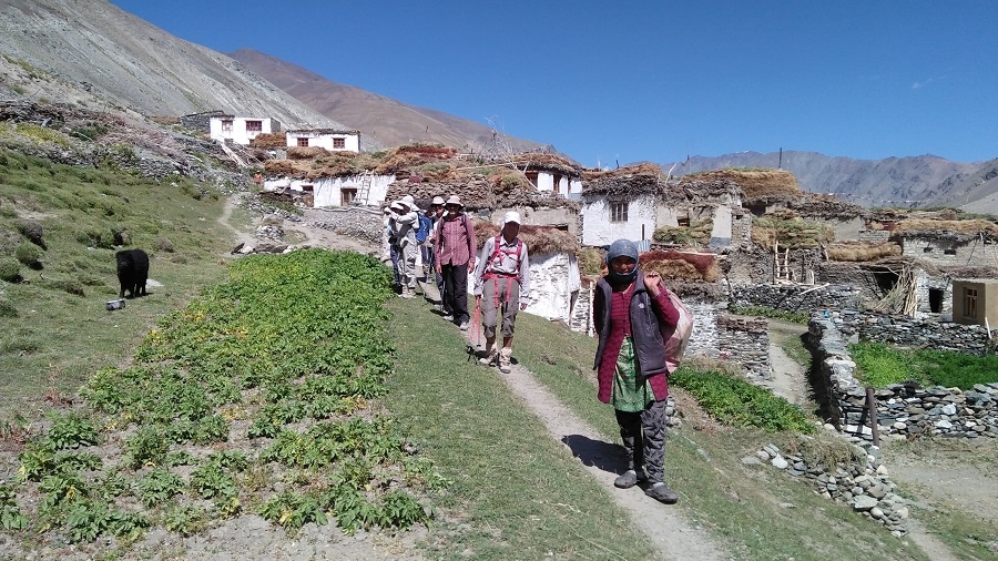
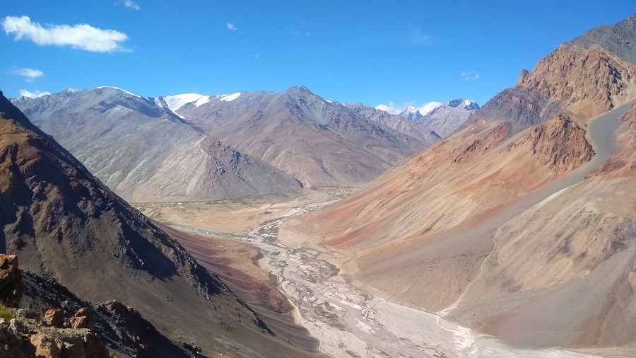
You will pass through many villages along the way and meet with locals at their homes that are with our Zanskari staff. Spectacular view of Greater Himalayan range and its peak rising above 6000m, some of the best views are K2 and Nanga Parbat from Kanji La view of Nun 7135m and Kun 7077m and Akshu, Doda 6550m and Brahma 6574m. a peak in Southern Zanskar.
We begin this epic trip at delightful Kanji then cross the formidable Kanji La and a second pass Pikdong La to remote but friendly Dibling village. From Dibling you follow the Oma Chu to the base of Hanuma la to the large plains of Zanskar at Padum, here you will have the opportunity to visit several sights. From Zangla we take the wild Zanskar trail where only a few trekkers find their way to Shade village. Shade is the most remote and scenic place in Zanskar, where you will experience the traditional Zanskari village life in this far-flung village. Along the Tsarap River to one of the most spectacular sights of our trek to Phuktal and finally exploring the high villages of Southern Zanskar where our trek ends, we drive to Shinkun La pass to the vast plains of Sarchu and back to Leh.
Instead of finishing at Leh, you will have the option to finish your trip at Manali. You will drive on Leh - Manali highway to the hill resort town of Manali. Relax a couple of at this hill station before making a final departure to Delhi.
Our unique adventurous Grand Traverse of Zanskar – Join us.
Itinerary
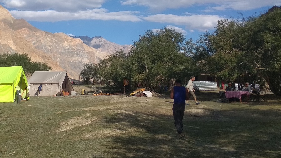
Sun. 28 July. Day 1 - Arrive at Leh 3500m.
Day 2 - Acclimatize: Sight-seeing Shanti Stupa, Leh Palace, Tsemo Gompa, Spituk
Day 3 - Acclimatize: Sight-seeing Thiksey Hemis Matho Stok palace
Day 4 - Drive Lamayuru (3430m), en route visit Likir - Alchi
Day 5 - Drive Kanji (3850m)
Day 6 - Trek Kanji River Junchtion - Kuthak Cha Kelcha (4050m)
Day 7 - Trek Base Camp Kanji La (4300m)
Day 8 - Trek Kanji La (5342m) – Kanji Sumdo (4370m)
Day 9 - Trek mid camp – Base Camp Pikdong La (4400 m)
Day 10 - Trek Pikdong la (5029m) - Dibling doksa (4200m)
Day 11 - Trek Dibling (4000m)
Day 12 - Trek Lingshed Sumdo (3680m)
Day 13 - Trek Barmi la (4694m) – Lanang Sumdo (4000m)
Day 14 - Trek Zingchen (3370 m) via Hanuma La (4700m)
Day 15 - Trek Hanumil (3400 m) via Perfi La (3900m)
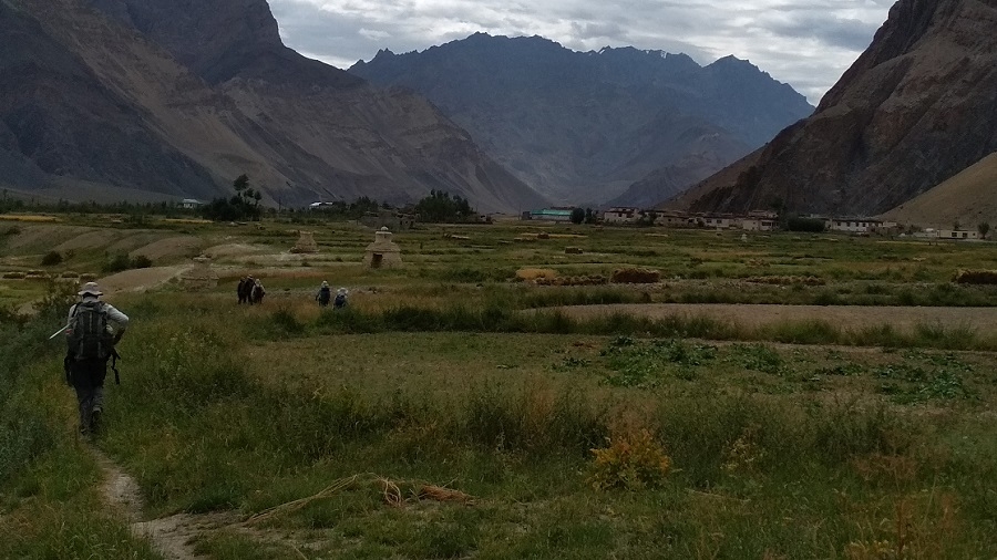
Day 16 - Trek Pidmo (3420m) – Zangla River camp.
Day 17 - Rest Zangla (Optional visit stunning Karsha, Padum, restock supply)
Day 18 - Trek Zangla Sumdo 3900m.
Day 19 - Trek Pandang La High camp 4450m.
Day 20 - Trek Yangdam Chen (4220 m) Cross Pandang La (5110 m)
Day 21 - Trek Mitsik Doksa 4285m, Cross Liyu La 4375m & Lar La 4690m
Day 22 - Trek Shade (4220 m) via Rotang La (4900 m)
Day 23 - Rest Shade (4220 m)
Day 24 - Trek Yatah hidden camp (4000 m)
Day 25 - Trek Phuktal (3830 m)
22 Aug. Day 26 - Trek Purne, drive Tangze - Kargyak (4120 m), explore Khi & Shanka villages.
Day 27 - Drive Leh via Shinkun La (5090m) Darcha & Sarchu
Day 28 - Rest Leh
25 Aug. Day 29 - Depart Leh
Option Ending Trip at Manali
22 Aug. Day 26 - Trek Purne, drive Tangze - Kargyak (4120 m), explore Khi & Shanka villages.
Day 27 - Drive Manali via Shinkun La – Darcha
Day 28 - Rest/explore Manali
Day 29 - Manali - New Delhi
26 Aug. Day 30 - Depart hometown
More pictures of Zangla - Shade - Phuktal trekking route, please visit
https://www.potala-himalaya.com/trekking/wild-zanskar-trek-india
Trip Dossier
Day 1: Arrive Leh 3500m.
Welcome to Leh, after your long flight from your hometown to Delhi, and meet with us at Leh airport. Our representative will greet you at Leh airport. Prem will meet you at your hotel. Most of the flight arrives in Leh in the morning time and the rest of the day is free to relax and acclimatize to the altitude of 3500m as well as visit Leh bazaar.
Day 2: Acclimatize: Sight-seeing Shanti Stupa, Leh Palace, Tsemo Gompa, Spituk
Today sightseeing around Leh. Visit the Royal Palace of Leh from the 16th century, and continue through the fields of Sankar monastery, which adjoins north Leh. Continue to the Shanti Stupa and finally end your day with a visit to Spituk Gompa. Our driver will pick you up from the hotel at 8:30 am after breakfast. Finish your day before lunch and you will have time to go for lunch at Leh Market.
Day 3: Acclimatize: Sight-seeing Shey - Thiksey - Hemis - Matho - Stok palace.
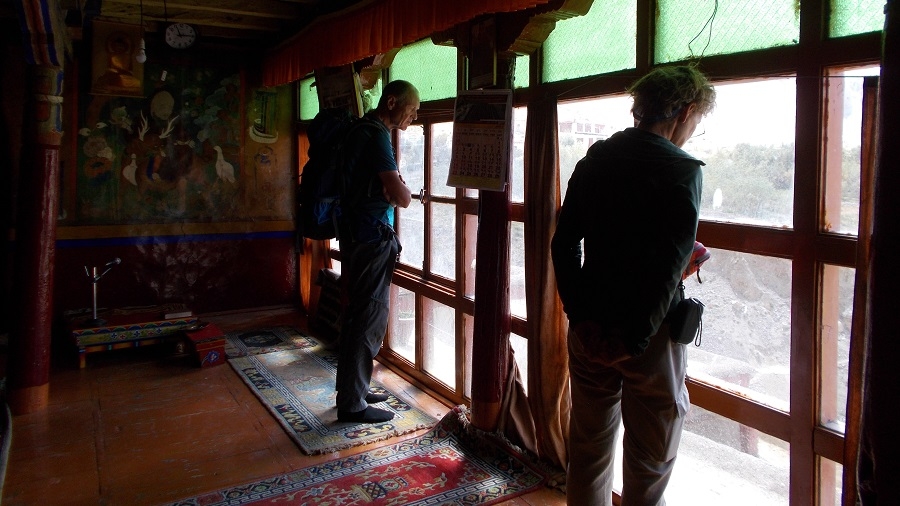
A full day of sightseeing and visiting the most important place in around the Indus Valley. You will have a guide for this day trip, especially for Gompa. There are many places to visit but we have chosen five sights which are suitable for a day trip. Leaving from the hotel at 8:30 am after breakfast you will visit first Shey Palace, then Thiksey. Thiksey monastery, which is at a distance of 27 km from Hemis, this monastery is the oldest monastery of Gelugpa School in Ladakh. The great Lama Paldan Shesrap built it in the 14th century. Here you can see the big statue of the Future Buddha. Continue to Taktok and Chemdey and return to visit Hemis monastery which is 45 km far from Leh and it takes a 90-minute drive. The great Mahasiddha Staktsang Raspa along with great ancestor Singey Namgyal built this biggest monastery in the 16th century. Continue to Matho then we drive to Stok which is situated opposite Leh at a distance of 14 km, Stok visits of Royal Palace built in 1825 AD and the palace has great collections of antiquity. Continue to visit Matho situated 10 km from Stok, which has a 10th-century complex. Finally back to Leh and final preparation for trek.
Day 4: Leh - Lamayuru (3430m), en route visit Likir – Alchi
Today we drive to the timeless Lamayuru Gompa en route first visit to Likir than Alchi Gompa, situated at a distance of 68 km from Leh. Its monastery was built on lowlands rather than on a hilltop as others are, to protect from enemies. The Chortens around Alchi Gompa contains numerous murals of Lotsava Rinchen Zangpo, who built this monastery. Alchi monastery has vast collections of wall paintings and wood sculptures. We continue to drive to Lamayuru which is 58 km from Alchi. The oldest monastery in Ladakh was founded by Indian scholar Mahasiddhacharya Naropa in the 11th century. Lamayuru hosts a mask dance festival (Yuru Kabgyat) during the 17th and 18th day of the fifth months of the Tibetan Lunar calendar. It belongs to the red hat sect of Tibetan Buddhism; the monastery is rich with Thankas and wall paintings. Lamayuru monastery was constructed by Arahat Nimagung between the 10th and 11th centuries. History says that in the 11th century, the Mahasidha Naropa visited this place and the cave where he resided and meditated is still to be seen inside the monastery. This is mostly visited by travelers located on the Srinagar - Leh road. Enjoy homestay at Lamayuru.
Day 5: Lamayuru (3430m) - Kanji (3850m)
A stunning drive along the Kanji chu to Kanji village. The starting point of our trekking tomorrow, explore the Kanji village.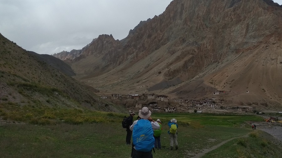
*Kanji village*
Day 6: Trek Kanji River Junchtion - Kuthak Cha Kelcha (4050m)
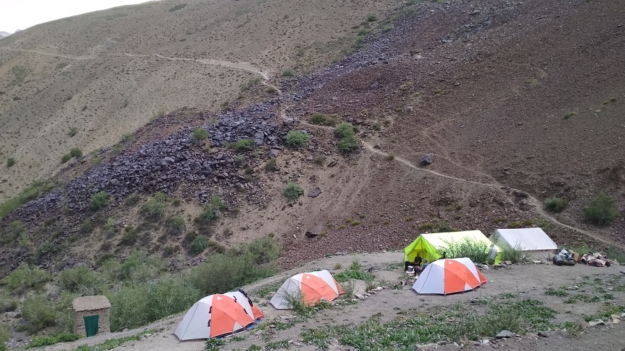
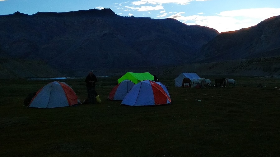
Leaving Kanji behind trek upwards slowly along the stream to three valleys to Kuthak Cha kelcha where Yaks and Dzo can be found grazing in the area. We camp at this beautiful location.
Day 7: Trek to Base (4300m)
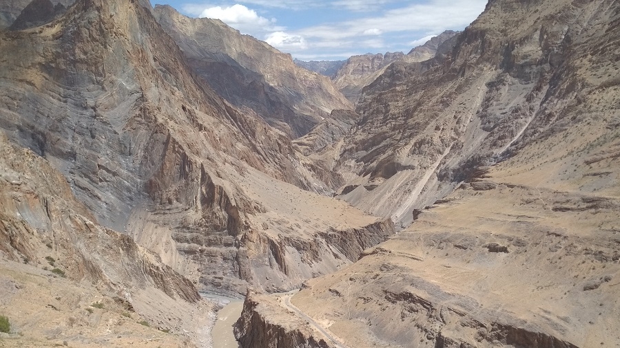
Today short trekking to the base, Leaving camp for a few hours to a large open valley floor we take the extreme right-hand valley and enter in a large gorge that will take us to the base.
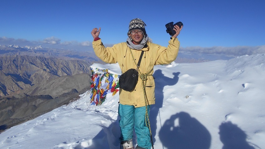
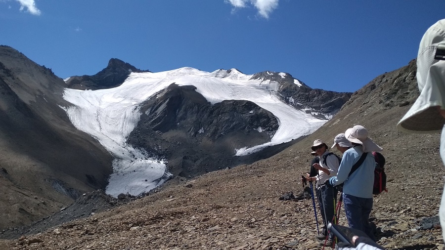
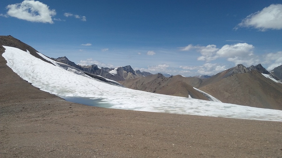
Day 8: Trek to Kanji La (5342m) – Kanji Sumdo (4370m)
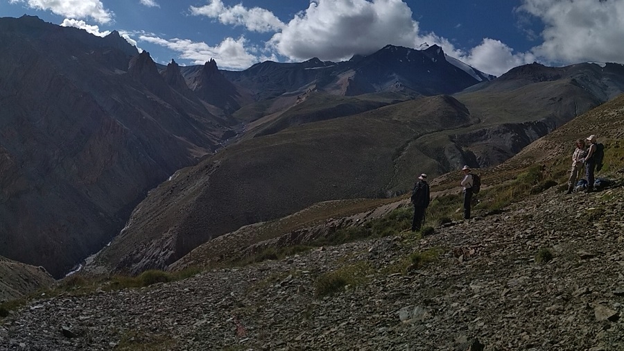
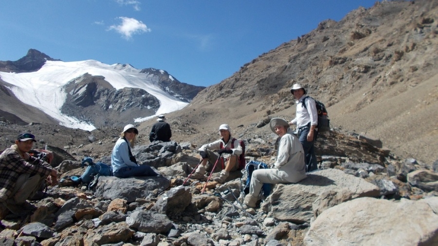
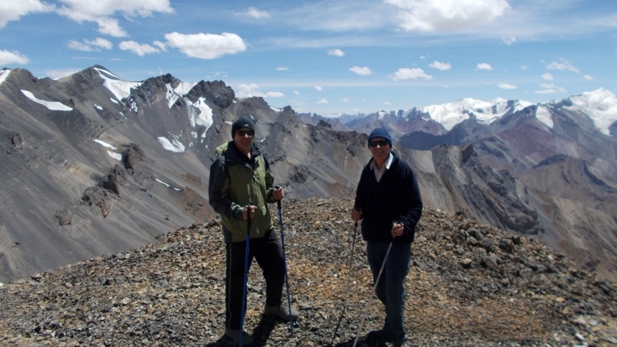
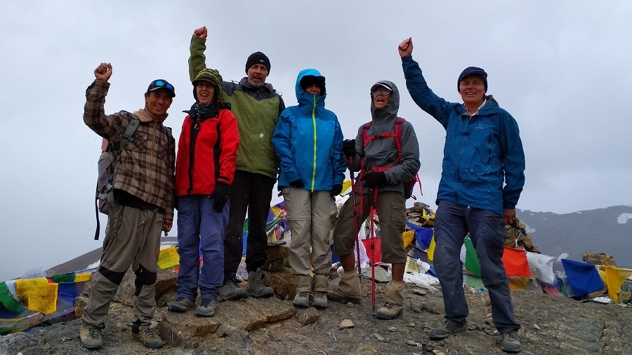
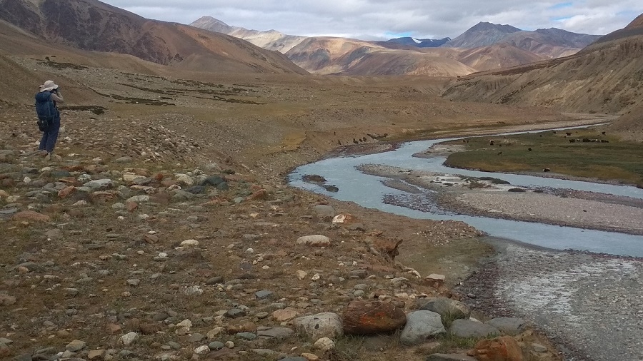
Leaving camp today we climb on tricky loose rock moraine on a small glacier to the pass. On a clear sky, one can have a clear view of Nanga Parbat to the west and K2 to the North. To view this you might need a good binocular. After lunch at the top, we continue down through a wonderful canyon to the junction and here we will have the first view of Nun and Kun which remains in sight for an hour. The view across the Southern horizon is the spectacular and better appearance of the peak rising in the Great Himalayan Range. Some of the known and famous peaks are Hagshu, Doda, and Brahma. A very small campsite but presents a spectacular view.
Day 9: Trek Base Camp Pikdong La (4400 m)
Soon after leaving the camp, we cross the large river right as we leave our campsite. Heading to the right at river level and joining the main trail coming from Dibling.
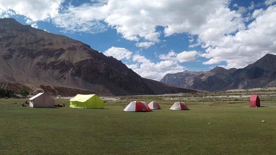
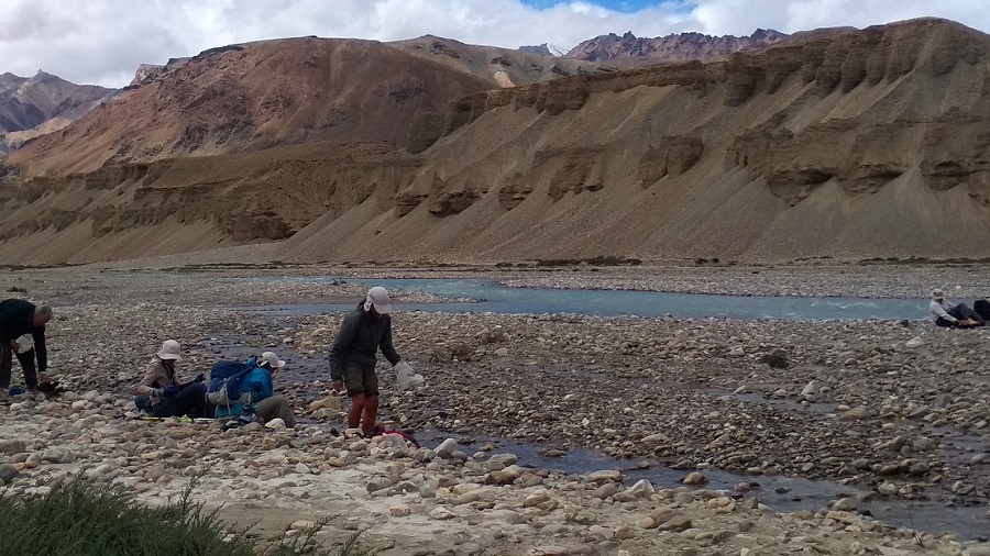
We continue to contour, staying high through grassy, rocky hillsides with marmots sticking their heads out of their holes, sunning themselves on rocks, and whistling at our approach, the valley decorated with colorful mountain flowers. It’s a 1½ hour's hike to the intersection of the route to Dibling (at our old campsite across the river), the ‘sumdo’ of two major river valleys. We continue along a similar trail and reach a smaller valley where we descend, cross a small stream, and then hike back up. The valley is rockier and more undulating, and we soon see our campsite across a wide valley in front of us. But before reaching it, though, we have to descend again to a surging river and try to cross on an old bridge, often washed away. One more climb and we’ve reached our lovely campsite atop a relatively flat plateau, a snowcapped valley to our right.
Day 10: Trek to Pikdong la (5029m) - Dibling doksa (4200m)
An early start today and a long day ahead for us. Leaving camp we cross the stream close to camp and climb a Pikdong La before passing through a narrow gorge at some points. Soon after the pass steep descent pass to Dibling Doksa, a wonderful & comfortable camp for tonight.
We start the morning switch backing out of camp, hiking past fantastic, narrow canyons with sculpted walls. Trekking along a glacial riverbed, we jump the river for an hour and turn right at the cairn on the high cliff. We continue to climb on the right of the valley, with one last small descent to the stream, followed by an easy ascent on a switch-backing trail to reach the Puzdong La, adorned with multi-colored Tibetan prayer flags. We’ll be treated to spectacular vistas from the top of the pass, and one year we saw a herd of ibex standing statuesquely on the nearby cliffs, a scene from the walls of a pre-historic cave dwelling.
After a rest at the scenic pass, we begin a steep descent on a scree-covered trail, switchbacking down into the wonderfully green valley below. Jumping the river at the bottom of the valley, we continue through the willow grove (Dibling Base Camp). We’ll stop for a scenic lunch here by the clear stream before continuing to Dibling, another 2½ hours of hiking down the valley. Soon after lunch, we have a small climb to a ridge on the left side of the river. We drop back down to the valley bottom and pass a large seasonal herding settlement (doksa) of the Dibling inhabitants, now with several older Dibling-pa tending the sheep, goats, and yaks in their basic houses. We can take a peek inside one of these, perhaps picking up some fresh yogurt from a villager. Inside these dark houses, with beams of sunlight shining through the chinks their only light, locals live as they have for centuries, making cheese and butter, weaving their sheep and goat wool, and chanting their Buddhist prayers with their mani beads in their free time. We continue along the small, willow-lined stream, crossing it several times and stopping for spring water at the source of the spring (which we’ll share with the yaks) as we head towards the intersection of the Oma Chu and the magical village of Dibling. Our campsite for today is here.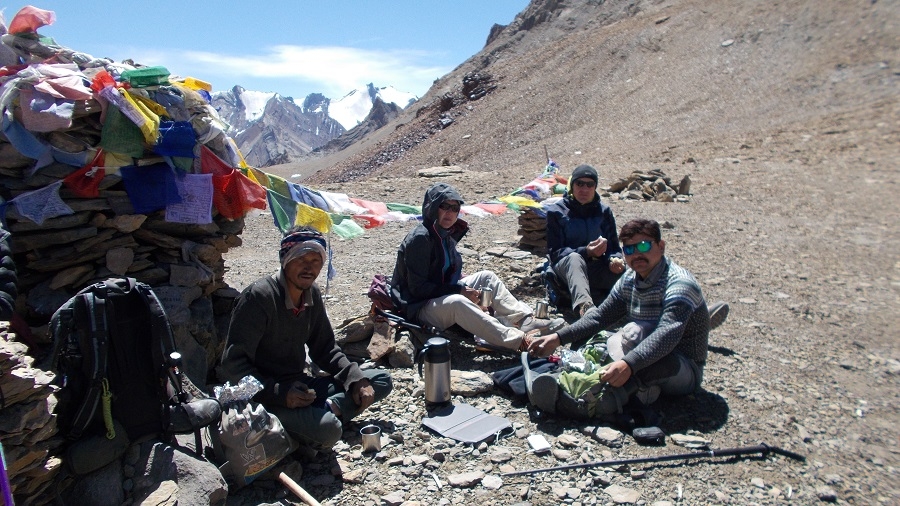
*Pikdong La 5030m*
Day 11: Trek to Dibling (4000m)
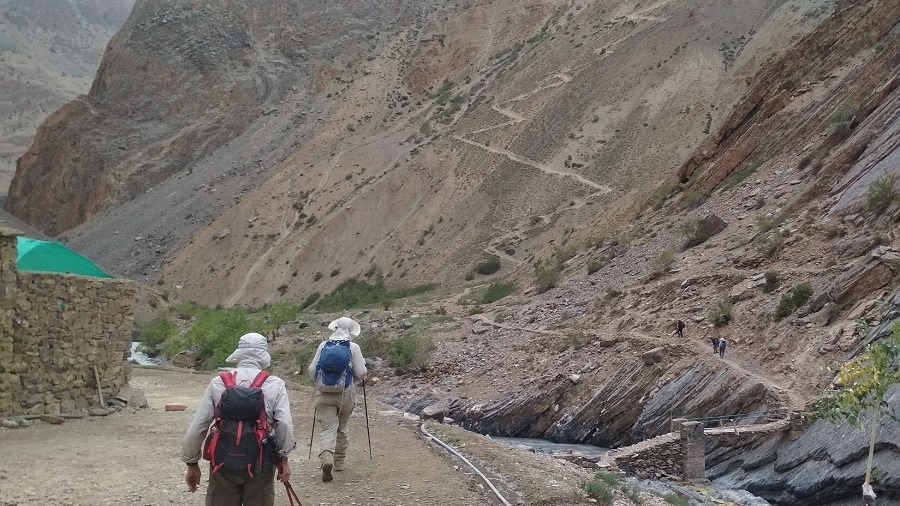
Today is a short walk to the village of Dibling. After crossing the stream trek on a large open valley. A ford short before Dibling and along the canal to the village of Dibiling. Today camp is set amidst a village. We reach Dibling by lunchtime. Rest of the day explore the village and meet the inhabitants, living in this remote part of Ladakh. You will have time to wash clothes or take a bath.
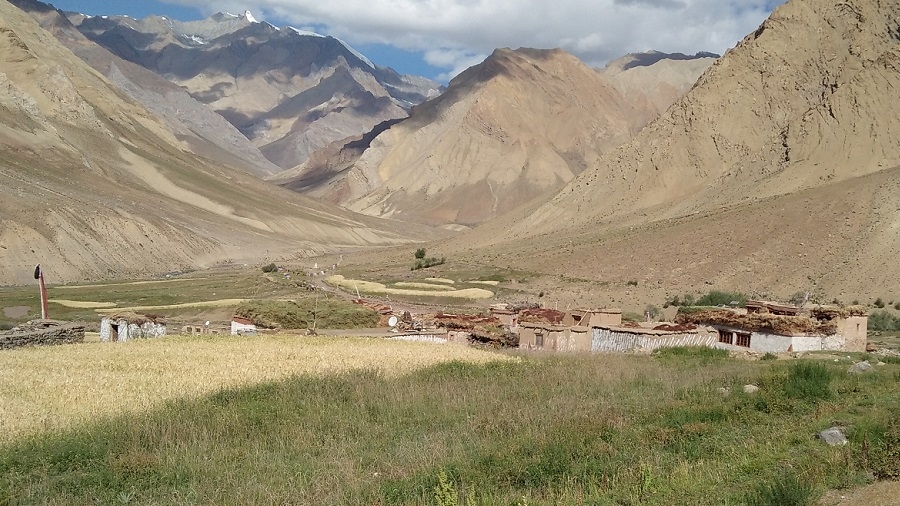
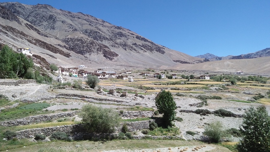
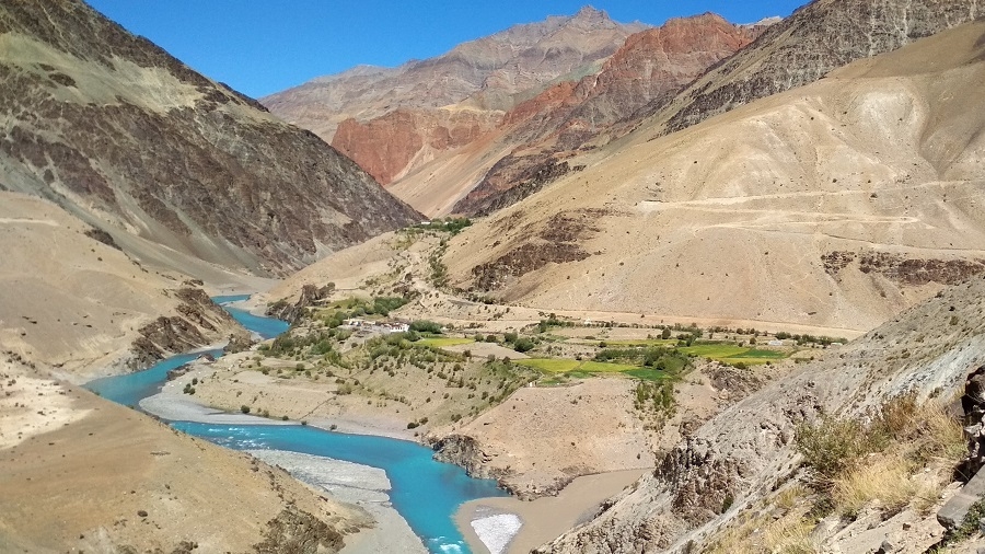
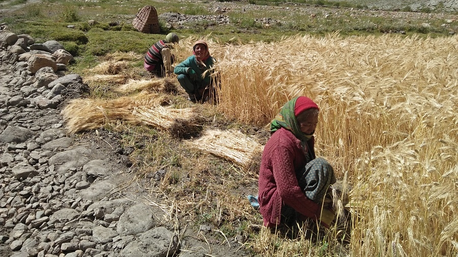
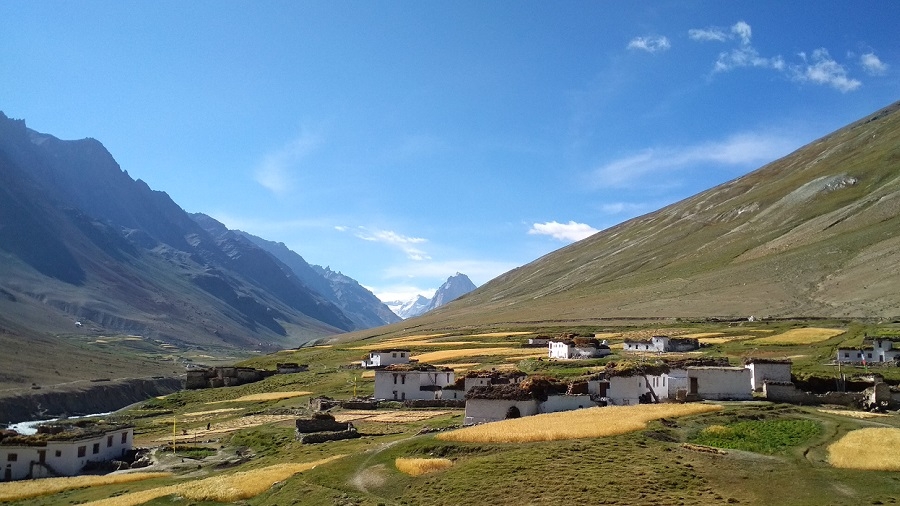
We pass through Dibling’s extensive, billowing fields of barley and peas, the villagers out in the fields tending to the crops, and look up the valley to Dibling Gompa and the ancient chortens silhouetted against the canyon wall. Dibling, with its white-washed houses, mani walls, and prayer wheel, exists timelessly, with dried grass – fodder for the animals and insulation for the houses – lining the roof-tops in preparation for their harsh winters.
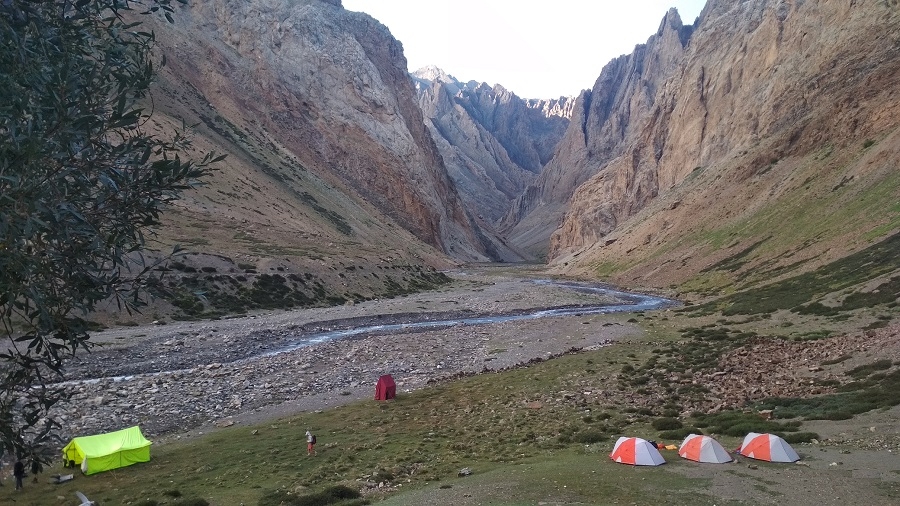
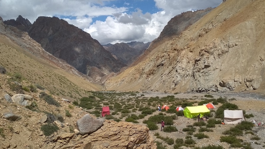
Our campsite ten minutes from the village is idyllic, one of our ‘best of’ in Ladakh and Zanskar, and the villagers, who see few Westerners, are very welcoming and genuine. We have the afternoon to wander through the village at harvest time, visit the ancient monastery (gompa) which guards the village from above, and wash in the clear river that runs by our campsite. Today is a short trek to Dibling as we explore the Dibling village this afternoon. Enjoy half of the rest day.
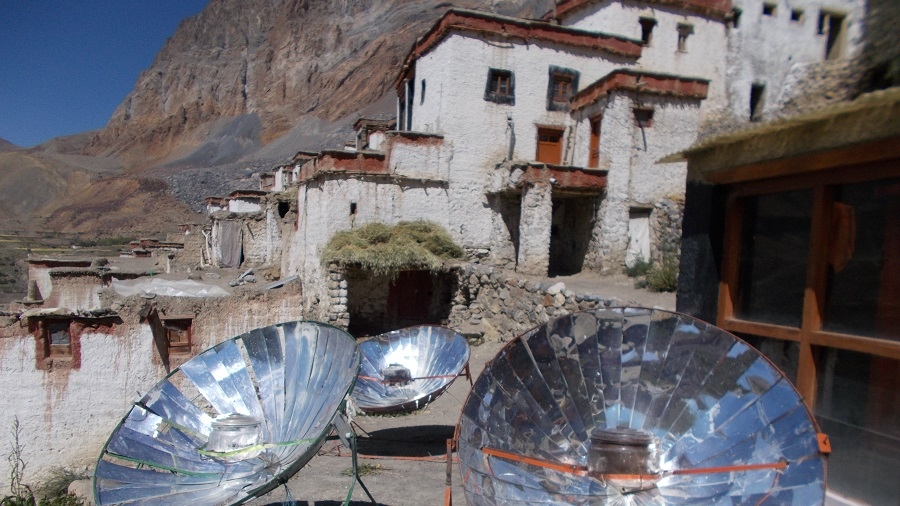
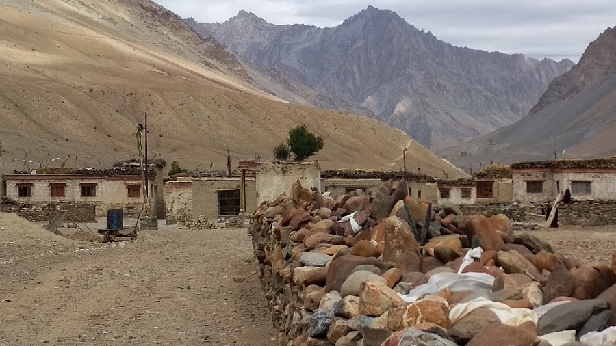
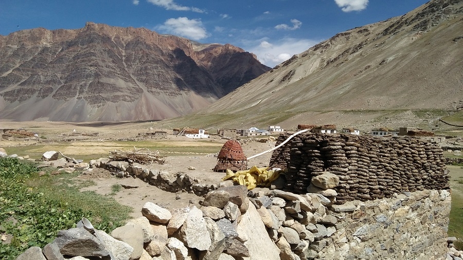
Enjoy our rest day, and take advantage of the day to explore this wonderful, remote village of 12 houses and approximately 50 inhabitants, happy to have visitors interested in their traditional lifestyle. In actuality, a day is not nearly enough to appreciate this remote outpost of traditional Tibetan Buddhist life. This village is cut off from the rest of Ladakh and Zanskar for six months of the year, so they must be self-sufficient. At the top of the village is the 100-year-old Dibling Gompa, featuring murals painted with natural pigments.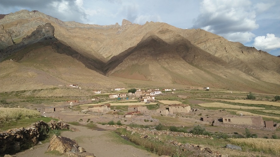
*Dibling village*
Day 12: Trek to Lingshed Sumdo (3680m)
We follow the Oma Chu River (Oma - Milk, Chu - water), and many times the main River and side streams are crossed. At some stretches it's tricky to find a way. Keeping our pace on the valley floor continue to Lingshed Sumdo.
Day 13: Trek to Barmi la (4694m) - Lanang Sumdo (4000m)
Leaving camp we take a narrow gorge coming from the left and a long climb to the small pass of Barmi La. Today an easy climb to the pass. The first view of Lingshed appears to sighted. The trail to the left goes to Lingshed village. We descend to Lanang also known as the base of Hanuma La. We take the time to visit Lingshed Gompa 4010m. We spend the morning hiking gently up the valley, heading towards the pass, and finally crest the Barmi La. After a rest on the pass, we contour down the hillsides, hues of reds and greens, and are treated to views over to Lingshed village and Lingshed Monastery (Gompa), backed by dramatic craggy rocks. We traverse and descend steeply down to our scenic campsite in a sheltered, sparkling valley below the Hanama La. There are opportunities to hike up this narrowing valley in the afternoon, and possible blue sheep sightings, or just relax in this lovely spot and enjoy the surroundings.
Day 14: Trek to Hanuma La (4700m) - Snertse (3940m) – Zingchen 3410m.
Soon after camp long ascents towards Hunuma la pass 4800m. From the top of the pass panoramic view of Lingshed, Sengge la, and Ladakh Mountain ranges. This pass is a connecting point between Ladakh and Zanskar, then descent deep inside the hanging valley until Snertse. After Snertse's long descent towards Oma tokpo where we camp for tonight.
Day 15: Trek to Parfi La (3900m) - Hanamur (3400m)
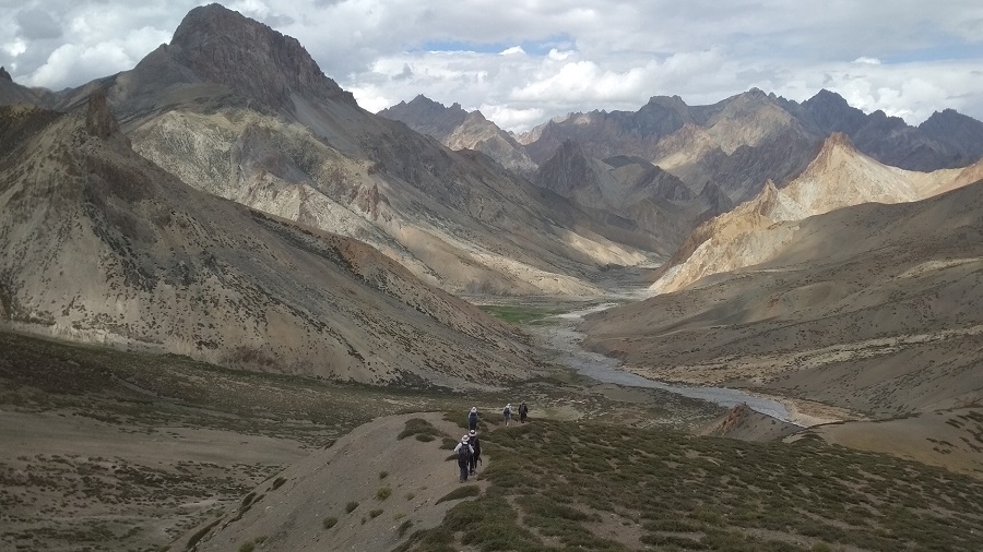
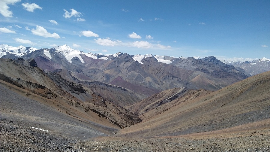
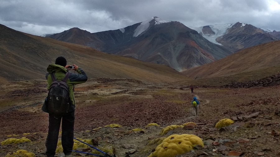
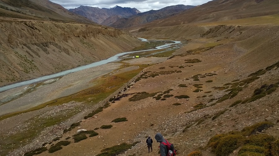
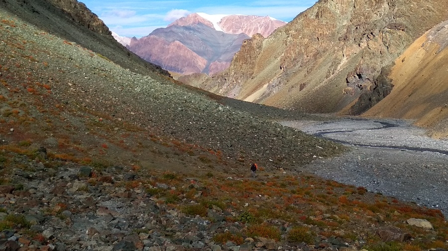
Crossing the Oma tokpo long ascent towards Perfi la 3950m. It’s the last pass between our first part of the trek Kanji - Padum. From the top, we will be rewarded with a great view of the Zanskar Mountains and could visible the Hanumil from the pass. Last patch we trek along the Zanskar River to the village of Hanumil and another comfortable campsite for tonight.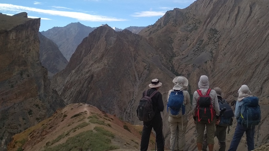
*Looking towards Perfi La trail from Snertse*
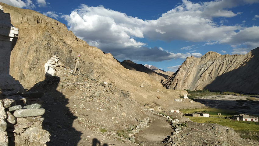
Day 16: Trek to Pidmo (3420m) – Zangla River Camp.
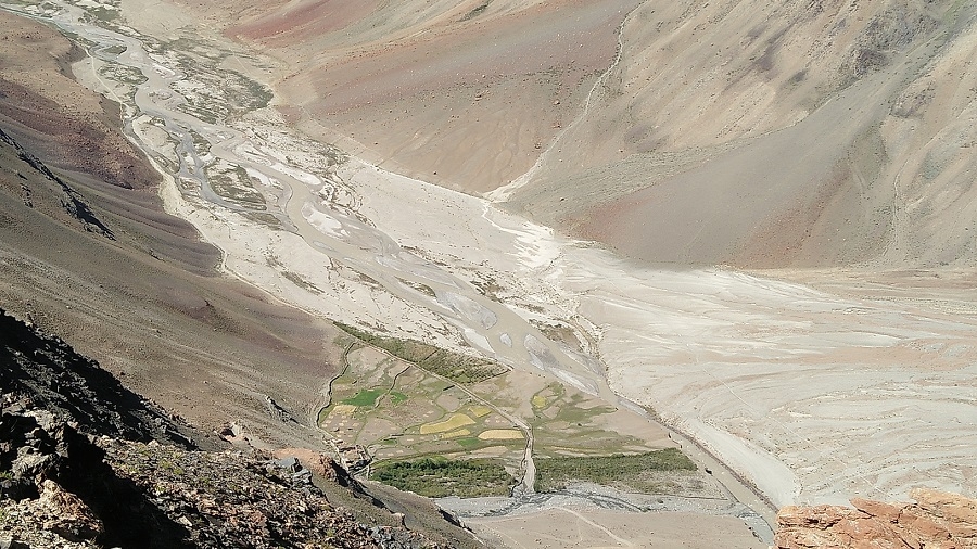
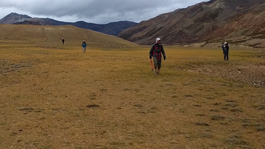
Today after breakfast we follow the left bank of the Zanskar River on a relatively level path. We cross the village of Pidmo 3420m. A small village located beside the Zanskar River. Pidmo to Zangla is not so far to reach our campsite at Zangla River camp
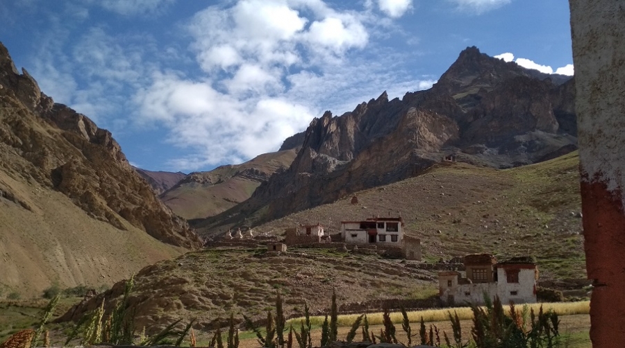
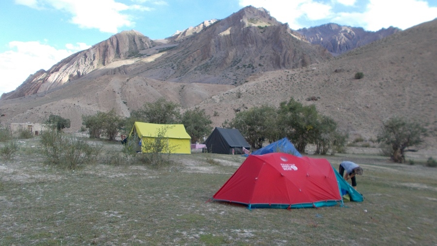
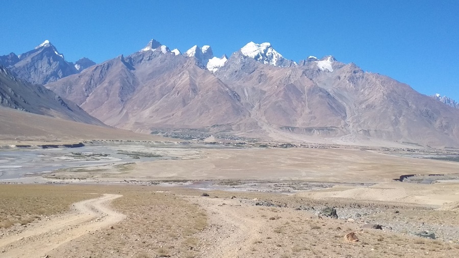
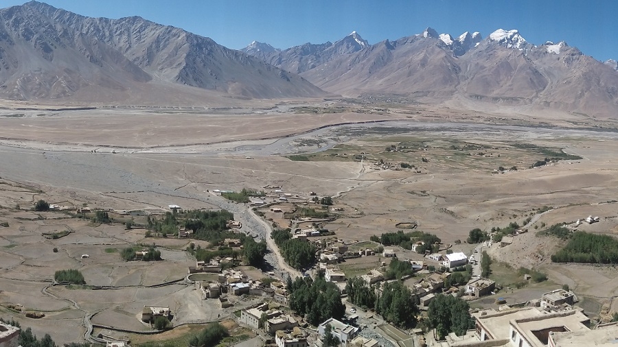
Day 17: Rest Zangla. Optional visit stunning Karsha, Padum, restock supply.
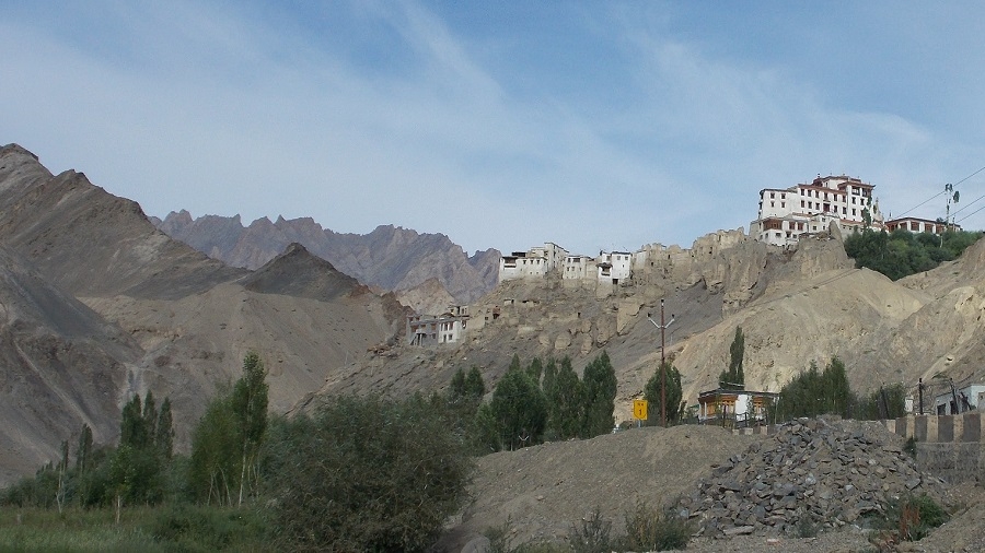
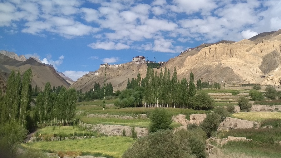
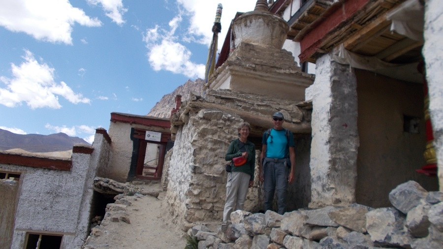
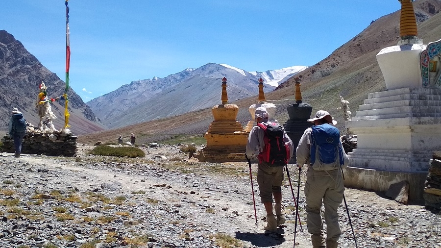
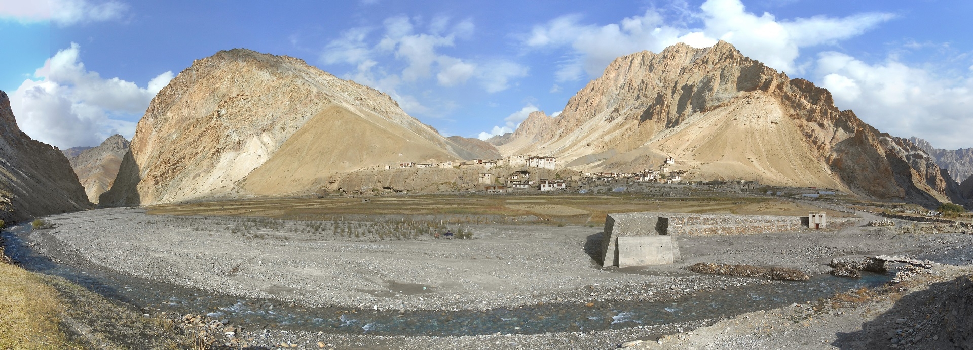
Today you have a full-day culture tour around Padum by drive. The morning after breakfast, drive to Stongde village. Visit a beautiful picturesque monastery built on a hilltop by Lama Marpa 950 years ago. Approximately 60 monks are residing in this monastery. After the visit, continue the drive to Karsha (Pair of White i.e., Outer white and Inner white). Visit Karsha monastery. This monastery is the largest of all the monasteries in Zanskar and this monastery (Gonpa) was first founded by Great Lama Phagspa Shesrap (the translator of Zanskar). From the monastery, you have an amazing and spectacular view of the capital of Zanskar (Padum) and its surrounding mountains. After the visit explore Padum (The capital of Zanskar). Overnight in Padum. (3530m)
Day 18: Trek to Zangla Sumdo 3900m.
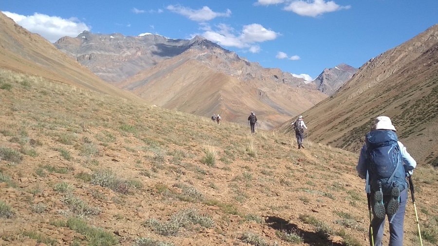
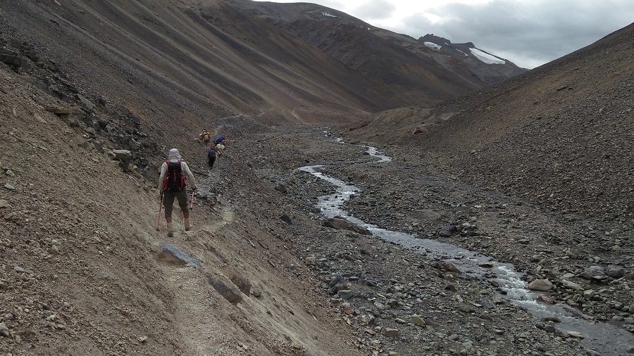
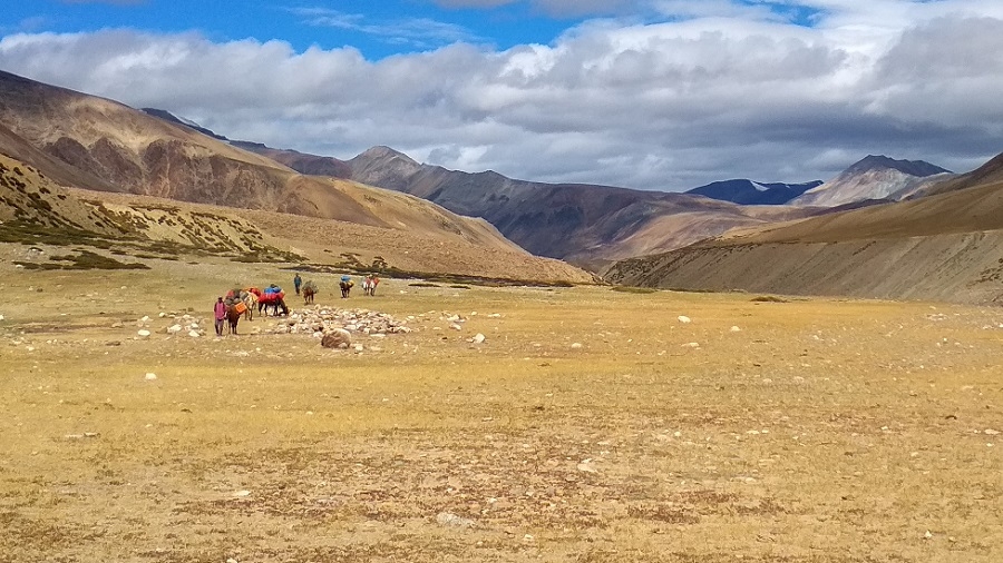
We start our wild, 5-day Himalayan trekking route (many of them sandal and trekking pole days, including today) through the colorful gorges and canyons from Zanskar and Zangla to the remote Shun Shade valley, beginning with a section of the Jumlam, or ‘middle route’. The Jumlam is an old Silk Route trail leading into Zanskar, a Ladakh Zanskar trek used when the rivers were low enough to trek along the riverbeds.
Leaving our Zangla campsite, we trek 45 minutes up to the Zangla Ani Gompa (nunnery), continue along the road past the once-impressive King of Zangla’s house (with an enclosed stable in front), and then ascend for another half hour to the impressive Zangla Fort, home to the kings of Zangla of yore. The present King of Zangla is the same age as, and a friend of, HH the Dalai Lama; we gave him a ride home several years ago from Padum. Just afterward we pass the protector deity’s small Lhakhang (god’s house) on the right of the trail followed by ancient lookout towers on both sides of the valley, now crumbling and in ruins, attesting to the importance of the Jumlam trade route centuries ago.
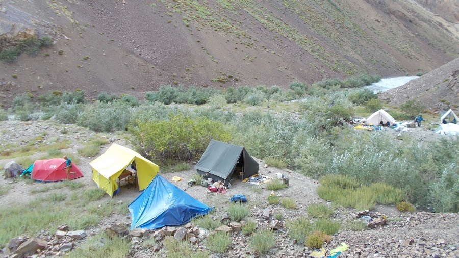
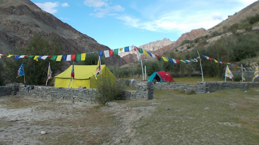
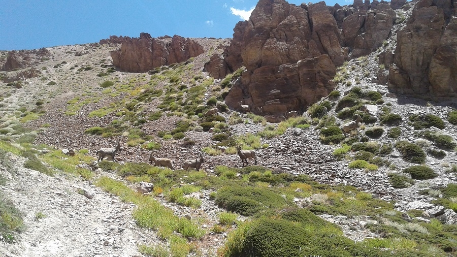
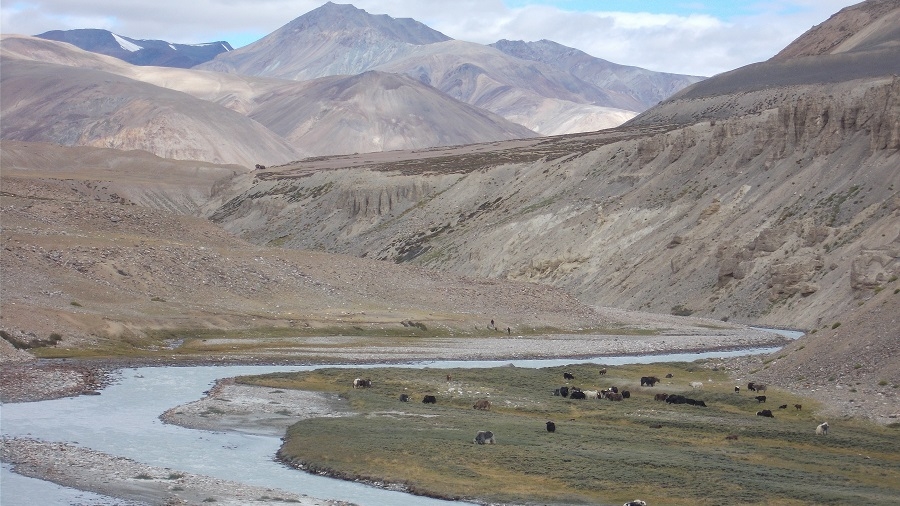
We walk along the irrigation ditch for a bit while descending and soon reach the green doksa of the Zangla people. From here we head left, or east, along the Zumlung Chu (river), crossing many times in the willow-shaded valley full of ancient beds of fossilized oysters. It should take us about five hours of hilly walking, with many river crossings, to reach our campsite, just past the turnoff (to the right) leading to the main Jumlam route and the Charchar La. Our camp at Tzazar Doksa is lovely and warm, surrounded by willows, but loses the sun early. After a wash in the stream right in front of us, take a 5-minute walk through seabuckthorn bushes to the doksa, and possibly a walk to the hill above camp for later afternoon sun. There are blue sheep and ibex in this valley, as well as (potentially) bears.
Day 19: Trek to Pandang La High camp 4450 m.
We follow the shimmering Zumlung Chu on today’s Zanskar trek, with plenty of ‘Himalayan flats’ throughout the day. The first two hours of hiking are easy, crossing the river many times in a magical valley that opens up as we head north. Note the amazing canyon on our left and the dramatic, soaring canyons in general as we hike today. The valley is full of ‘dinosaur plants’, willows, and oyster beds, a rocky, narrow valley of large scree trails. At the second sumdo, or river junction, at 3950 meters the trail narrows and we trek through a batch of seabuckthorn bushes, probably without the tart, orange berries just yet. Our trail undulates as we negotiate the tricky valley floor, often climbing and descending to avoid sheer rocks dropping to the river or thick groves of underbrush. This route is known by villagers from Tsazar just south of Zangla, who use the valley as their summer pastures. Villagers from Shade also sometimes know this remote region.
Finally, we make a sharp right, cross the stream, and ascend steeply for a bit on a trail of loose scree and rocks, which eventually flattens out. Flowers and oases of trees appear in the stark landscape, softening it, and our trail becomes more gradual. If we turned directly left through a grove of willows to our right we would discover our hidden Bazza Camp (4250m), a green pasture by a clear stream named after our friend Bazza who celebrated his birthday here in during our exploratory trek in this region.
From here we have one last steep ascent through green pastures, passing several doksas, and staying on the steep ravine that drops down below us to our right. Blue sheep roam the hillsides, so keep your eyes open as you walk through the green plateaus ahead. After about 45 minutes we reach our green Pangang La High Camp, with a very cold spring and incredible views including tomorrow’s Pandang La. We have encountered a herd of semi-wild Zanskari horses at this dramatic high camp, possessive of their grazing area and quite aggressive towards our horses.
Day 20: Trek Pandang La (5110 m) – Yangdam Chem (4430 m)
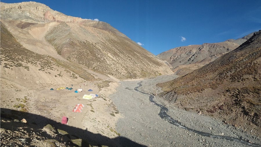
Another pass day today, starting with yet another steep ascent through meadows colored with pink and red bistort, the views increasingly spectacular as we look back to the craggy peaks of Zanskar behind us. We’ll trek for about 2 ½ hours to crest the Pandang La, where we’ll stop and admire the panorama of Himalayan peaks from this remote pass. The trail to our right at the pass as we look ahead towards Shade leads, eventually, to Tsazar. A route to explore another year. The descent begins with an easy 20 minutes of contouring to the left, followed by a steeper descent down into the Niri Chu Valley. We’ll stop for lunch at the first green plateau about 45 minutes below the pass, or possibly at camp. From here, it’s half an hour to the green doksa near the river where the staff have set up a beautiful camp for the night. There is lots to explore if you have the energy for some hiking above camp, across the river. Blue sheep roam the hillsides, and there is also lots of bird life including hoopoes along the riverside amongst the collection of doksas.
Day 21: Trek Mitsik Doksa 4285m via Liyu La 4375m & Lar La 4690m
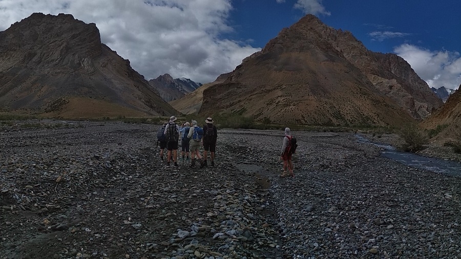
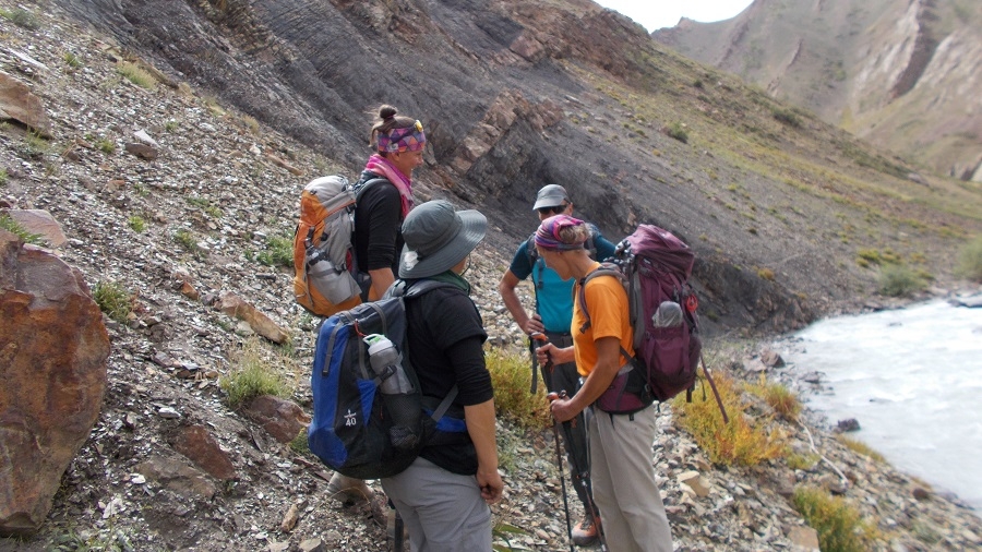
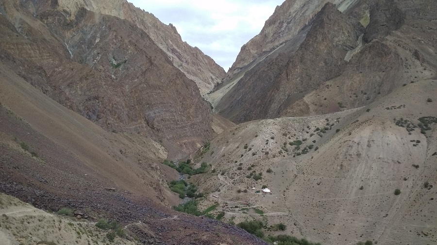
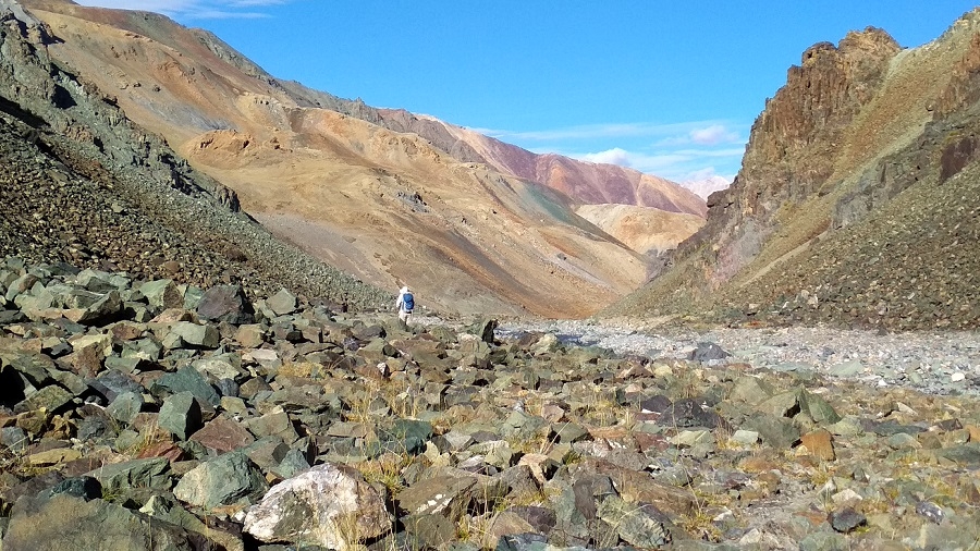
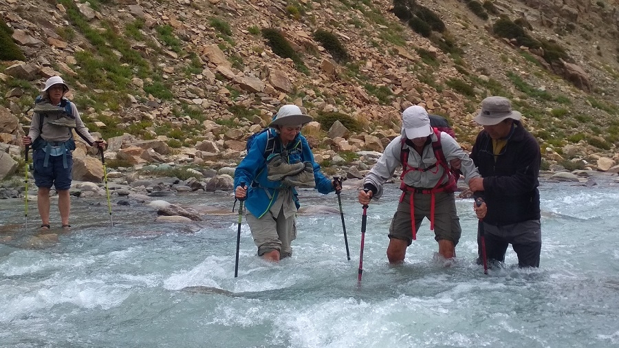
An adventurous and beautiful river day, with an incredible array of wildlife watching from the craggy hillsides judging from the prints we encounter. Bear, wolf, snow leopard, blue sheep, and red fox are among the tracks that we generally encounter, an exciting route! Leaving camp, we cross our river almost immediately and continue along the right banks of the river for half an hour on a relatively flat trail. At the sumdo of this river and the Niri Chu, we pass by a large river valley to the left that leads to the nomadic region of Kharnak. We have to cross Niri Chu, and then continue to cross and re-cross this river throughout the morning, staying mostly at river level. Wear sandals or running shoes and have your trekking poles with you! (It’s possible to take a high trail on the right of the Niri Chu to avoid crossing it in the morning, but this trail is often exposed or washed away). The valley is a dramatic combination of soaring cliff-walls, canyons, and green river valleys, lovely.
After about three hours of river hiking we cross the small, intersecting stream coming from our left and climb for a short time to a grassy plateau, the Niri Chun camp from our exploratory trek, our river crossings finished. We soon reach Shade Pullu, another doksa, and then have 45 min – 1 hour of slightly exposed, high trails to reach the ridge-top Liyu La, a dramatic vantage point from where we look out to our next pass, the Lar La. 15 minutes of descent brings us to the Niri Doksa valley, from where we begin to climb again up this steep grazing ridge; we will stop for lunch about halfway up the steep, switch-backing trail. The pass generally takes about 1 ½ hours to climb, the craggy rock outcropping at the top a welcome sight! The views from this pass are some of the most dramatic in the valley, worth a half hour of gazing back over the remote river valleys that we trekked through, and onwards towards Shade.
Our descent is another steep one as the valley drops right down to a green doksa called Mitsik Doksa, where the staff has set up camp at yet another mindboggling beautiful camp right on the pebbly riverside. Mitsik Doksa is a wide flood plain along the river, absolutely wonderful, sometimes visited by locals from Shade on their way to or from a doksa. Take the afternoon to do some laundry and explore the river valley towards Niri Chu, which snakes through deep canyons below us. We’re right below tomorrow’s pass, the Rotang La, so we will arrive at Shade early enough to explore this wonderful remote village.
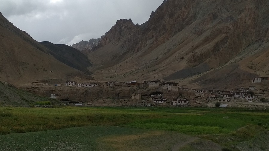
Day 22: Trek Shade (4220 m) , Cross Rotang La (4900 m)
It’s about a three hours climb to the 4890 meters Rotang La from camp, hiking somewhat steeply past Rotang Doksa (4470m) where we might find some fresh sheep-milk yogurt if the villagers have camped here. From the doksa, the trail switchbacks a bit more gradually to the Rotang La. The descending valley on the Shade side is colorful in shades of yellows, oranges, and reds, and it’s a lovely and easy descent of about an hour to Shade, with one small ridge between. We’ve seen snow leopard prints in this valley as well, as you would expect near a remote village of herders. Just before the village, we pass an extensive collection of white-washed chortens, signs of Shade’s importance along the ancient salt trade routes.
Our campsite is just before Shade, on the only flat area next to a stream, a spot perfectly situated for washing, and for sunrise and sunset photos of Shade village and its patchwork of fields. The villagers and village kids will be by in the afternoon, and at sunset the large flocks of sheep and goats are herded into the closed paddocks for milking, the herders carrying essential loads of dried grass on their backs.
Shade, not often visited by Westerners, is one of the most interesting villages we’ll encounter on our trek, so we will head out to explore after lunch. The village is a cluster of 14 traditional, closely packed Zanskari mud-brick houses, with corrals for the goats and sheep, grass drying on the rooftops, small vegetable gardens, and an idyllic atmosphere. There are approximately 95 inhabitants, of whom three of the men are in the Indian Army, bringing a bit of extra wealth to the village. There are also five lamas/monks and one ‘chomo’, or nun, residing in the village, and our friend the amchi (also the headman), with his wife and five children, impressive for a remote village of this size. We’ll visit some of the local houses for a glass of tea, chang (Tibetan barley beer), yogurt from the nearby doksa, or some churpi (dried cheese).
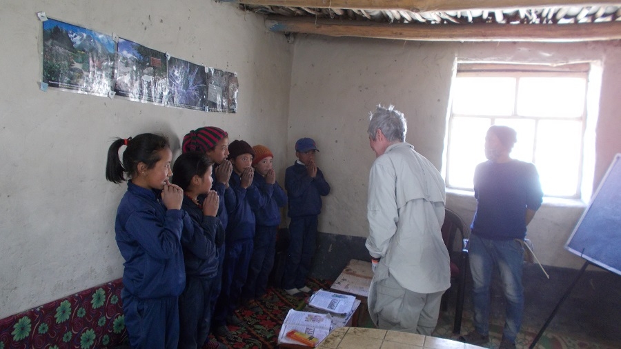
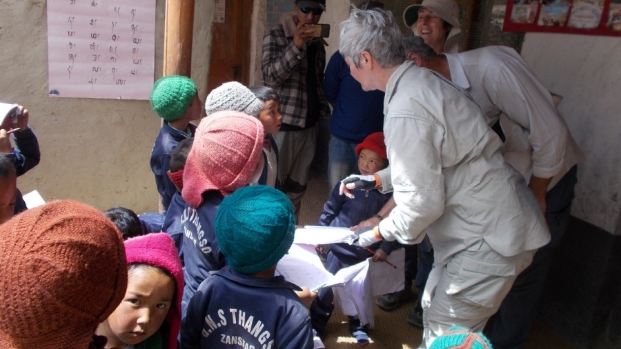
Shade is surrounded by extensive fields of barley (ne), potatoes (aloo), sag (shema), and snap peas and they also have greenhouses in which they grow radish (labo), cilantro, cabbage, cauliflower, and carrots. There is a small school here that is desperately in need of supplies, so this is a good place to offload school supplies. Some of the locals stay up in the doksas north of our campsite, sometimes returning every few days and other times staying longer. The villagers rotate grazing their flocks and protecting them from the many wolves and snow leopards in the area! Local words for some of the wildlife we might encounter: snow leopard (shen), ibex (hin), blue sheep (nabo), and wolf (shanku).
Day 23: Rest Shade (4220 m)
Today is a rest day and wash your clothes or take a bath and we visit some of the homes in this village.
Day 24: Trek Yatah hidden camp (4000 m)
Another amazing trekking day ahead as we head to Yatah, our next remote campsite halfway to Phuktal Gompa in Central Zanskar. Leaving the Shangri-La of Shade via a trail directly below the village, we pass through the entrance chorten and descend past the harvesting villagers for about 45 minutes to where the river plummets through a narrow gorge and the canyon closes in on us. At the intersection of the Niri Chu (river) we reach the village ‘lhatoo’ (4100 m), a kata-covered monument dedicated to Shade’s protector deity called Cho Gyumjang, a female goddess. Her peak is just to the left if you’re looking up the narrow canyon towards Shade, and locals invite the monks from Phuktal Gompa to have a yearly puja for her (which we’ve been lucky to witness).
Turning left at the lhatoo, with the Niri Chu again far below us, we have about ten minutes of the slightly exposed trail as we head towards Trantrog Gompa (4020m). Soon the valley opens, the turquoise river takes wide S turns and our canyons become dramatic hoodoos over the riverbed. We can see the tiny hamlet of Trantog ahead, with its small gompa said to be either 30-40 or 750 years old. Perhaps there was an ancient meditation cave at the site of this gompa, which the caretaker told us was built by a lama from Phuktal. The interesting woman who holds the key might be around to show us the village treasures. There are only three people living in the village and about as many houses. Still, it’s certainly a scenic spot built up on a craggy hill overlooking this idyllic valley.
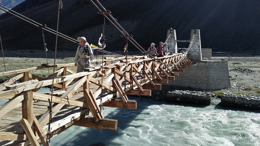
From Trantog we descend to the willow-lined Niri Chu which we cross (bring your sandals), afterwards climbing on an exposed trail to a contouring trail high above the valley. Soon we reach ‘Trantog Sumdo’ (3960m) leading to the Shun Shade Valley. We contour on a wide trail above the Nialo Kontse Chu, which the river has become after the last intersection, for another 1 1/2 hours. We pass a new and an old bridge across the river, the old one an original rope bridge. Three ridges later we’ve reached Tsarap Sumdo (3920m), after which the trail becomes a bit more exposed. One steep drop, slightly exposed, a similar climb back up to the trail and it’s half an hour to camp at the high grazing pastures of Yatah. Yatah is about 150 meters above the trail to the right, an unexpected site after our narrow, steep-sided canyon, and it will take another half an hour to reach it.
Day 25: Trek Phuktal (3830 m)
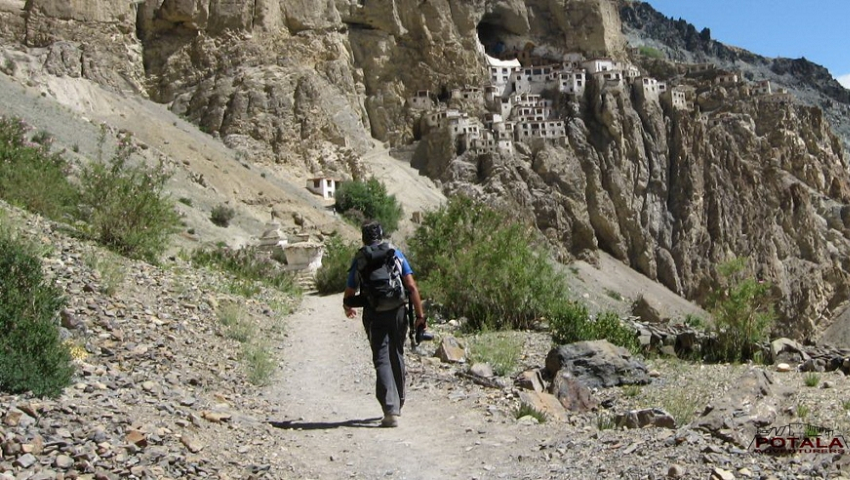
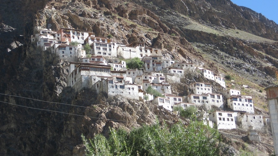
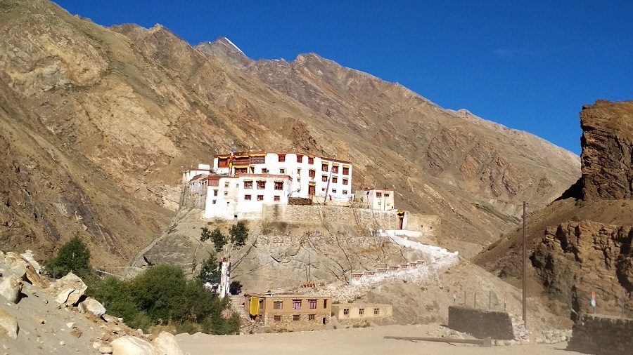
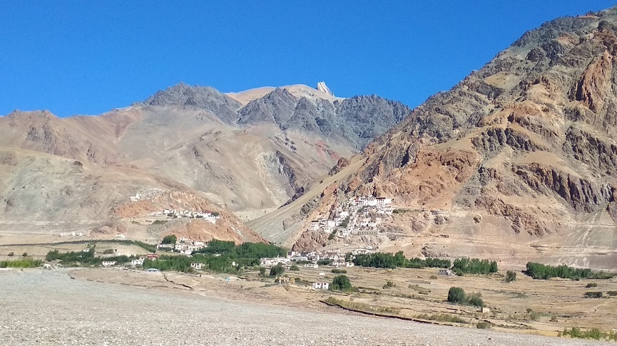
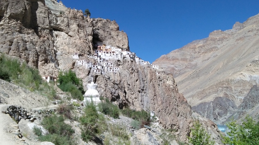
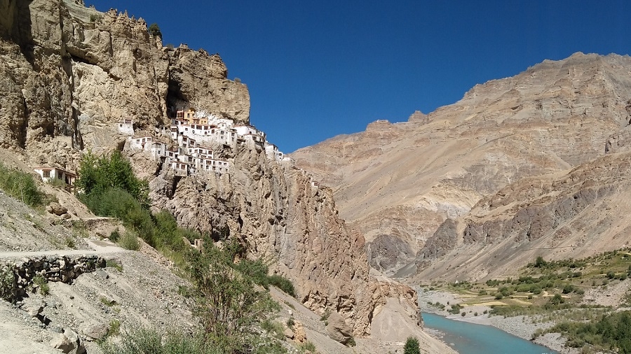
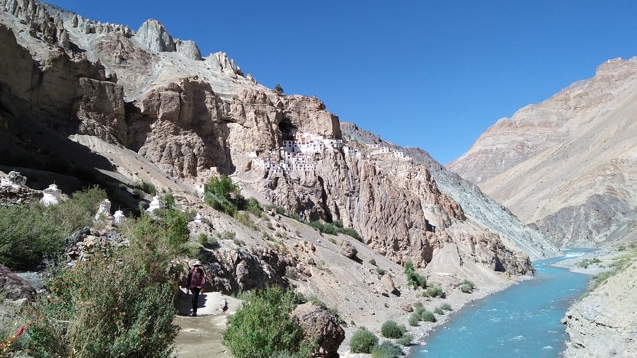
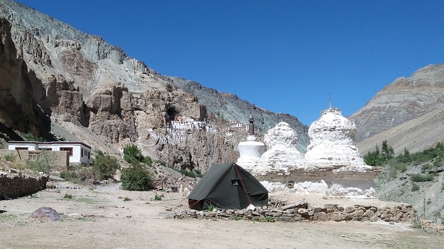
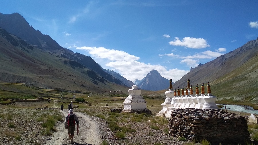
Another wonderful Zanskari trekking day, starting with a climb of 100 meters above camp to drop back down to the main trail. From the flags at the top of the ridge, we descend back down to meet the main trail at the point where a new, cantilevered bridge is being built. On the other side of this small gully, we contour on a good trail high above the Tsarap Chu and past several small doksa. It’s a hot trail as the high-altitude sun reflects off the mica-filled sandy hills around us, so dress accordingly. There is a long, dusty, and hot climb to reach the Phuktal La, from where we’re treated to a tremendous view over the spectacular Phuktal Gompa and the green, checkered valley. We’ll stop for lunch here, at the massive, white-washed Chorten, followed by a very short descent to the iconic Buddhist monastery.
Phuktal Gompa (3900m), which translates as ‘the cave of leisure or liberation’, is spectacularly built into a cliff-side, one of the most colorful gompas in Zanskar as well as one of the oldest Tibetan Buddhist monasteries in the Indian Himalaya (15th century, although information inside the monastery claims that it’s nearly 1000 years old). Phuktal Gompa has a school attached, and the young, lively monks are always keen to practice their English or to have a photo taken. The gompa itself is a real Central Asian treasure with ancient prayer rooms, an old library, a fountain with magical waters in the original cave, a Tibetan medicine center, and a wonderful kitchen.
Day 26: Trek Purne, drive to Tangze & Kargyak (4120 m). Explore Khi, Thanglesgo & Shanka village
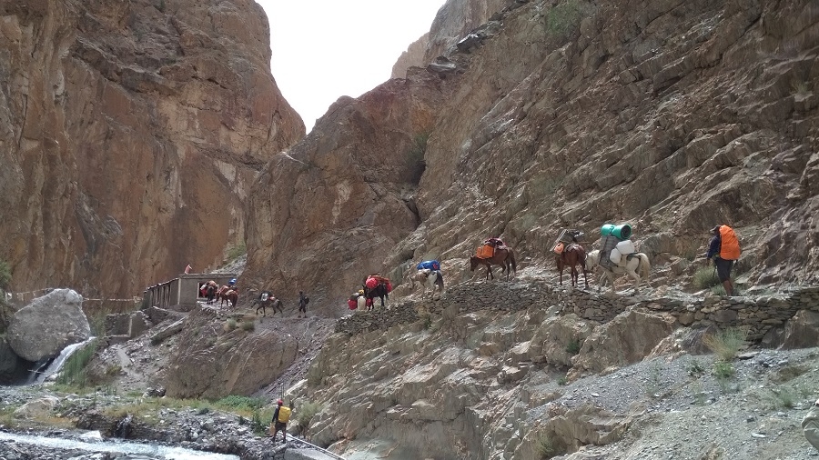
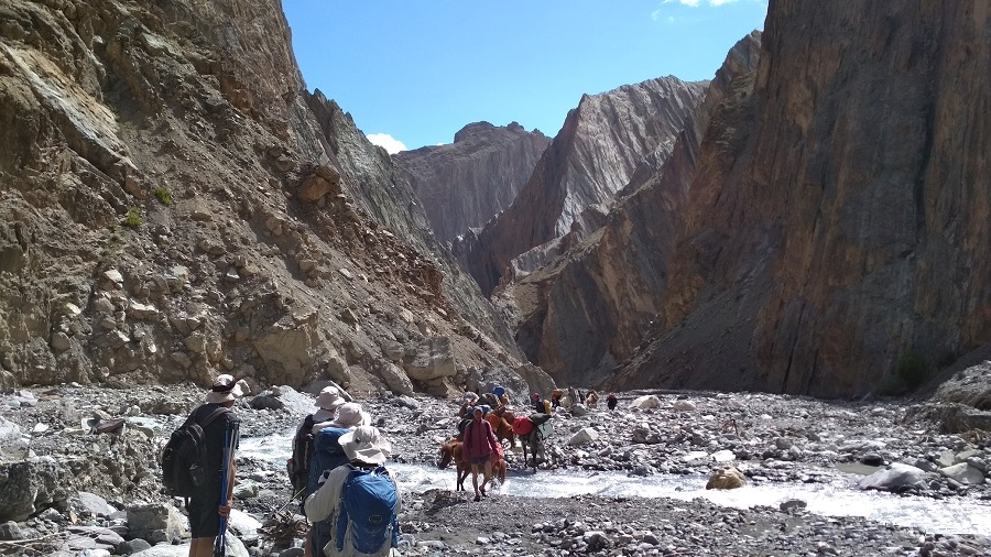
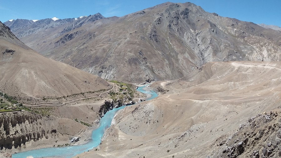
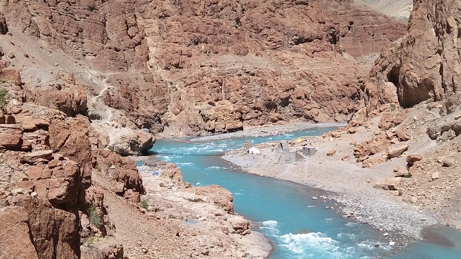
The trail descends to the Tsarap River and we follow the right bank of this River to Purney, one of the most stunning sights of Zanskar. You cross the Tsarap River by a temporary bridge and the trail goes along the left bank of the river to Purney. It will take 2:30 hrs to reach Purney from Phuktal. Arriving at Purney, we ride of vehicle to Kargyak camp. After lunch explore the beautiful villages of Kyi and Thangso and continue up to the last village of Shanka. This area is most remotest part of Zanskar and meet happy people. After visiting Shanka we trek back to camp.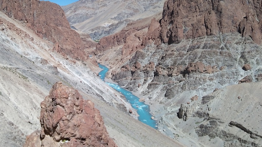
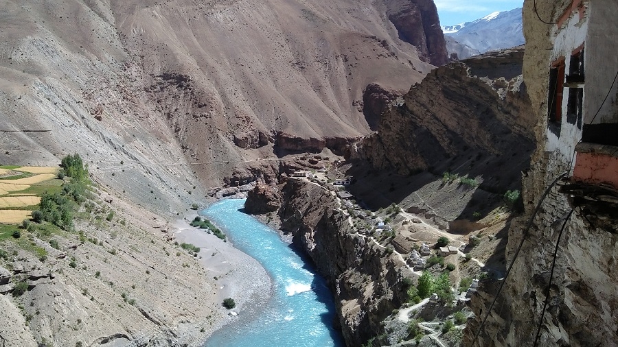
*Phuktal - Purney trail along the left banks of Tsarap River - Zanskar*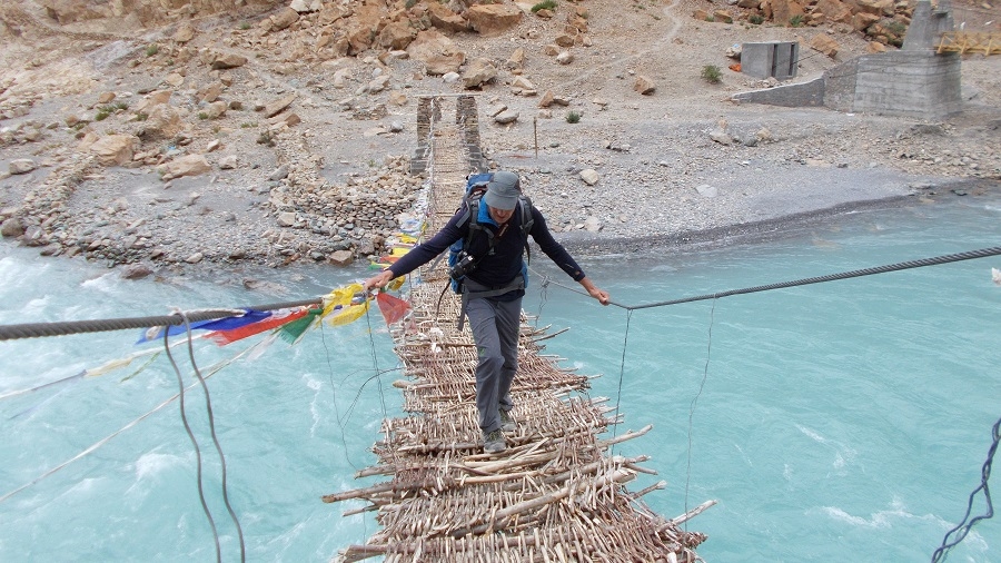
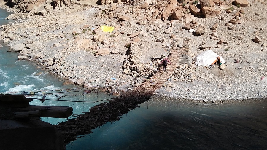
*Tsarap river hanging bridge Phuktal - Purney trail*
*Khi village near Kurgiakh* higher villages of Zanskar.
Day 27: Drive Leh via Shinkun La & Sarchu.
Following the Kargiak Chu, with the Gompa Rangjung monolith looming spectacularly in front, we ascend the switchbacks and cross the Shingo La pass, reaching the region of Lahaul in Himachal Pradesh. Today leaving camp, we drive to cross the Shinkun La and enter in Lahaul valley and arriving at Darcha, we take the Leh – Manali highway to reach Leh.
Today is an epic driving day, a beautiful day for driving through the traditional villages of lower Zanskar, crossing the nearly 5000 meter, glaciated Shingo La pass, and then continuing back up to Sarchu on the Leh-Manali highway.
Day 28: Rest Leh.
Day 29: Depart Leh. Leh airport drop.
_____________________________
Option Ending Trip at Manali
Day 26 - Trek Purne, drive Tangze - Kargyak (4120 m), explore Khi & Shanka villages.
The trail descends to the Tsarap River and we follow the right bank of this River to Purney, one of the most stunning sights of Zanskar. You cross the Tsarap River by a temporary bridge and the trail goes along the left bank of the river to Purney. It will take 2:30 hrs to reach Purney from Phuktal. Arriving at Purney, we ride of vehicle to Kargyak camp. After lunch explore the beautiful villages of Kyi and Thangso and continue up to the last village of Shanka. This area is most remotest part of Zanskar and meet happy people. After visiting Shanka we trek back to camp.
Day 27 - Drive Manali via Shinkun La – Darcha
Along the Chandra River valley to the Atal tunnel and to the beautiful hill station of Manali.
Day 28 - Rest/explore Manali
Explore local sights
Day 29 - Manali - New Delhi
A stunning drive through the lower hills of Himalayas & the plains of Punjab
Day 30 - Depart hometown
A day to relax and evening depart to airport and flight back to hometown.
Welcome to Leh, after your long flight from your hometown to Delhi and meet with us at Leh airport. Our representative will greet you at Leh airport. Prem will meet you at your hotel. Most of flight arrives Leh by morning time and the rest of the day is free to relax and acclimatize to the altitude of 3500m as well as visit Leh bazar.
Today sightseeing in around Leh. Visit the Royal Palace of Leh from the 16th century, continue through the fields of Sankar monastery, which is adjoins the north Leh. Continue to the Shanti Stupa and finally ends your day with visit of Spituk gompa. Our driver will pick you up from hotel at 8:30am after breakfast. Finish your day before the lunch and you will have time to go for lunch at Leh market.
A full day of sightseeing and to visit the most important place in around Indus valley. You will have a guide for this day trip especially for gompa. There are many places to visit but we have chosen five sights which is suitable for a day trip. Leaving from hotel at 8:30am after breakfast you will visit first Shey palace, than Thiksey. Thiksey monastery, which is at a distance of 27 km from Hemis, this monastery is the oldest monastery of Gelugpa School in Ladakh. The great Lama Paldan Shesrap built it in 14th century. Here you can see the big statue of the Future Buddha. Continue to Taktok and Chemdey and return back to visit Hemis monastery which is 45 km far from Leh and it takes 90 minute drive. The great Mahasiddha Staktsang Raspa along with great ancestor Singey Namgyal builds this biggest monastery in 16th century. Continue to Matho than we drive to Stok which is situated opposite of Leh at a distance of 14 kms, At Stok visit of Royal Palace built during 1825 AD and palace has great collections of antiquity. Continue to visit Matho situated 10 kms from Stok, which has 10th century complex. Finally back to Leh and final preparation for trek.
Today we drive to timeless Lamayuru Gompa enroute first visit of Likir than Alchi Gompa, situated at a distance of 68 kms from Leh. Its monastery built on lowlands rather than on a hilltop as others are, in order to protect from enemies. The chortens around Alchi gompa contains numerous wall murals of Lotsava Rinchen Zangpo, who has built this monastery. Alchi monastery has vast collections of wall paintings, and wood sculpture. We continue to drive to Lamayuru which is 58 kms from Alchi. Oldest monastery in Ladakh, founded by Indian scholar Mahasiddhacharya Naropa in 11th century. Lamayuru host mask dance festival (Yuru Kabgyat) during 17th and 18th day of fifth months of the Tibetal Lunar calendar. It belongs to red hat sect of Tibetan Buddhism; monastery is rich with Thankas and wall paintings. Lamayuru monastery was constructed by Arahat Nimagung in between 10th and 11th century. History says that in the 11th century the Mahasidha Naropa visited this place and the cave where he resided and meditated is still to be seen inside the monastery. This mostly visited by travellers located on the Srinagar - Leh road. Enjoy homestay at Lamayuru.
A stunning drive along the Kanji chu to Kanji village. The starting point of our trekking tomorrow, explore the Kanji village.
Leaving Kanji behind trek upwards slowly along the stream to three valley to Kuthak Cha kelcha where Yaks and Dzo can be found grazing in the area. We camp at this beautiful location.
Today short trekking to the base, Leaving camp for few hours to large open valley floor and we take the extreme right hand valley and enter in a large gorge that will take us to the base.
Leaving camp today we climb on tricky loose rock moraine on a small glacier to the pass. On a clear sky one can have a clear view of Nanga Parbat to the west and K2 to the North. To view this you might need a good binocular. After lunch at top we continue down through wonderful canyon to the junction and here we will have first view of Nun and Kun which remains in sight for an hour. The view across the Southern horizon is spectacular and better appearance of peak rising in Great Himalayan Range. Some of known and famous peaks are Hagshu, Doda and Brahma. A very small campsite but present a spectacular view.
Soon after leaving the camp, we cross the large river right as we leave our campsite. Heading to the right at river level and joining the mail trail coming from Dibling.
We continue to contour, staying high through grassy, rocky hillsides with marmots sticking their heads out of their holes, sunning themselves on rocks and whistling at our approach, the valley decorated with colorful mountain flowers. It’s a 1½ hour hike to the intersection of the route to Dibling (at our old campsite across the river), the ‘sumdo’ of two major river valleys. We continue along a similar trail and reach a smaller valley where we descend, cross a small stream and then hike back up. The valley is rockier, more undulating, and we soon see our campsite across a wide valley in front of us. But before reaching it, though, we have to descend again to a surging river and try to cross on an old bridge, often washed away. One more climb and we’ve reached our lovely campsite atop a relatively flat plateau, a snowcapped valley to our right.
An early start today and long day ahead for us. Leaving camp we cross stream close to camp and climb a Pikdong La, before pass through a narrow gorge at some points. Soon after the pass steep descent after pass to Dibling Doksa, a wonderful & comfortable camp for tonight.
We start the morning switch backing out of camp, hiking past fantastic, narrow canyons with sculpted walls. Trekking along a glacial riverbed, we jump the river for an hour and turn right at the cairn on the high cliff. We continue to climb on the right of the valley, with one last small descent to the stream, followed by an easy ascent on a switch backing trail to reach the Puzdong La, adorned with multi-colored Tibetan prayer flags. We’ll be treated to spectacular vistas from the top of the pass, and one year we saw a herd of ibex standing statuesquely on the nearby cliffs, a scene from the walls of a pre-historic cave dwelling.
After a rest at the scenic pass, we begin a steep descent on a scree-covered trail, switchbacking down into the wonderfully green valley below. Jumping the river at the bottom of the valley, we continue through the willow grove (Dibling Base Camp). We’ll stop for a scenic lunch here by the clear stream before continuing on to Dibling, another 2½ hours of hiking down valley. Soon after lunch we have a small climb to a ridge on the left side of the river. We drop back down to the valley bottom and pass a large seasonal herding settlement (doksa) of the Dibling inhabitants, now with several older Dibling-pa tending the sheep, goats and yaks in their basic houses. We can take a peek inside one of these, perhaps picking up some fresh yogurt from a villager. Inside these dark houses, with beams of sunlight shining through the chinks their only light, locals live as they have for centuries, making cheese and butter, weaving their sheep and goat wool and chanting their Buddhist prayers with their mani beads in their free time. We continue along the small, willow-lined stream, crossing it several times and stopping for spring-water at the source of the spring (which we’ll share with the yaks) as we head towards the intersection of the Oma Chu and the magical village of Dibling. Our campsite for today is here.
Today is short walk to the village of Dibling. After crossing stream trek on a large open valley. A ford short before Dibling and along the canal to village of Dibiling. Todays camp is set amidst village. We reach Dibling by lunch time. Rest of the day explore the village and meet inhabitants, living in this remote part of Ladakh. You will have time to wash clothes or take a bath.
We pass through Dibling’s extensive, billowing fields of barley and peas, the villagers out in the fields tending to the crops, and look up the valley to Dibling Gompa and the ancient chortens silhouetted against the canyon wall. Dibling, with its white-washed houses, mani walls and prayer wheel, exists timelessly, with dried grass – fodder for the animals and insulation for the houses – lining the roof-tops in preparation for their harsh winters.
Our campsite ten minutes from the village is idyllic, one of our ‘best of’ in Ladakh and Zanskar, and the villagers, who see few Westerners, are very welcoming and genuine. We have the afternoon to wander through the village at harvest time, visit the ancient monastery (gompa) which guards the village from above, and wash in the clear river that runs by our campsite. Today is a short trek to Dibling as we explore the Dibling village afternoon. Enjoy half of rest day.
Enjoy our rest day, and take advantage of the day to explore this wonderful, remote village of 12 houses and approximately 50 inhabitants, happy to have visitors interested in their traditional lifestyle. In actuality, a day is not nearly enough to appreciate this remote outpost of traditional Tibetan Buddhist life. This village is cut off from the rest of Ladakh and Zanskar for six months of the year, so it’s essential that they be self-sufficient. At the top of the village is the 100-year-old Dibling Gompa, featuring murals painted with natural pigments.
We follow Oma Chu River (Oma - Milk, Chu - water) and numbers of time main River and side streams to be cross. At some stretches its tricky to find way. Keeping our pace on the valley floor continue to Lingshed Sumdo.
Leaving camp we take narrow gorge coming from the left and long climb to the small pass of Barmi La. Today an easy climb to the pass. The first view of Lingshed apprear to sight. The trail to the left goes to Lingshed village. We descend to Lanang also known as the base of Hanuma La. We take a time to visit Lingshed gompa 4010m. We spend the morning hiking gently up the valley, heading towards the pass, and finally crest the Barmi La. After a rest on the pass, we contour down the hillsides, hues of reds and greens, and are treated to views over to Lingshed village and Lingshed Monastery (Gompa), backed by dramatic craggy rocks. We traverse and descend steeply down to our scenic campsite in a sheltered, sparkling valley below the Hanama La. There are opportunities to hike up this narrowing valley in the afternoon, and possible blue sheep sightings, or just relax in this lovely spot and enjoy the surroundings.
Soon after camp long ascents towards Hunuma la pass 4800m. From top of pass panoramic view of Lingshed, Sengge la and Ladakh Mountain range. This pass is connecting point between Ladakh and Zanskar, than descent deep inside hanging valley until Snertse. After Snertse long descent towards Oma tokpo where we camp for tonight.
Crossing the Oma tokpo long ascent towards Perfi la 3950m. It’s the last pass between our first part of trek Kanji - Padum. From top we will be rewarded with great view of Zanskar Mountains and could visible the Hanumil from pass. Last patch we trek along the Zanskar River to village of Hanumil and another comfortable campsite for tonight.
Today after breakfast we follow the left bank of Zanskar River on relatively level path. We cross the village of Pidmo 3420m. Small village located beside Zanskar River. Pidmo to Zangla is not so far to reach our campsite of Zangla River camp
Today you have full day culture tour around Padum by drive. Morning after breakfast, drive to Stongde village. Visit beautiful picturesque monastery built on hill top by Lama Marpa 950 years ago. Approximately 60 monks are residing in this monastery. After the visit, continue drive to Karsha (Pair of White i.e., Outer white and Inner white). Visit Karsha monastery. This monastery is the largest of all the monastery in Zanskar and this monastery (Gonpa) was first founded by Great Lama Phagspa Shesrap (the translator of Zanskar). From the monastery, you have amazing and spectacular view of the capital of Zanskar (Padum) and its surrounding mountains. After the visit explore Padum (The capital of Zanskar). Overnight in Padum. (3530m)
We start our wild, 5-day Himalayan trekking route (many of them sandal and trekking pole days, including today) through the colorful gorges and canyons from Zanskar and Zangla to the remote Shun Shade valley, beginning with a section of the Jumlam, or ‘middle route’. The Jumlam is an old Silk Route trail leading into Zanskar, a Ladakh Zanskar trek used when the rivers were low enough to trek along the riverbeds.
Leaving our Zangla campsite, we trek 45-minutes up to the Zangla Ani Gompa (nunnery), continue along the road past once-impressive King of Zangla’s house (with an enclosed stable in front) and then ascend for another half hour to the impressive Zangla Fort, home to the kings of Zangla of yore. The present King of Zangla is the same age as, and a friend of, HH the Dalai Lama; we gave him a ride home several years ago from Padum. Just afterwards we pass the protector deity’s small lhakhang (god’s house) on the right of the trail followed by ancient lookout towers on both sides of the valley, now crumbling and in ruins, attesting to the importance of the Jumlam trade route centuries ago.
We walk along the irrigation ditch for a bit while descending and soon reach the green doksa of the Zangla people. From here we head left, or east, along the Zumlung Chu (river), crossing many times in the willow-shaded valley full of ancient beds of fossilized oysters. It should take us about five hours of hilly walking, with many river crossings, to reach our campsite, just past the turnoff (to the right) leading to the main Jumlam route and the Charchar La. Our camp at Tzazar Doksa is lovely and warm, surrounded by willows, but loses the sun early. After a wash in the stream right in front of us, take a 5 minute walk through seabuckthorne bushes to the doksa, and possibly a walk to the hill above camp for later afternoon sun. There are blue sheep and ibex in this valley, as well as (potentially) bears.
We follow the shimmering Zumlung Chu on today’s Zanskar trek, with plenty of ‘Himalayan flat’ throughout the day. The first two hours of hiking are easy, crossing the river many times in a magical valley which opens up as we head north. Note the amazing canyon on our left and the dramatic, soaring canyons in general as we hike today. The valley is full of ‘dinosaur plants’, willows and oyster beds, a rocky, narrow valley of large scree trails. At the second sumdo, or river junction, at 3950 meters the trail narrows and we trek through a batch of seabuckthorne bushes, probably without the tart, orange berries just yet. Our trail undulates as we negotiate the tricky valley floor, often climbing and descending to avoid sheer rocks dropping to the river or thick groves of underbrush. This route is known by villagers from Tsazar just south of Zangla, who use the valley as their summer pastures. Villagers from Shade also sometimes know this remote region.
Finally, we make a sharp right, cross the stream and ascend steeply for a bit on a trail of loose scree and rocks, which eventually flattens out. Flowers and oasis of trees appear in the stark landscape, softening it, and our trail becomes more gradual. If we turned directly left through a grove of willows to our right we would discover our hidden Bazza Camp (4250m), a green pasture by a clear stream named after our friend Bazza who celebrated his birthday here in during our exploratory trek in this region.
From here we have one last steep ascent through green pastures, passing several doksas, staying on the steep ravine which drops down below us to our right. Blue sheep roam the hillsides, so keep your eyes open as you walk through the green plateaus ahead. After about 45 minutes we reach our green Pangang La High Camp, with a very cold spring and incredible views including tomorrow’s Pandang La. We have encountered a herd of semi-wild and Zanskari horses at this dramatic high camp, possessive of their grazing area and quite aggressive towards our horses.
Another pass day today, starting with yet another steep ascent through meadows colored with pink and red bistort, the views increasingly spectacular as we look back to the craggy peaks of Zanskar behind us. We’ll trek for about 2 ½ hours to crest the Pandang La, where we’ll stop and admire the panorama of Himalayan peaks from this remote pass. The trail to our right at the pass as we look ahead towards Shade leads, eventually, to Tsazar. A route to explore another year. The descent begins with an easy 20 minute of contouring to the left, followed by a steeper descent down into the Niri Chu valley. We’ll stop for lunch at the first green plateau about 45 minutes below the pass, or possibly at camp. From here, it’s a half an hour to the green doksa near the river where the staff have set up a beautiful camp for the night. There is lots to explore if you have the energy for some hiking above camp, across the river. Blue sheep roam the hillsides, and there is also lots of bird life including hoopoes along the riverside amongst the collection of doksas.
An adventurous and beautiful river day, with an incredible array of wildlife watching from the craggy hillsides judging from the prints we encounter. Bear, wolf, snow leopard, blue sheep, red fox are amongst the tracks that we generally encounter, an exciting route! Leaving camp, we cross our river almost immediately and continue along the right banks of the river for half an hour on a relatively flat trail. At the sumdo of this river and the Niri Chu we pass by a large river valley to the left that leads to the nomadic region of Kharnak. We have to cross Niri Chu, and then continue to cross and re-cross this river throughout the morning, staying mostly at river level. Wear sandals or running shoes and have your trekking poles with you! (It’s possible to take a high trail on the right of the Niri Chu to avoid crossing it in the morning, but this trail is often exposed or washed away). The valley is a dramatic combination of soaring cliff-walls, canyons and green river valleys, lovely.
After about three hours of river hiking we cross the small, intersecting stream coming from our left and climb for a short time to a grassy plateau, the Niri Chun camp from our exploratory trek, our river crossings finished. We soon reach Shade Pullu, another doksa, and then have 45 min – 1 hour of slightly exposed, high trails to reach the ridge-top Liyu La, a dramatic vantage point from where we look out to our next pass, the Lar La. 15 minutes of descent brings us to the Niri Doksa valley, from where we begin to climb again up this steep grazing ridge; we will stop for lunch about half way up the steep, switch-backing trail. The pass generally takes about 1 ½ hours to climb, the craggy rock outcropping at the top a welcome sight! The views from this pass are some of the most dramatic in the valley, worth a half hour of gazing back over the remote river valleys that we trekked through, and onwards towards Shade.
Our descent is another steep one as the valley drops right down to a green doksa called Mitsik Doksa, where the staff have set up camp at yet another mindboggling beautiful camp right on the pebbly riverside. Mitsik Doksa is a wide flood plain along the river, absolutely wonderful, sometimes visited by locals from Shade on their way to or from a doksa. Take the afternoon to do some laundry and explore down the river valley towards Niri Chu, which snakes through deep canyons below us. We’re right below tomorrow’s pass, the Rotang La, so we will arrive at Shade early enough to explore this wonderful remote village
It’s about a three hours climb to the 4890 meter Rotang La from camp, hiking somewhat steeply past Rotang Doksa (4470m) where we might find some fresh sheep-milk yogurt if the villagers have camped here. From the doksa the trail switchbacks a bit more gradually to the Rotang La. The descending valley on the Shade side is colorful in shades of yellows, oranges and reds, and it’s a lovely and easy descent of about an hour to Shade, with one small ridge between. We’ve seen snow leopard prints in this valley as well, as you would expect near a remote village of herders. Just before the village we pass an extensive collection of white-washed chortens, signs of Shade’s importance along the ancient salt trade routes.
Our campsite is just before Shade, on the only flat area next to a stream, a spot perfectly situated for washing, and for sunrise and sunset photos of Shade village and its patchwork of fields. The villagers and village kids will be by in the afternoon, and at sunset the large flocks of sheep and goats are herded into the closed paddocks for milking, the herders carrying essential loads of dried grass on their backs.
Shade, not often visited by Westerners, is one of the most interesting villages we’ll encounter on our trek, so we will head out to explore after lunch. The village is a cluster of 14 traditional, closely packed Zanskari mud-brick houses, with corrals for the goats and sheep, grass drying on the rooftops, small vegetable gardens and an idyllic atmosphere. There are approximately 95 inhabitants, of whom three of the men are in the Indian Army, bringing a bit of extra wealth to the village. There are also five lamas/monks and one ‘chomo’, or nun, residing in the village, and our friend the amchi (also the headman), with his wife and five children, impressive for a remote village of this size. We’ll visit some of the local houses for a glass of tea, chang (Tibetan barley beer), yogurt from the nearby doksa or some churpi (dried cheese).
Shade is surrounded by extensive fields of barley (ne), potatoes (aloo), sag (shema) and snap peas and they also have greenhouses in which they grow radish (labo), cilantro, cabbage, cauliflower and carrots. There is a small school here which is desperately in need of supplies, so this is a good place to off-load school supplies. Some of the locals stay up in the doksas north of our campsite, sometimes returning every few days and other times staying longer. The villagers rotate grazing their flocks and protecting them from the many wolves and snow leopards in the area! Local words for some of the wildlife we might encounter: snow leopard (shen), ibex (hin), blue sheep (nabo) and wolf (shanku).
Today a rest day and wash your clothes or take a bath and we visit some of homes in this village.
Another amazing trekking day ahead as we head to Yatah, our next remote campsite half way to Phuktal Gompa in Central Zanskar. Leaving the Shangri-La of Shade via a trail directly below the village, we pass through the entrance chorten and descend past the harvesting villagers for about 45 minutes to where the river plummets through a narrow gorge and the canyon closes in on us. At the intersection of the Niri Chu (river) we reach the village ‘lhatoo’ (4100 m), a kata-covered monument dedicated to Shade’s protector deity called Cho Gyumjang, a female goddess. Her peak is just to the left if you’re looking up the narrow canyon towards Shade, and locals invite the monks from Phuktal Gompa to have a yearly puja for her (which we’ve been lucky to witness).
Turning left at the lhatoo, with the Niri Chu again far below us, we have about ten minutes of slightly exposed trail as we head towards Trantrog Gompa (4020m). Soon the valley opens, the turquoise river takes wide S turns and our canyons become dramatic hoodoos over the riverbed. We can see the tiny hamlet of Trantog ahead, with its small gompa said to be either 30-40 or 750 years old. Perhaps there was an ancient meditation cave at the site of this gompa, which the caretaker told us was built by a lama from Phuktal. The interesting woman who holds the key might be around to show us the village treasures. There are apparently only three people living in the village and about as many houses. Still, it’s certainly a scenic spot built up on a craggy hill overlooking this idyllic valley.
From Trantog we descend to the willow-lined Niri Chu which we cross (bring your sandals), afterwards climbing on an exposed trail to a contouring trail high above the valley. Soon we reach ‘Trantog Sumdo’ (3960m) leading to the Shun Shade valley. We contour on a wide trail above the Nialo Kontse Chu, which the river has become after the last intersection, for another 1 1/2 hours. We pass a new and an old bridge across the river, the old one an original rope bridge. Three ridges later we’ve reached Tsarap Sumdo (3920m), after which the trail becomes a bit more exposed. One steep drop, slightly exposed, a similar climb back up to the trail and it’s half an hour to camp at the high grazing pastures of Yatah. Yatah is about 150 meters above the trail to the right, an unexpected site after our narrow, steep-sided canyon, and it will take another half an hour to reach it.
Another wonderful Zanskari trekking day, starting with a climb of 100 meters above camp to drop back down to the main trail. From the flags at the top of the ridge, we descend back down to meet the main trail at the point where a new, cantilevered bridge is being built. On the other side of this small gully we contour on a good trail high above the Tsarap Chu and past several small doksa. It’s a hot trail as the high altitude sun reflects off the mica-filled sandy hills around us, so dress accordingly. There is a long, dusty and hot climb to reach the Phuktal La, from where we’re treated to a tremendous view over the spectacular Phuktal Gompa and the green, checkered valley. We’ll stop for lunch here, at the massive, white-washed chorten, followed by a very short descent to the iconic Buddhist monastery.
Phuktal Gompa (3900m), which translates as ‘the cave of leisure or liberation’, is spectacularly built into a cliff-side, one of the most colorful gompas in Zanskar as well as one of the oldest Tibetan Buddhist monasteries in the Indian Himalaya (15th century, although information inside the monastery claims that it’s nearly 1000 years old). Phuktal Gompa has a school attached, and the young, lively monks are always keen to practice their English or to have a photo taken. The gompa itself is a real Central Asian treasure with ancient prayer rooms, an old library, a fountain with magical waters in the original cave, a Tibetan medicine center, a wonderful kitchen.
Trail descend to Tsarap River and we follow the right bank of this River to Purney, one of most stunning sight of Zanskar. You cross the Tsarap River by temprorary bridge and trail goes along the left bank of river to Purney. It will take 2:30 hrs to reach Purney from Phuktal. Arriving at Purney, we ride of vehicle to Kargyak camp. After lunch explore beautiful village of Kyi and Thangso and continue upto last village of Shanka. This area is most remotest part of Zanskar and meet happy people. After visiting Shanka we trek back to camp.
Following the Kargiak Chu, with the Gompa Rangjung monolith looming spectacularly in front, we ascend the switchbacks and cross the Shingo La pass, reaching the region of Lahaul in Himachal Pradesh. Today leaving camp, we drive to cross the Shinkun La and enter in Lahaul valley and arriving at Darcha, we take the Leh – Manali highway to reach Leh.
Today is an epic driving day, a beautiful day fo driving through the traditional villages of lower Zanskar, crossing the nearly 5000 meter, glaciated Shingo La pass, and then continuing back up to Sarchu on the Leh-Manali highway.
Rest Leh.
Leh airport drop. Depart Leh.
ü All ground transportation to & fro as per the itinerary Leh to Leh.
ü Leh airport transfer & Leh sightseeing / Indus valley tour.
ü 7 nights hotel accommodation (Leh at CP plan, home stay at Lamayuru, Padum on MAP plan, Manali CP plan)
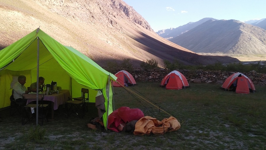
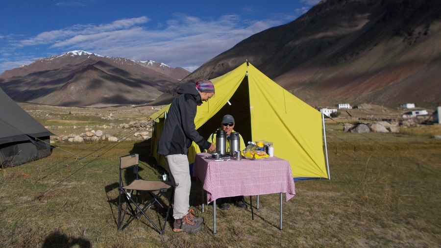
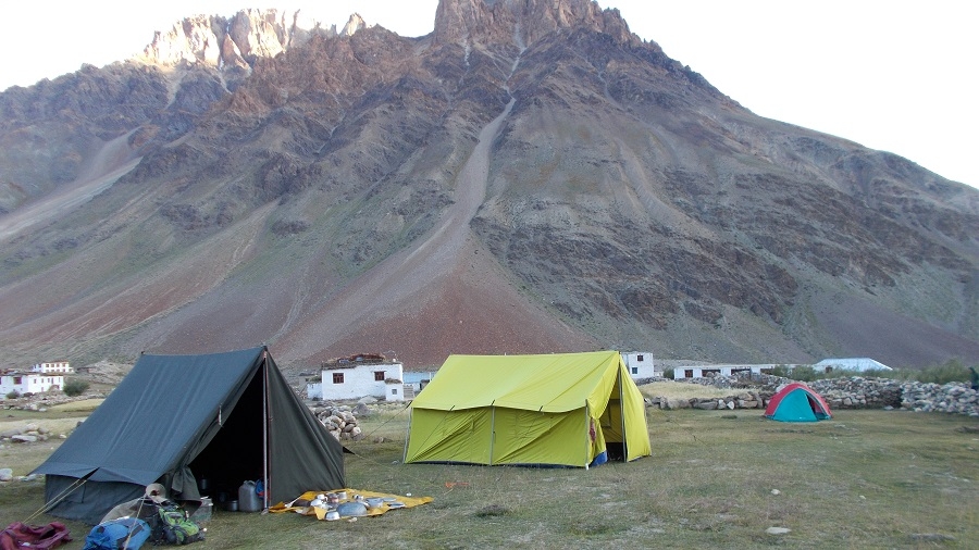
ü 19 nights camp with all camping facilities. 3 men spacious 4 season tents for 2, sleeping bags, foam mattresses, dining tent, trekking poles & safety gears.
ü All meal during trek - starts with bed tea to breakfast, lunch, 3 course dinner, tea /coffee, snacks. from Indian, Tibetan, Chinese to continental cuisine.
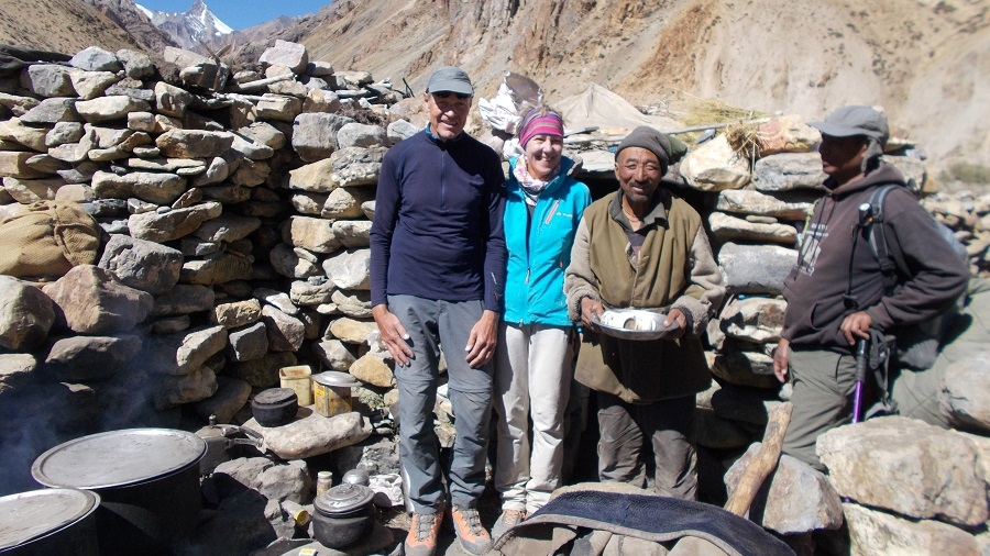
ü Support staff: well English, Ladakhi speaking local trekking guide, cook & camp crew.
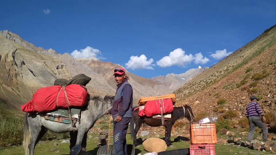
ü Muleteer avec trekking mules/horses for porterage of your luggage and trekking gear.
ü Camping fee, trekking permits.
ü Goods and services tax.
ü First aid medical kit.
× Domestic flight. Delhi - Leh, Leh - Delhi
× Hotel in Delhi.
× Travel insurance.
× Soft or hard drinks.
× Entrance fee at monasteries
× Personal tipping to staff: Guide, cook, helper, horseman, driver.
× Any unforeseen cost arises by natural hazards rain, snow, road block which cost extra lodging & boarding beyond trip Schedule.
“Good support on all various aspects. 4 season tent to keep me warm all night. Provide sleeping bag and thick mattress; provide rope carabineer for Umasi La glacier travel. Morning bed tea and hot water for washing. Gas stove are in good condition. Its play an important role to prepare a hot meal after a long trek. Porters are helpful for helping me to some obstacle on river crossing, glacier crossing. ...
"The whole Trek was phantastic and a very special experience for us. We learned a lot about the country and the people there saw fantastic landscapes and climbed high passes. Sherab was a great guide, showed us a lot of animals and their footprints, even snow leopards, he talked to everybody besides the trek and we were invited for tea, curt and chang, Ravi Is the best cook ...
Hello Prem - Thank you again for efforts to make our treks as successful as possible. I enjoyed the road journey to Shimla which went well, even with the bad weather. Rajay and Madan did a good job of looking after me, particularly Rajay with passing on messages from you and being able to talk to my wife, Cynthia, who also made it back to Delhi the day before ...
PRICE
Price on request
HIGHLIGHTS
Zanskar Great Himalaya Trail
High pass of Kanji La
Lungnak, Zanskar & Indus river valley
Dibling - an isolated village in Ladakh
TRIP FACTS
Activity - Trekking expedition
Region - Ladakh Zanskar
Difficulty Level - Strenuous
Max Altitude – 5342m Kanji La
Max sleeping altitude - 4650 meters
Lowest trek altitude - 3400 meters
Trip Length – 29 or 30 days Delhi to Delhi
24 days Leh to Leh
19 days trekking
22 nights camping
5 nights hotel
Best time – Mid-July to Sept. End
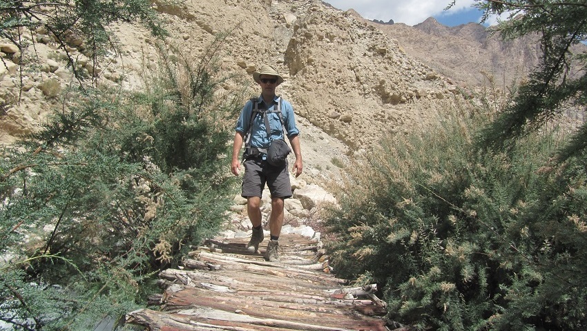
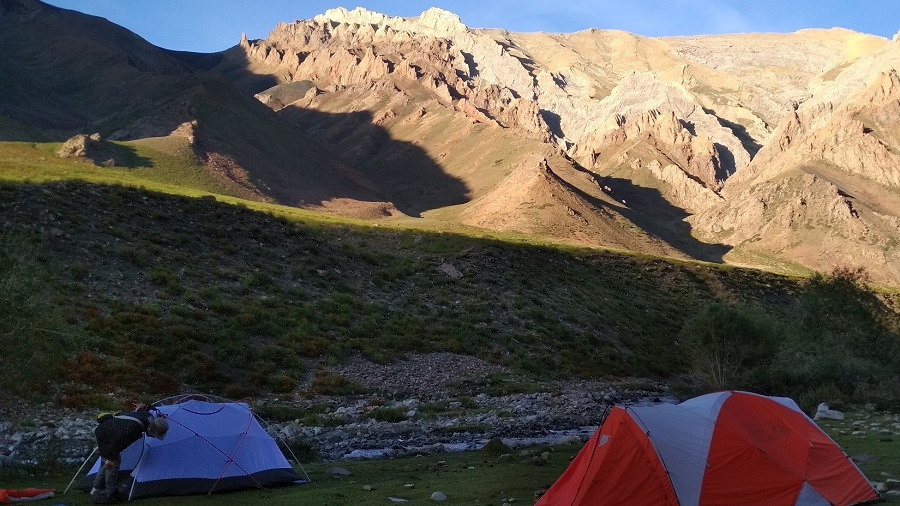
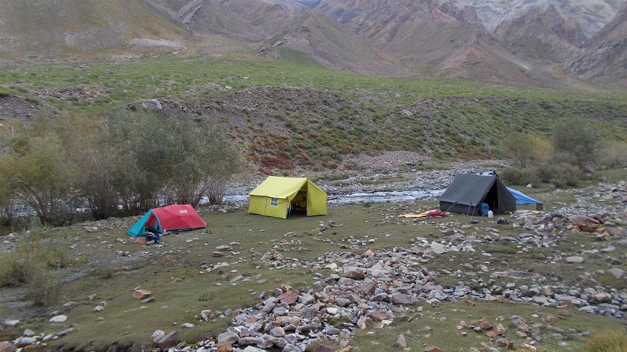
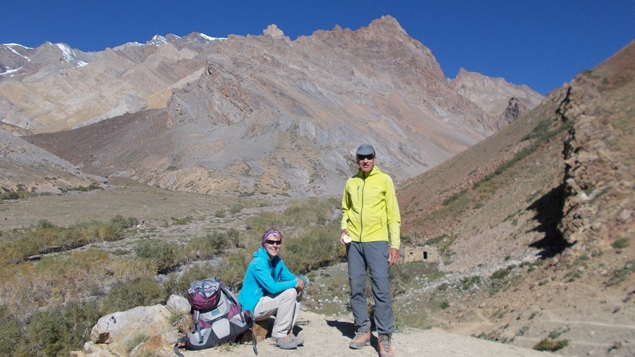
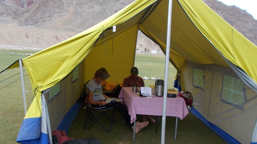
PHOTO GALLERY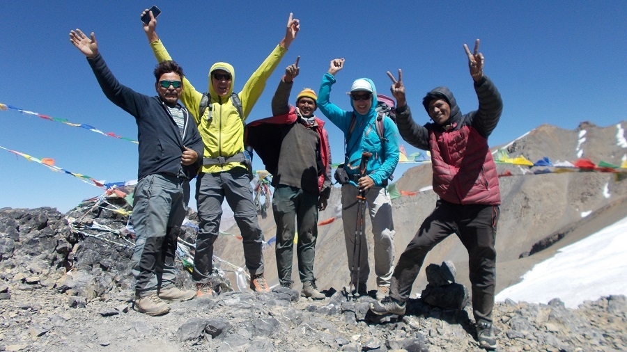
Kanji La (2019)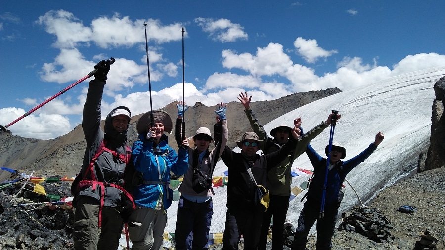
Kanji La (2018)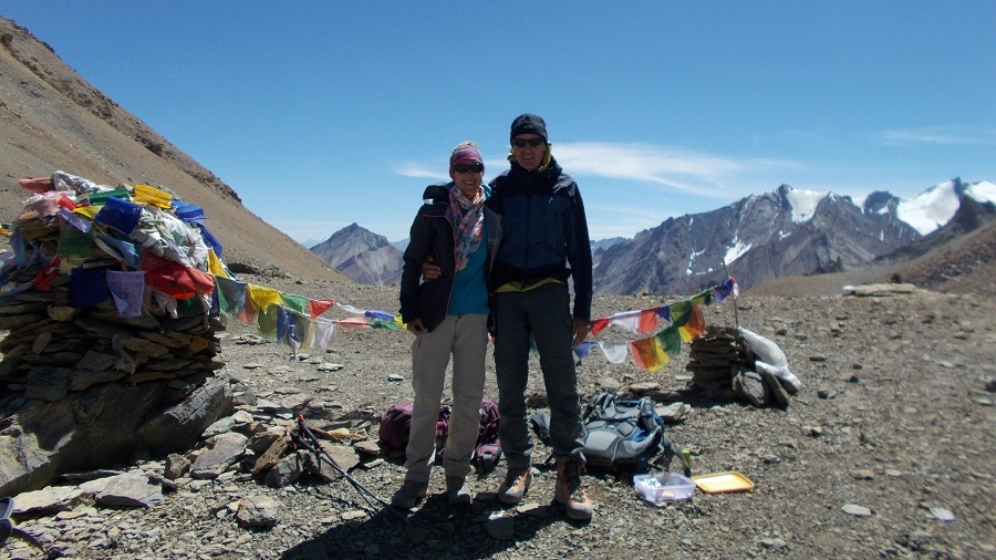
Pikdong La/Pudzong La (2019)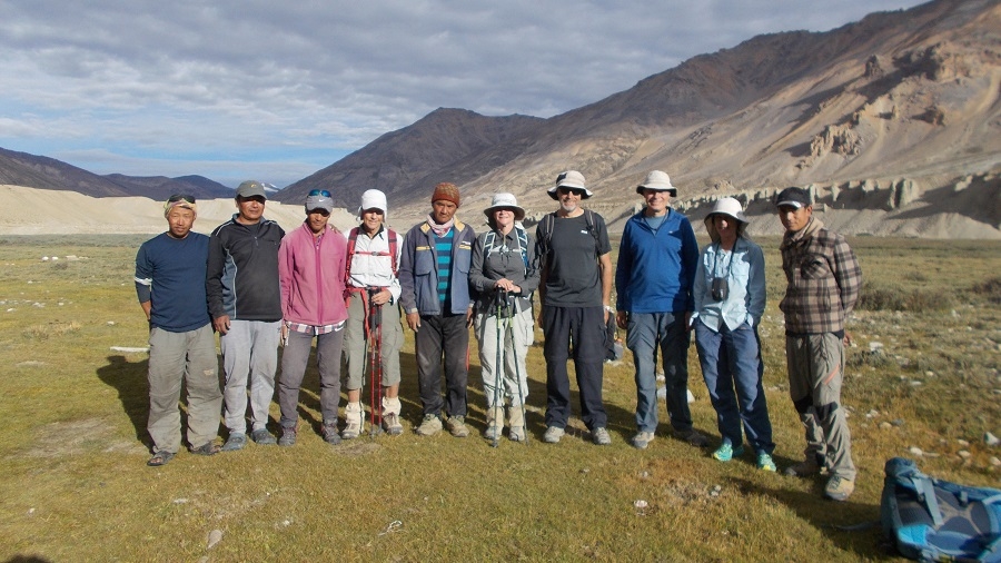
Sarchu (End of the trek)
Umasi La - Kanji La (2015)
Shilla gorge