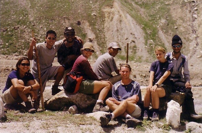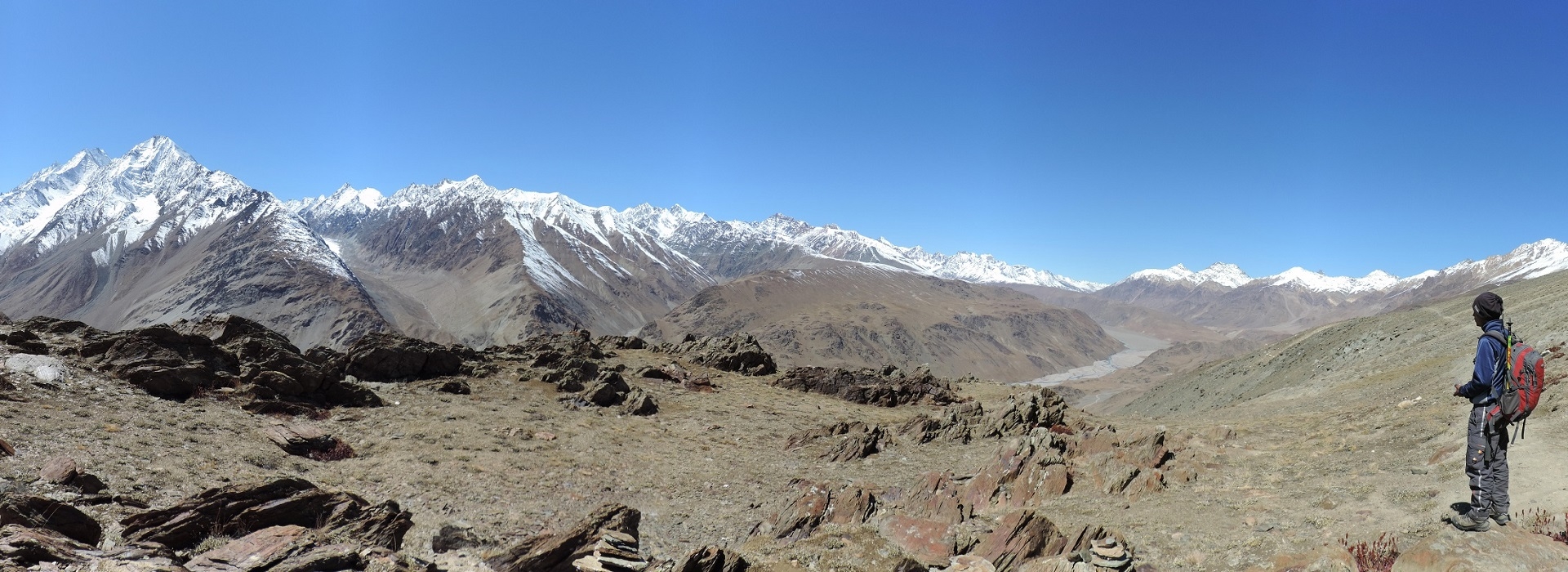
Himachal Pradesh is a leading and popular trekking destination in Indian Himalaya. With many short treks in Himachal, Hamta pass is considered one of the best treks in the Manali region. Hamta pass at an altitude of 4270m, located on the easternmost part of Pir Panjal range of Himalayan foothills. Hamta pass trek is a breathtaking but relatively moderate trek that anyone beginner or experienced trekker can do. Famed for spectacular Himalayan landscapes that change dramatically as you progress and combine stunning mountain scenery with three or four days of manageable walking. Crossing Hamta pass the landscape changes dramatically from lush green to barren semi-desert of Lahaul & Spiti district of Himachal. Hamta pass is frequently used by Shepherds from the remote Kangra region, who goes to the higher meadows of Lahaul during summer with their flocks of sheep. Indrasan and Deo Tibba are two peaks that you will see during the Hamta pass crossing.
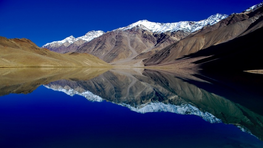
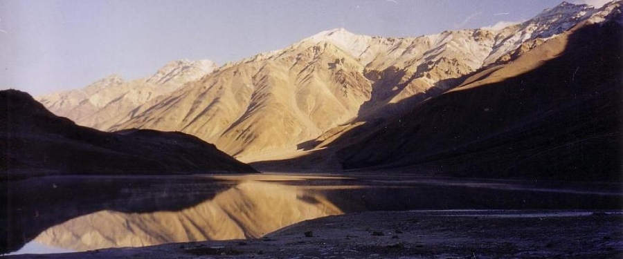
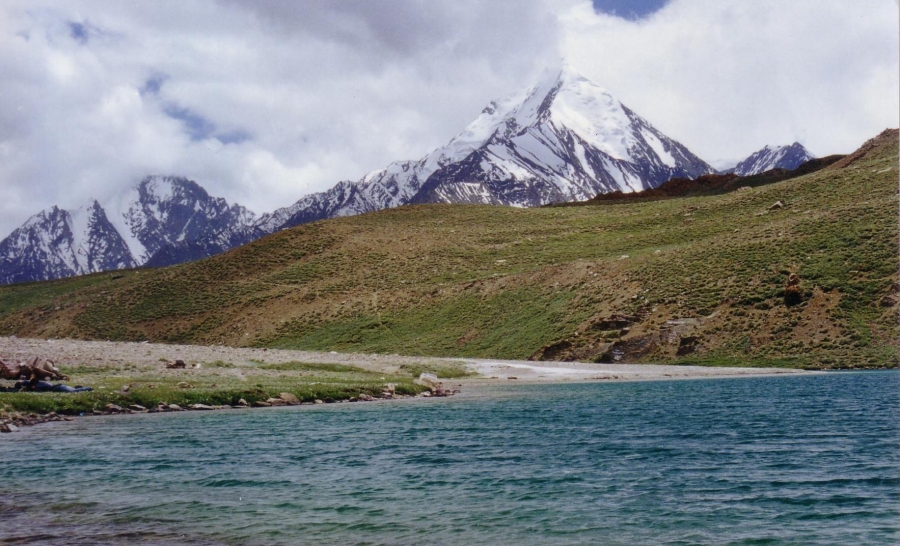
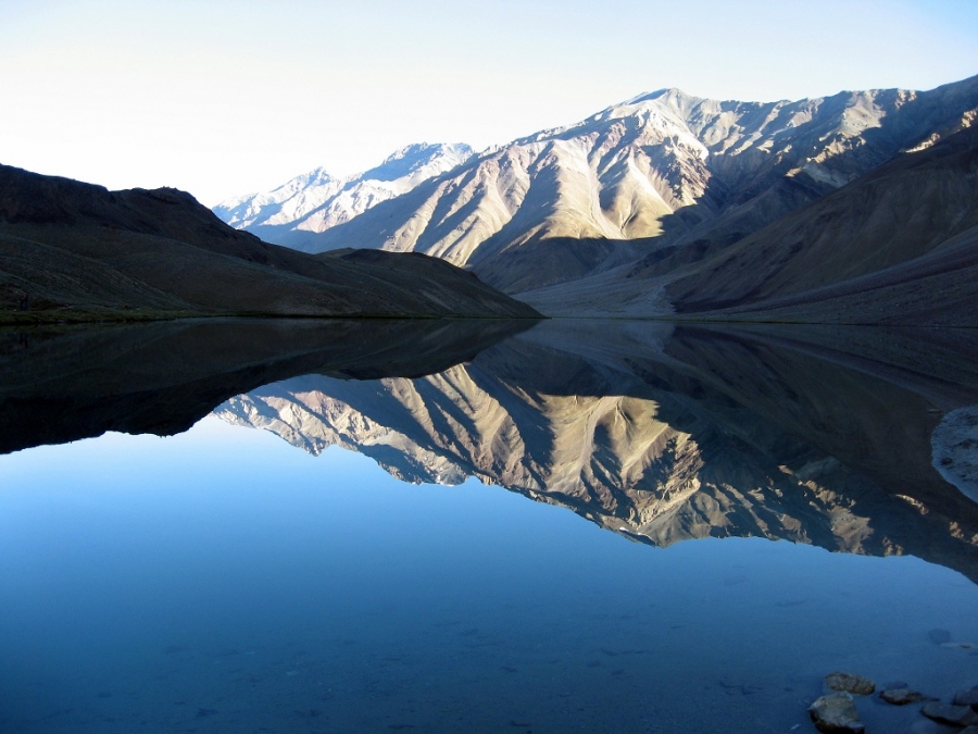
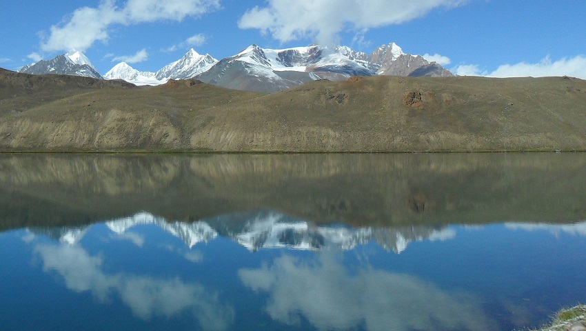
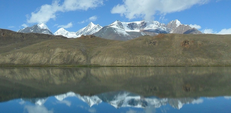
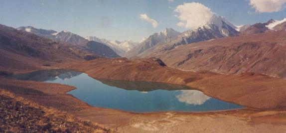
Chandra Tal meaning the Lake of Moon is situated at an altitude of 4270m in the Himalayan region of Lahaul and Spiti. Situated mostly in the part of Spiti. Chandratal is a popular destination for trekkers and campers. The trail from Kunzum la is more scenic and panoramic overlooking Samudra Tapu glacier, CB peaks, KR group of a peak, and among all the highest Mulkila peak standing west of Chandratal. It takes only 4 hrs. walk from Kunzum to Chandratal Lake. The vast meadows of Lake and its surroundings are a favorite summer home for Gaddi Shepherds who graze their flocks in the vicinity of the Lake. The Gaddi shepherds have long held traditional grazing rights in the area. The Lake is also one of the two high-altitude wetlands of India which have been designated as Ramsar sites.
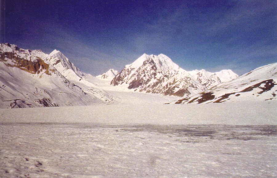
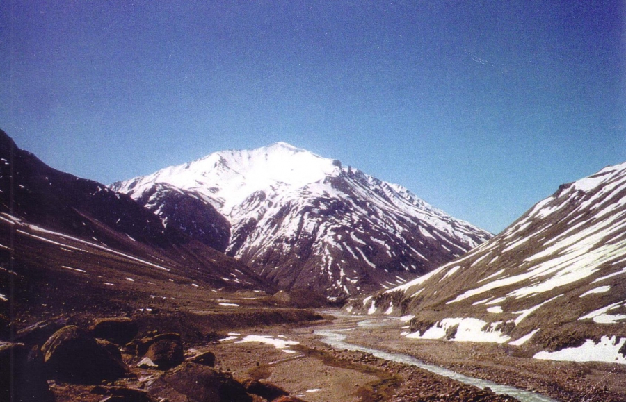
This trekking program sets out from the Jobri (2900m) in Hamta valley. At the beginning of Hamta valley and ends after arriving at Baralacha la (4890m). Beginning to trek from Jobri (2900m) gentle and easy trail through thick silver oak forest, Hamta river to Chikka (3300m), followed by the small stream before Jwara. Scaling height and leaving Bears den (Balu ka Ghera) behind you cross Hamta pass (4268m). From the top of pass, one could see peaks of Deo-Tibba (6001m) and Indrasan (6220m). Now trek down to main Chandra valley, after crossing river, following the left bank of Chandra, we cross over the wooden bridge near Chhatru (3100m). Further, 45 km on a dirt road, driving up to Kunzum La (4551m) having a view of Spiti valley, 8 km trek down in large meadows, the lake of moon approached. Further, the trail crosses the two river crossings of Tokpo Yongma and Tokpo Gongma. Crossing over the boulders and grassy stretches, reach the top of the Baralacha la. The pass joins the Manali-Leh national highway.
Hamta pass - Chandratal - Baralacha trek Outline itinerary
Day 1 - Arrive Manali
Day 2 - Manali, drive to Prini (1'900m) - Jobri (2900m) 1 hr -Trek to Chikka (3,100m) 4-5 hrs,
Day 3 - Trek to Balu Ka Gera (3'600m) 6-7 hrs, O/N camp
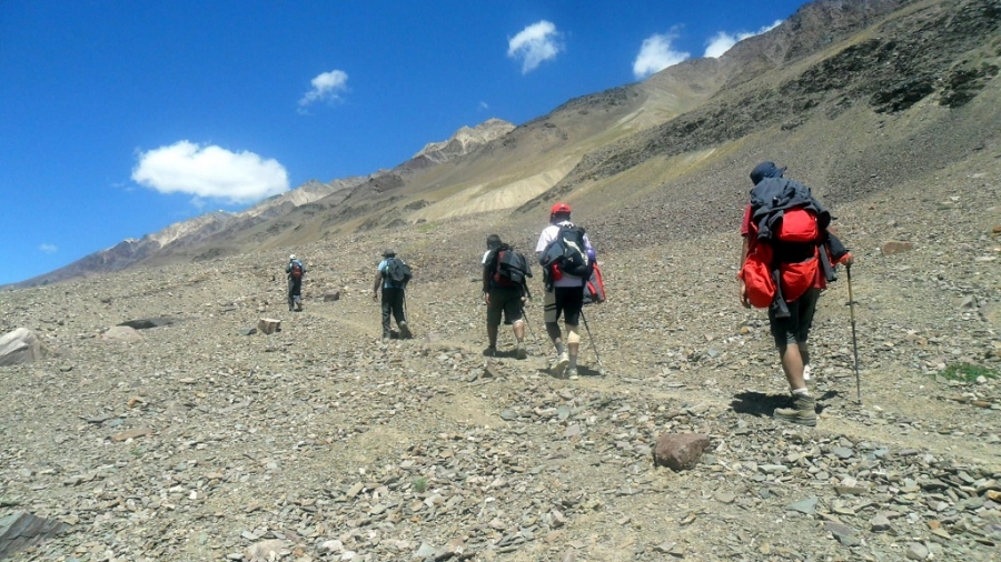
Day 4 - Trek to Hamta pass (4'268m) - Shia Goru (3'900m) 7-8 hrs, O/N camp
Day 5 - Trek to Chatru (3'100m) 5-6 hrs, Drive to Chota Dara 1 hr. O/N camp
Day 6 - Drive Batal - Kunzum la (4551m) 1:30 hrs, Trek Palhamo dhar (4650m) - Chandratal (4270m) 5 hrs.
Day 7 - Trek to Tokpo Yongma 4'400m 6-7 hrs, O/N camp
Day 8 - Trek to Tokpo Gongma (4'700m) 6-7 hrs, O/N camp
Day 9 - Trek to Baralacha la (4'890m) 4-5 hrs & drive to Keylong (3'100m) - Manali (1'940m) 7 hrs.
Day 10 - Manali to Chandigarh or Delhi
Detailed trip itinerary
Day 1 - Arrive Manali
Arrive Manali and explore local sights in around Manali.
Day 2 - Manali, drive to Prini (1'900m) - Jobri (2900m) 1 hr -Trek to Chikka (3,100m) 4-5 hrs
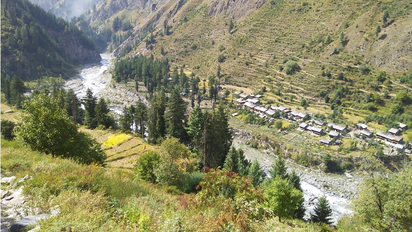
Today leaving Manali, we drive 3 km south of Manali on the left bank of Beas River to Prini village. Continue to drive through the Prini village and temple located above the village. Arriving at Hamta village and Sethan village. Sethan village is small settlements of early horseman known as Khampas of Tibetan origin. Who are mainly dealt with trekking mules up today? 45-minute walk through alpine forest to the Panduropa, Panduropa is known for the small paddy field - where Pandavas of Mahabharata during their exile, spent a part of time in this region and said to be cultivated crops at Panduropa. Now we trek 3 hrs. Horizontally through thickly forested area with abundance of flowers untill reaching the campsite of Chikka.
Day 3 - Trek to Balu Ka Gera (3'600m) 6-7 hrs, O/N camp
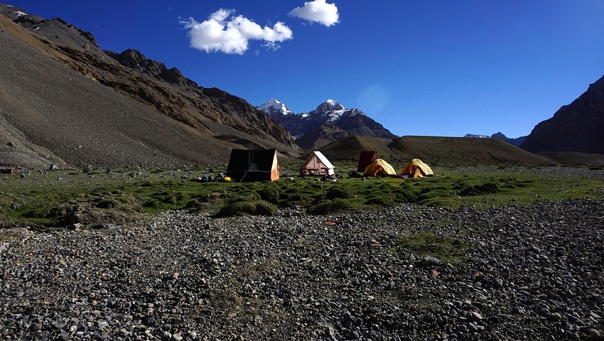
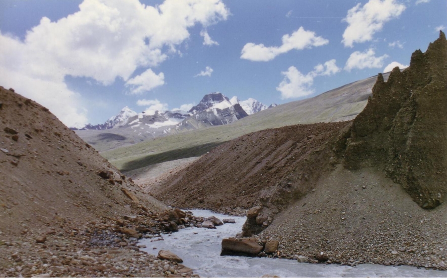
Today leaving Chikka we follow the left banks of Hamta. Later we cross Hamta stream by bridge. Another wooden bridge at short distance. Around Chhika some fantastic view of Rocky Mountains. After crossing the second bridge we climb gently to Jwara for 2 hrs. walks. Where we will pass beneath the waterfall. The next adventure is going to be a stream crossing just before Jwara. With the help of Guide and if not, with the help of riding horse you may cross the stream. Now the trail gently climbs to Balu ka Gera campsite. From where we will have first view of our next day crossing of Hamta pass. It’s a beautiful campsite close to crystal clear water. Be aware of Bear in this area by early season trek and late season trek. The area itself is known for Bears Den. Keep exploring surrounding of you for a rare view of Bear.
Day 4 - Trek to Hamta pass (4'268m) - Shea Goru (3'900m) 7-8 hrs, O/N camp
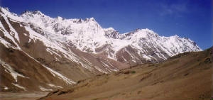
A gradual climb begins after Bhalu ka gera (bears den). Balu ka Gera that is known for wild flowers, rocks and caves. A further 1: 30 hrs. Minutes trail takes you to Hamta pass. From Hampta pass fantastic view of Inderkila, Deo Tibba (6001m) and Indersan (6220m). Which is superb to see? After crossing the Hampta pass, one enters the Lahoul valley. Walk down to the campsite near by the stream. Overnight camp.
Day 5 - Trek to Chatru (3'100m) 5-6 hrs, Drive to Chota Dara 1 hr. O/N camp
Cross-stream near the camp and follow the right bank until it joins with the Chandra River. Again, cross the same stream by small wooden bridge. Now follow the left bank of Chandra River. 30 minutes later a motor able bridge to be cross to reach at the campsite of Chhatru. After some break, we drive from Chhatru to Chota Dara campsite. Which is situated along the Chandra River with breathtaking view of Bara Shigri peaks.
Day 6 - Drive Batal - Kunzum la (4551m) 1:30 hrs, Trek Palhamo dhar (4650m) - Chandratal (4270m) 5 hrs.
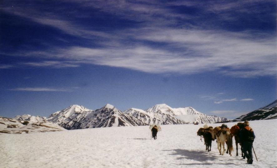
Leaving Chota Dara behind we continue along the right bank of Chandra River. Good view of Bara Shigri glacier on the left side. All above the glacier which is 12 km in length longest in Himachal, peaks of White Sail, Shigri Parbat, and Kullu Makalu where daring mountaineers touch the sky can widely be seen. Crossing bridge soon after Batal, we drive towards Kunzom la following small stream, which originated above pass. Arriving at pass has a glimpse of Spiti valley, which runs 170 kms towards south. We take a path, which goes to Lake 8 km; approach large meadows - a favorite area with a multitude of shepherd’s huts. Passing and crossing a long stretch of stony ground and small stream arrive at the lake. Across Chandra river most fascinating sight of Samudra Tapu glacier, North Dakka glacier, South Dakka glacier and Silver glacier. Above the glaciers towering mighty peaks of Moulkila and C.B. peaks. Leaving Kunzom we trek to Chandratal which is 8 kms long and has a wide panoramic view of Chandra Bhaga peaks all around. Camp after Chandratal.
Day 7 - Trek to Tokpo Yongma 4'400m 6-7 hrs, O/N camp
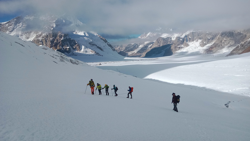
A long exhausted trek but well worth, because occasionally trekkers encounters patches of green pastureland. This stretch is about 14 to 16 km. The trail starts with a series of ups and downs through steep ravine and boulders - stream fields. As you progress, a flat grassy land, which slopes up to snow, clad ridge. Snow cock can be heard has heard and even sighted, if you are lucky. After 3 hrs the trail winds down a knoll, which has a steep precipice to the river far down to the left. Cross the stream if the water is low or find Snow Bridge up near the source. Or camp and cross next morning as earliest.
Day 8 - Trek to Tokpo Gongma (4'700m) 6-7 hrs, O/N camp
Trek through a narrow valley flanked on both sides by snow capped mountains. Star walk early as possible, since this stream to be cross, while the flow of the water is less early in the day. A short walk after crossing the river, here the valley opens out on a broad plateau where camp is set on a delightful grassy patch.
Day 9 - Trek to Baralacha la (4'890m) 4-5 hrs & drive to Keylong (3'100m) - Manali (1'940m) 7 hrs.
Today early departure from camp towards Baralacha la pass, which is 7 km long, gives the source of three rivers - Chandra through South, Bhaga through upper Lahoul and Yunam towards Zanskar. A splendid view of M-4, which is the highest in the Moulkila range, can be seen from the trail as well as of Keorang range of Great Himalayas. On the pass, join the main highway. We will be pick up by our vehicle here and drive to Manali.
Day 10 - Manali to Chandigarh or Delhi
Morning depart to Chandigarh or take a overnight volvo bus to Delhi.
Arrive Manali and explore local sights in around Manali.
Today leaving Manali, we drive 3 km south of Manali on the left bank of Beas River to Prini village. Continue to drive through the Prini village and temple located above the village. Arriving at Hamta village and Sethan village. Sethan village is small settlements of early horseman known as Khampas of Tibetan origin. Who are mainly dealt with trekking mules up today? 45-minute walk through alpine forest to the Panduropa, Panduropa is known for the small paddy field - where Pandavas of Mahabharata during their exile, spent a part of time in this region and said to be cultivated crops at Panduropa. Now we trek 3 hrs. Horizontally through thickly forested area with abundance of flowers untill reaching the campsite of Chikka.
Today leaving Chikka we follow the left banks of Hamta. Later we cross Hamta stream by bridge. Another wooden bridge at short distance. Around Chhika some fantastic view of Rocky Mountains. After crossing the second bridge we climb gently to Jwara for 2 hrs. walks. Where we will pass beneath the waterfall. The next adventure is going to be a stream crossing just before Jwara. With the help of Guide and if not, with the help of riding horse you may cross the stream. Now the trail gently climbs to Balu ka Gera campsite. From where we will have first view of our next day crossing of Hamta pass. It’s a beautiful campsite close to crystal clear water. Be aware of Bear in this area by early season trek and late season trek. The area itself is known for Bears Den. Keep exploring surrounding of you for a rare view of Bear.
A gradual climb begins after Bhalu ka gera (bears den). Balu ka Gera that is known for wild flowers, rocks and caves. A further 1: 30 hrs. Minutes trail takes you to Hampta pass. From Hampta pass fantastic view of Inderkila, Deo Tibba (6001m) and Indersan (6220m). Which is superb to see? After crossing the Hampta pass, one enters the Lahoul valley. Walk down to the campsite near by the stream. Overnight camp.
Cross-stream near the camp and follow the right bank until it joins with the Chandra River. Again, cross the same stream by small wooden bridge. Now follow the left bank of Chandra River. 30 minutes later a motor able bridge to be cross to reach at the campsite of Chhatru. After some break, we drive from Chhatru to Chota Dara campsite. Which is situated along the Chandra River with breathtaking view of Bara Shigri peaks.
Leaving Chota Dara behind we continue along the right bank of Chandra River. Good view of Bara Shigri glacier on the left side. All above the glacier which is 12 km in length longest in Himachal, peaks of White Sail, Shigri Parbat, and Kullu Makalu where daring mountaineers touch the sky can widely be seen. Crossing bridge soon after Batal, we drive towards Kunzom la following small stream, which originated above pass. Arriving at pass has a glimpse of Spiti valley, which runs 170 kms towards south. We take a path, which goes to Lake 8 km; approach large meadows - a favorite area with a multitude of shepherd’s huts. Passing and crossing a long stretch of stony ground and small stream arrive at the lake. Across Chandra river most fascinating sight of Samudra Tapu glacier, North Dakka glacier, South Dakka glacier and Silver glacier. Above the glaciers towering mighty peaks of Moulkila and C.B. peaks. Leaving Kunzom we trek to Chandratal which is 8 kms long and has a wide panoramic view of Chandra Bhaga peaks all around. Camp after Chandratal.
A long exhausted trek but well worth, because occasionally trekkers encounters patches of green pastureland. This stretch is about 14 to 16 km. The trail starts with a series of ups and downs through steep ravine and boulders - stream fields. As you progress, a flat grassy land, which slopes up to snow, clad ridge. Snow cock can be heard has heard and even sighted, if you are lucky. After 3 hrs the trail winds down a knoll, which has a steep precipice to the river far down to the left. Cross the stream if the water is low or find Snow Bridge up near the source. Or camp and cross next morning as earliest.
Trek through a narrow valley flanked on both sides by snow capped mountains. Star walk early as possible, since this stream to be cross, while the flow of the water is less early in the day. A short walk after crossing the river, here the valley opens out on a broad plateau where camp is set on a delightful grassy patch.
Today early departure from camp towards Baralacha la pass, which is 7 km long, gives the source of three rivers - Chandra through South, Bhaga through upper Lahoul and Yunam towards Zanskar. A splendid view of M-4, which is the highest in the Moulkila range, can be seen from the trail as well as of Keorang range of Great Himalayas. On the pass, join the main highway. We will be pick up by our vehicle here and drive to Manali.
Morning depart to Chandigarh or take a overnight volvo bus to Delhi.
- All ground transportation to & fro as per the itinerary.
- 7 nights camp with all camping facilities. 3 men spacious 4 season tents for 2, sleeping bags, foam mattresses, dining tent, trekking poles & safety gears.
- All meal during trek - starts with bed tea to breakfast, lunch, 3 course dinner, tea /coffee, snacks. from Indian, Tibetan, Chinese to continental cuisine.
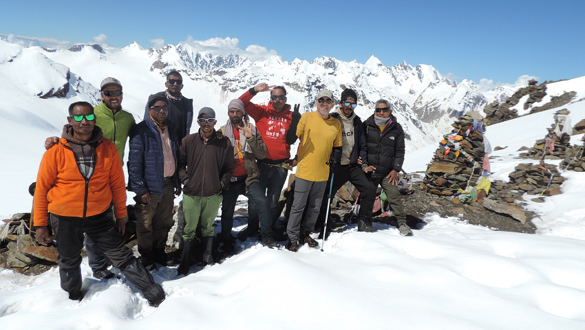
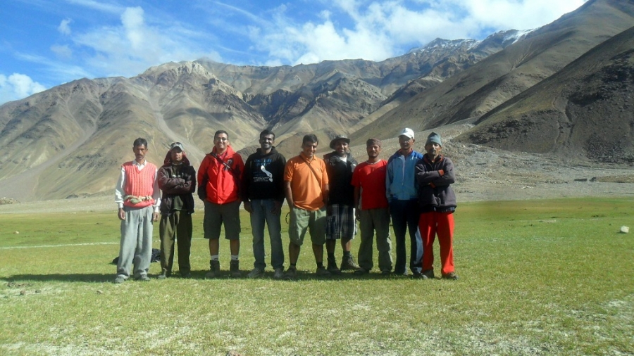
- Support staff: Qualified trekking guide, cook & camp crew.
- Trekking mules/horses or porters for porterage of your luggage and trekking gear.
- Camping fee, trekking permits.
- Goods and services tax.
- First aid medical kit.
× Domestic flight. (Delhi airport transfer on request)
× Delhi Manali transfer.
× Hotel in Manali.
× Travel insurance.
× Soft or hard drinks.
× Entrance fee at monasteries
× Personal tipping to staff: Guide, cook, camp crew, horsemen, porters, driver.
× Any unforeseen cost arises by natural hazards rain, snow, road block which cost extra lodging & boarding beyond trip Schedule.
Trip Facts
Activity - Trekking & hiking
Region: Manali & Lahaul Spiti, Himachal
Difficulty level - Moderate
Max Altitude - 4900 meters
Max sleeping altitude - 4700 meters
Lowest trek altitude - 1900 meters
Trip Length - 10 days Delhi to Delhi
8 days Manali to Manali
8 days trekking
7 nights camping
Best time - June end to mid-Sept