Zanskar is a small Tibetan Buddhist Kingdom, lying just north of the main Himalayan range and about 120 miles long. It is part of the former Kingdom of Ladakh, and up until relatively recent times, its two ‘Kings’, or Gyalpos (precious rulers), mediated local disputes and in ancient times, collected taxes for the main King of Ladakh.
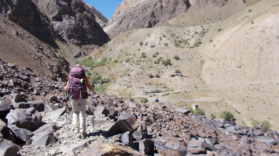
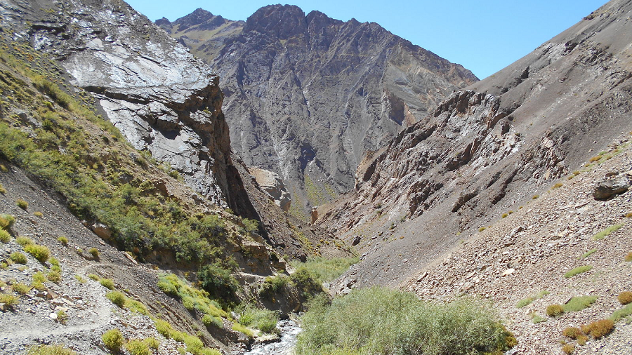
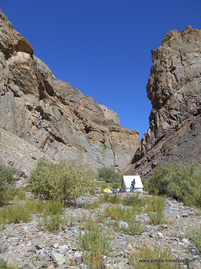
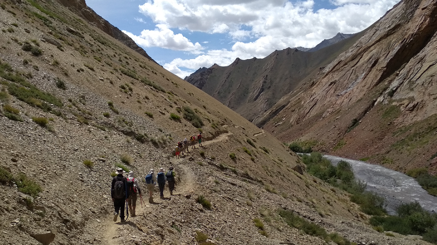
Our Zanskar trek takes us completely off the beaten track, trekking through very remote country. Starting near Mount Nun, we gradually make our way through the mountains into Zanskar. Trekking up through a series of gorges that can only be navigated when water levels are low, we head towards Phuktal monastery.
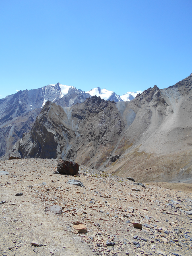
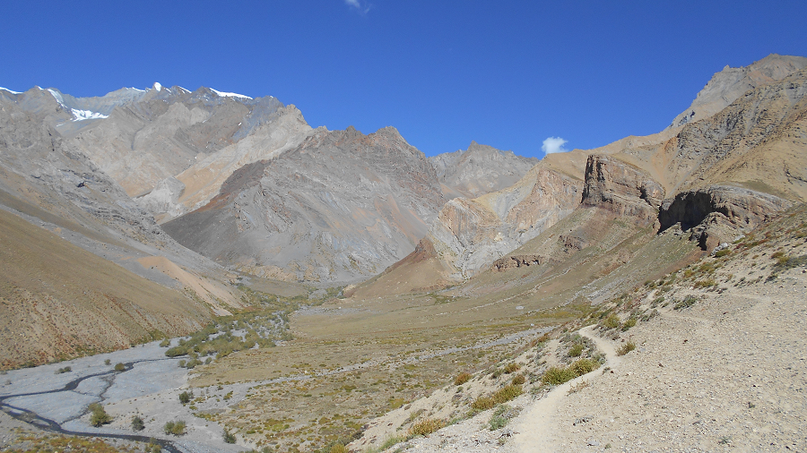
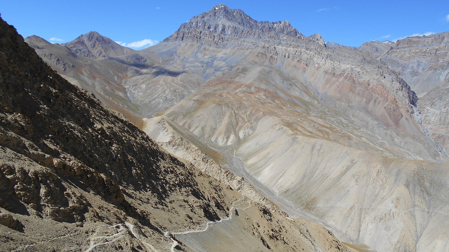
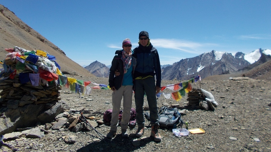
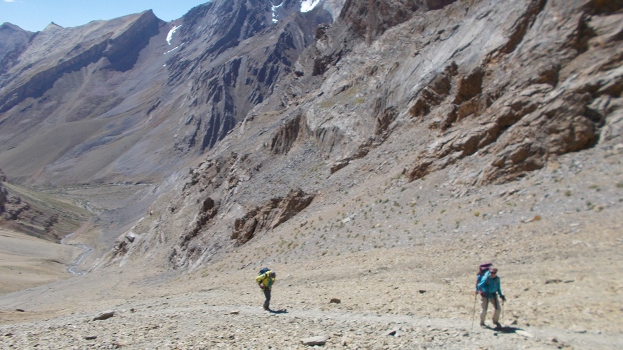
This is one of our most exciting and diverse trekking routes, a stunningly beautiful and challenging trek through remote canyon lands, crossing many high Himalayan passes (most 5000+ meters), and trekking through the hidden, green valleys and villages of mythical Ladakh and Zanskar.
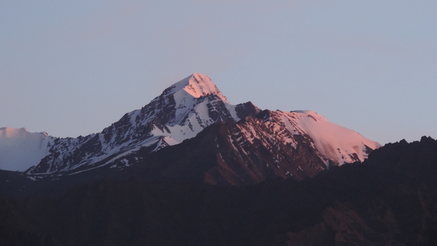
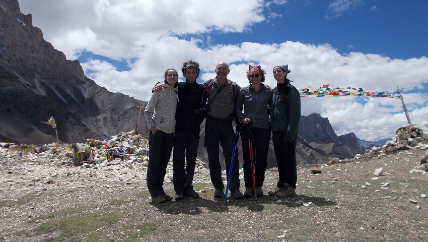
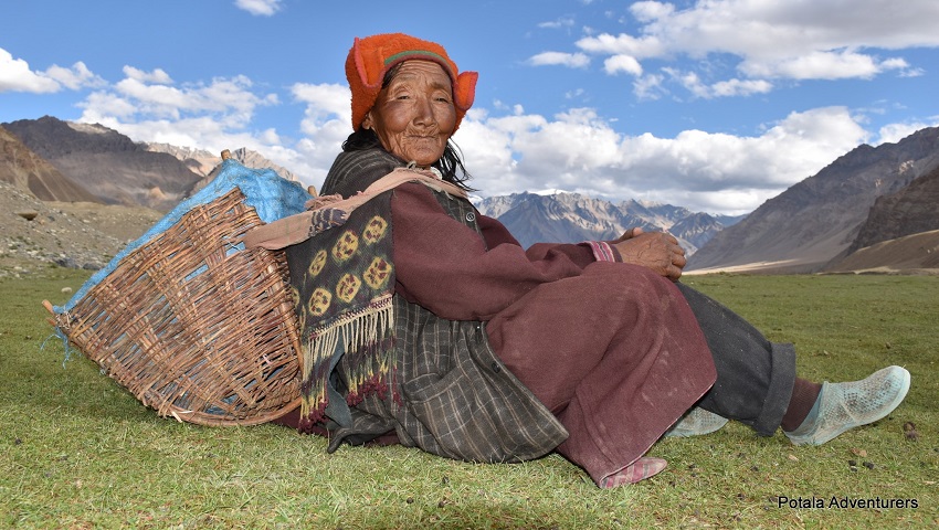
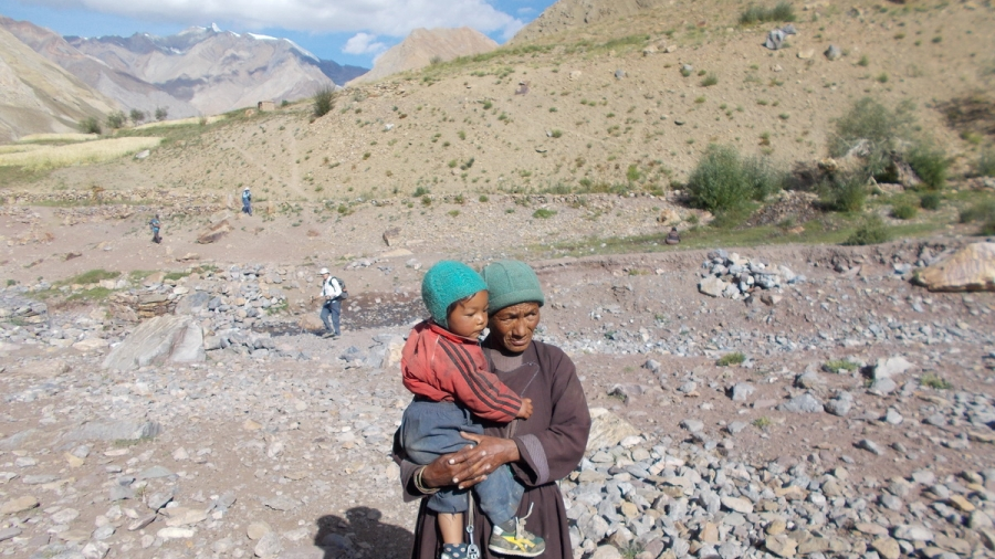
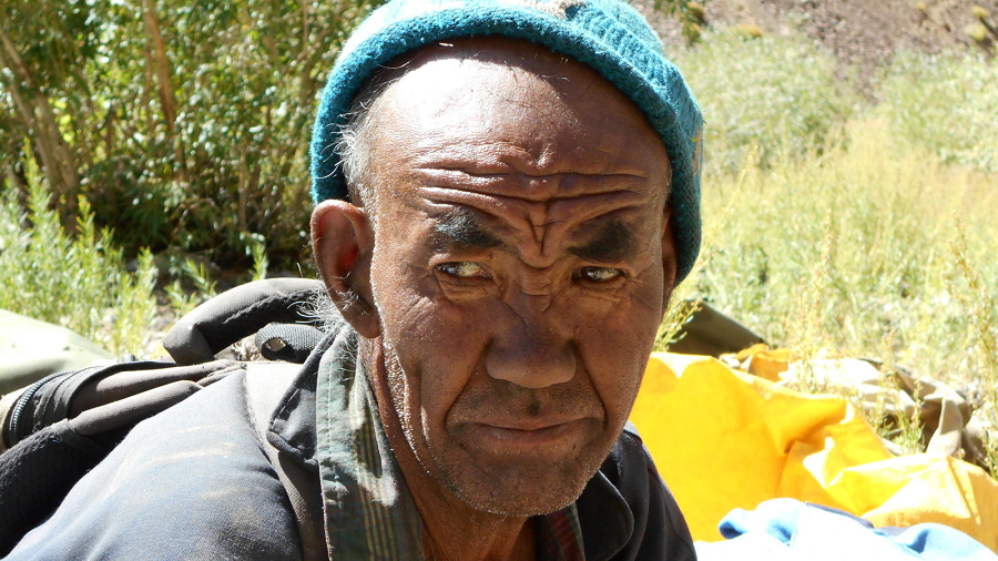
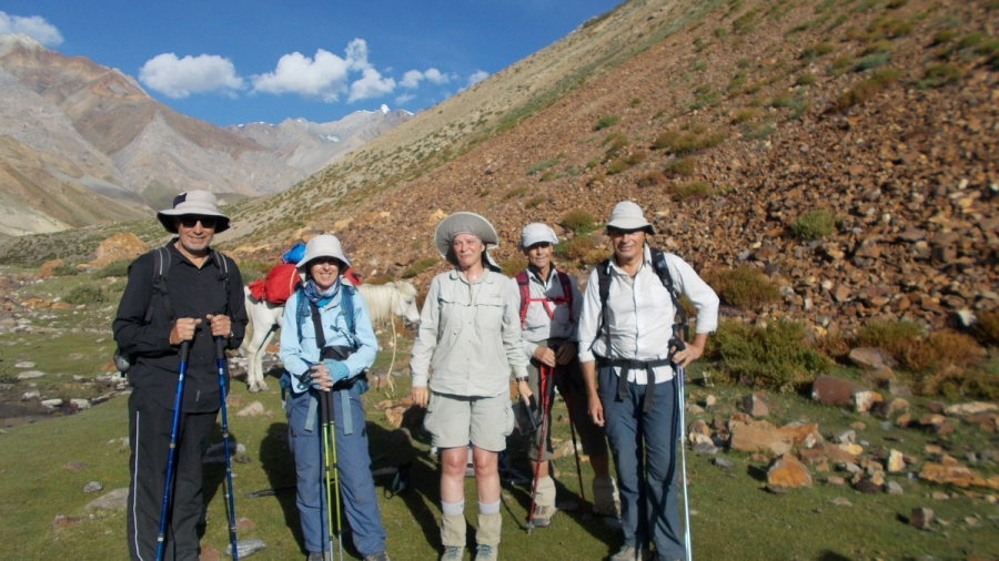
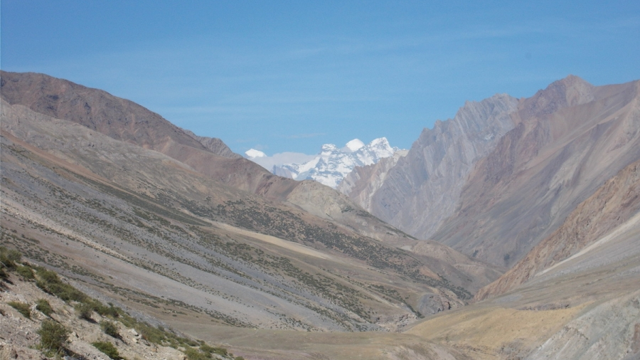
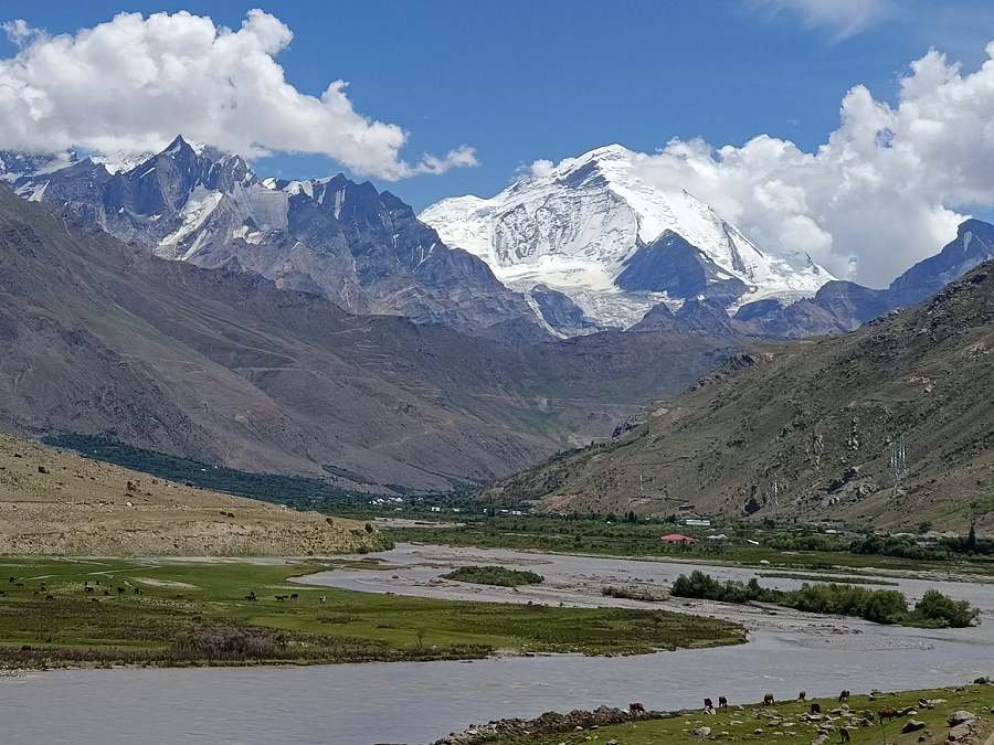
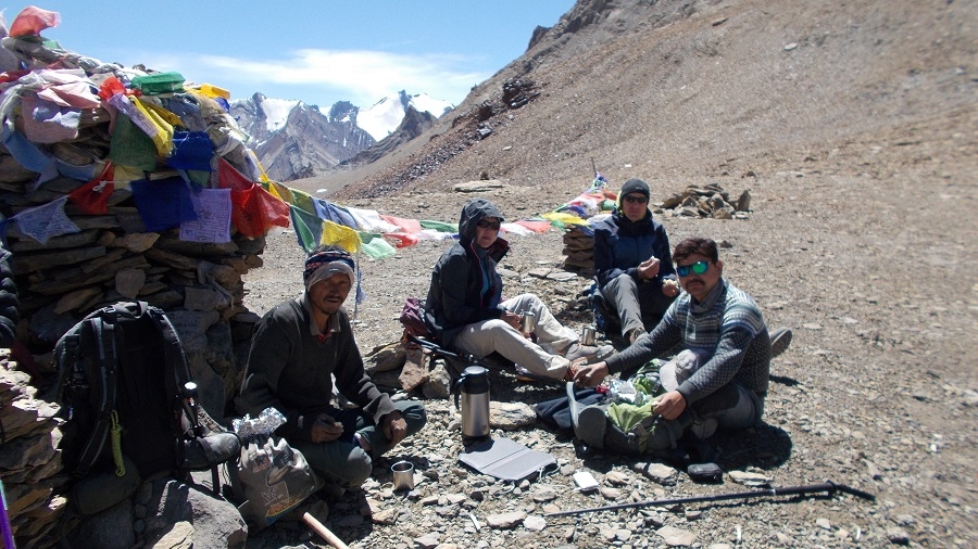
You will pass through many villages along the way and meet with locals at their homes, who are with our Zanskari staff. Spectacular view of the Greater Himalayan range and its peak rising above 7000m. Some of the best views are Nun 7135m, Kun 7077m, and Doda 6550m.
We begin this epic trip at delightful Rangdum and pass Pikdong La (Puzdong La) to the remote but friendly Dibling village. From Dibling, you follow the Oma Chu to the base of Hanuma la to the large plains of Zanskar at Padum. Here, you will have the opportunity to visit several sights. From Zangl, we take the wild Zanskar trail where only a few trekkers find their way to Shade village. Shade is the most remote and scenic place in Zanskar, where you will experience the traditional Zanskari village life in this far-flung village. Along the Tsarap River to one of the most spectacular sights of our trek to Phuktal, and finally exploring the high villages of Southern Zanska, where our trek ends, we drive to Shinku La pass to Manali.
You will drive on the Leh-Manali highway to the hill resort town of Manali. Relax a day at this hill station before making a final departure to Delhi. Our unique adventurous Grand Traverse of Zanskar – Join us.
ZANSKAR TREK RANGDUM TO PHUKTAL
Day 1 – Delhi – Leh flight, Arrive at Leh (3,600m), Airport pickup, Check into Hotel, Relax.
Day 2 – Leh Acclimatization and sightseeing at Shanti Stupa, Leh Palace, Tsemo Gompa, Spituk
Day 3 – Leh: Acclimatization and Sightseeing at Shey, Thiksey, Stakna, Hemis & Matho.
Day 4 - Drive Mulbekh, cross Namika La (3,820m).
Day 5 - Drive to Kargil, Suru Valley & Rangdum Zanskar, passing by the Nun Kun Peaks & Glaciers, and visit Rangdum Gonpa.
Day 6 - Trek Yak Camp
Day 7 – Trek Base Camp Pudzong La (4,400m)
Day 8 - Trek Pudzong la (5,029m) - Dibling doksa (4,200m) - Dibling (4,000m)
Day 9 - Trek Lingshed Sumdo (3,680m)
Day 10 - Trek Barmi la (4,694m) – Lanang Sumdo (4,000m)
Day 11 - Trek Zingchen (3,370 m) via Hanuma La (4,700m)
Day 12 - Trek Hanumil (3,400 m) via Perfi La (3,900m)
Day 13 - Trek Pidmo (3,420m) – Zangla River camp.
Day 14 - Zangla River Camp & Central Zanskar Day Trip visit Thongde – Karsha – Sani - Padum (3,600m).
Day 15 - Trek Tsazar Doksa Sumdo (3,900m).
Day 16 - Trek Pandang La High camp (4,450m).
Day 17 - Trek Kharnak Sumdo (4,390m), Cross Pandang La (5,175m)
Day 18 - Trek Mitsik Doksa (4,285m), Cross Liyu La (4,375 m) & Lar La (4,690m)
Day 19 - Trek Shade (4,220m) via Rotang La (4,900m)
Day 20 - Trek Yatah hidden camp (4,000m)
Day 21 - Trek Phuktal (3,900m), Drive Purne (3,800m)
Day 22 - Drive Padum
Day 23 - Drive Leh via Nyerak - Nimmu.
Day 24 - Leh
Day 25 - Depart Delhi.
_____________________________________
Alternative Driving Route Purne - Leh
Day 22 – Drive Sarchu via Shinku La (5,090m)
Day 23 – Drive Leh via Taglang La
Day 24 – Leh
Day 25 – Depart Leh
_____________________________________
Option Ending in Manali, Purne – Manali - Delhi
Day 22 – Purne – Manali via Shinku La (5090 m)
Day 23 – Manali (2,050m)
Day 24 – Manali to Delhi private taxi or Overnight Volvo bus
Day 25 – Depart Delhi.
_____________________________________
Cost Includes
ü All Ground Transportation to & fro as per the Itinerary, Leh to Manali.
ü Leh Airport Transfers & Leh Sightseeing Tour, Manali to Delhi transfer.
ü Central Zanskar Valley Day Trip.
ü 6 Nights of Hotel Accommodation in Leh on (day 1,2,3, 23,24), Padum 1 night on (day 22) at CP Plan.
ü 1 night (day 4) of hotel/homstay/tented accommodation at Mulbekh, breakfast, dinner.
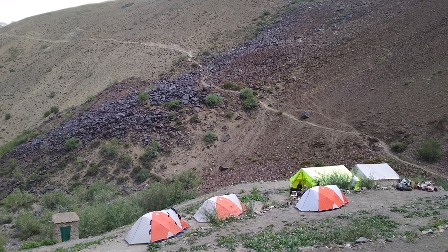
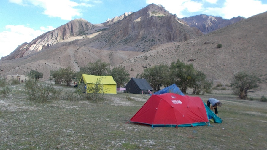
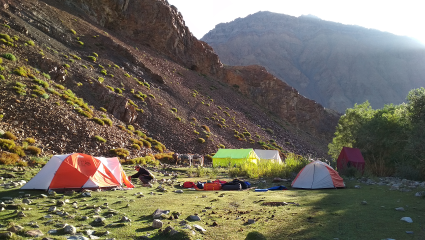
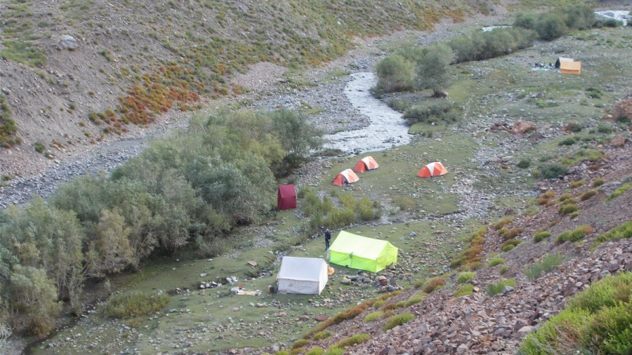
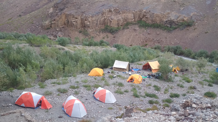
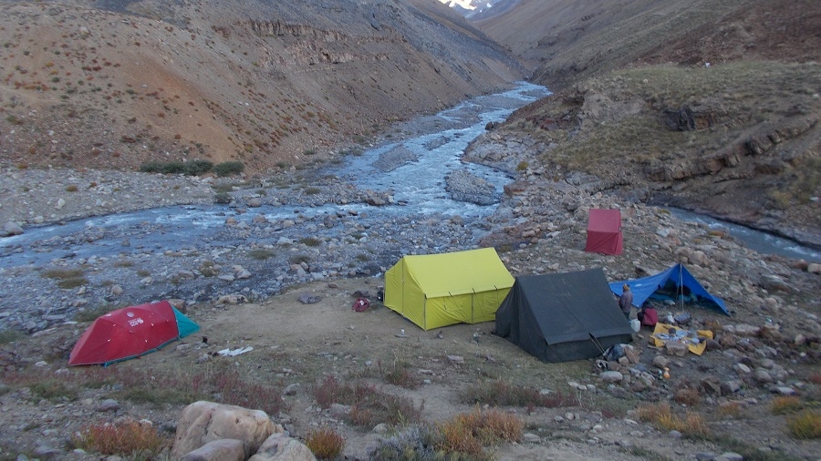
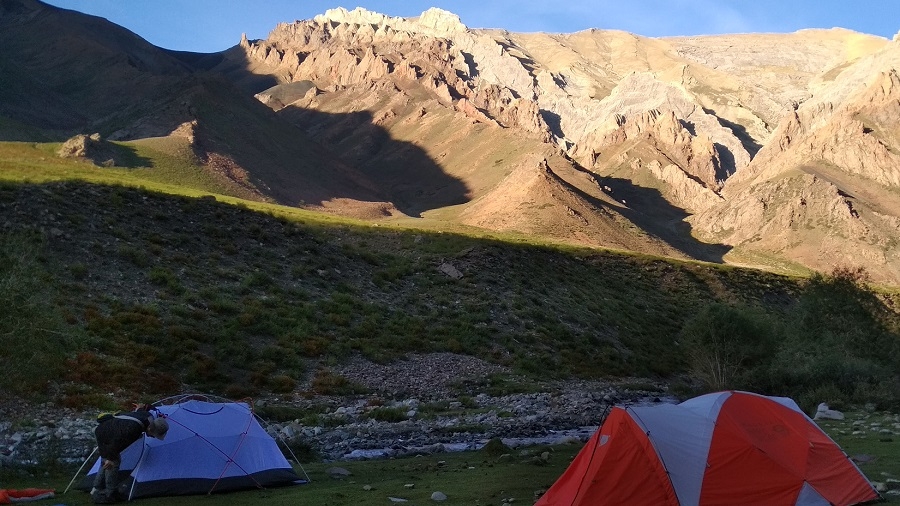
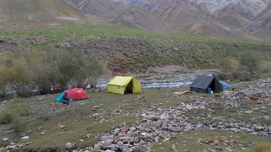
17-Night Camp (days 5 to 21) with all Camping facilities. 3 men spacious 4-season tents for 2, Sleeping bags, foam Mattresses, Dining tent, Camp chair/table, Trekking poles & Safety gear.
ü All Meals during the Trek start with Bed Tea to Breakfast, Lunch, 3-Course Dinner, Tea /Coffee, and snacks, from Indian, Tibetan, and Chinese to Continental Cuisine.
ü Support staff: English-speaking local Trekking Guide, Cook & Camp Crew.
ü Trekking Mules, Horses for carrying Luggage & Trekking Gear.
ü Camping fees, Goods & services Tax.
ü Restricted Area Permits.
ü Basic first-aid medical kit, oxygen cylinder, oximeter.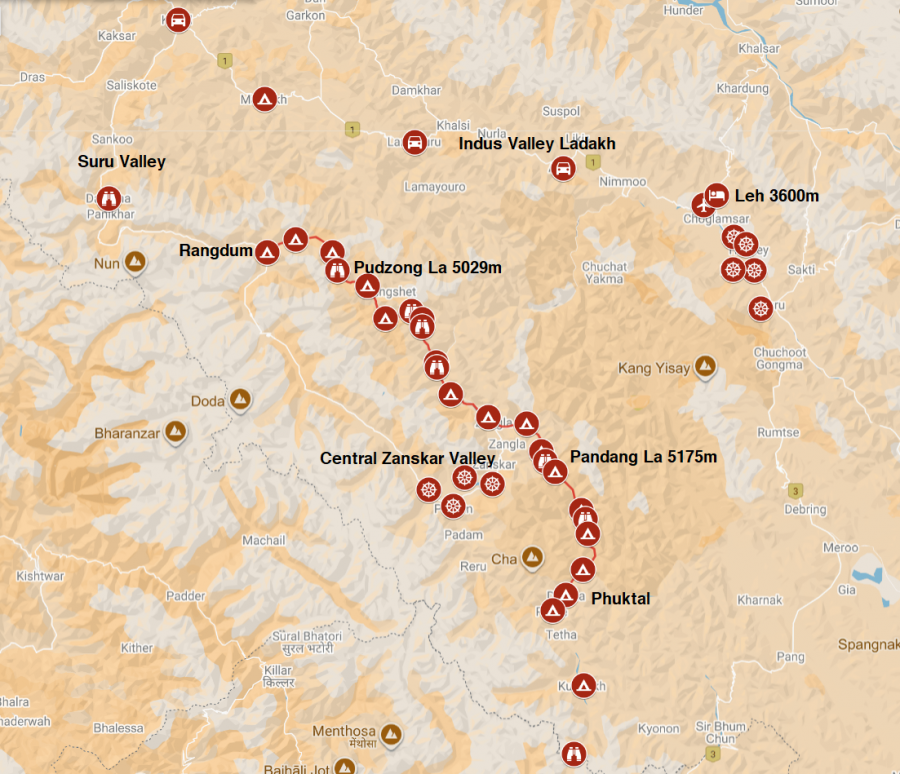
REVIEWS
"The whole Trek was fantastic and a very special experience for us. We learned a lot about the country and the people there, saw fantastic landscapes and climbed high passes. Sherab was a great guide, showed us a lot of animals and their footprints, even snow leopards, he talked to everybody beside the trek and we were invited for teaand curt and chang, Ravi Is the best cook between Manali and Leh and every day we got the best food and Service.Deepak also was working very hard and was a good camp boy. Our horseman did a great Job, Jai looked always for his horses, and no one was injured or in bad condition.We can recommend you and your company from the first to the last step. Also, you did organize everything for the best, the equipment was perfect, the provided food and the services we booked If we come back to this region and plan similar treks, we sure will do this with you..Best greetings"
Mr. Manmayer - Germany - Couple
_____________________________________
"5* - Excellent - A VERY SPECIAL EXPERIENCE! We did this trek in summer 2017 - it was a very special experience. As promised, the route was really wild & remote. Overall I can say that the trip was very well organised, we had a very competent guide (Sherab) and an excellent cook (Indra). The trek is physically quite demanding, but the experience is well worth it. Especially the river crossings I remember very well. Bring a large brimmed hat and wear long-sleeve shirts. The air is very dry, it took us some time to adapt to it.
Some other impressions:
Very good hotel in Leh (quiet location, large room).
Excellent & diverse food - even after many days of walking without the chance of re-supplying (amazing what Indra could do on the gasoline cookers).
Very helpful & friendly team.
Our families at home we notified via e-mail about our location & condition. Sherab used the satellite phones in the villages to talk to Prem.
Sherab knew many people along the route and we were often invited into the houses.
We saw among others, blue sheep and ibex. There were fresh tracks of bear and snow leopard."
Mr. Rene - couple - Switzerland
_____________________________________
"Salut Prem - Nous avons tardé à te répondre, enfin nous te donnons des nouvelles. Pour nous tout va bien, le retour s’était bien passé et nous avons encore pleins de souvenirs dans nos têtes. Encore mille mercis pour ce beau trek! C’était formidable, plein de magnifiques paysages et de très belles rencontres!
Mr. Marc & group of 4 - France - 1 to 31 Aug
LADAKH ZANSKAR DREAM TREK RANGDUM TO PHUKTAL TREK - DETAILED ITINERARAY
Day 1 – Delhi – Leh flight, Arrive at Leh (3,600 m), Airport pickup, Check into Hotel, Relax.
Welcome to Leh, after your long flight from your hometown to Delhi, and meet with us at Leh airport. Most of the flight arrives in Leh in the morning time and the rest of the day is free to relax and acclimatize to the altitude of 3,600 m as well as visit Leh bazaar.
Day 2 – Leh Acclimatize: Sight-seeing Shanti Stupa, Leh Palace, Tsemo Gompa, Spituk.
Today sightseeing around Leh, visit the Royal Palace of Leh from the 16th century, and continue through the fields of Sankar monastery, which adjoins north Leh. Continue to the Shanti Stupa and finally end your day with a visit to Spituk Gompa. Our driver will pick you up from the hotel at 8:30 am after breakfast. Finish your day before lunch and you will have time to go for lunch at Leh Market.
Day 3 – Leh Acclimatize: Sight-seeing Shey, Thiksey, Stakna, Hemis & Matho.
A full day of sightseeing and visiting the most important place in around the Indus Valley. You will have a guide for this day trip, especially for Gompa. There are many places to visit but we have chosen five sights which are suitable for a day trip. Leaving from the hotel at 8:30 am after breakfast you will visit first Shey Palace, then Thiksey. Thiksey monastery, which is at a distance of 27 km from Hemis, this monastery is the oldest monastery of Gelugpa School in Ladakh. The great Lama Paldan Shesrap built it in the 14th century. Here you can see the big statue of the Future Buddha. Continue to Taktok and Chemdey and return to visit Hemis monastery which is 45 km far from Leh and it takes a 90-minute drive. The great Mahasiddha Staktsang Raspa along with great ancestor Singey Namgyal built this biggest monastery in the 16th century. Continue to Matho then we drive to Stok which is situated opposite Leh at a distance of 14 km, Stok visits of Royal Palace built in 1825 AD and the palace has great collections of antiquity. Continue to visit Matho situated 10 km from Stok, which has a 10th-century complex. Finally back to Leh and final preparation for trek.
Day 4 - Drive Mulbekh cross Namika La (3,820m).
Today we board our private vehicle and drive to the timeless Lamayuru Gompa en route first visit to Likir than Alchi Gompa, situated at a distance of 68 km from Leh. Its monastery was built on lowlands rather than on a hilltop as others are, to protect from enemies. The Chortens around Alchi Gompa contains numerous murals of Lotsava Rinchen Zangpo, who built this monastery. Alchi monastery has vast collections of wall paintings and wood sculptures. We continue to drive to Lamayuru which is 58 km from Alchi. The oldest monastery in Ladakh was founded by Indian scholar Mahasiddhacharya Naropa in the 11th century. Lamayuru hosts a mask dance festival (Yuru Kabgyat) during the 17th and 18th day of the fifth months of the Tibetan Lunar calendar. It belongs to the red hat sect of Tibetan Buddhism; the monastery is rich with Thankas and wall paintings. Lamayuru monastery was constructed by Arahat Nimagung between the 10th and 11th centuries. History says that in the 11th century, the Mahasidha Naropa visited this place and the cave where he resided and meditated is still to be seen inside the monastery. This is mostly visited by travelers located on the Srinagar - Leh road. Enjoy homestay at Lamayuru or Mulbekh.
Day 5 - Drive Kargil, Suru Valley & Rangdum Zanskar, Pass Nun Kun Peaks & Glaciers, visiti Rangdum Gompa.
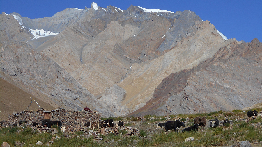
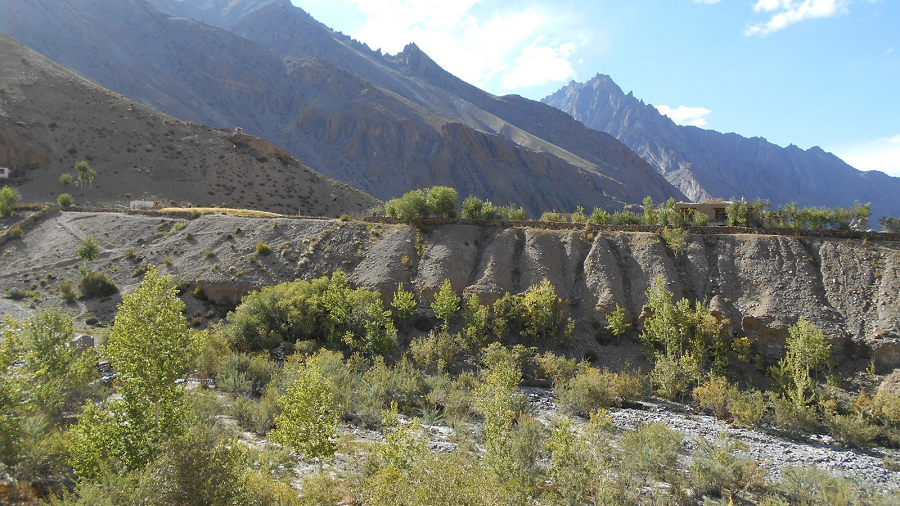
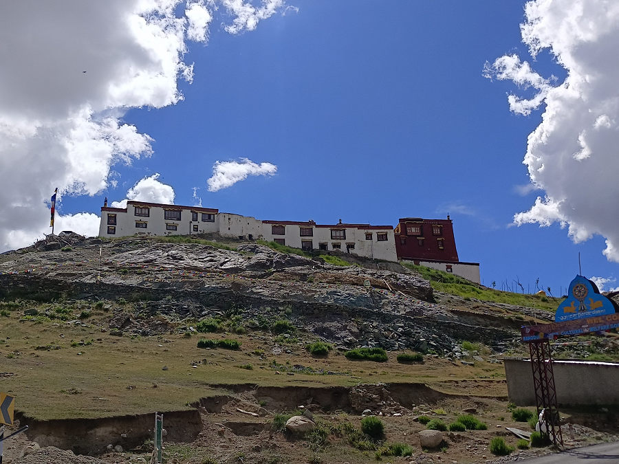
Leaving Mulbekh, we drive 35 km following the Wakka Chu to the road just before Kargil from where we turn left. The journey from Kargil to Rangdum is a scenic traverse through the Suru Valley, serving as the gateway to the Zanskar region. The distance is approximately 130 km. Typically takes 4–6 hours by car, though it can take longer for photographers or due to road conditions. The road stretch from Kargil to Rangdum is generally smooth and tarred. The route is known for its dramatic transitions from lush green valleys to desolate mountain landscapes. Sankoo & Kartse Khar: Famous for a 7-meter tall rock-carved Maitreya Buddha statue dating back to the 7th or 8th century. Panikhar & Parkachik, these villages offer stunning views of the Nun (7,135m) & Kun (7,077m) peaks, the highest in the Zanskar range. Parkachik Glacier, A massive glacier visible directly from the road. Rangdum is a small, remote settlement located at an altitude of approximately 3,657 meters (12,000 ft). Rangdum Monastery: An 18th-century Gelugpa monastery perched on a hilltop that resembles a sugarloaf.
Day 6 - Trek Yak Camp (4,245m)
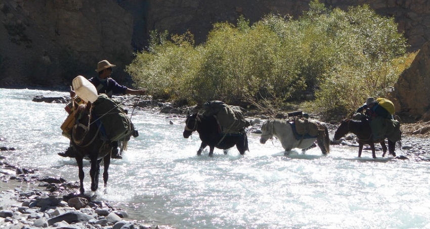
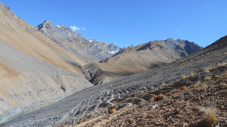
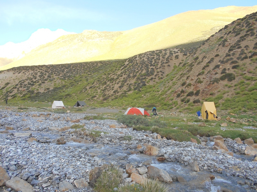
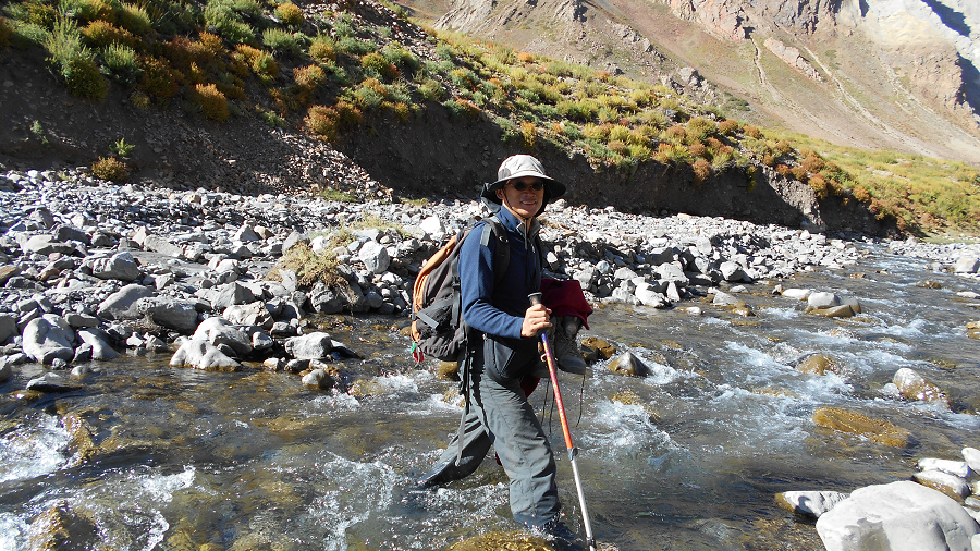
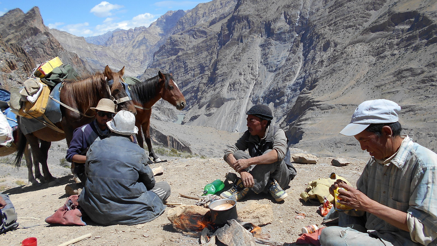
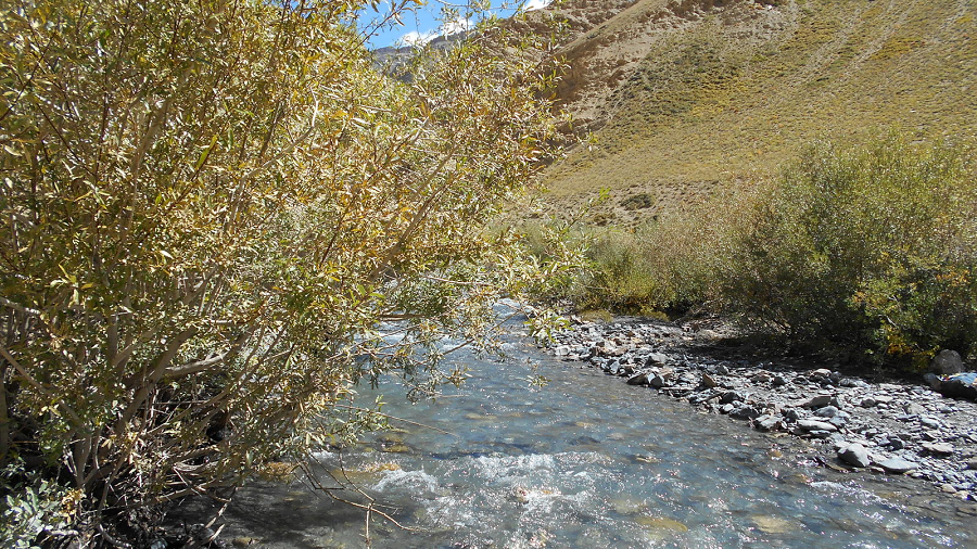
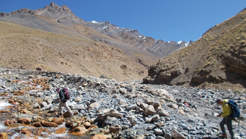
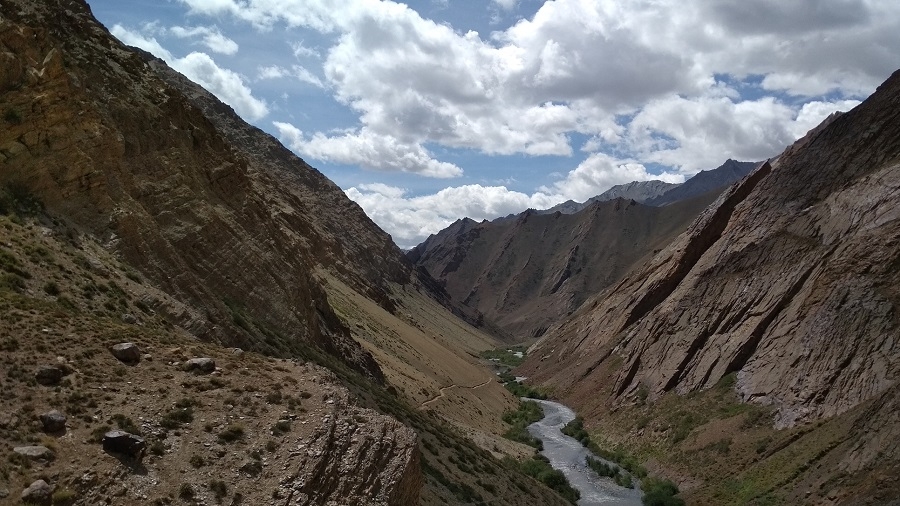
After breakfast start trekking up the large valley heading east-northeast, which leads to the Kanji La. This is the way you will follow, but instead of crossing the Kanji La, you turn off to go over the Pudzong La Pass. For the first hour, or so, you walk on the riverbed and then the path gradually contours up the right-hand mountain-side. A huge, contorted cliff appears on the other side, thousands of feet high. Then below you, instead of sloping banks leading to the river plain, the river emerges from a square-cut gorge. This box canyon is made up of glacial deposit which the river, over millennia, has cut through. Your path has contoured the mountainside well above this. You may hear lots of squeaking marmots and see eagles soaring above. The gorge below is certainly very impressive and after some time, you will see an equally impressive side gorge entering from the other side of the river. After three hours, you stop for lunch at some old shepherds' stone huts, and one hour after that there is an easy river crossing.
There is a camp just before the Kanji La turn off, but this is very small and not suitable for a group with a number of tents, so it's much better to continue to a nicer and far more spacious camp another 3 hours or so up the valley. You will therefore continue to contour along parallel to the gorge below, with the path rising slightly. In about 40 minutes you will reach the Kanji La junction and 20 minutes or so beyond here, look back and you will see framed in the end of the valley magnificent views of the peaks of Nun and Kun.
Distance 12 km, 6 hrs trek
Day 7 – Trek Base Camp Pudzong La (4400 m)
Soon after leaving the camp, we cross the large river right as we leave our campsite. Heading to the right at river level and joining the main trail coming from Dibling.
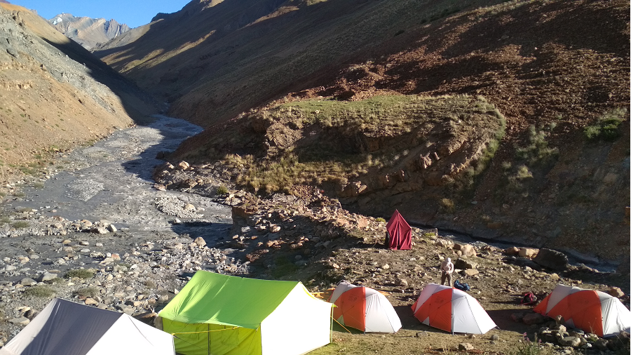
We continue to contour, staying high through grassy, rocky hillsides with marmots sticking their heads out of their holes, sunning themselves on rocks, and whistling at our approach, the valley decorated with colorful mountain flowers. It’s a 1½ hour's hike to the intersection of the route to Dibling (at our old campsite across the river), the ‘sumdo’ of two major river valleys. We continue along a similar trail and reach a smaller valley where we descend, cross a small stream, and then hike back up. The valley is rockier and more undulating, and we soon see our campsite across a wide valley in front of us. But before reaching it, though, we have to descend again to a surging river and try to cross on an old bridge, often washed away. One more climb and we’ve reached our lovely campsite atop a relatively flat plateau, a snowcapped valley to our right.
Day 8 - Trek Pudzong la (5,050 m) - Dibling doksa (4200m).
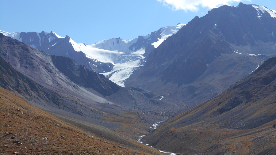
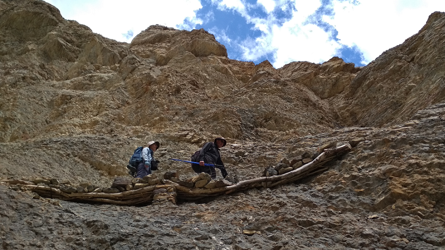
This is an amazing day! From Hell Camp you turn up a stunningly beautiful valley with a snake-like stream coming down from a wall of snow-covered peaks at the end. You toil up the right-hand side of the valley wondering where the hell the pass is. It looks seriously difficult ahead, but in fact the pass itself is hidden out of sight. You carry on now to a shoulder which provides quite a nice rest spot and then descend to the river bed. This is about one and a half hours from Hell Camp. You now have to cross the stream several times, but at this time of the year it should be just easy boulder-hopping. You are now in the upper part of the valley and you may well come across snow banks covering the stream. Eventually, you exit the rocky river bed, finally climbing to a shoulder where some years there is the start of the snow approaching the pass. By now you will be able to see that your path leading to the pass is either an easy trail on broken shale or an easy snow-slog. Crampons and ice axes are unnecessary and it is unlikely you will need gaiters. 3 km distance from camp to pass with a 500m gain.
So having taken three hours to get to the pass, it is now only a two hour descent to the valley some 900m/3,000ft below. Leaving the pass, snow slopes and then rocks lead to a gulch down which the zigzag path brings you out past fantastic pale gold rock walls and towers on either side to the wide valley. There are breathtaking views looking right down the sweeping valley to where you are going to camp tonight. We should say here also that the views from the Pudzong La are superb - snowy peaks in every direction. You will stop for lunch once out of the steeper sections although it may be cold and windy and you may wish to hurry on. The camp is at 4,150m/13,616ft amongst an area of clumpy small trees and bushes between the junctions of two streams, with fabulous views. Ahead, and framed at the end of the valley, is a distant pointed rock peak.
Day 9 - Trek Dibling (4000m) - Lingshed Sumdo (3680m)
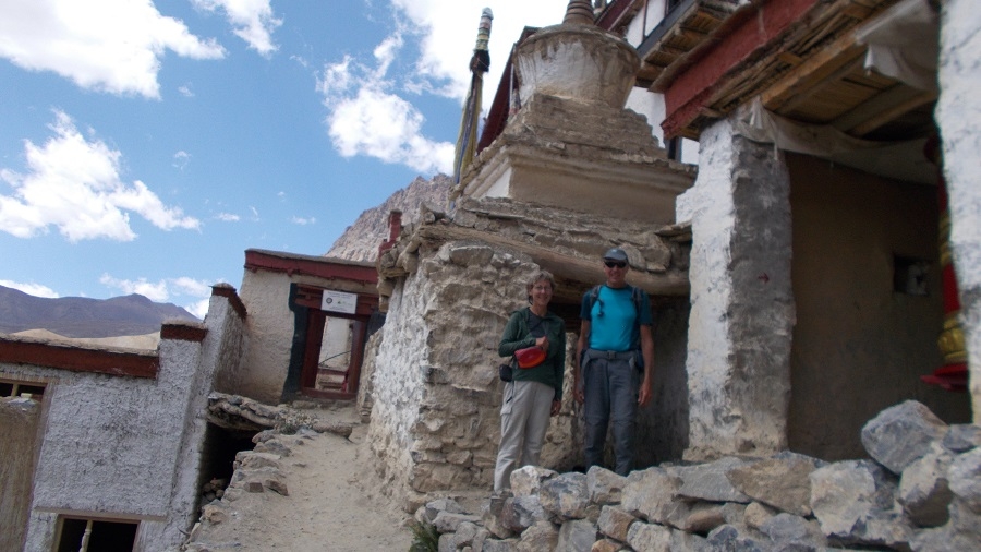
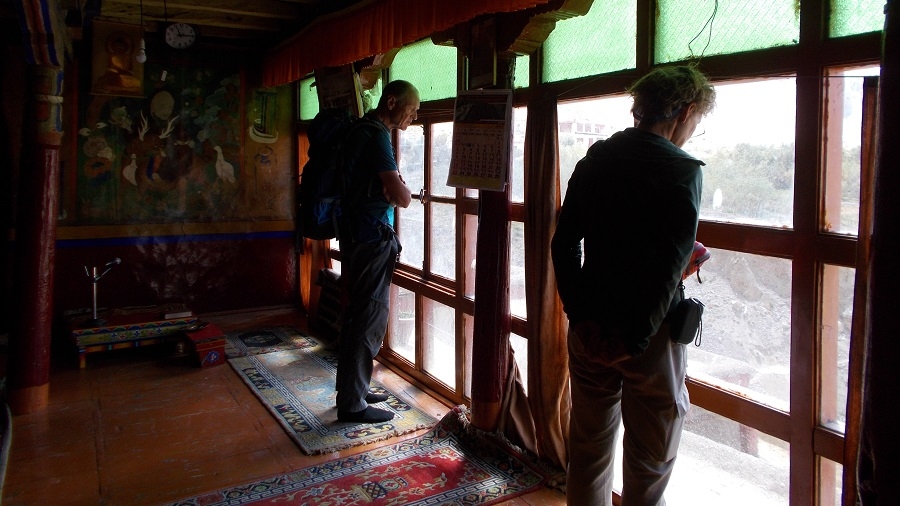
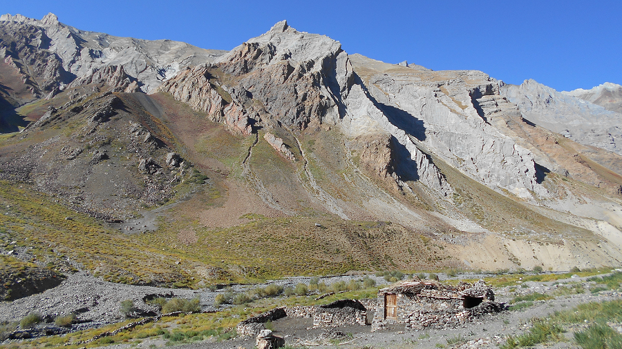
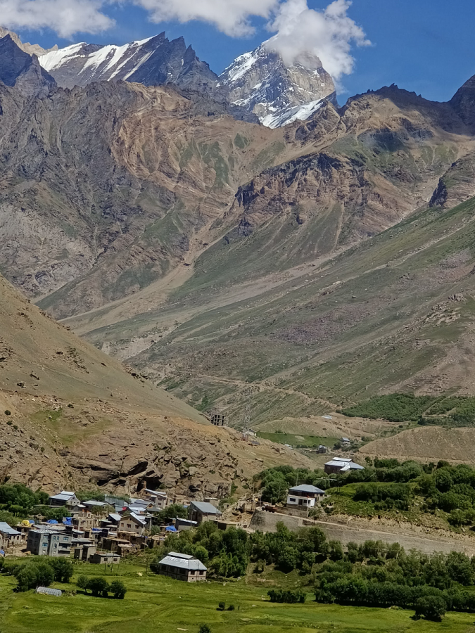
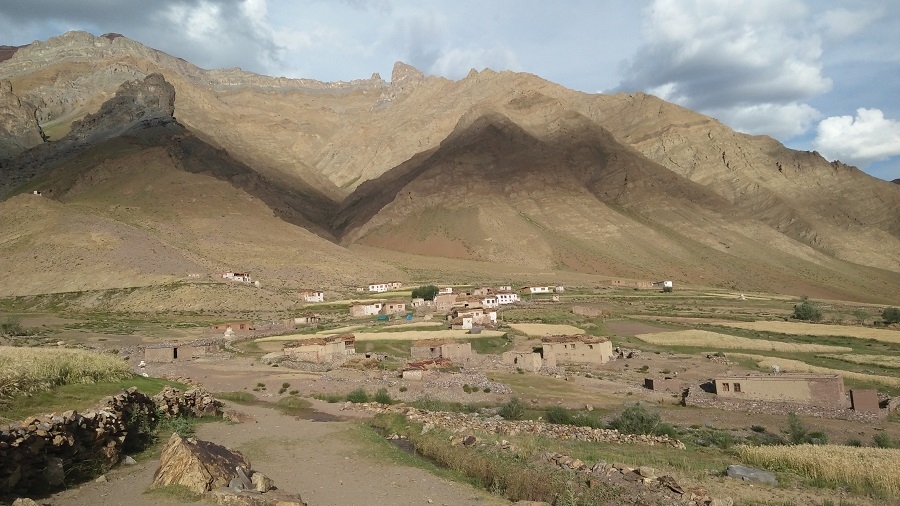
Leaving camp, you stroll easily down the left-hand side of the valley past some deserted houses and some unworked fields. Another hour from here brings you to the pretty village of Dibling where there are some 14 houses and a gompa. The monastery, as with virtually all Ladakhi villages, sits above the village and it is well worth the walk up to have a look around. It is a 75 year old, Yellow Hat temple (you are allowed to take photos inside), whose main figures are Shakyamuni Buddha, Chenrizig, Maitreya (Buddha of the future), and Zongkhapa (founder of the Gelukpa Yellow Hat Sect). It is indeed a pretty little village with substantial houses, nice chortens and surrounded by good fields. In fact, you may find that the village is empty as virtually everybody is out in the fields dealing with the harvest. Nevertheless, your Sirdar and his crew ought to be able to find somebody with a key to open up the temple for you to have a look around. That is, of course, if the resident monk is not 'at home'. It is quite incredible to think that this is the only village in this valley and that it is cut off from all other parts of Ladakh and Zanskar by very high passes. Again, it enjoys a Shangri-La setting and the people will have seen very few Westerners.
Leaving the village, you follow an improved footpath and after a while some parts of the path are exposed, exciting and dramatic. You should get into camp reasonably early today and could well have time for washing clothes, etc. You camp on a lovely area overlooking the river below next to a river coming in from the left. The Ladakhi word for river junction is "sumdo", hence this is the first sumdo beyond Dibling.
We follow the Oma Chu River (Oma - Milk, Chu - water), and many times the main River and side streams are crossed. At some stretches it's tricky to find a way. Keeping our pace on the valley floor continue to Lingshed Sumdo.
Day 10 - Trek Barmi la (4694m) – Lanang (4000m)
Leaving camp we take a narrow gorge coming from the left and a long climb to the small pass of Barmi La. Today an easy climb to the pass, The first view of Lingshed appears to sighted. The trail to the left goes to Lingshed village. We descend to Lanang also known as the base of Hanuma La. We take the time to visit Lingshed Gompa 4010m. We spend the morning hiking gently up the valley, heading towards the pass, and finally crest the Barmi La. After a rest on the pass, we contour down the hillsides, hues of reds and greens, and are treated to views over to Lingshed village and Lingshed Monastery (Gompa), backed by dramatic craggy rocks. We traverse and descend steeply down to our scenic campsite in a sheltered, sparkling valley below the Hanuma La. There are opportunities to hike up this narrowing valley in the afternoon, and possible blue sheep sightings, or just relax in this lovely spot and enjoy the surroundings.
You may encounter local people from the village of Dibling whose nearest place to shop is the village of Lingshed. It is some 9.5 km and three to 3.5 hours down the gorge to reach Lingshed Sumdo, 3,700m/12,139ft.
Distance: 16 km, 6 hours.
Day 11 - Trek Zingchen (3370 m) via Hanuma La (4700m)
Soon after camp long ascents towards Hunuma la pass 4800m. From the top of the pass panoramic view of Lingshed, Sengge la, and Ladakh Mountain ranges. This pass is a connecting point between Ladakh and Zanskar, then descent deep inside the hanging valley until Snertse. After Snertse's long descent towards Oma tokpo where we camp for tonight.
Day 12 - Trek Hanamur (3400 m) via Perfi La (3900m)
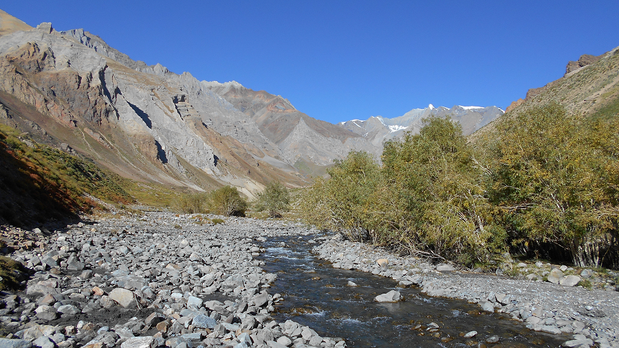
Crossing the Oma tokpo long ascent towards Perfi la 3950m. It’s the last pass between our first part of the trek Kanji - Padum. From the top, we will be rewarded with a great view of the Zanskar Mountains and could visible the Hanumil from the pass. Last patch we trek along the Zanskar River to the village of Hanumil and another comfortable campsite for tonight.
Day 13 - Trek Pidmo (3420m) – Zangla River camp.
Today after breakfast we follow the left bank of the Zanskar River on a relatively level path. We cross the village of Pidmo 3420m. A small village located beside the Zanskar River. Pidmo to Zangla is not so far to reach our campsite at Zangla River camp
Day 14 – Zangla River Camp, Optional central Zanskar Day Trip visit Thongde – Karsha – Sani - Padum (3,600m).
Today you have a choice either to have a full day rest at camp or a full-day culture tour around Padum by drive. Or this central Zanskar cultural tour you can make on Day 22 coming from Purne to Padum and visit the valley.
Day 15 - Trek Tsazar Doksa Sumdo (3,900 m).
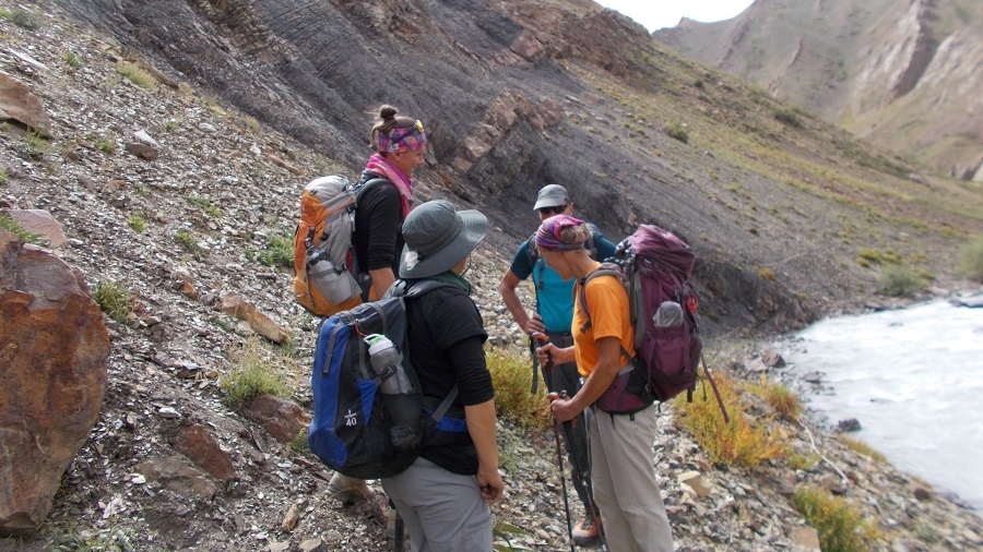
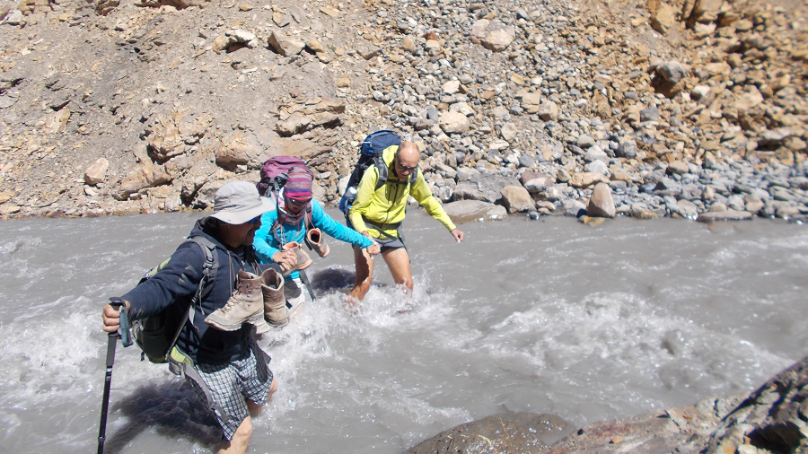
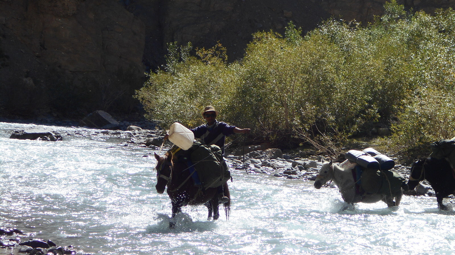
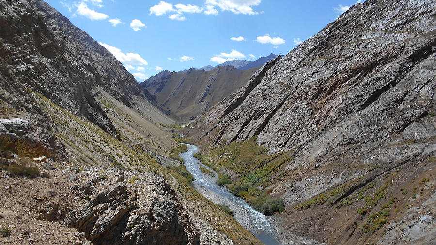
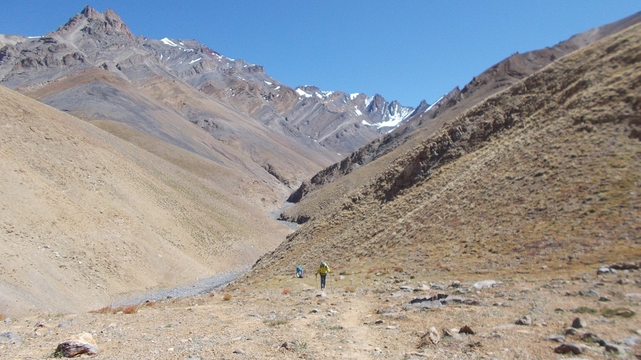
We start our second part of the wild route trek, a 7-day Himalayan trekking route. Where we cross rivers & streams numerous times and many of them are sandal and trekking poles day including today. through the colorful gorges and canyons from Zanskar and Zangla to the remote Shun Shade valley.
Leaving our Zangla campsite, we trek 45 minutes up to the Zangla Ani Gompa (nunnery), continue along the road past the once-impressive King of Zangla’s house, and then ascend for another half hour to the impressive Zangla Fort, home to the kings of Zangla of yore. The present King of Zangla is the same age as, and a friend of, HH the Dalai Lama.
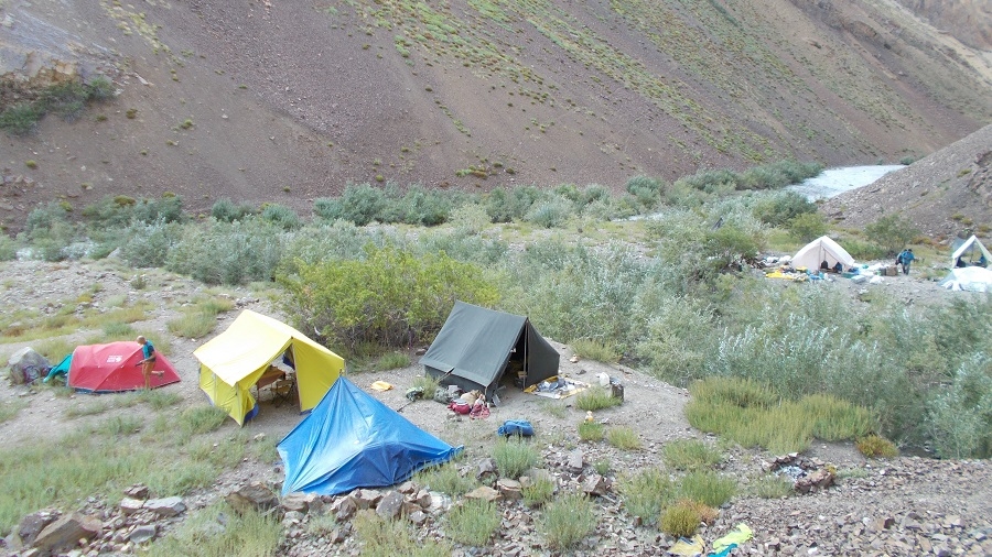
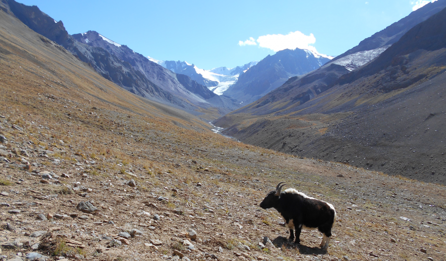
We walk along the irrigation ditch for a bit while descending and soon reach the green doksa of the Zangla people. From here we head left, or east, along the Zumlung Chu (river), crossing many times in the willow-shaded valley full of ancient beds of fossilized oysters. It should take us about five hours of hilly walking, with many river crossings, to reach our campsite, just past the turnoff (to the right) leading to the main Jumlam route and the Charchar La. Our camp at Tzazar Doksa is lovely and warm, surrounded by willows. After a wash in the stream right in front of us, take a 5-minute walk through seabuckthorn bushes to the doksa, and possibly a walk to the hill above camp for later afternoon sun. There are blue sheep and ibex in this valley, as well as (potentially) bears.
Day 16 - Trek Pandang La High camp (4,450 m).
Leaving Tsazar Doksa camp after breakfast, we follow the shimmering Zumlung Chu. The first two hours of trekking are easy, crossing the river many times in a magical valley that opens up as we head north. Note the amazing canyon on our left and the dramatic, soaring canyons in general as we hike today. At the second sumdo, or river junction, at 3950 meters, the trail narrows and we trek through a batch of seabuckthorn bushes, probably without the tart, orange berries just yet. This route is known by villagers from Tsazar just south of Zangla, who use the valley as their summer pastures.
Finally, we make a sharp right, cross the stream, and ascend steeply for a bit on a trail of loose scree and rocks, which eventually flattens out. Flowers and oases of trees appear in the stark landscape, softening it, and our trail becomes more gradual.
From here we have one last steep ascent through green pastures, passing several doksas, and staying on the steep ravine that drops down below us to our right. Blue sheep roam the hillsides. After about 45 minutes we reach our green Pangang La High Camp, with a very cold spring and incredible views including tomorrow’s Pandang La.
Day 17 - Trek Kharnak Sumdo River Camp (4,390m), Cross Pandang La (5,175m)
Leaving early from high camp to cross another high pass today, we start with a steep ascent through meadows colored with pink and red, the views increasingly spectacular as we look back to the craggy peaks of Zanskar behind us. We’ll trek for about 2 ½ hours to crest the Pandang La, where we’ll stop and admire the panorama of Himalayan peaks from this remote pass. The descent begins with an easy 20 minutes of contouring to the left, followed by a steeper descent down into the Niri Chu Valley. We’ll stop for lunch at the first green plateau about 45 minutes below the pass, or possibly at camp. From here, it’s half an hour to the green doksa near the river where the staff have set up a beautiful camp for the night. There is a lot to explore if you have the energy for some hiking above camp, across the river. Blue sheep roam the hillsides, and there is also lots of bird life, including hoopoes along the riverside amongst the collection of doksas.
Day 18 - Trek Mitsik Doksa (4,285 m), Cross Liyu La (4,375 m) & Lar La (4,690 m)
Leaving camp, we cross our river almost immediately and continue along the right banks of the river for half an hour on a relatively flat trail. At the confluence of this river and the Niri Chu, we pass by a large river valley to the left that leads to the nomadic region of Kharnak. We have to cross Niri Chu, and then continue to cross and re-cross this river throughout the morning, staying mostly at river level.
An adventurous and beautiful river day, with an incredible array of wildlife watching from the craggy hillsides, judging from the prints we encounter. Bear, wolf, snow leopard, blue sheep, and red fox are among the tracks that we generally encounter, an exciting route!
After about three hours of river hiking, we cross the small, intersecting stream coming from our left and climb for a short time to a grassy plateau. We soon reach Shade Pullu, another doksa, and then have 45 min – 1 hour of slightly exposed, high trails to reach the ridge-top Liyu La, a dramatic vantage point from where we look out to our next pass, the Lar La. 15 minutes of descent brings us to the Niri Doksa valley, from where we begin to climb again up this steep grazing ridge. The pass generally takes about 1 ½ hours to climb, the craggy rock outcropping at the top a welcome sight.
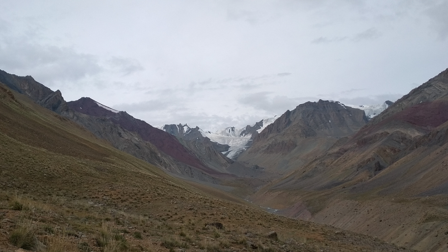
Our descent is another steep one as the valley drops right down to a green doksa called Mitsik Doksa. Mitsik Doksa is a wide flood plain along the river, absolutely wonderful, sometimes visited by locals from Shade on their way to or from a doksa. We’re right below tomorrow’s pass, the Rotang La, so we will arrive at Shade early enough to explore this wonderful, remote village.
Day 19 - Trek Shade (4,220 m) via Rotang La (4,900 m)
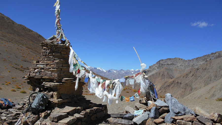
Today, after breakfast, leaving camp, it’s about a three-hour climb to the 4890m Rotang La from camp, hiking somewhat steeply past Rotang Doksa (4470m). where we might find some fresh sheep-milk yogurt if the villagers have camped here. From the doksa, the trail switchbacks a bit more gradually to the Rotang La. The descending valley on the Shade side is colorful in shades of yellows, oranges, and reds, and it’s a lovely and easy descent of about an hour to Shade. Just before the village, we pass an extensive collection of white-washed chortens.
Our campsite is just before Shade, on the only flat area next to a stream, a spot perfectly situated for washing, and for sunrise and sunset photos of Shade village and its patchwork of fields.
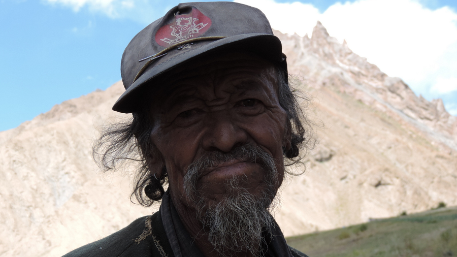
The village is a cluster of 14 traditional, closely packed Zanskari mud-brick houses, with corrals for the goats and sheep, grass drying on the rooftops, small vegetable gardens, and an idyllic atmosphere. There are approximately 95 inhabitants. We’ll visit some of the local houses for a glass of tea, chang (Tibetan barley beer), yogurt from the nearby doksa, or some churpi (dried cheese).
Shade is surrounded by extensive fields of barley, potatoes, sag, and snap peas and they also have greenhouses in which they grow radish, cilantro, cabbage, cauliflower, and carrots. There is a small school here that is desperately in need of supplies, so this is a good place to offload school supplies. Some of the locals stay up in the doksas north of our campsite, sometimes returning every few days and other times staying longer. The villagers rotate grazing their flocks and protecting them from the many wolves and snow leopards in the area.
Day 20 - Trek Yatah camp (4,000 m)
Today, leaving Shade village to our next remote campsite halfway between Phuktal. Setting off from Shade, a trail directly below the village, we pass through the entrance chorten and descend past the harvesting villagers for about 45 minutes to where the river plummets through a narrow gorge and the canyon closes in on us. At the intersection of the Niri Chu (river) we reach the village ‘lhatoo’ (4100 m). Turning left at the lhatoo, with the Niri Chu again far below us, we have about ten minutes of the slightly exposed trail as we head towards Trantrog Gompa (4020m). Soon the valley opens, the turquoise river takes wide S turns and our canyons become dramatic hoodoos over the riverbed. We can see the tiny hamlet of Trantog ahead, with its small gompa said to be either 30-40 or 750 years old.
From Trantog, we descend to the willow-lined Niri Chu which we cross , afterwards climbing on an exposed trail to a contouring trail high above the valley. Soon we reach ‘Trantog Sumdo’ (3960m) leading to the Shun Shade Valley. We contour on a wide trail above the Nialo Kontse Chu, which the river has become after the last intersection, for another 1 1/2 hours. We pass a new and an old bridge across the river, the old one an original rope bridge. Three ridges later we’ve reached Tsarap Sumdo (3920m), after which the trail becomes a bit more exposed. One steep drop, slightly exposed, a similar climb back up to the trail and it’s half an hour to camp at the high grazing pastures of Yatah. Yatah is about 150 meters above the trail to the right, an unexpected site after our narrow, steep-sided canyon, and it will take another half an hour to reach it.
Day 21 - Trek Phuktal (3,900 m), Drive Purne (3,800m)
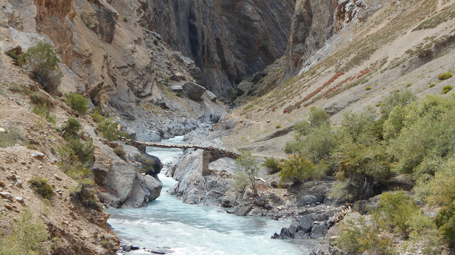
Leaving Yatah camp after breakfast, starting with a climb of 100m above camp to drop back down to the main trail. From the flags at the top of the ridge, we descend back down to meet the main trail at the point where a new, cantilevered bridge is being built. On the other side of this small gully, we contour on a good trail high above the Tsarap Chu and past several small doksa. There is a long, dusty, and hot climb to reach the Phuktal, exploring and visiting the Phuktal, a short descent to the bridge, crossing it and to the road, where our vehicle will be waiting for us and a short drive to Purne for overnight stay in homestay or camp.
Day 22 – Drive Padum (3600m), visit Bardan.
Today you have a short drive to Padum. The morning after breakfast leaving Purne drive to Raru, visit Bardan and check into hotel in Padum and afternoon free to relax and explore Padum bazaar. Or it is also possible to reach Leh in one day from Purne making it 7-8 hrs by car. Thus you have day 23 free day in Leh.
Day 23 – Drive Leh via Nyerak – Nimmu.
Early departure from Padum, so will have half day you relax at Leh. We take the newly constructed road Padum to Leh via Nyerak & Nimmu.
The northern terminus is located at Nimmu in Ladakh, about 35 km (22 mi) east of Leh. The distance from Nimmu via Padum to the southern terminus at Darcha in Himachal Pradesh is 297 km (185 mi). The road consists of three major sections: Nimmu – Padum, Padum – Shingo La, Shingo La – Darcha.
Distance: 191 km, 5 hrs.
Day 24 – Leh
Day 25 – Depart Leh.
Welcome
to Leh, after your long flight from your hometown to Delhi, and meet with us at
Leh airport. Most of the flight arrives in Leh in the morning time and the rest
of the day is free to relax and acclimatize to the altitude of 3,600 m as well
as visit the Leh bazaar.
Today, sightseeing around Leh, visit the Royal Palace of
Leh from the 16th century, and continue through the fields of Sankar monastery,
which adjoins north Leh. Continue to the Shanti Stupa and finally end your day
with a visit to Spituk Gompa. Our driver will pick you up from the hotel at
8:30 am after breakfast. Finish your day before lunch and you will have time to
go for lunch at Leh Market.
LEH PALACE
Leh Palace, also known as Lachen Palkar Palace, is a former royal
palace overlooking the city of Leh in Ladakh UT, India. It was constructed
circa 1600 AD by Sengge Namgyal. The palace was abandoned when Dogra forces
took control of Ladakh in the mid-19th century and forced the royal family to
move to Stok Palace. It is nine storeys high; the upper floors accommodated the
royal family, while the lower floors held stables and store rooms. Much of
the palace is in deteriorated condition, and little survives of its interior
decorations.
The Palace Museum holds a rich collection of jewellery, ornaments, ceremonial
dresses and crowns. Tibetan thangka or paintings, which are more than
450 years old, with intricate designs, still retain the bright colours derived
from crushed and powdered gems and stones. Structures around the palace's base
include the prominent Namgyal Stupa, the colourfully muraled Chandazik Gompa Avalokitevara,
and the 1430 Chamba Lhakhang (Maitreya
Buddha) with medieval mural fragments located between the inner and outer
walls.
SPITUK MONASTERY
Spituk Monastery, also known as Spituk Gompa or Pethup Gompa, is
a Buddhist monastery in Spituk, Leh, in Ladakh UT, 8 km from Leh. The
site of Spituk was blessed by the Arhat Nyimagung. It was founded by
Od-de, the elder brother of Lha Lama Changchub Od, when he came to Maryul in
the 11th century. He introduced the monastic community. When Lotsewa
(translator) Rinchen Zangpo came, he said that an exemplary religious
community would arise there, and so the monastery was
called spituk (exemplary). During the time of Dharma raja Gragspa
Bum-Ide, the monastery was restored by Lama Lhawang Lodos and the order of
Tsonkhapa was introduced and it has remained intact as such till present.
Founded as a Red Hat institution, the monastery was taken over by the
Gelugpa (Yellow Hat sect) in the 15th century.
The monastery is home to 100 monks and a giant statue
of Kali (unveiled during the annual festival).
Every year the Gustor Festival is held at Spituk
from the 27th to 29th day in the eleventh month of the Tibetan calendar.
A full day of sightseeing and visiting the most important
place in around the Indus Valley. You will have a guide for this day trip,
especially for Gompa. There are many places to visit but we have chosen five
sights which are suitable for a day trip. Leaving from the hotel at 8:30 am
after breakfast you will visit first Shey Palace, then Thiksey. Thiksey
monastery, which is at a distance of 27 km from Hemis, this monastery is the
oldest monastery of Gelugpa School in Ladakh. The great Lama Paldan Shesrap built
it in the 14th century. Here you can see the big statue of the Future Buddha.
Continue to Taktok and Chemdey and return to visit Hemis monastery which
is 45 km far from Leh and it takes a 90-minute drive. The great Mahasiddha
Staktsang Raspa along with great ancestor Singey Namgyal built this biggest
monastery in the 16th century. Continue to Matho then we drive to Stok which is
situated opposite Leh at a distance of 14 km, Stok visits of Royal Palace built
in 1825 AD and the palace has great collections of antiquity. Continue to visit
Matho situated 10 km from Stok, which has a 10th-century complex. Finally back
to Leh and final preparation for trek.
SHEY PALACE
Shey Monastery or Gompa or the Shey Palace are complex
structures located on a hillock in Shey, 15 kilometres (9.3 mi) to the
south of Leh in Ladakh Union Territory, northern India on the
Leh-Manali road. Shey was the summer capital of Ladakh in the past. It contains
a huge Shakyamuni Buddha statue. It is the second largest Buddha statue in
Ladakh.
The original palace, now in ruins, was built near the
Shey village by Lhachen Palgyigon, the king of Ladakh (then called Maryul),
in the 10th century. The Moghul noble Mirza Haidar Dughlat stayed
here during his invasion of Ladakh in the 16th century.
The current Shey Palace and Monastery were also built in
1655 on the instructions of Deldan Namgyal, in the memory of his late
father, Sengge Namgyal, below the first palace. The monastery is
noted for its giant copper with gilded gold statue of a seated Shakyamuni
Buddha. The statue is so named since Buddha was the sage (muni) of the Sakya people
who resided in the Himalayan foothills and their capital was Kapilvastu.
It is said to be the second largest such statue in Ladakh.
Shey was the old capital of the upper Ladakh region. When
the Dogras of Jammu invaded Ladakh in 1842, the Namgyals abandoned
the palace and fled to Stok (they made it their permanent residence) on
the opposite side of the Indus River. It is conjectured that the fort found in
ruins, not dated, above the present palace at Shey, belonged to this period of
invasion. Subsequently, when the political dictates necessitated shifting
of the capital to Leh, even then the importance of Shey continued since it was
a mandatory requirement of the Namgyal kings to father their heir apparent
here. Wikipedia…
THIKSEY MONASTERY
Thiksey Monastery or Thiksey monastery affiliated with the
Gelug school of Tibetan Buddhism. It is located on top of a hill
in Thiksey approximately 19 kilometres (12 mi) east of Leh, in
the Ladakh region of northern India. It is noted for its
resemblance to the Potala Palace in Lhasa Tibet, and is the largest monastery
in central Ladakh, notably containing a separate set of buildings for female
renunciates that has been the source of significant recent building and
reorganization.
The monastery is located at an altitude of 3,600 metres (11,800 ft) in the
Indus Valley. It is a twelve-storey complex and houses many items of Buddhist
art such as stupas, statues, thangkas, wall paintings and
swords. One of the main points of interest is the Maitreya Temple
installed to commemorate the visit of the 14th Dalai Lama to this
monastery in 1970; it contains a 15 metres (49 ft) high statue of
Maitreya, the largest such statue in Ladakh, covering two stories of the
building.
In the early 15th century, Je Tsongkhapa, the founder of the Gelug
School—often called "the Yellow Hats"—sent six of his disciples to
remote regions of Tibet to spread the teachings of the new school.
Tsongkhapa gave one of his disciples, Jangsem Sherap Zangpo (shes rab
bzang po), a small statue of Amitayus (the sambhogakaya form
of Amitabha), containing bone powder and a drop of Tsongkhapa's own blood.
Tsongkhapa directed him to meet the King of Ladakh with a message seeking his
help in the propagation of Buddhism.
The King, who was then staying in the Nubra Valley near Shey,
loved the gift of the statue. After this meeting, the King directed his
minister to help Sherab Zangpo to establish a monastery of the Gelug order in
Ladakh. As a result, in 1433, Zangpo founded a small village monastery called
Lhakhang Serpo "Yellow Temple" in Stagmo, north of the Indus. In
spite of his efforts, the lamas who embraced the Gelug order were initially
few, although some of his disciples became eminent figures over the years.
In the mid 15th century, Palden Zangpo continued the monastic work started by
his teacher, Sherab Zangpo. He decided to build a larger monastery here that
was dictated by an unusual event that occurred while choosing a site. Legends
narrate that Tsongkhapa had predicted that his doctrine would prosper on the
right bank of the Indus River. This prediction came true when the Thiksey
Monastery was established. This was followed by others such as Spituk Monastery and Likir
Monastery, which are also situated on the right bank of the Indus.
According to legend, Sherab Zangpo and Palden Zangpo were performing sacred
rituals near the Yellow Temple. The torma offerings were then taken
to a rock outcrop to be thrown down to the valley. As they were about to throw
the torma into the valley, two crows appeared and carried away the ceremonial
plate with the offering of torma. They then placed the torma at a location on
the other side of the hill. When Palden Zangpo and his disciples began looking
for the torma, they reached Thiksey, where they found that the crow had placed
the torma on a stone in perfect order and in an undisturbed
condition. Palden took this finding as a divine directive to build the
monastery there. Source Wikipedia…
STAKNA MONASTERY
Stakna Monastery or Stakna Gompa is a Buddhist monastery of
the Drugpa sect in Stakna, Leh, Ladakh Union Territory, northern
India, 21 or 25 kilometres from Leh on the left bank of the Indus River.
It was founded in the late 16th century by a Bhutanese scholar and saint,
Chosje Modzin. The name, literally meaning 'tiger's nose' was given because it
was built on a hill shaped like a tiger's nose. Of note is a sacred Arya
Avalokitesvara statue from Kamrum, Assam. Stakna has a residence of
approximately 30 monks.
It is the only Bhutanese Drukpa Kagyu monastery in Ladakh, headed by the Je
Khenpo in Bhutan, whereas the other Drukpa monasteries in Ladakh are of
the Gyalang Drukp's school, based at Hemis. This split in the Drukpa Kagyu
lineage occurred in the 17th century when there was a dispute over who was the
true reincarnation of the 4th Gyalwang Drukpa. Wikipedia…
HEMIS MONASTERY
Hemis Monastery is a Himalayan monastery (gompa) of the Drukpa Lineage,
in Hemis on the bank of the Indus River, Ladakh UT, India. Situated
45 km from Leh, it was re-established in 1672 by the Ladakhi king Sengge
Namgyal. The annual Hemis festival honouring Padmasambhava is held there
in early June.
Hemis village is located 40 km southeast of Leh on
Leh-Manali Highway and under-construction Bhanupli – Leh line. Hemis
Monastery existed before the 11th century.
In 1894 Russian journalist Nicalas Notovitch claimed
Hemis as the origin of an otherwise unknown gospel, the Life of Saint
Issa, Best of the Sons of Men, in which Jesus is said to have
travelled to India during his 'lost years'. According to Notovitch, the work
had been preserved in the Hemis library and was shown to him by the monks there
while he was recuperating from a broken leg, and his Sherpa guide
translated it for him. Notovich's version of the manuscript was translated
from Tibetan to Russian to French to English. However, historians view
Notovitch as having fabricated the evidence, which he allegedly admitted
himself. Bible scholar Bart D. Ehrman states that "Today there
is not a single recognized scholar on the planet who has any doubts about the
matter. The entire story was invented by Notovitch, who earned a good deal of
money and a substantial amount of notoriety for his hoax."
The Indian Pandit Swami Abhedananda claims to have read
the same manuscript and published his account of viewing it after his visit to
Hemis in 1921. Abhedananda claims on the book jacket that it was
translated for him with the help of a "local Lama interpreter", and
it substantially matched Notovich's publication. After Abhedananda's death, one
of his disciples said that when he went to the monastery to ask about the
documents, he was told that they had disappeared.
The Hemis Festival is dedicated to Lord Padmasambhava (Guru
Rinpoche), revered as the representative reincarnate of Buddha. He is believed
to have been born on the 10th day of the fifth month (non or jyestha) of the
Monkey year of the Tibetan calender, as predicted by the Buddha Shakyamuni. It
is also believed that his life mission was, and remains, to improve the
spiritual condition of all living beings. Therefore, on this day, which comes
once in a cycle of 12 years, Hemis observes a major extravaganza in his memory.
The observance of these sacred rituals is believed to provide spiritual
strength and good health. The Hemis festival takes place in the rectangular
courtyard in front of the main door of the monastery. The space is wide and
open, save for two raised square platforms, three feet high with a sacred pole
in the center. A raised dais with a richly cushioned seat, a finely painted
small Tibetan table, and ceremonial items – cups full of holy water, uncooked
rice, and tormas made of dough and butter, along with incense sticks – are
placed. A number of musicians play traditional music with four pairs of
cymbals, large-pan drums, small trumpets, and large-sized wind instruments.
Next to them, a small space is assigned for the lamas to sit.
The ceremonies begin with an early morning ritual atop
the gompa, where, to the beat of drums, the resounding clash of cymbals, and
the spiritual wail of pipes, the portrait of "Dadmokarpo" or
"Rygyalsras Rinpoche" is ceremoniously displayed for all to admire
and worship.
The most esoteric festivities include the mystic mask
dances. The mask dances of Ladakh are collectively referred to as chams
performances. Chams performances are essentially part of the Tantric tradition,
performed only in those gompas that follow the Tantric Vajrayana teachings,
and the monks perform tantric worship. Wikipedia…
MATHO MONASTERY
Matho Monastery, or Matho Gonpa or Mangtro
Monastery or Mangtro Gonpa, from the Tibetan "mang" that
means "many" and "tro" that means "happiness", is
a Tibetan Buddhist monastery located 26 kilometres southeast of Leh
in Ladakh UT, northern India, on the banks of the Indus River. The
village of Matho is located at the mouth of a deep gorge running out of
the Zanskar Range and across the Indus. It is directly opposite Thikse Monastery.
Matho and Skidmang in the eastern Ladakh (130 km to
the east of Leh) are the only example in Ladakh of the Sakyapa sect
of Tibetan Buddhism. Because Matho does not lie on the main highway from Leh,
it sees fewer visitors than Hemis, Thiske or Shey. However, it is known to
outsiders for its annual Oracle Matho Nagrang Festival, held on the 14th and
15th days of the first month of the Tibetan calendar. During this festival, two
oracles, known as "Rongtsan", are said to inhabit for a few hours the
body of two monks. The purpose of these oracles is to attempt to predict the
fortunes of the local village communities for the coming year. Two monk that
are to be the oracles vehicles are chosen every three years by the monks of the
monastery for a duration of 3 years. The first year the monks will have to
meditate for 9 months before the festival. The following two years the meditation
will last 2 months. When the two monk come out from the retreat, all the monks
will gather together to form a circle. The names of the two monks will be
placed in a bowl. The bowl is then sealed and passed from one monk to the next
until one name comes out from the bowl - this monk is chosen by the monastery's
protector to perform the oracle.
Matho is also home to a collection of thangkas dating
back to the 14th century.
Founded in 1410 by Lama Dugpa Dorje, it belongs to the Sakya Order.
It is noted for its six-hundred-year-old thangkas and its Matho
Nagrang Festival.
The gompa is the only one in Ladakh belonging
to the Sakyapa and is said to be one of the few which is seeing an increase of
monks in recent years.
Most of the buildings are rather dilapidated but there is
a new assembly hall or du-khang which was built in 2005 and which has
very colourful paintings and a Sakyamuni Buddha as main statue. There is a
small chapel on the top story containing images of Sakya Pandita and
other Sakya lamas. There is a 'museum' adjoining it with a number of very
beautiful old thangkas, some of which are thought to have been brought
from Tibet in the first half of the 15th century when the monastery was
founded. Unfortunately, many of them are very worn. The masks and robes worn by
the lamas in the annual dance festival may also be seen in the museum.
The annual festival of the two Rongtsan oracles takes place around the Buddhist
new year, usually in the first half of March. Two monk are chosen every three
years to get ready as the potential receptacles. They purify themselves with
months of fasting and meditation to make themselves suitable receptacles for
receiving the oracles spirits. When possessed they are said to be able to perform
many astounding feats such as cutting themselves with knives and walking around
the ramparts of the top storey blindfolded with no fear of falling down the
precipice below. While in this trance state they answer questions about the
prospects for Matho and Ladakh for the coming year as well as personal
questions put to them by individuals. However, if skeptical questions are put
to the oracle to test him, he is said to react "with a frenzied display of
anger."
Today we board our private vehicle and drive to the
timeless Lamayuru Gompa en route first visit to Likir than Alchi Gompa,
situated at a distance of 68 km from Leh. Its monastery was built on lowlands
rather than on a hilltop as others are, to protect from enemies. The Chortens
around Alchi Gompa contains numerous murals of Lotsava Rinchen Zangpo, who
built this monastery. Alchi monastery has vast collections of wall paintings
and wood sculptures. We continue to drive to Lamayuru which is 58 km from
Alchi. The oldest monastery in Ladakh was founded by Indian scholar
Mahasiddhacharya Naropa in the 11th century. Lamayuru hosts a mask dance
festival (Yuru Kabgyat) during the 17th and 18th day of the fifth months of the
Tibetan Lunar calendar. It belongs to the red hat sect of Tibetan Buddhism; the
monastery is rich with Thankas and wall paintings. Lamayuru monastery was
constructed by Arahat Nimagung between the 10th and 11th centuries. History
says that in the 11th century, the Mahasidha Naropa visited this place and the
cave where he resided and meditated is still to be seen inside the monastery.
This is mostly visited by travelers located on the Srinagar - Leh road. Enjoy
homestay at Lamayuru or Mulbekh.
MULBEKH MONASTERY (GOMPA) 3505m
“Mulbekh Monastery (Gompa) consists of the 9m tall Maitreya Buddha statue, the
1400 CE kharosti language edicts on the hill, and two 800 years old gompas,
Serdung Gompa of Drukpa lineage and Rgaldan-se Gompa of Gelugpa. Rgaldan-se
Gompa, established by Tungba Lzawa who is also known as Agu Tungba, was
renovated in 2016. The Nyima Lhakhang temple was built around 800 years ago in
the oldest section of the Mulbekh Monastery by the students of the great
Tibetan scholar Lotsawa Rinchen Zangpo, and houses Lhakhang, or sacred objects.
The double gompas are dramatically situated at the very top of a crag 200m
above the road. They were connected with the nearby palace of Raja Kalon of
Mulbekh, rreached by a steep footpath winding up from behind.
Mulbekh Chamba | The Chamba is one of the three tallest rock cut relief statue
of Buddha in Ladakh, which are collectively also known as the “Bamyan Buddhas
of Ladakh”. The famous rock cut Chamba Statue in Mulbekh village, a striking
enormous figure carved into the rock face on the right hand side of the road.
It is a 9m tall Maitreya Buddha (Buddha who will be reborn, also called the
“chamba” in local language) statue overlooking the old trade route and modern
highway. It dates to the Kushan period dating to 1st century BC to 6th century
CE, predating Tibetan Buddhism and now-destroyed 6th century Buddhas of Bamiyan
of Afghanistan. Modern scholars date it as being from around the eighth
century. Unfortunately, the lower part of the statue is partly obscured by a
small temple built in 1975.
Nearby are some ancient rock inscriptions or edict
written in Kharosthi script that issue an edict to the local people to
discontinue sacrificing goats. The edit was written by King Bhum Ide
(Tsongkapa), who ruled western Ladakh around 1400 CE. His younger brother,
Dragspa, ruled the rest of Ladakh. Tsongkapa, called Bhum Ide, was a king and
great reformer of Buddhism who lived in Ladakh from 1378 – 1441 CE, and set up
monasteries near Leh at Spitok, Sangkar, Phyang and Trigtse. He removed the
discrepancies from the current practices, and made the monks switch from Red
Hat sect to Yellow Hat sect. One of his successors, King Trashi (1500 -1530
CE), also made it mandatory for Ladakhi families to send at least one or two
children to become monk who did not have to be the eldest child.
Every year at least once or twice in each
village the heart was torn out of a living goat in front of an altar. King Lde
had the following inscription carved: “Oh Lama (Tsongkapa [1378-1441), take
notice of this! The king of faith, Bum lde, having seen the fruits of works in
the future life, gives orders to the men of Mulbe to abolish, above all, the
living sacrifices, and greets the Lama. The living sacrifices are abolished.”
The people of Mulbekh found this too onerous to follow, for beside King Lde’s
edict, on the same rock, is an inscription saying the order was too hard to be
executed. “For what would the local deity say, if the goat were withheld from
him?” – Wikipedia
Distance Driving: 179km, 5-6 hrs drive) (B, L, D)
Leaving Mulbekh, we drive 35 km following the Wakka Chu
to the road just before Kargil from where we turn left. The journey from Kargil to Rangdum is
a scenic traverse through the Suru Valley, serving as the gateway to the
Zanskar region. The distance is approximately 130 km. Typically takes 4–6
hours by car, though it can take longer for photographers or due to road
conditions. The road stretch from Kargil to Rangdum is generally smooth and tarred.
The route is known for its dramatic transitions from lush green valleys to
desolate mountain landscapes. Sankoo & Kartse Khar: Famous for a
7-meter tall rock-carved Maitreya Buddha statue dating back to the
7th or 8th century. Panikhar & Parkachik, these villages offer stunning
views of the Nun (7,135m) & Kun (7,077m) peaks, the highest in the
Zanskar range. Parkachik Glacier, A massive glacier visible directly from
the road. Rangdum is a small, remote settlement located at an altitude of
approximately 3,657 meters (12,000 ft). Rangdum Monastery: An
18th-century Gelugpa monastery perched on a hilltop that resembles a sugarloaf.
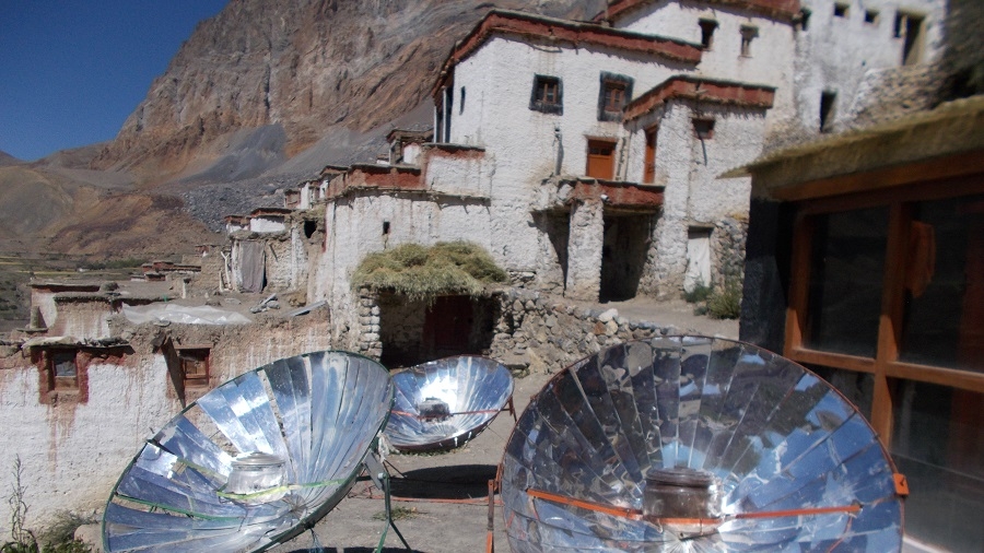
RANGDUM MONASTERY (GONPA)
Rangdum Monastery is a Tibetan Buddhist monastery belonging to the
Gelugpa sect, situated on top of a small but steep sugarloaf hill at an
altitude of 4,031 m (13,225 ft) at the head of the Suru Valley, in Ladakh.
It is next to the tiny village of Julidok (Zulidok), and about 25 km north
of the 4,400 m (14,436 ft) Pensi La (pass), which leads into
Zanskar. It is on Padum – Sankoo - Kargil Road, 103 km northwest
of Padum, 87 km southeast of Sankoo & 196 southeast of Kargil. The
monastery was electrified using solar energy in June 2017 by Global Himalayan
Expedition (GHE). According to an inscription the monastery was built by Gelek
Yashy Takpa during the reign of King Tsewang Namgyal (1753-1782) of
Ladakh. Although it is physically in the Suru Valley, it is culturally part of
Zanskar.
Because the summer's brevity sometimes interferes with crop harvests, to
supplement the locally produced dairy products, both the village and the
monastery depend on outside supplies brought up the largely barren Suru Valley,
or over the 4,400 metre (14,436 ft) Pensi La pass from Zanskar. The
monastery was electrified using solar energy in June 2017 by Global Himalayan
Expedition, along with the nearby village of Shakma Karpo. The first two female
engineers of the region trained by Barefoot College and GHE executed the
project.
The monastery is home to about 30 monks and almost as many donkeys. To
ensure income for the nearby local communities, GHE has set up homestays in the
villages, allowing travelers to visit the monastery while experiencing an
authentic culture in the homestays.
After breakfast start trekking up the large valley
heading east-northeast, which leads to the Kanji La. This is the way you will
follow, but instead of crossing the Kanji La, you turn off to go over the
Pudzong La Pass. For the first hour, or so, you walk on the riverbed and then
the path gradually contours up the right-hand mountain-side. A huge, contorted
cliff appears on the other side, thousands of feet high. Then below you,
instead of sloping banks leading to the river plain, the river emerges from a square-cut
gorge. This box canyon is made up of glacial deposit which the river, over
millennia, has cut through. Your path has contoured the mountainside well above
this. You may hear lots of squeaking marmots and see eagles soaring above. The
gorge below is certainly very impressive and after some time, you will see an
equally impressive side gorge entering from the other side of the river. After
three hours, you stop for lunch at some old shepherds' stone huts, and one hour
after that there is an easy river crossing.
There is a camp just before the Kanji La turn off, but
this is very small and not suitable for a group with a number of tents, so it's
much better to continue to a nicer and far more spacious camp another 3 hours
or so up the valley. You will therefore continue to contour along parallel to
the gorge below, with the path rising slightly. In about 40 minutes you will
reach the Kanji La junction and 20 minutes or so beyond here, look back and you
will see framed in the end of the valley magnificent views of the peaks of Nun
and Kun.
Distance 12 km, 6 hrs trek
Soon
after leaving the camp, we cross the large river right as we leave our
campsite. Heading to the right at river level and joining the main trail coming
from Dibling.
We continue to contour, staying high through grassy, rocky hillsides with marmots
sticking their heads out of their holes, sunning themselves on rocks, and
whistling at our approach, the valley decorated with colorful mountain flowers.
It’s a 1½ hour's hike to the intersection of the route to Dibling (at our old
campsite across the river), the ‘sumdo’ of two major river valleys. We
continue along a similar trail and reach a smaller valley where we descend,
cross a small stream, and then hike back up. The valley is rockier and more
undulating, and we soon see our campsite across a wide valley in front of us.
But before reaching it, though, we have to descend again to a surging river and
try to cross on an old bridge, often washed away. One more climb and we’ve
reached our lovely campsite atop a relatively flat plateau, a snowcapped valley
to our right.
This is an amazing day! From Camp you turn up a
stunningly beautiful valley with a snake-like stream coming down from a wall of
snow-covered peaks at the end. You toil up the right-hand side of the valley
wondering where the hell the pass is. It looks seriously difficult ahead, but
in fact the pass itself is hidden out of sight. You carry on now to a shoulder
which provides quite a nice rest spot and then descend to the river bed. This
is about one and a half hours from Hell Camp. You now have to cross the stream
several times, but at this time of the year it should be just easy
boulder-hopping. You are now in the upper part of the valley and you may well
come across snow banks covering the stream. Eventually, you exit the rocky
river bed, finally climbing to a shoulder where some years there is the start
of the snow approaching the pass. By now you will be able to see that your path
leading to the pass is either an easy trail on broken shale or an easy
snow-slog. Crampons and ice axes are unnecessary and it is unlikely you will
need gaiters. 3 km distance from camp to pass with a 500m gain.
So having taken three hours to get to the pass, it is now
only a two hour descent to the valley some 900m/3,000ft below. Leaving the
pass, snow slopes and then rocks lead to a gulch down which the zigzag path
brings you out past fantastic pale gold rock walls and towers on either side to
the wide valley. There are breathtaking views looking right down the sweeping
valley to where you are going to camp tonight. We should say here also that the
views from the Pudzong La are superb - snowy peaks in every direction. You will
stop for lunch once out of the steeper sections although it may be cold and
windy and you may wish to hurry on. The camp is at 4,150m/13,616ft amongst an
area of clumpy small trees and bushes between the junctions of two streams,
with fabulous views. Ahead, and framed at the end of the valley, is a distant
pointed rock peak.
Leaving camp, you stroll easily down the left-hand side
of the valley past some deserted houses and some unworked fields. Another hour
from here brings you to the pretty village of Dibling where there are some 14
houses and a gompa. The monastery, as with virtually all Ladakhi villages, sits
above the village and it is well worth the walk up to have a look around. It is
a 75 year old, Yellow Hat temple (you are allowed to take photos inside), whose
main figures are Shakyamuni Buddha, Chenrizig, Maitreya (Buddha of the future),
and Zongkhapa (founder of the Gelukpa Yellow Hat Sect). It is indeed a pretty
little village with substantial houses, nice chortens and surrounded by good
fields. In fact, you may find that the village is empty as virtually everybody
is out in the fields dealing with the harvest. Nevertheless, your Sirdar and
his crew ought to be able to find somebody with a key to open up the temple for
you to have a look around. That is, of course, if the resident monk is not 'at
home'. It is quite incredible to think that this is the only village in this
valley and that it is cut off from all other parts of Ladakh and Zanskar by
very high passes. Again, it enjoys a Shangri-La setting and the people will
have seen very few Westerners.
Leaving the village, you follow an improved footpath and
after a while some parts of the path are exposed, exciting and dramatic. You
should get into camp reasonably early today and could well have time for
washing clothes, etc. You camp on a lovely area overlooking the river below
next to a river coming in from the left. The Ladakhi word for river junction is
"sumdo", hence this is the first sumdo beyond Dibling.
We
follow the Oma Chu River (Oma - Milk, Chu - water), and many times the main
River and side streams are crossed. At some stretches it's tricky to find a
way. Keeping our pace on the valley floor continue to Lingshed Sumdo.
Leaving
camp we take a narrow gorge coming from the left and a long climb to the small
pass of Barmi La. Today an easy climb to the pass, The first view of Lingshed
appears to sighted. The trail to the left goes to Lingshed village. We descend
to Lanang also known as the base of Hanuma La. We take the time to visit
Lingshed Gompa 4010m. We spend the morning hiking gently up the valley, heading
towards the pass, and finally crest the Barmi La. After a rest on the pass, we
contour down the hillsides, hues of reds and greens, and are treated to views
over to Lingshed village and Lingshed Monastery (Gompa), backed by dramatic
craggy rocks. We traverse and descend steeply down to our scenic campsite in a
sheltered, sparkling valley below the Hanuma La. There are opportunities to
hike up this narrowing valley in the afternoon, and possible blue sheep
sightings, or just relax in this lovely spot and enjoy the surroundings.
You may encounter local people from the village of Dibling whose nearest place
to shop is the village of Lingshed. It is some 9.5 km and three to 3.5 hours
down the gorge to reach Lingshed Sumdo, 3,700m/12,139ft.
Distance: 16 km, 6 hours.
Soon
after camp long ascents towards Hunuma la pass 4800m. From the top of the pass
panoramic view of Lingshed, Sengge la, and Ladakh Mountain ranges. This pass is
a connecting point between Ladakh and Zanskar, then descent deep inside the
hanging valley until Snertse. After Snertse's long descent towards Oma tokpo
where we camp for tonight.
Crossing
the Oma tokpo long ascent towards Perfi la 3950m. It’s the last pass between
our first part of the trek Kanji - Padum. From the top, we will be rewarded
with a great view of the Zanskar Mountains and could visible the Hanumil from
the pass. Last patch we trek along the Zanskar River to the village of Hanumil
and another comfortable campsite for tonight.
Today
after breakfast we follow the left bank of the Zanskar River on a relatively
level path. We cross the village of Pidmo 3420m. A small village located beside
the Zanskar River. Pidmo to Zangla is not so far to reach our campsite at
Zangla River camp.
Zangla Village & Fort
Climbing gradually out of our campsite, hike along the plateau past a weathered
rock carved with thousand-year-old Mon chortens, soon reaching Zangla Chomo
Gompa (nunnery) to the northern side of the village. Follow the village road
past the King of Zangla’s house, where our Kamzang Journeys group had tea one
summer with the royal residents, including the Queen Mother. The King of
Zangla, Gyalthes Nima Norboo Namgial Ldey, of the Sonsten Gampo lineage, is the
same age as the Dalai Lama (early 80s). Songsten Gampo was the great 7th
century Tibetan king who unified much of Tibet, encouraged the spread of
Tibetan Buddhism and was the patron of the creation of the Tibetan script. He
had two wives, one Chinese and the other Nepali. The king’s family is also of
the Nyimagon lineage, a Tibetan king from the 11th century whose youngest of
three sons, Ldey Tsugon, ruled Zanskar, Lahoul and Spiti. The other two sons
ruled areas of western Tibet (Guge, Purang) near Mount Kailash.
We sometimes met the king in Zangla, and one year drove
him to and from Padum, obtaining a group photo with the staff on the return
trip. He was the same age as the Dalai Lama, a friend of his, but he has since
passed away. The King’s house now has a new horse stable in front, and the new
house right next to the somewhat dilapidated royal residence is the house of
the village carpenter. The piece de resistance of Zangla, however, is its
fortress, presently being restored by an organization called ‘Cosmos Room’. The
ruins of the 900-year-old Zangla Fort, the old dzong (palace fortress) of the
ancient Kings of Zangla, are a breathtaking site, built precariously on top of
a ledge of rock at the intersection of the Zanskar River and the small river
leading out to the Jumlam, or middle route. This route was an autumn trading
route to avoid the high passes of Ladakh, and must have been open to invasions,
thus the fort and series of lookout towers down the Jumlam valley. The dzong
houses a wonderful prayer room, which we happened upon a few years ago. In
2005, over two straight weeks of continuous rain and wind literally ‘melted’
the dzong, and it is now quite as safe as it was previously. The famous
Hungarian scholar Alexander Csoma de Koros spent a winter in the
19th century studying Tibetan in order to make a dictionary in a room in
the fort, now commemorated as his room. The fort is guarded over by a giant,
new stupa built in 2009, while more ancient chortens with tsatsas in the niches
line the trail as we descend back to the village and eventually to camp.
Mons
“Mons of the Khesa race were dominant in the past in the region of western
Himalayas. The Mons have been Buddhist in the region from the time of the
Kushan dynasty, established by Emperor Kanishka. Mons, the dominant population
in the Zanskar valley, and are said to belong to an Aryan race linked to
Kaniskha’s period as their features do not match those of the local tribes or
the Mongolians. The Mons are credited with building 30 monasteries, chortens
and temples, including Karsha, Testa, Muni, Phuktal, Pune, Bardal, Padum,
Pipting, Stonde, Zangla, and Lingshot. – Wikipedia
Today you have a choice either to have a full day rest at
camp or a full-day culture tour around Padum by drive. Or this central Zanskar
cultural tour you can make on Day 22 coming from Purne to Padum and visit the
valley.
Sani Gompa 3670m
1000-year-old Sani Gompa is situated on the Stod River along the road to
Rangdum and the Suru Valley. Sani is a Drukpa Kargyu gompa with several
resident nuns living in the monastery. The monastery is renowned for its unique
Kanika Chorten, presumed to date back to the time of the famous Kushan emperor,
Kanishka (Kanika is the English transliteration of the emperor’s name) who
lived around 127 CE. Kanishka is well known in Buddhist literature as the
promoter of Buddhism in this region, sponsoring a significant Buddhist
conference in Kashmir.
“Padmasambhava, or Guru Rinpoche, is said to have dwelt
for five years in the small ‘Gamshot Lhakang’ squeezed between the main
building and the corridor, to the right of the Kanika chorten. Inside may be
seen a figure of Guru Rinpoche and historical scenes in half relief on both
sides of the statue. Apparently, one can just see the white opening
to a cave in a cliff across the river from the monastery where Padmasambhava is
also said to have meditated for several years and it is still used as a
meditation cell. The monastery is also claimed to be connected with the famous
Indian Yogi Naropa (956-1041 CE). There is now small room next to the Kanika
chorten where it is thought that Naropa meditated in which there is a veiled
bronze statue of the yogi. A group of Kargyu nuns established a small retreat
centre at ‘Starkhugnza’ in the 1990s. It is a site above Sani which was founded
by Ngawang Tsering (1657-1732), a famous Zanskar meditator. All of the nunneries
in Zanskar are under the spiritual authority of the monks and few have much in
the way of endowments.” – Wikipedia
Karsha Gompa 3690m
Karsha is the largest, most important, and possibly the most scenic monastery
in Zanskar, built high up into the cliffs above the village of Karsha. The
monastery is said to be founded by Guru Rimpoche, or Padmasambhava, and is
under the control of the Ngari Rimpoche (the younger brother of HH the Dalai
Lama. A fire recently burned down the kitchen, but a new, larger kitchen was
rebuilt. The inside of the main assembly hall is purely Tibetan Buddhist, with
ancient murals on the walls, priceless Buddhist statues, and ancient rock
carvings nearby. There are about 100 resident monks at the monastery, and also
houses the nearby Dorje Zong nunnery nearby.
“Karsha Gompa was founded by the translator Phagspa
Shesrab, and the monastery is also known by the name Karsha Chamspaling. The
oldest remaining structure, an Avalokiteshvara temple, Chuk-shik-jal, contains
wall paintings which seem to associate it with the era of Rinchen Zangpo
(958–1055). Behind the Ngari Rimpchoche’s seat in the chapel is a statue of
Lhaso Cho Rinpoche, brought from Lhasa in the 1960s, with a golden crown
decorated with carnelian and turquoise. The most important festival, known as
the Karsha Gustor, is held around January, with masked cham dances. A chorten
in the precincts of Karsha monastery houses the mummified body of an incarnate
lama called the Rinchen Zangpo, sealed in a silver-lined wooden box. Karsha
Gompa overlooks the 3-armed valley, with Karsha village in foreground, and sits
at the confluence of the Lungtsi River and the Dodi valleys. The Doda River
flows past the monastery from its source at the Drang Drung Glacier of the
Pensi La. The Zanskar River takes a turn at Karsha, and flows in a
northwesterly direction, eventually joining the Indus River near Nimmu in
Ladakh.
Dorjee Zong Nunnery, founded in the 14th century and
one of the oldest monastic centers in Zanskar, is located at the top of the
valley, and features a sacred image of 11-headed Avaloketeshvara.” – Wikipedia
Stongde Gompa 3815m
Stongde Gompa, one of the oldest in Zanskar, was built in 1052 by Naropa’s
disciple, the famous translator Lama Marpa, and taken over by the Gelugpa in
the 15th century, with Je Tsongkhapa as its present head. Stongde is the
second largest monastery in Zanskar, with approximately 60 monks and many
students, renowned for its Gustor Festival during the summer.
After the climb to the gompa, climb to the
monastery roof for wonderful views of the patchwork of Stongde village and the
Zanskar valley. It’s one of the most lively and colorful monasteries, perched
precariously up on a craggy rock ledge, and surrounded by lovely birch woods.
We has many friends there, including Geshe Lobsang who lectures and travels
around the world, and founded the monastic school. Geshe Stenzin and his
brother, are also good friends; they might invite us for tea and give us a tour
of the gompa, including its room of treasures in back of the oldest ‘lhakhang’,
or prayer hall. You might be able to catch the evening puja in the butter-lamp
lit prayer room if you do the trip in reverse, a surreal experience with
resonating, deep chanting, cymbals, Tibetan drums, a step back hundreds of
years.
We start our second part of the wild route trek, a 7-day
Himalayan trekking route. Where we cross rivers & streams numerous times
and many of them are sandal and trekking poles day including today, through the
colorful gorges and canyons from Zanskar and Zangla to the remote Shun Shade
valley.
Leaving our Zangla campsite, we trek 45 minutes up to the
Zangla Ani Gompa (nunnery), continue along the road past the once-impressive
King of Zangla’s house, and then ascend for another half hour to the impressive
Zangla Fort, home to the kings of Zangla of yore. The present King of Zangla is
the same age as, and a friend of, HH the Dalai Lama.
We walk along the irrigation ditch for a bit as we descend and soon reach the green doksa of the Zangla people. From here
we head left, or east, along the Zumlung Chu (river), crossing many times in
the willow-shaded valley full of ancient beds of fossilized oysters. It should
take us about five hours of hilly walking, with many river crossings, to reach
our campsite, just past the turnoff (to the right) leading to the main Jumlam
route and the Charchar La. Our camp at Tzazar Doksa is lovely and warm,
surrounded by willows. After a wash in the stream right in front of us, take a
5-minute walk through seabuckthorn bushes to the doksa, and possibly a walk to
the hill above camp for later afternoon sun. There are blue sheep and ibex in
this valley, as well as (potentially) bears.
Leaving Tsazar Doksa camp after breakfast, we follow the
shimmering Zumlung Chu. The first two hours of trekking are easy, crossing the
river many times in a magical valley that opens up as we head north. Note the
amazing canyon on our left and the dramatic, soaring canyons in general as we
hike today. At the second sumdo, or river junction, at 3950 meters, the trail
narrows and we trek through a batch of seabuckthorn bushes, probably without
the tart, orange berries just yet. This route is known by villagers from Tsazar
just south of Zangla, who use the valley as their summer pastures.
Finally, we make a sharp right, cross the stream, and
ascend steeply for a bit on a trail of loose scree and rocks, which eventually
flattens out. Flowers and oases of trees appear in the stark landscape,
softening it, and our trail becomes more gradual.
From here, we have one last steep ascent through
green pastures, passing several doksas, and staying on the steep ravine that
drops down below us to our right. Blue sheep roam the hillsides. After about 45
minutes, we reach our green Pangang La High Camp, with a very cold spring and
incredible views, including tomorrow’s Pandang La.
Leaving
early from high camp to cross another high pass today, we start with a steep
ascent through meadows colored with pink and red, the views increasingly
spectacular as we look back to the craggy peaks of Zanskar behind us. We’ll
trek for about 2 ½ hours to crest the Pandang La, where we’ll stop and admire
the panorama of Himalayan peaks from this remote pass. The descent begins with
an easy 20 minutes of contouring to the left, followed by a steeper descent
down into the Niri Chu Valley. We’ll stop for lunch at the first green plateau
about 45 minutes below the pass, or possibly at camp. From here, it’s half an
hour to the green doksa near the river where the staff have set up a beautiful
camp for the night. There is a lot to explore if you have the energy for some
hiking above camp, across the river. Blue sheep roam the hillsides, and there
is also lots of bird life, including hoopoes along the riverside amongst the
collection of doksas.
Leaving camp, we cross our river almost immediately and
continue along the right banks of the river for half an hour on a relatively
flat trail. At the confluence of this river and the Niri Chu, we pass by a
large river valley to the left that leads to the nomadic region of Kharnak. We
have to cross Niri Chu, and then continue to cross and re-cross this river
throughout the morning, staying mostly at river level.
An adventurous and beautiful river day, with an incredible
array of wildlife watching from the craggy hillsides, judging from the prints
we encounter. Bear, wolf, snow leopard, blue sheep, and red fox are among the
tracks that we generally encounter, an exciting route.
After about three hours of river hiking, we cross the
small, intersecting stream coming from our left and climb for a short time to a
grassy plateau. We soon reach Shade Pullu, another doksa, and then have 45 min
– 1 hour of slightly exposed, high trails to reach the ridge-top Liyu La, a
dramatic vantage point from where we look out to our next pass, the Lar La. 15
minutes of descent brings us to the Niri Doksa valley, from where we begin to
climb again up this steep grazing ridge. The pass generally takes about 1 ½
hours to climb, the craggy rock outcropping at the top a welcome sight.
Our descent is another steep one as the valley
drops right down to a green doksa called Mitsik Doksa. Mitsik Doksa is a wide
flood plain along the river, absolutely wonderful, sometimes visited by locals
from Shade on their way to or from a doksa. We’re right below tomorrow’s pass,
the Rotang La, so we will arrive at Shade early enough to explore this
wonderful, remote village.
Today, after breakfast, leaving camp, it’s about a
three-hour climb to the 4890m Rotang La from camp, hiking somewhat steeply past
Rotang Doksa (4470m). where we might find some fresh sheep-milk yogurt if the
villagers have camped here. From the doksa, the trail switchbacks a bit more
gradually to the Rotang La. The descending valley on the Shade side is colorful
in shades of yellows, oranges, and reds, and it’s a lovely and easy descent of
about an hour to Shade. Just before the village, we pass an extensive
collection of white-washed chortens.
Our campsite is just before Shade, on the only flat area
next to a stream, a spot perfectly situated for washing, and for sunrise and
sunset photos of Shade village and its patchwork of fields.
The village is a cluster of 14 traditional, closely
packed Zanskari mud-brick houses, with corrals for the goats and sheep, grass
drying on the rooftops, small vegetable gardens, and an idyllic atmosphere.
There are approximately 95 inhabitants. We’ll visit some of the local houses
for a glass of tea, chang (Tibetan barley beer), yogurt from the nearby doksa,
or some churpi (dried cheese).
Shade is surrounded by extensive fields of
barley, potatoes, sag, and snap peas and they also have greenhouses in which
they grow radish, cilantro, cabbage, cauliflower, and carrots. There is a small
school here that is desperately in need of supplies, so this is a good place to
offload school supplies. Some of the locals stay up in the doksas north of our
campsite, sometimes returning every few days and other times staying longer.
The villagers rotate grazing their flocks and protecting them from the many
wolves and snow leopards in the area.
Today, leaving Shade village to our next remote campsite
halfway between Phuktal. Setting off from Shade, a trail directly below the
village, we pass through the entrance chorten and descend past the harvesting
villagers for about 45 minutes to where the river plummets through a narrow
gorge and the canyon closes in on us. At the intersection of the Niri Chu
(river) we reach the village ‘lhatoo’ (4100 m). Turning left at the lhatoo,
with the Niri Chu again far below us, we have about ten minutes of the slightly
exposed trail as we head towards Trantrog Gompa (4020m). Soon the valley opens,
the turquoise river takes wide S turns and our canyons become dramatic hoodoos
over the riverbed. We can see the tiny hamlet of Trantog ahead, with its small
gompa said to be either 30-40 or 750 years old.
From Trantog, we descend to the willow-lined Niri Chu
which we cross , afterwards climbing on an exposed trail to a contouring trail
high above the valley. Soon we reach ‘Trantog Sumdo’ (3960m) leading to the
Shun Shade Valley. We contour on a wide trail above the Nialo Kontse Chu, which
the river has become after the last intersection, for another 1 1/2 hours. We
pass a new and an old bridge across the river, the old one an original rope
bridge. Three ridges later we’ve reached Tsarap Sumdo (3920m), after which the
trail becomes a bit more exposed. One steep drop, slightly exposed, a similar
climb back up to the trail and it’s half an hour to camp at the high grazing
pastures of Yatah. Yatah is about 150 meters above the trail to the right, an unexpected
site after our narrow, steep-sided canyon, and it will take another half an
hour to reach it.
Leaving Yatah camp after breakfast, starting with a climb
of 100m above camp to drop back down to the main trail. From the flags at the
top of the ridge, we descend back down to meet the main trail at the point
where a new, cantilevered bridge is being built. On the other side of this
small gully, we contour on a good trail high above the Tsarap Chu and past
several small doksa. There is a long, dusty, and hot climb to reach the
Phuktal, exploring and visiting the Phuktal, a short descent to the bridge,
crossing it and to the road, where our vehicle will be waiting for us and a
short drive to Purne for an overnight stay in a homestay or camp.
PHUKTAL MONASTERY
The Phuktal Gompa owes its legacy to powerful and renowned scholars and
teachers who resided in the cave, around which the monastery has been built,
and has for long been a place for retreat, meditation, learning, and teaching.
This is reflected in its name Phuktal, which is derived from Phukthal,
made up of Phuk ???
meaning 'cave', and Tal ???
or Thal meaning 'at leisure' in the endangered Zangskari
dialect of the Tibetan languages. An alternate spelling of Phuktal
is Phukthar, where Thar ??
means 'liberation'. Hence, the name Phuktal means 'the cave of leisure' or 'the
cave of liberation'.
The Phuktal Monastery is built around a natural cave, which is believed to have
been visited by numerous sages, scholars, translators, and monks around 2,550
years ago. The remote location of the monastery was ideal for monks looking for
peace and solitude to meditate. The present Phuktal Gompa, of the
Gelug school of Tibetan Buddhism, was established in the early 15th
century by Jangsem Sherap Zangpo, a disciple of Je Tsongkhapa. Tsongkhapa was
the founder of Gelug, which is one of the newest schools of Tibetan Buddhism.
Believed to be one of the earliest residents of
the cave are the 16 Arhats, or the legendary followers of Buddha. The images of
these 16 Arhats appear on the cave walls. The great scholars and
translators Padmasambhava and Phakspa Nestan Dusdan are believed to have
lived in the cave, and so is the great leader and translator Lama Marpa
Lotsawa. In the 12th century, the Tibetan translator Zanskar Lotsawa Phagpa
Sherab also lived and worked from Phuktal. The eminent scholars and brothers
Dangsong, Pun, and Sum, who were believed to have the supernatural power of
flight gave teachings on Dharma at Phuktal. When Jangsem Sherap Zangpo
arrived at Phuktal, the three brothers bequeathed the holy site to him and
departed. According to legend, the spiritually gifted Zangpo caused a spring to
appear and run from the cave, a tree to grow on top of the cave and for the
cave itself to grow larger in size. Then, under his guidance, the present
structure of the monastery was built around the cave. It is built in the
cliffside, like a honeycomb. The cliff is part of a lateral gorge of a major
tributary of the Lungnak River (Lingti- Tsarap River). The monastery today
houses a main temple, prayer rooms, a library with rare sacred texts,
apartments and living quarters, teaching facilities, a kitchen, and of course,
the original cave and the sacred spring, which is protected. It is home to
about 70 monks.
Today
you have a short drive to Padum. The morning after breakfast leaving Purne
drive to Raru, visit Bardan and check into hotel in Padum and afternoon free to
relax and explore Padum bazaar. Or it is also possible to reach Leh in one day
from Purne making it 7-8 hrs by car. Thus you have day 23 free day in Leh.
Early
departure from Padum, so will have half day you relax at Leh. We take the newly
constructed road Padum to Leh via Nyerak & Nimmu.
The northern terminus is located at Nimmu in Ladakh, about 35 km
(22 mi) east of Leh. The distance from Nimmu via Padum to the southern
terminus at Darcha in Himachal Pradesh is 297 km (185 mi). The road
consists of three major sections: Nimmu – Padum, Padum – Shingo La, Shingo La –
Darcha.
Distance: 191 km, 5 hrs.
A day to explore the local bazaar last time.
Early morning transfer to the airport and adieu to Ladakh.
Cost Includes
ü All Ground Transportation to & fro as per the Itinerary, Leh to Manali.
ü Leh Airport Transfers & Leh Sightseeing Tour, Manali to Delhi transfer.
ü Central Zanskar Valley Day Trip.
ü 5 Nights of Hotel Accommodation in Leh, 3 nights on (day 1,2,3), Manali 1 night on (day 22), Delhi 1 night on (day 23) at CP Plan.
ü 1 night (day 4) of hotel/homstay/tented accommodation at Mulbekh, breakfast, dinner.
17-Night Camp (days 5-21) with all Camping facilities. 3 men spacious 4-season tents for 2, Sleeping bags, foam Mattresses, Dining tent, Camp chair/table, Trekking poles & Safety gear.
ü All Meals during the Trek start with Bed Tea to Breakfast, Lunch, 3-Course Dinner, Tea /Coffee, and snacks, from Indian, Tibetan, and Chinese to Continental Cuisine.
ü Support staff: English-speaking local Trekking Guide, Cook & Camp Crew.
ü Trekking Mules, Horses for carrying Luggage & Trekking Gear.
ü Camping fees, Goods & services Tax.
ü Restricted Area Permits.
ü Basic first-aid medical kit, oxygen cylinder, oximeter.
Cost Excludes
× Domestic flight. Delhi - Leh
× Rest of the hotel in Delhi.
× Travel insurance.
× Soft or hard drinks.
× Entrance fee at monasteries
× Personal tipping to staff: Guide, cook, helper, horsemen.
× Any unforeseen cost arising from natural hazards rain, snow, or road block, which costs extra lodging & boarding beyond the trip Schedule.
The whole Trek was fantastic and a very special
experience for us. We learned a lot about the country and the people there, saw
fantastic landscapes and climbed high passes. Sherab was a great guide, showed
us a lot of animals and their footprints, even snow leopards, he talked to
everybody beside the trek and we were invited for teaand curt and chang, Ravi
Is the best cook between Manali and Leh and every day we got the best food and
Service.Deepak also was working very hard and was a good camp boy. Our horseman
did a great Job, Jai looked always for his horses, and no one was injured or in
bad condition.We can recommend you and your company from the first to the last
step. Also, you did organize everything for the best, the equipment was
perfect, the provided food and the services we booked If we come back to this
region and plan similar treks, we sure will do this with you..Best greetings
Mr. Manmayer - Germany - Couple